~~~~~~~~~~~~~~~~~~~~~~~~~~~~~
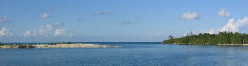
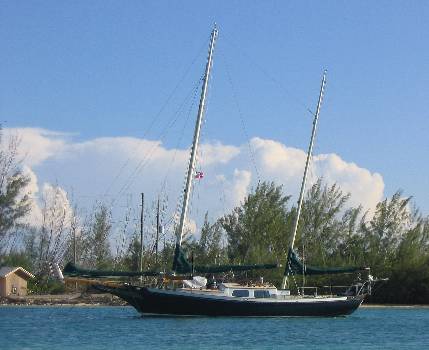
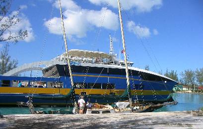
Marathon overview, looking west
We have arrived in our first Bahamas anchorage after leaving Florida about 48 hours ago. Just to keep things straight, the days since our last report go like this:
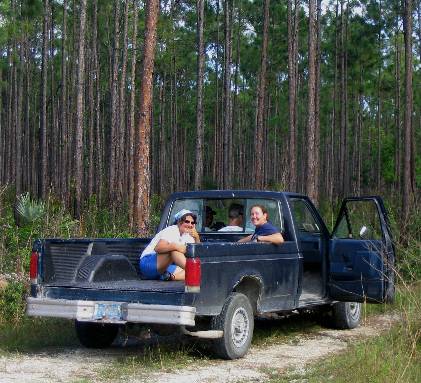
Tuesday, November 2nd -- Left Marathon, FL, motored 25 miles (inside the Keys) into strong easterly headwinds, anchored in lee of Long Key
Wednesday, November 3rd -- Motored 12 miles into strong easterly headwinds, anchored in lee of Windley Key adjacent to the channel to the Snake Creek Bascule Bridge on US Highway 1 (the Florida Keys Overseas Highway).
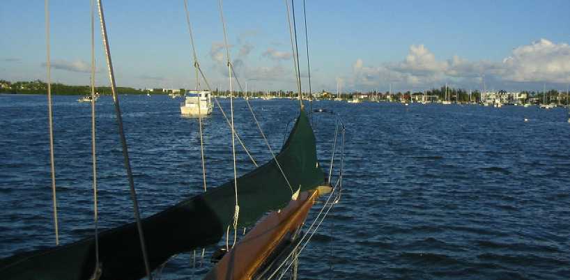
Thursday, November 4th -- Secured Wind Song for the ocean, passed through Snake Creek Bascule Bridge at 1:30 pm. and headed across the Gulf Stream. Our plan was to enter onto Great Bahama Bank at South Riding Rock (a barren doot of land on the eastern edge of the Gulf Stream 80 nautical miles ENE of Snake Creek and roughly 42 nautical miles due east of Key Largo), thence 65 nmi across the Bank to an anchorage on the east side of the Joulters Cays, a very shallow archipelago north of the northern end of Andros Island.
Friday, November 5th -- Passed onto the Bank around 0800 and continued ENE, under sail at last as the easterly veered to ESE, on a heading to clear the shoals north of Joulters Cays. We knew we would not make it in daylight, and we stopped to anchor for the night -- in the middle of nowhere, no land in sight, in 10 feet of water -- after 50 miles.
Saturday, November 6th --
Woke in choppy seas from a southerly pre-front wind, raised anchor, and tried
for the Joulter Cays anchorage. This got us into all sorts of trouble with
shallows, some soft and some not, and after a close encounter with a rock
bottom we got the flock out of there, headed for the deep water of the Tongue
of the Ocean east of Andros, then south to Morgan's Bluff, a harbor with
a buoyed channel for commercial inter-island shipping, where we sit now.
~~~~~~~~~~~~~~~~~~~~~~~~~~~~
Those who have been following closely
will have recognized that we did not leave the US on November 1st as planned,
leaving two days later instead. However, anyone familiar with cruising will
understand immediately and won't even need an explanation, knowing already
that it would be either 1) weather, 2) repairs, 3) waiting for mail, or 4)
all of the above. In this case it was (4).
The 15-20 knot easterly that had been blowing across the Gulf Stream for days finally eased on Thursday, allowing us to attempt the crossing. The Stream is no place to be when the wind is blowing from anywhere in front of it, as large, short, steep seas develop. We waited until after the wind dropped to 5-10 knots, then waited another 12 hours to give the seas a chance to subside, and headed out intending to time our arrival on the Banks at daybreak. We got there three hours early, so Lynn and Tania spent their 3-6 am watch alternately idling into a knot of current and then drifting with it, keeping station 5 miles off the reef. Then Lane and Roxanne came on watch at six and took Wind Song on in. Not long after, the wind veered south, and they raised sail. Lynn and Tania awoke to the gentle motion of a happy boat on a close reach in flat water with only a foot of chop.
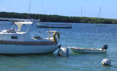
Since it is ill-advised to travel at night on the Banks, we simply stopped the boat a couple hours before sundown, anchored, and waited for dawn. Roxanne and Tania, noting that we were anchored in CLEAR WATER for the first time since 1994, immediately broke out the snorkeling gear, deployed the swim ladder, and jumped in. Inside of five munutes they'd already located every sea slug and sea star for a radius of 100 feet, plus located the anchor and checked its set. All this before Lynn and Lane had even gotten wet.
This morning we tried to get around the north end of Joulters Cays and down the east side of the group to a shallow entrance to an anchorage. We found so much shoal water and foul ground it finally scared us away. We went aground once on a sandy eel-grass shoal, which wasn't so bad because it was soft and the tide was low at the time, but later when we found ourselves stumbling into rocks less than six inches under our keel -- in a foot of sea -- we scrammed as fast as we could, straight off the Bank and into water several hundred feet deep, and came down here to Morgan's Bluff for the night. The only problem here is that this cove is exposed to the north, and that's where the wind is expected to come from tonight. In fact, it has already switched. However, there are shallows 2-3 miles north of us to block the swell, and we know we're good up to and well beyond the predicted wind strength (15-20), so we'll deal with the discomfort.
4 pm -- Well, no sense being obdurate. The wind veered all the way to NE, so we moved over to the shelter of the bluff and out of most of the surge, so we're feeling better already. However, both girls participated in this anchor drill on the foredeck, thus being simultaneously, to all onlookers, a) visible, and b) female. That's all it took for four young black dudes from the tiny commercial boat basin to jump in the nearest skiff and plane out at full throttle to offer their compliments. Dad took care of this, and we parted amicably.
And boy, is it quieter over here. What a difference 300 yards can make.
By the way, The "Morgan" in Morgan's Bluff refers to the infamous Captain Henry Morgan, British buccaneer, whose story, according to the Microsoft Encarta Encyclopedia, goes like this:
"Welsh buccaneer, born in Llanrhymny. He is said to have been kidnapped at Bristol when a boy and sold as a servant on the West Indian island of Barbados. After a time he worked his way to Jamaica, where he joined the buccaneers, adventurers who preyed on Spanish settlements and shipping; by 1666 he was in command of his own vessel. Commissioned by the governor of Jamaica to carry on hostilities against the Spanish, Morgan captured and sacked settlements in Cuba, Panama, and Venezuela. He was brought to England in 1672 to be tried for plundering Panama City after a treaty had been signed between England and Spain. Convinced of his loyalty, King Charles II knighted Morgan and appointed him lieutenant governor of Jamaica."
So. You rob, pillage, and plunder, and your punishment is to be knighted and finish your career enjoying the many and varied rewards of public service. Think of it as presaging modern Florida. (For insight into FL corruption, read the compendium of Carl Hiaason's columns from the Miami Herrald, collectively entitled "Kick Ass".)
Anyway, he liked this particular
cove, and more or less made it his own. The bay is 10 - 12 feet deep pretty
much everywhere, which would accommodate whatever ship he would have been
arriving in. It is protected by said Bluff from the prevailing E to SE winds,
and in fact all winds from S to W as well. In addition, Andros Island is
blessed with numerous natural water springs, always attractive to the pirate
(er, cruising) crowd.
~~~~~~~~~~~~~~~~~~~~~~~~~~~~~
Marathon overview,
looking west
The ghost boats
of Marathon.
(below left)
Dead dinghy, absentee owner. The motor's still on the dinghy's transom .
. . eight feet underwater.
(below right) A
splendid bare teak ketch with full boat awning . . . and a five foot
diameter PVC peace sign affixed to the forestay! (It's side-on to the camera.)
 _
_
(below left)
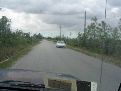
Enroute to Long Key from Marathon on the "inside the Keys" route, which crosses
several shoals via dredged channels. Hey California sailors, surely your
ocean comes equipped with street signs too, no?
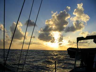
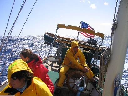
(below right) Eastbound
across the Gulf Stream, sunset approaching, Lynn waxing rhapsodic about something
or other as the girls try not to laugh out loud.
 _
_
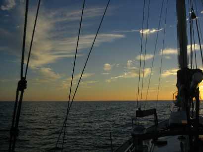
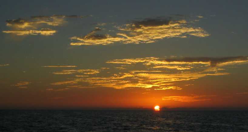
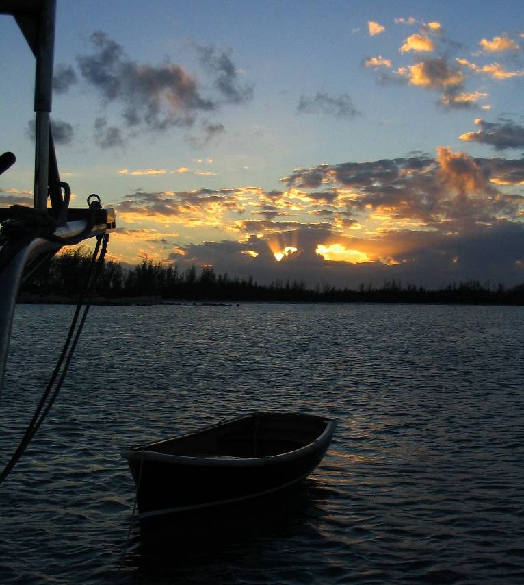
(below left)
Sunset over the Gulf Stream. Lane and Roxanne have the first watch, 1800-2100
(6 - 9 pm EST)
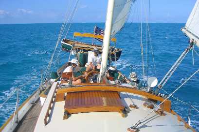
(below) Sailing
across the Great Bahama Bank on one of those days "better than which it does
not get", Lynn steering, Tania chilling, Roxanne studying up on Spanish town
names and insults . . .
 _
_
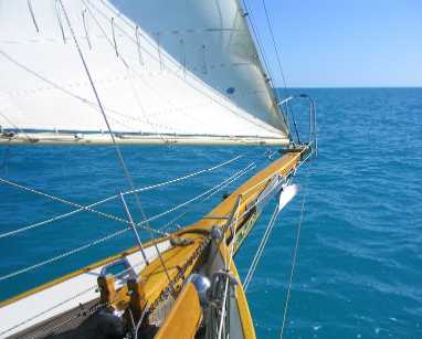
(below)
. . . the bowsprit stretching sail toward the horizon, the bow wave gurgling
through milky aqua ocean fifteen feet deep over white sand bottom, uninterrupted
for 60 nautical miles, no land in sight anywhere.
 _
_
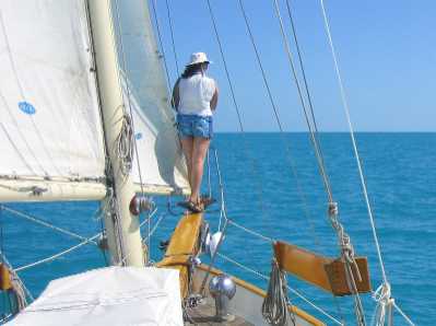
(below left)
The girls cool their feet in the wake on the lee side.
(below right)
Roxanne stares at the bottom from the only place on the boat with an undisturbed
view of it.
 _
_
(below 3 pix)
Anchored out on the Banks for the night, surrounded by emptiness and the cosmic
light show.
 _
_
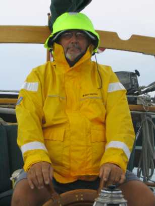
(below left)
In the morning, the clear weather is over and rain is spitting . . . but hey,
this is the Bahamas, so you just throw a foulie jacket over your T-shirt and
shorts.
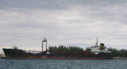
(below right)
The Dolphin, documented in La Paz, Baja California, Mexico, carries
boatload after boatload of water from Morgan's Bluff, Andros Island,
to the thirsty citizens (and tourists) of Nassau, New Providence Island. The
round trip, including loading, unloading and 4 hours underway, takes under
12 hours -- 24/7/365. Try to imagine the boredom. But we have to hand it
to the captain: he docks and undocks this 500 foot tanker himself four times
a day -- with a single screw, no tug, no bow thruster, night and day, in
all weather, with at most five feet of water under his bottom -- and he makes
it look dirt simple. (The breakwater extends outward from the Bluff named
for Morgan the pirate.)
 _
_
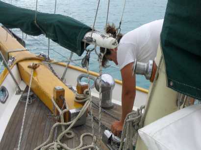
(below)
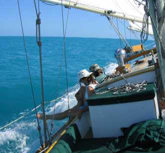
Roxanne pretty much handles anchor duty on Wind Song, and she's getting
good at it.
~~~~~~~~~~~~~~~~~~~~~~~~~~~~~~~~~~~~~~~~~~~~~~~~~~~~
24° 50.54' N, 77°
53.43' W
Staniard Creek, Andros Island,
Bahamas
November 7th, 2004
Well, so much for Morgan's Bluff. We needed to take at least one lay day to do various bits of work, not to mention for Lane to recover from the passage from Florida -- passages, no matter how straightforward after the fact, are stressful when in progress mostly from uncertainty what the weather is going to do before you find protection.
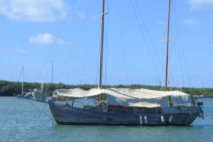
But Lynn did not like Morgan's Bluff, felt like an alien, and didn't want to hang there another day, given that the plan was to head south down the island and check in with customs in Fresh Creek (two stops south), even though (Lane talking) the holding ground and swinging room were superlative, and the protection from the prevailing wind was perfect, and so what if there were a few "doctor" flies around? (so named because their bite feels like a hypodermic needle -- also known as horse flies). So we headed south 22 miles to Staniard Creek, which sounds idyllic in the guide book, but they failed to mention that the bottom in the creek is combination limestone and coral with an inch or so of sand on top to fool the unsuspecting yachtie.
So here we sit, our bright stainless steel CQR anchor lying on the bottom in seven feet of water, gleaming visibly in the moonlight, fully exposed (not buried), its tip snagged behind a small outcrop the size of a fist. In a narrow tidal estuary where the direction of pull may change every six hours. Hmm. Lane does NOT feel "CQR". ("secure") And we have "doctor" flies here too.
The trip down here was in very light wind from astern, so we motored again -- offshore, in the deep water. The mild conditions were a blessing when we got ready to cross onto the reef again, because the path from offshore to the creek mouth is intricate and surrounded by unforgiving shallows (limestone rock and coral), and the creek entrance itself requires crossing a bar carrying only 3 feet at low tide (we crossed in 4.5 feet at high tide, leaving 12 inches under the keel) over a space only 20 feet wide or so. We spent an hour getting this all accomplished, with Roxanne on the end of the bowsprit calling the bottom, Tania relaying communications, Lynn reading out the directions in the Bahamas Guide, and Lane at the helm and watching depth and bottom color around the boat. It was a ticklish business. Roxanne later announced she'd had enough fun to last a week, basically being "responsible for someone else's boat." No amount of "we're all in this together" or "the captain is always 100% responsible" affected her view.
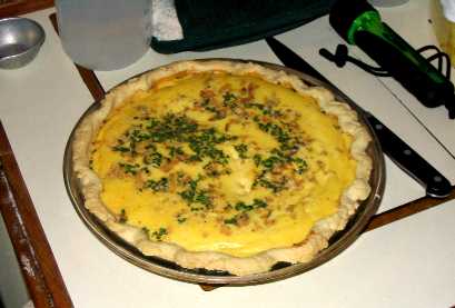
So we swam and celebrated making
it safely, and Tania cooked garlic bread and a real quiche in a real pie
crust -- a signal achievement in the almost uncontrollable oven we've got
here. It was the best meal we've had so far.
~~~~~~~~~~~~~~~~~~~~~~~~~~~~~~~~~~~~
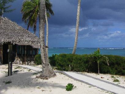
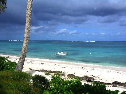
From inside Staniard
Creek looking out (roughly north). This is a small creek.
On our right,
the small dock where guests, having arrived by small plane,
embark on a small water taxi to . . .
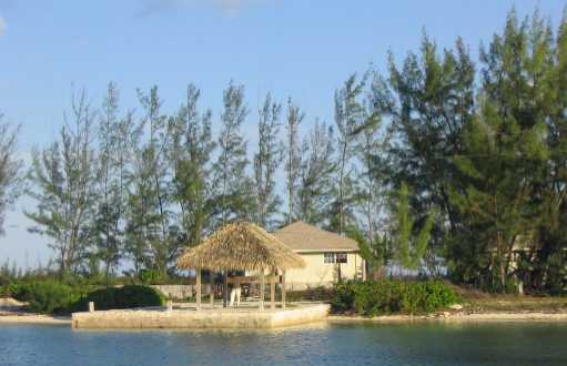
. . . the
dock of the small resort on the cay to our left. That's the water
taxi off to the left in the distance, a "delta destroyer" with two small
outboards and a gabled gazebo on top for shade. The one thing not small about
this "Kamalame Key" resort is the price. A dock in the photo below costs
$3 per foot per night, or $163/night for Wind Song. Maybe it includes
the use of the swimming pool. Resident guests pay $1000 per night.

And for dinner,
the piece de resistance!
~~~~~~~~~~~~~~~~~~~~~~~~~~~~~~~~~~~~~~~~~~~~~~~~~~~~~~~~
25° 10.57' N, 78°
01.81' W
Morgan's Bluff, Andros Island,
Bahamas
Saturday, November 13th, 2004
Back in Morgan's Bluff?? What happened?
Weather and bad anchorages, that's what. Based on the past few days of experience it is clear that the mild weather we experienced ten years ago in the Spring bears no relation to the weather we're seeing right now in the Winter. Since November 6th we have seen no wind that is not in the NE quadrant (N through ESE), and, except for the last 36 hours, blowing 15-25 knots. This makes the eastern shore of Andros a very dangerous lee shore. The result is, except for Morgan's Bluff, which has a wide, deep ship channel to a wide bay with good bottom, the anchorages are tight, rockbound, current-ridden, and have bad bottoms (rock and/or coral). This means that if you are in one of these anchorages (say, Staniard Creek), 1) you literally cannot get off the edge of the reef to deep water if the wind exceeds 15 knots, due to six foot swells stacking up in the shallows, 2) you cannot travel inside the reef because it is shallow and full of coral and rock, which you cannot see when the water surface is disturbed by heavy wind, and 3) if you DO manage to get out of an anchorage and off the reef to deep water, there you will stay, because you can't even think about coming back into the shallows in those conditions. In other words, once inside an anchorage, even a bad one, there you must stay whatever the dangers, because leaving is worse.
We stayed four sleepless nights in Staniard Creek waiting for the main anchor to let go of the tiny nub of coral it was hung on. We deployed and kept redeploying, as the wind shifted, a second anchor onto the sandy shallows all around us in an attempt to keep the direction of pull on the main anchor steady. On the fourth morning, when the wind had veered to east and eased to 15-20 knots, Lane decided he could not bear another night in that anchorage, so he pre-reefed the main and mizzen, we raised anchor, and out we went into the maelstrom, intending to return to Morgan's Bluff. At high tide we cleared the bar outside the creek with 18 inches under our keel (and bear in mind that once high tide passed we could not return even if we wanted to), then motored for the edge of the reef, where we found six foot breaking swells stacked no more than a boatlength apart, bringing our forward progress literally to a standstill. Seriously, we spent two very long minutes at full throttle going not one inch forward, and we had about 100 yards of these waves to get through.
But the wave set abated slightly and we crept out, raised sail, and bore off WNW for Morgan's Bluff, where we wowed the locals on the water ship wharf four hours later by sailing down the buoyed channel with breaking waves in the shallows on both sides of us, rounding up inside the Bluff, dropping sail, and calmly laying down our anchor like we did this sort of thing every day. We later spoke with some of these folks, whose comments were of the "This mon be one gutsy captain" ilk, but Lynn's interpretation was, they thought we were CRAZY. They observed that on that same day the captain of the weekly Nassau mail boat, an 80 foot trawler that serves all the southern Bahamian "out islands", refused to leave port in Nassau. This doesn't make sense; it wasn't that bad.
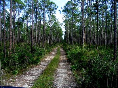
Having come back here, we needed fuel and water, so yesterday Lane took the dinghy in to the small commercial boat basin dug out of the limestone shore to look up Patrick Romer, who sells Esso fuel, and while fueling and watering an hour later we met a US cruiser named David on a small trawler in the basin, who told us everyone we should try to meet. One of them was an Andros native named Chris, who has interests in a number of Andros ventures, and who, for the price of five gallons of gas in his pickup truck (that's $20 here) spent the next four hours tour-guiding us around north Andros, which turned out to be very interesting.
Andros is poorer than most other Bahamian islands, has virtually the only agriculture, the only naturally occurring ground water (other islands collect rain water in cisterns), the largest area (80 miles long), and the lowest population density (5000 people total; Nassau is 250,000). Where boating is concerned, it has one decently navigable coast (east), but this coast is exposed to prevailing winds, treacherous in any but calm conditions, and has very few decent harbors. At the same time it has some of the best fishing, the only hunting (pheasant, wild boar), the fewest resorts, and the most affordable property.
It is also, it turns out, no
place to be in winter.
~~~~~~~~~~~~~~~~~~~~~~~~~~~~~~~~~~~~~
Monday, November 15th, 2004
We had a slim weather window that could have got us to Nassau, 30 miles away, but study of the data available to us on the harbor, plus very little local knowledge, plus the understanding that at least some of what we need a city for (mail, phone, laundry, propane, water, fuel) is available here in Morgan's Bluff, plus the fact that another front, this one more serious, was coming and we have more options here, we decided not to go. For one day we went into the local commercial boat basin, where, amazingly, dockage is free (first come first served, on a noninterference basis with ferries and other small shipping), water is free, and the mail boat wharf, when open, has free electricity. It also is hot, buggy, dirty, surge-y, and rock/cement-bound. We used this day to top up batteries, work on our two computers, and so Lynn could hire a ride to the nearest laundromat (a real third world experience). The rest of the family sweltered and got bitten to death below decks by no-see-ums, and we left to go back out to an open-air anchorage as soon as Lynn returned.
The half-day we spent with Chris bears description. He took us first to a brand new small resort called The Bahama Coconut Farm (www.bahamacoconutfarm.com), with which he has relations because he moonlights as a hunting guide and his clients can stay there. It was a delightful spot, cheaper than almost anywhere else in the Bahamas we've seen, with separate two-bedroom cabins on the beach front, each with a small kitchen. It is run by a couple from Green Bay, Wisconsin, (backed by a consortium of investors), who interestingly opted to develop this property on Andros with more difficult staffing and support challenges than, say, Eleuthera because, as Jim, the owner, said to his wife, "Why just be a property owner on Eleuthera when we could make a difference on Andros?" The Andros populace is certainly less accustomed to the business environment, and has to be taught everything -- in fact, the pricing and billing structure is purposely simplified so the help can understand it. Jim's own comment was "You can't expect quick minds in people whose minds have not been regularly challenged since birth." It does not mean they are unintelligent, they are just not used to the mental exercise necessary for a serious business. Jim knew this going in -- and chose it. Pretty impressive.
Chris took us to a nearby bank where we could get some cash (the $300-per-boat Customs fee had cleaned us out), drove us through several small settlements varying from dirt-poor to middle class to an occasional isolated "mansion" (a normal US east coast style house), then out to the airport to pick up our Customs receipt, showed us to a few services we might need in the next few days (laundry, BATELCO communications office, grocery, etc.), then on to a couple local attractions: a real "blue hole" and "Morgan's Cave" -- all with full commentary on Andros history, economy, infrastructure, and politics by a guy with his hand in many local ventures. He's not rich by US standards, but he's intelligent, thoughtful, foreign-educated (Vancouver, Canada), locally well-connected, and doing fine by any Andros Island standard. He (and his fellow Androsians, it seems) are intent on taking their development slowly, carefully, and notably without the "help" of the casino gambling interests prevalent on New Providence (Nassau) and Grand Bahama (Freeport) Islands. How they can resist casino pressure is amazing -- it helps that those other two islands want to keep gambling to themselves -- but even so, the Androsians themselves don't want it. They are concerned for the protection of their environment and local control of their own island's development, and they seem to be clear that gambling interests are inconsistent with both.
Which brings us to the blue hole
and Morgan's Cave, but we'll let the photos be the description. Read on.
~~~~~~~~~~~~~~~~~~~~~~~~~~~~~~~~~~
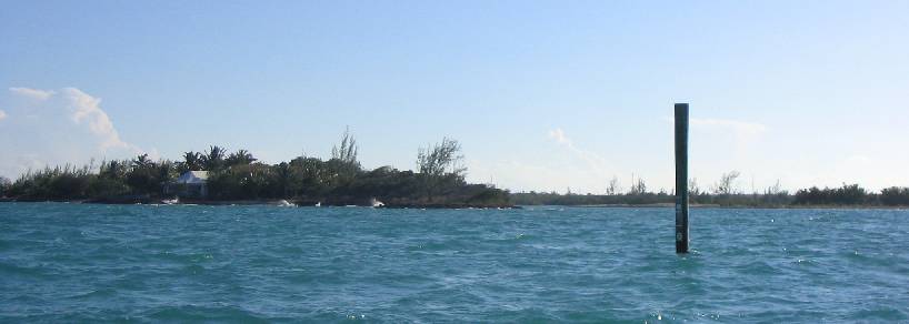
The entrance to
Staniard Creek at high tide. This uncharted post says 5 feet of depth,
but on which side?? Turns out it's the left . . . and the "channel"
is half a boatlength wide. How does one find this out? By trial and error.
We tried the right side first, backed away with six inches under the keel,
then tried left. Nice.
(below left) Wind
Song in Staniard Creek before the wind started howling. This photo is
taken from the dinghy while in 18 inches of water at low tide. Clearly there
is not much room to swing . . . and the bottom is rock and coral. The one
redeeming virtue is, most of the shallows are sand.
(below right) The wet
sail back north to Morgan's Bluff under reefed main and mizzen only. Everything
was soaked after this little 20-mile jaunt.
 _
_
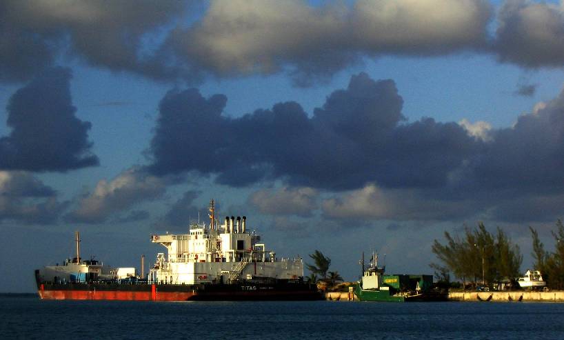
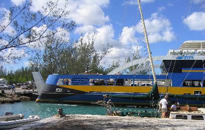
Compared to Dolphin
(pictured earlier) this is the "big" Nassau water tanker: Titas, registered
in Nassau. Between them, these ships carry 13.5 million gallons of water
a day to Nassau. If that sounds like a lot for 250,000 people, it
is, but don't forget tourists, hotels, and resorts. For shipment purposes,
it's only a cube 122 feet on a side.
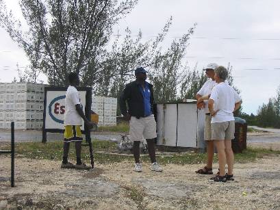
(below left)
Mom and Dad discuss fueling options with the Esso man, Patrick Romer (center)
and his assistant Charles (left). BTW, those large white crates are full of
locally grown grapefruit, which are awaiting "the grapefruit boat", a small
(250 foot) cargo vessel that takes 1500 of the crates at a time on its deck.
This boat arrived at night in dirty weather and drove right straight
into the tiny harbor with possibly five feet of clearance on each
side of the channel, and (we thought) no room to turn around once inside.
Wind Song herself has less than 20 feet on each side of her in that
channel, and we wouldn't dream of trying it at night. They nose that ship
right up to a cement ramp on shore, tie off to bollards bow and stern, open
their bow, drop a steel ramp onto the cement, and start loading crates with
a forklift. It took eight hours. That's three crates a minute with one forklift.
The ship was gone at dawn. What's more, we were later told that it turned
around before leaving . . . in a space you could skip a rock across,
with rock and cement all around, and with small boats tied on all sides.
There can't have been more than a few feet of clearance.
(below right)
From Chris's truck: Yes, they drive on the left here.
 _
_
(below) Two views of
the shoreline, shallows, and barrier reef in front of the Bahama Coconut Farm
resort.
 _
_
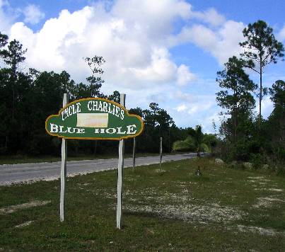
Uncle Charlie's Blue Hole,
named for its discoverer. The girls rode in back of Chris's truck, hoping
it didn't rain. In the background is the native Andros pine forest, with palmetto,
weed, and scrub underneath, all growing tenuously on top of porous but otherwise
solid limestone.
 _
_
 _
_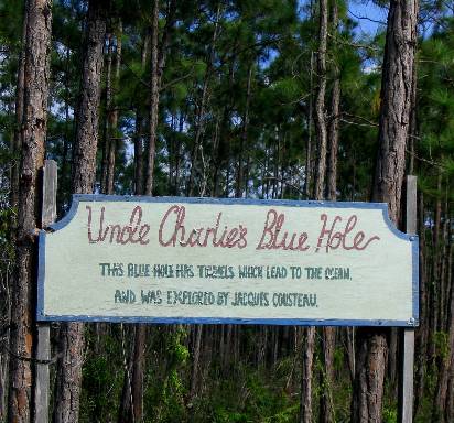
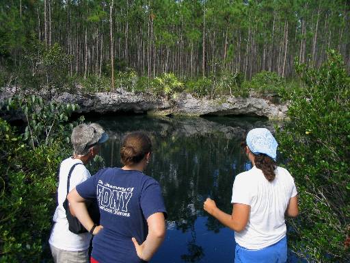
What is a "blue hole"? It's
essentially a large "spring", a sort of very deep "sink hole" where the land
has an opening right to the water table, which on Andros is very near the
surface. This is fresh water. It's not clear that anyone knows exactly how
they get formed (including Jacques Cousteau, who explored this one), but
many of them, including this one, have been demonstrated to connect to the
ocean. That's Chris with Lynn and the girls at right.
 _
_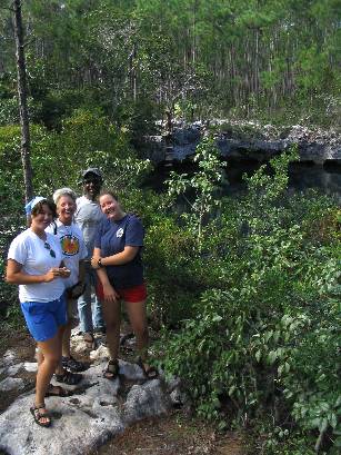
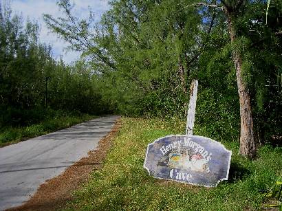
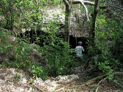
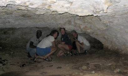
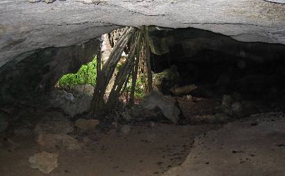
"Henry Morgan's Cave", which
has no demonstrated connection to the buccaneer (or for that matter anyone
named Morgan), is on top of "Morgan's Bluff", the spit of rock that is protecting
Wind Song right this minute from the northeasterly half gale outside
that's been blowing for two days. Lynn drops over the ledge to cave level,
lower left.
 _
_
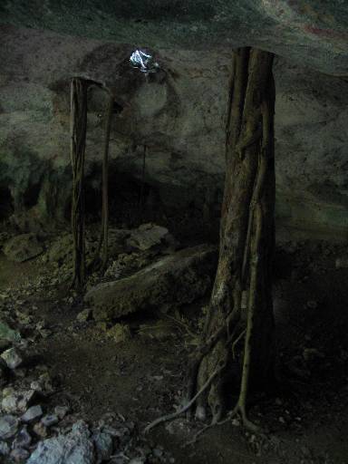
(below left) At the
back of the main chamber. Lane didn't follow, having injured his noggin already
twice this week on the boat.
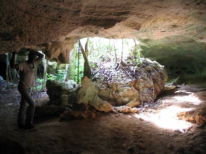
(below right ) Looking
back at the entrance.
 _
_
Trees from above the cave
grow right down through holes in the roof looking for water and soil
(below right) Chris poses
for scale. Behind him, center, is a recent roof cave in. Hmm. Is this how
blue holes form? Maybe they just get eroded from beneath until the ground
collapses. Those roots probably help out some, too!
 _
_
The Nassau ferry backs down
into the Morgan's Bluff inner harbor about 20 feet from Wind Song's
side, no muss no fuss, but it still gave Lane heart palpitations. If it touched
us, we'd crush like an egg shell.
 _
_
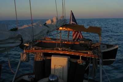
OK, let's finish up this report with another sunset picture. This one shows the cold front coming, the winds from which we are now in our third day of. (Oooh, bad syntax.) We've already got our GPS programmed with the course to Allan's Cay in the Exuma chain, 70 miles to the ESE, the first 30 across the Tongue of the Ocean, the last 40 across another part of the Great Bahama Bank. As soon as the seas calm down we'll go. We'll mail this and a bunch of other stuff tomorrow, get propane, and top off our water, then we'll be ready.
Oh yes, one last thing. We noted above that we've made some changes to our cruise plan, mostly to accommodate the bad winter weather that we did not expect. We know now that we need to plan around ready availability of bulletproof anchorages with good bottom, adequate swinging room, and 360 degree protection, because this probably won't be the last cold front we sit out. Right now if we look about a mile north we can see the swells that have rolled in from the deep water just to the east steadily breaking as they travel a mile or more across flats of gradually diminishing depth. We're talking eight to ten foot waves that start breaking in 20 feet of water at the edge of the barrier reef and don't stop for more than a mile -- across what passes for navigable water around here. In fact, the recommended route to what is reputed to be a good anchorage in northerlies, about two miles north from here, runs right across that stretch of water. Needless to say, we don't plan to go there -- and our situation is not entirely tenable even here -- if, for example, the wind were to back from NE to N, and those waves started coming into this bay. That's not supposed to happen, but it could . . .
So we've drawn up a revised plan. This new plan eliminates the rest of Andros Island, the Crooked-Acklins group, and the Jumentos Cays, all of which turn out to be bad places to be in winter weather. It is possible we'll eliminate Long Island as well, but that is TBD. It also shows our accomplished route to date since Marathon and our revised anticipated arrival in Fort Lauderdale (not Fort Worth Inlet/West Palm Beach) on April 27th (not May 15th), 2005 -- because Tania has to get on a plane from there to LAX on May 1st to go back to El Segundo for two weeks of Advanced Placement testing. It also gives us 36 days of slack against that deadline (which is a lot more than the VIIRS project used to have that Lane worked on back in LA. Hey, how's all that going, guys? I can tell you this, there ain't no less stress here where we are!). Our plan right now is, we're going directly to the Exumas, the most paradisical of all the Bahamas, and we plan to just HANG OUT over there in as much protection as we can find! After all, cruising SHOULD be less stressful than working for a living, right?
Well, that's our goal, anyway.
~~~~~~~~~~~~~~~~~~~~~~~~~~~~~~~~~
from Lynn:
While Lane has done a superb job describing the wind strength, direction, etc., I would like to contribute a little more graphic description of our life aboard during this past week. In short, it has been scary, difficult and no fun! If we had know we were going to encounter weather like this, we probably would have postponed the trip until January. The wind has been howling through the rigging, the boat has been bouncing, vibrating and rolling, we've been checking our position with respect to the land and wind regularly, hoping that we don't lose the boat on a lee shore. Nobody has wanted to do anything except lie in their berth and read, and Lane and I don't even have a berth during the day to which we can retreat. I announced this morning that in addition to washing my face, brushing my teeth and feeding everyone, I was going to cut and file my nails!!! Doing anything extra takes a huge act of will. In short, we are in survival mode. Forget about planning or creating anything, we're just trying to make it through each day. We've all been sleeping 10-11 hours a night - ah, the sweet oblivion of sleep (except that it gets interrupted every time the boat makes a new noise or odd movement). What's amazing is that everyone is still civil, supportive and doing what is required to keep the boat and us safe. The girls have been amazing in that regard - no complaints, great crew-work, rising to deal with ridiculously adverse circumstances. The collage we made back in L.A. to inspire us in our game to get here pictured clear water, sun, beaches - in short, paradise. We haven't had a glimpse of that yet, but the girls are still in the game. I couldn't be more proud of them.
~~~~~~~~~~~~~~~~~~~~~~~~~~~~~~~~~
Roxanne's petit coin
Well, I guess I should put my $0.02 US in,
too. So far, my take on our adventures in Bahamaland is: Gee, this is new!
I actually don't think the weather's been as bad as it could be, although
I certainly wouldn't have wanted to take the boat out in it. (I get seasick
easily.) As a matter of fact, I'm glad we ran into it early on in the trip;
if we hit it again, we'll at least know what to do. It's been a real learning
experience for me, seeing as last time we were dealing with problems like
this I was essentially oblivious...I've been surprised to find out that I'm
just not bothered as much as I thought I would be. Even with the wind and
the seas and everything. I get more concerned about the boat than about myself,
and the boat's still floating, so what's the problem? Sure, we're all dirty
and smelly and we call yellow Crisco "butter" but...it sure could be worse!
Maybe I'm just pessimistic? Oh wait, no, I'm not. You want to know what's
worse? BEING LOOKOUT. "Enough fun to last a week" does not BEGIN to describe
it. I do not like shoal water, and I especially do not like NAVIGATING shoal
water in a BOAT that IS NOT MINE. FREAK OUT.
But besides that it's been pretty cool. Life's
different out here, and that's nice.
~~~~~~~~~~~~~~~~~~~~~~~~~~~~~~~~~
Tania's take:
I pretty much agree with Mom on the whole "survival" thing. Dad kinda passed over how hellish these past weeks have been. I would be able to deal with it all if I could only sleep uninterrupted for a night...unfortunately, the main mast comes right through the v-berth and the halyards and lazy jacks slap against it all night - of course, the sound travels perfectly down the mast to our luxurious bedchamber (har). And the anchor line creaks. And the wind fills up the wind scoop and makes it sound like there's a hurricane outside. And the boat rocks 24/7 because of all the swell coming in. It's really hard to get much done, particularly around school. I've been reading mostly, but my excuse is that I'm reading books for my English class...I'm rereading Roots by Alex Haley (an atrocious book, in my humble opinion) in preparation for a literary analysis comparing it to The Namesake (by Jhumpa Lahiri) due in December. But enough complaining. At least we're here, and hopefully the weather will clear up soon. I'm getting cabin fever!
Hello to all mes amies!! I have decorated my spacious boudoir with photos of all you guys - pictures of it will follow in the next web update.