The boat only touched bottom once, in sand, at idle speed. Henry knows how to read Bahamian water.
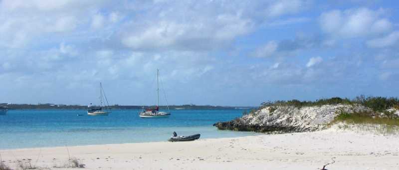
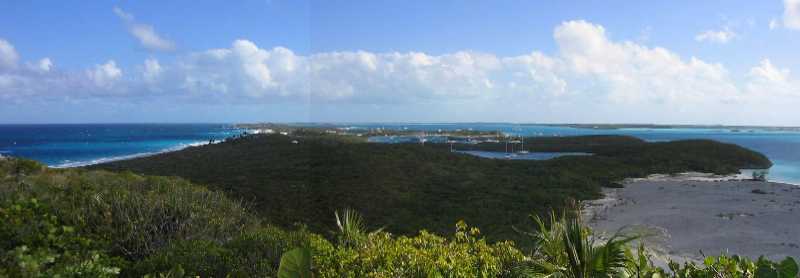
Well, hurry up and stop, that's what we're doing. We're sitting in the anchorage behind what used to be called Little Bell Island and what has always been denoted as Cambridge Cay on the chart, but what has changed is that all the cruisers are now calling it Cambridge Cay, so that's what we'll call it too. We have come all of eight miles from Warderick Wells. This is the last (most southerly) island in Exuma Park.
We got here Monday afternoon in a dead calm, spent Tuesday enjoying the place, and then a new cold front came in yesterday that is still blowing like snot and is not expected to ease sufficiently for our next move until tomorrow at the earliest. And there's another, stronger front coming right behind this one. Since this one's been blowing a steady 20-25 knots, we're not looking forward to sitting through 25-30 for three days.
We have maybe a two day window between fronts. We're going to try to get all the way to Georgetown, 66 nautical miles from here, traveling only by day.
First, let's catch up on Warderick Wells. Last you heard, it was Saturday December 11th (the dateline didn't get onto the "late-breaking news" at the end of the last report), and we were wondering whether Lane would get to go help sink a Haitian trader. The answer was no, because the Royal Bahamas Defence Force (RBDF) had no immediate plan to do so -- much to the relief of everyone involved except Lane, because everyone but Lane had done it before and HATED the job. Turns out the words "the most godawful stink you have ever experienced" do not BEGIN to describe the human degradation evident aboard these boats, particularly when carrying illegal immigrants, which can number as high as 100 -- below decks, packed side by side like herring, between the ribs of the boat, UNDER the cargo, which can be anything from coal to mattresses -- all in only 50 feet of length. They let 'em up on deck a few at a time at night to eat and poop (assuming they were able to wait . . . ), then back in their holes before dawn. One of the RBDF marines said you can smell these boats from 150 yards away. From those who had witnessed the situation up close, all they had to say was that life must really be wretched in Haiti if this was what people would go through for their freedom.
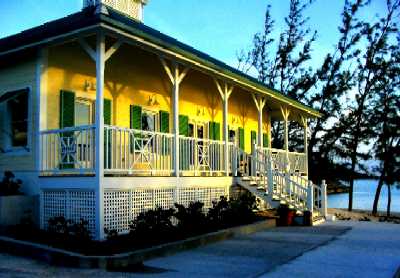
OK. Enough of that. We then got an invitation to a birthday dinner for Glenn, the head volunteer, the next afternoon, for which we stayed over, and which was held at the Warden's new residence. Wow. Looking up at that house from a dinghy in the water, two stories tall and sitting about 20 feet above high water, it is impossible to get much of an idea what it would be like to live there. It's not a large structure, but the view is frankly almost beyond belief, and the living quarters are closely tied to the outdoors. Every wall on both floors is filled with screened but unglazed windows each with a shutter over it that can be pulled up by a tackle from inside. Every bed has one next to it. The cupola on top of the 4-sided gabled roof has shuttered openings in all four directions, so breeze can be directed through the entire structure no matter what the wind direction -- like Jefferson's Monticello, if you've been there, but with the difference that in the Bahamas there's actually wind most of the time. Around the outside is a wide, circumferential, roofed porch, so rain can't get into the house unless it is blowing almost horizontally.
Plus there was TV (NFL football!) and a six pound beef tenderloin, cooked to perfection. Much of the rest was potluck, including an actual green salad, which we haven't seen in weeks.
One of those in attendance was Henry Nixon, Warden of the Great Inagua National Park, a nature preserve on Great Inagua Island that is home to 50,000 flamingos. Henry was on Warderick Wells to fill in for Warden Ray Darville in Exuma Park while Ray is on vacation, on the assumption that the Black Point poachers had probably figured out Ray was going to be gone for awhile and would be out in force doing their thing. What made this interesting to Lane was that he had heard that, contrary to earlier stories he'd heard that volunteers are not allowed on the Patrol Boat, volunteers do sometimes go out on Patrol, and what's more, it is purely up to Warden discretion, and the acting Warden was right there at the table. So Lane asked, and got invited to go on a short patrol the next day (Monday).
It lasted about 90 minutes, but it was non-stop action, because just as they were getting set to leave the dock, two fast-moving Boston Whalers (a small, sturdy, open fiberglass motorboat popular among Bahamian natives) went past the harbor entrance at full bore headed for some cays north of there. As soon as Henry had his (armed) RBDF guy on board they (including Lane) were GONE, and that means full throttle right through the anchorage, doing 40 knots past anchored boats not 10 feet away, out across the cut, and barreling up the Sound side of the cays in terrifyingly shallow water.
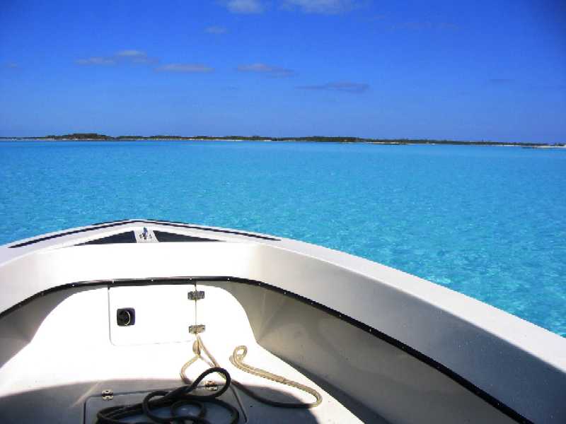
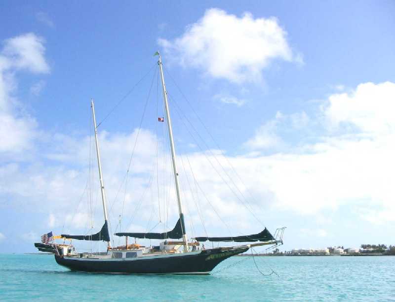
Here's a photo. This was taken
at 40 knots in two feet of water over sand bottom. We got down as low as
1.5 feet of water, and rock bottom.
The boat only touched bottom once, in sand,
at idle speed. Henry knows how to read Bahamian water.
They missed the poachers on the first pass, but flushed one of them out of a hole not far north of Warderick Wells on the return trip, and the chase was on. It was disappointing to discover that the patrol boat, 21 feet long with a 225 hp outboard motor, was hard-pressed to try and catch the 15 foot Boston Whaler -- because it also had a 225 hp motor! As it began to pull slowly away, Henry started cutting between cays to cut off some distance, and his final move was to drive directly through the Warderick Wells mooring field (while the poacher went around the cays) and straight out the back through a 20 foot wide gap in solid rock with rock and coral on the bottom, at dead low tide with no more than 18 inches of water, at full throttle, 40 knots, flaps down, motor trimmed forward to lift the stern to aid planing . . . and Lane's guts clenched up tight, his hands gripping every grab rail available, waiting for the impact.
Which did not come, though Lane cannot understand why, as our own 2 hp outboard on our inflatable dinghy, total depth one foot, has hit rock there in the past. Whatever, as they came out the poacher boat was still half a mile ahead and obviously not going to be caught that day. Henry slunk the boat back to the dock, and we gave up for the day. At least those guys lost a day of fishing and spent a bunch on gasoline. That's good.
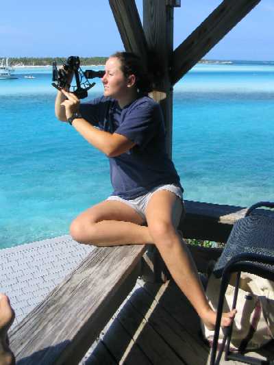
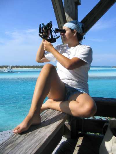
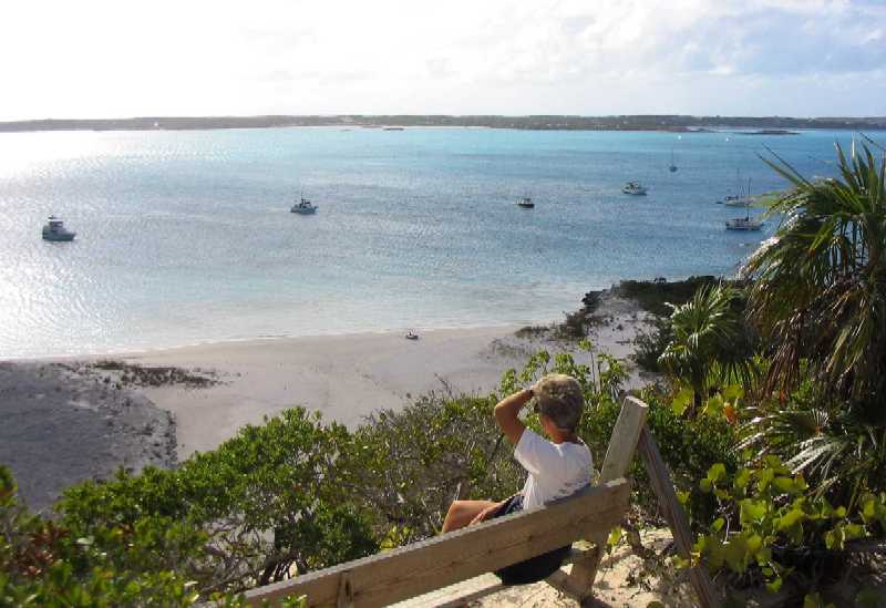
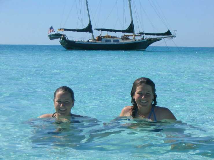
With a half day remaining and great weather,
Tania decided she wanted to learn how to take a noon sun sight with our
sextant, so she and Lane went up to the HQ to be comfortable while doing it.
Roxanne was finishing her volunteer labor stint right about then and joined
in, resulting in these pictures.
 __
__
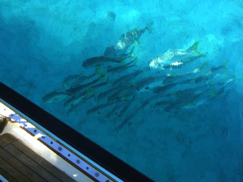
Then back aboard Wind Song for the
afternoon, during which this school of Horsehide Jack malingered beneath
our boat hoping we'd drop some scraps of meat overboard (they don't eat much
else). These guys are two to three feet long.
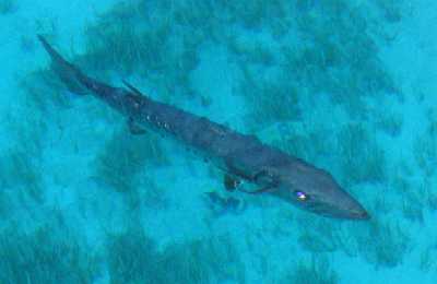
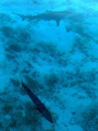
And we went to Cambridge Cay the next day. As it turned out, a couple of "friends" followed us. One of them was "Bubba".
You may recall we mentioned "Bubba", the
4 1/2 foot barracuda (nicknamed "The Bubba-nator" by Roxanne), and two
sharks. Bubba and the larger shark followed us to Cambridge Cay. Below left
is a late afternoon portrait of Bubba taken with flash. We left the red-eye
in -- it seems to fit Bubba's "personality", what there is of it. Lower
right is the two of them together. Swimming, anyone?
 __
__
Right now Bubba is hanging out, virtually
invisible, beneath our dinghy which is tied off behind our stern. A lurking
presence. In order to get a little time in the water, we all piled into
the dinghy, motored over to a sand flat at low tide, and sat around in one
to two feet of water. At least we got wet.
This is the sort of behavior you get from wildlife that gets fed by humans. Those guys at the Park should know better. Henry Nixon said we should go swimming anyway, said the fish wouldn't bother us, called them "friendly". Right. We don't believe there is ANY behavior among barracudas or sharks that could be construed as "friendly".
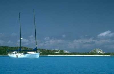
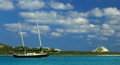
OK, on to a pair of before-and-after pix,
just for completeness.
Below left, Daybreak, Cambridge Cay,
early April 1994.
Below right, Wind Song, Cambridge
Cay, mid-December 2004.
 __
__
And finally, the canonical sunset picture,
with sliver of moon. Remember the adage "Red sky at night, sailor's delight"?
Didn't turn out that way this time.
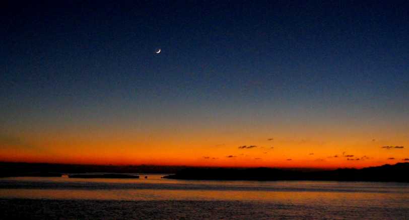
23° 31.04' N, 75° 45.40'
W
Georgetown, Great Exuma Island, Exuma
Cays, Bahamas
Tuesday, December 21st, 2004
"Changes in latitudes, changes in attitudes." (Jimmy Buffett)
"If life doesn't fit, make alterations." (Stella, in the movie Silverado)
Boy, and how. Winter is teaching us lessons here, and it is driving us to make alterations -- and get south. Note that the LAT and LON now start with 23 and 75 degrees respectively. We are almost exactly on the Tropic of Cancer.
Winter in the Bahamas means a cold front sweeps through from the US weekly or more often, and their intensity increases steadily until about March. Also, the intensity is greater the closer you are to the US, i.e. it is worse the farther north and west you are. When a front comes through, you need a big anchor down, preferably two, in as secure a hole as you can find. The holy grail is to find a "bombproof" hidey hole, deploy your best ground tackle, hunker down until the gale passes (checking the tackle several times a day for chafe or other incipient failures), and then bolt for the next hole as soon as the wind abates. This is not a relaxed, "qué será, será" mode of cruising. This is not "let's take our time and explore every nook and cranny". This has pretty much turned into "let's beat it on down to Georgetown as fast as we possibly can and then not budge until Spring."
Why Georgetown? Let's count the ways. 1) In one place or another, it has room to anchor several hundred boats, and offers tolerably secure winter anchorage for over a hundred -- which is about how many are here right now. By March there will be between 400 and 500. 2) It is the furthest such anchorage south and east, and remember, per above, north and west are BAD. SE of here the weather improves further but the protection deteriorates. 3) It has all the supplies and services a cruiser really needs, even if it does not have all that everyone here might want. And 4) with the caveat that this is a town, not wilderness, it is a beautiful place at the same time.
This is a hard combination to say "no" to when, much as you want to see all those nooks and crannies along the way, the weather has you cowering with fear in your bed every night as your boat pitches, rolls, jerks, and shakes and the wind howls through your rigging like a living thing hungry for blood -- yours. It's a test. (Recall that life is not like school. In life the test comes first, then the lesson.) It raises the question every surfer asks when that really big winter swell arrives: "How much fun did you wanna have?" Maybe not as much as we thought. Maybe we're not as tough as we like to think. Nor is Wind Song.
So. Here we are. Been through one front already since we got here, and we had Wind Song in a killer hole (see 4th chart below). We slept like babes. Plus we've got water, diesel fuel, propane, gas for the dinghy, groceries, and even Internet access, all about 20 minutes away across the harbor. There's even a little beach bar & grill over here on the island across from town, and they have TV with NFL football on Sundays! Wow. Howie Long and Terry Bradshaw, the sublime and the ridiculous, sparring verbally as always. Lane pulled out his wallet, had three beers, and treated the family to burgers, fries, and Diet Cokes. "Cheeseburger in paradise." "Wasting away again in Margaritaville." (Jimmy Buffett again) Volleyball on the sand in the lee of the casuarina trees. Snorkeling. Windsurfing. Old farts playing dominos in the shade. The "Watercolor Group" meeting on the veranda of the Chat 'n' Chill (that's the bar/grill). Bible study and worship on the sand Sunday mornings. It's all right here, about a two minute dinghy ride beyond Wind Song's bowsprit. It's no wonder people get stuck here. It's like a floating, tropical, salt-water Leisure World where the only price of admission is the gumption to have gotten here by boat. Someone here shares your interests, cruising among them. Whatever reaction one might have to it all, it is incongruous but nonetheless inescapable that everyone who is here has passed the test. They got here, by boat, in winter. Even the dominos players. Some of them from half a world away.
Backing up a bit, we should fill in some details of how we got here. At Cambridge Cay we sat out a cold front for three days. Got ashore on the island once in that time, and took no photos. Listened to the weather report every morning, and when we got the window it was only predicted to last 2.5 days. We laid out a two-day plan to go straight to Georgetown: First, on 12/17, a 24 mile sail to Little Farmer's Cay, then 40 miles to Georgetown. Since the day was perfect for sailing on the banks, we decided part way there to add on 10 miles and make Little Darby Island, which almost proved our undoing as the approach was very shallow, very ill-defined, and we were negotiating it with only an hour of daylight left. We almost got stuck out on the banks overnight (which, last time we did it, did not turn out well, as you may recall). Then in the evening darkness a couple of Bahamian fishermen in a motorboat drove over the nylon rode of our secondary anchor, fortunately not damaging it significantly as we all burst on deck screaming at them to stop. Jeez, our anchor light was lit and everything. What can one say?
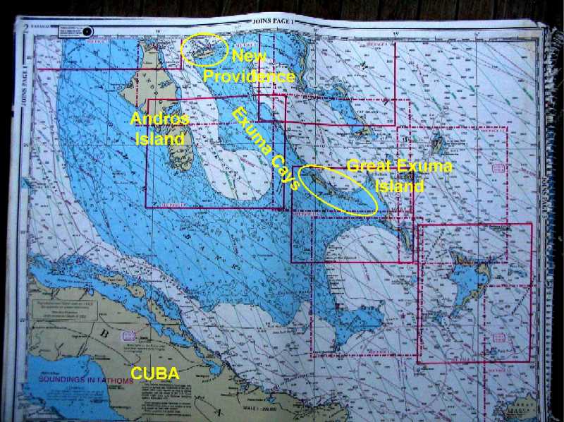
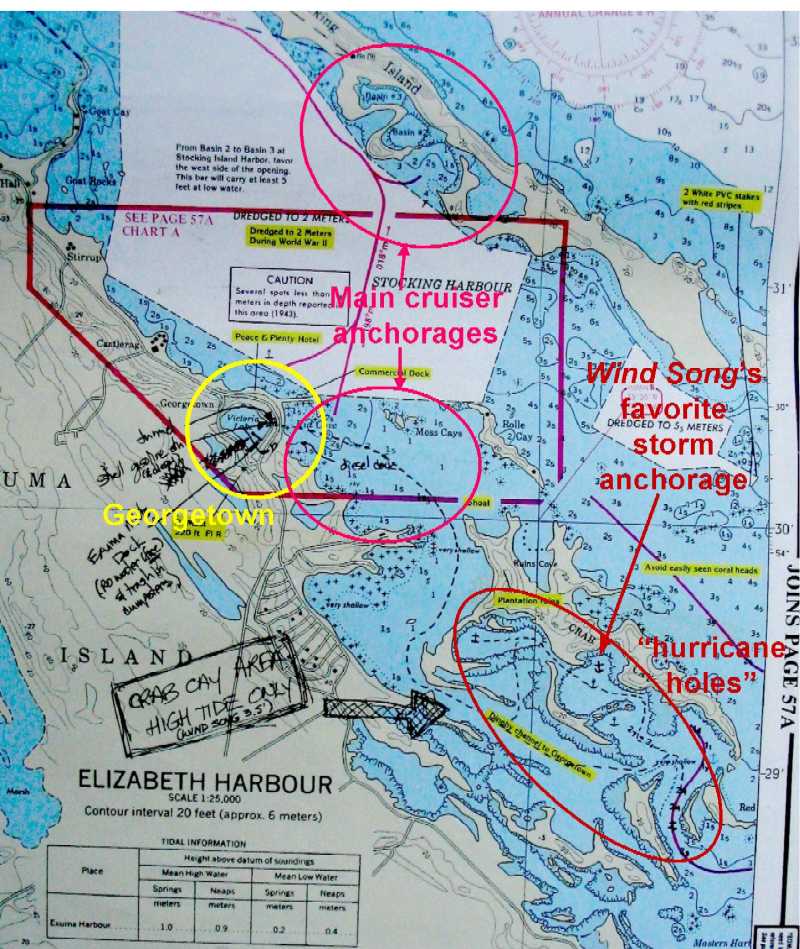
At dawn on 12/18 we raised the anchors, motored out into headwinds and confused 4'-6' seas, and bashed the remaining 35 miles under power to one of the popular yacht anchorages in the lee of Stocking Island, which forms the northern shore of Stocking/Elizabeth Harbour where Great Exuma Island forms the southern shore (and where Georgetown is). The intervening water is about one mile wide and twelve miles long, in a NW-to-SE line. Perhaps some charts would help.
Let's start with an overview. Great Exuma
Island is at the SE end of the Exuma Cays chain, which you may remember
from the satellite photo we've
shown earlier. Here's an overview chart:
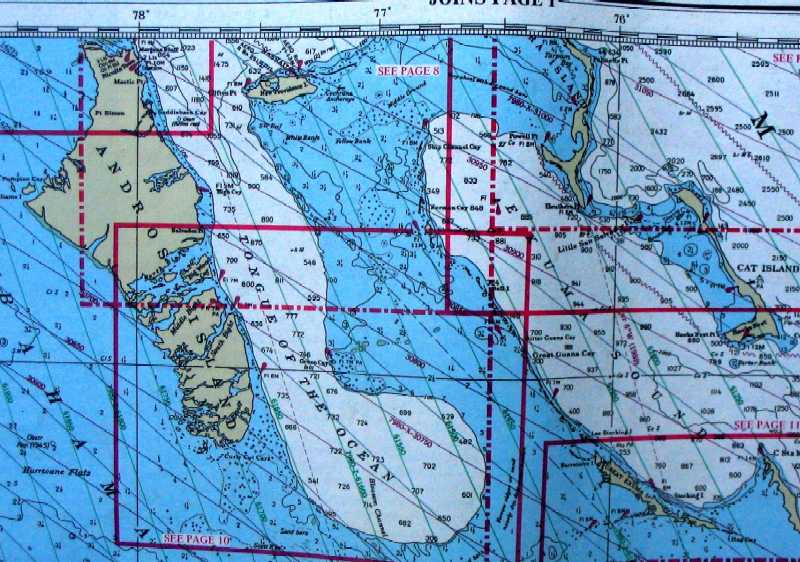
Here's a closer view:
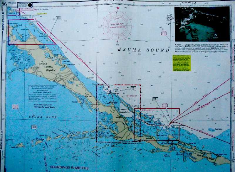
Now we get down to Great Exuma Island itself.
Stocking/Elizabeth Harbour is at lower center, along the NE shore of Great
Exuma Island. The scale here is such that the grid of faint lines marks
10 minutes of latitude/longitude -- i.e. 10 nautical miles N-S by 9.14 nmi
E-W. The white area labeled "Exuma Sound" is deep water (a mile or more),
while the blue area is shallow (20 feet or less). The transition is steep.
And now, the harbor itself. Right now we're
anchored just off the SE point of the central (open) basin in the northern
of the two "main cruiser anchorages". That SE point is called "Volleyball
Beach", for good reason: there are three volleyball courts there, with games
every afternoon at 1430. It is also the home of the Chat 'n' Chill
Bar & Grill. This harbor is about one mile across, from Stocking Island
on the NE to Georgetown to the SW, and is nowhere deeper than 20 feet, most
of it much less. The soundings shown are in meters and decimeters.
And what does it look like in real life? Well, today wasn't the best day to take this photo (below, under 100% cloud cover), but here it is anyway. The structure on the foreground sand spit is the Chat 'n' Chill. The owners of the dinghies on the beach are either in the bar, or playing dominos, or playing volleyball in the sand courts behind the trees to the right. The houses in the background are also on Stocking Island, which has no utilities from Georgetown, so the owner's association has its own generator, reverse osmosis watermaker plant, propane supply, etc. The bar is not part of that, and so provides all its own services. Owning and living in a house in these islands is a lot like living on a boat.
Scud, that large (44 foot) catamaran
whose stern is in the right foreground is the home of a family of four with
two blond boys 17 and 18 (similar ages as Roxanne and Tania) who have never
lived ashore. This is their third boat, which they had built in South Africa
a couple years ago and then went to pick up and bring home. They've been
cruising, including several months in Elizabeth Harbour annually, for 25
years.
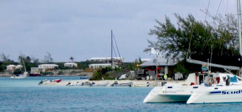
One refreshing feature of the boats in this area is that most (about 90%) are sailboats, and a fairly interesting variety of them. Some of them even sail occasionally.
23° 29.36' N, 75° 44.54'
W
Hole #2, Crab Cay, Exuma Cays, Bahamas
Sunday, December 26th, 2004
We're back in "Wind Song's favorite storm anchorage" (see above) in the Georgetown area, as a strong front is predicted to pass through today followed by 20-30 knot winds from NW through NE. We had our Christmas yesterday morning off Volleyball Beach, then motored the five miles or so over here around noon with Roxanne at the helm. We'll sit out the winds here.
As you may imagine, we did not have a Christmas tree. However, at the last minute Lynn realized we had some red and green cloth ribbon left over from when we made up our lead line (for depth sounding), and she used this to tie bows around two stainless steel posts that occupy the middle of Wind Song's cabin. We opened our presents and were delighted with them, even though we mostly knew what we were getting because we'd picked them out ourselves! T-shirts figured prominently in the mix, along with books, charts, and native handcrafts.
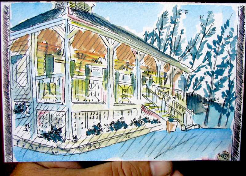
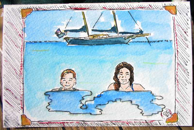
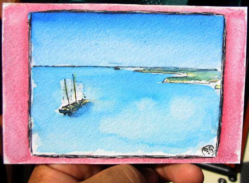
One surprise present from Roxanne for each
of the rest of us was particularly special and deserves mention (and viewing)
here: A small, precious watercolor, roughly 4" x 6", of a scene Lane had
photographed that had had special meaning for the recipient, each of which
you have already seen in one of our earlier reports. For Lynn, it was the
office at Highbourne Cay Marina,
at sunset:
For Tania, it was swimming off the beach with Roxanne
at Hawksbill Cay, with Wind Song at anchor behind:
And for Lane, it was the view from the hill at Hawksbill Cay
overlooking Wind Song and the Great Bahama Bank -- bordered
in pink, one of Lane's favorite colors, and which he associates with the
Exuma Cays:
We're going to be here in the Georgetown area probably through January. We plan to take a week or two to sail the 120 miles or so around Great and Little Exuma Islands -- Lane got a detailed chart of the area for Christmas that has all the information he needs but has lacked up until now. We'll probably return to Georgetown after that trip, top off tanks, larder, and propane, and finally head north again in early February.
23° 30.21' N, 75° 45.90'
W
Kidd Cove, Georgetown, Exuma Cays, Bahamas
Sunday, December 26th, 2004
Well, our stay in that anchorage sure didn't last. And it was not because the protection was no good. Quite the contrary. We'll get to that.
For now, let's take a bit of a tour through "Cruiser Central" in Georgetown: Lake Victoria, and the immediate "downtown" area.
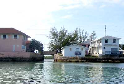
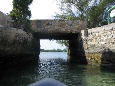
If you look at the second image above this sentence and squint, in the yellow circle labeled "Georgetown" you can see a small body of water labeled "Victoria Lake". There are thousands of such lakes in the Bahamas, and they contain (or in this case, contained) fresh water. However, those that are near the ocean are so useful as harbors that one often finds cuts through the limestone to join the lake and the ocean. If you squint further you will see the handwritten word "tunnel", and a dashed line going to it from the east.
This is the boater's access to Georgetown.
Going in from the outside (east), here's the tunnel (below left and right)
with the backside of Scotia Bank on the left, some shops on the right, and
the "main drag" (a one-lane, one-way street) above.
 __
__
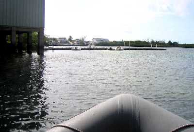
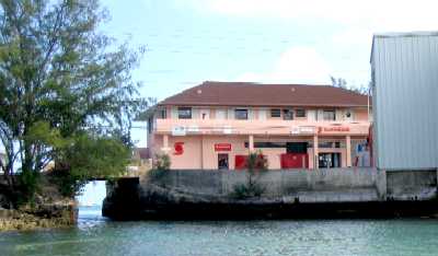
As you come through the tunnel (below left)
the Exuma Markets building is on your left, along with the dinghy dock they
provide for cruisers' use. The photo below right is looking back at the tunnel
past the Exuma Markets dock. Out at the first set of pilings on the dock is
the water hose through which they have for many years provided cruisers the
same slightly brackish but potable cistern water the townspeople drink, for
free. Reverse osmosis ("RO" desalinized) water has always been available from
several outlets for 40 to 50 cents a gallon for those who can't stomach the
rock-dust taste of rain catchment water. This year Exuma Markets installed
their own RO water maker and -- guess what? -- it's still free. They also
offer trash dumping, mail service, and endless info & advice, all for
nothing but the hope that you'll do your grocery shopping in their store.
And of course everyone does.
 __
__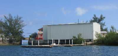
From inside the Lake looking NE (left of the
tunnel), that's the Shell gas station (below left), with their own dock,
where you can walk up and fill the gasoline jugs you use to fuel your dinghy
motor. Gas is $3.80 per US gallon pretty much everywhere in the Bahamas.
To the right of the tunnel (below right) is Scotia Bank, across the "street"
from Exuma Markets. That little dark door at left center, with the small red
sign over it, is the ATM booth that dispenses both Bahamas and US dollars,
which are interchangeable. Daily withdrawal limit is $600 until the currency
runs out, which it does on weekends, Bahamian dollars first.
 __
__
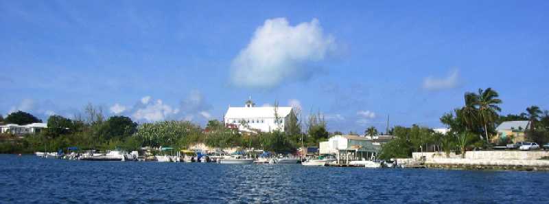
From inside looking north, that's St. Andrews
Anglican Church on the hill above town, where the view is spectacular. Below
are the extensive boat rental docks, which offer everything from runabouts
to "Delta Destroyer" charter boats, complete with a water slide off the
stern.
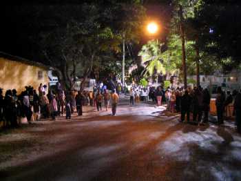
And back outside, in the "Kidd Cove" anchorage just east of Georgetown, a number of us are preparing for the winds of another cold front while (re)anchoring here near town because the second annual Georgetown "Junkanoo" celebration starts around 5 am tomorrow morning. Junkanoo is a Mardi-Gras-like costume parade and party that has been celebrated in Nassau for centuries. "Masks" for the parade, which are huge and are carried on the shoulders, are only limited in weight by what an individual can carry without wheels. We're going, and we're taking our flash digital camera.
Yes, that's right, Lynn decided this morning that Junkanoo was more important to her than a comfortable and secure anchorage in a blow. That's a first.
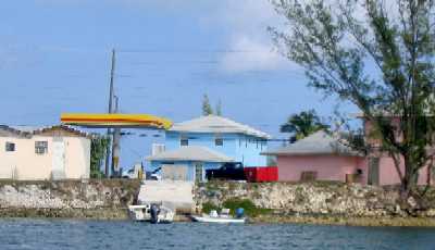
Note those Florida-like houses on the distant shore in the photo below. In 20 years this place will look just like Florida. If you feel you got left out of the investment opportunities of the Florida real estate boom, you have another chance. Just beat it on down here now. It won't last. You can own your own house on your own tiny cay five feet above high water -- on which cay you can make your own water and electricity, build your own dock, buy your own utility boat, ferry your own propane, parts for repairs, etc. . . . until a decade from now, when full utilities will finally be offered, and -- who knows? -- maybe there'll be a road.
It could happen. A Bahamian academic named
Neal Sealey, who wrote the definitive book on Bahamian geology, also was
one of the first to point out that the entire 120 miles of the Exuma Cays
could be connected to Nassau via road just like the Florida Keys are connected
to Miami. The entire thing would be about 160 miles long, handily beating
the Florida Overseas Highway for length. This was just his way of indicating
the geological similarity between the two, but there is a breed of real estate
developer that is highly susceptible to suggestion, and Florida is chock
full of them.
Volleyball Beach (again)
Tuesday, December 28th, 2004
We were anchored just off the Georgetown waterfront so we could get up at 4 am to go to Junkanoo, with a strong cold front predicted to bring 20-30 knot winds for several days. It was a rough night over there, open to N through E, and when we dinghied in for the Junkanoo Parade at about 0430 it was a wet ride, albeit short.
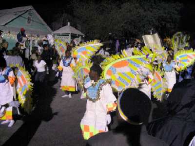
Junkanoo is a native black Bahamian celebration that takes place on the British holiday Boxing Day. The latter takes place the day after Christmas, when the servants, who naturally have worked right through Christmas Day, are lined up and given "gift boxes" by their employers and given the day off. The slaves were not afforded this luxury until (according to the stories we heard) one slave, named John Kanu (or Kanoo, thus the name Junkanoo), convinced his owners that the dedicated hard work of the slaves was worthy of at least one day off a year, and at some point his owners relented and offered their slaves Boxing Day off along with the servants. Since it was going to be the single day off they would get, the slaves began their celebration before dawn and didn't stop until dusk. This became a widespread practice among Bahamian slaves and has continued to this day among their descendants. The flavor is one of tribal pagan fervor mixed with Christian religious themes.
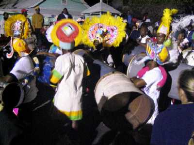
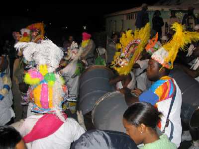
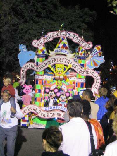
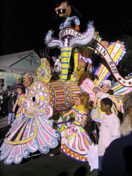
This year marked only the second Junkanoo parade in Georgetown, and was correspondingly small. Preparations go on all year long as people prepare "floats"and "masks, organize costumes, bands, and music, and so on. The parade consisted of two clusters or groups, each beginning with a "float" jury-rigged on to whatever vehicle was available, followed by people with "masks" up to about twenty feet high and fifteen feet wide loaded onto the shoulders of a single person -- who usually could not be seen -- sometimes with some muscular support from the rear by a couple of sturdy fellows, then followed by a band consisting of brasses, saxophones, small (E-flat) sousaphones, and a large percussion contingent with homemade drums made from 55 gallon steel barrels. Many paraders also carried whistles in their teeth and cowbells in their hands. The total effect was loud, raucous, exuberant, and, because the band only had one song to play, repetitive. Unlike most parades, the second group politely waited for the first group to complete the entire route and wind down somewhat before they started off. Given the volume and the very small venue (perhaps one city block, traversed very slowly), this was essential if the music were to be remotely intelligible.
Below left, the parade route with spectators
looking for safe spots from which to watch.
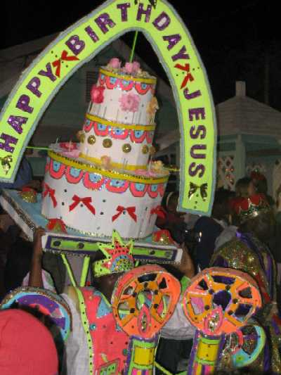
Below right, the first float.
 __
__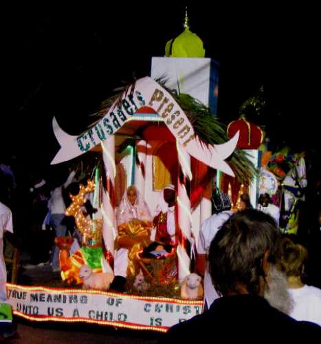
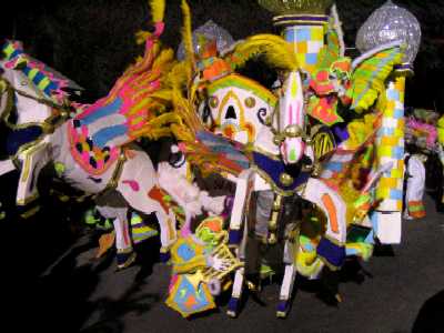
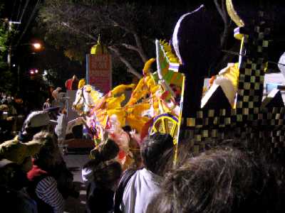
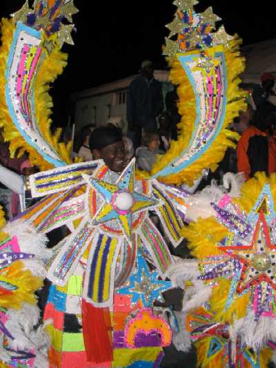
Below left and right, the first "mask", front
and rear views. Somewhere in there is a man, on foot, holding all that
up, and dancing.
 __
__
Below left, one of the smaller masks. Below
right, a "drill team" dancing group.
 __
__
Two more masks -- you can actually see the
faces here, if you look carefully.
 __
__
And following the float and masks, the band.
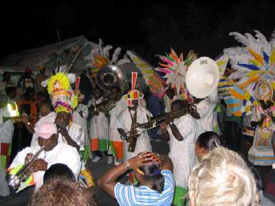 __
__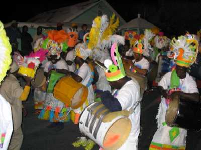
The big (55 gallon) drums rivaled anything
you've ever heard at a college football game, both in tone and volume.
 __
__
Another float led off the second parade group
. . .
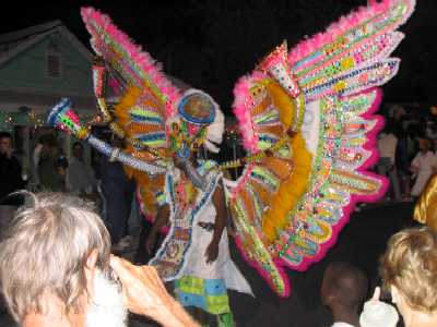
. . . followed by our choice for best "mask"
of the parade. This is one guy. That hole in front is his only view
port.
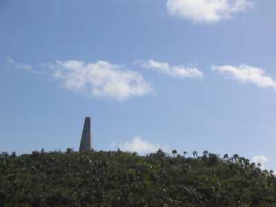
The first run-through (there are several) was over in about two hours, so we headed back to the boat for a couple more hours sleep, then moved Wind Song back here to Volleyball Beach to get some northerly protection. Lynn and Lane then headed off in the dinghy to try to find the reputed trail to the top of Stocking Island, where there is a large cement "beacon" (navigation landmark for boats out in Exuma Sound).
This was our quarry, that "tiny" white tower
on top of the hill in the center distance.
This was our staging point.
(below left) We make it across the island
to the Sound. A windy day. Still haven't found the "right" trail.
(below right) So near and yet so far.
The trail peters out, and bushwhacking through palmetto thicket in shorts
and reef walkers is out of the question. We detour right.
 __
__
We make it at last. That's an osprey nest
on top.
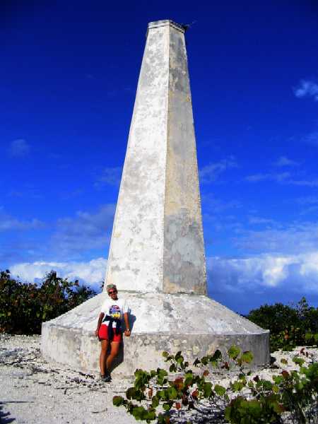
Pretty good view, too. This is looking southeast
along the length of the island, with the popular anchoring coves apparent.
Georgetown is across the bay about a mile to the right.
Lynn takes in the view across the bay to Great
Exuma Island on an overcast, blustery day, our dinghy a speck on the beach
below. By the way, as altitude goes in the Bahamas this is about as good
as it gets. The highest point in the Bahamas, on Cat Island, is 212 feet
above sea level.
Volleyball Beach (again) (again)
Friday, December 31st, 2004
We say "(again) (again)" because, in the near-gale-force northeasterlies we've been experiencing for the past week, on Christmas Day after the morning's events we went back over behind Crab Cay (again) for two blissful days of *not* bouncing all over the water and *not* listening to the anchor gear groan all through the night. But today we're back here off Volleyball Beach (again) as we prepare for the evening's festivities, to be held at the Chat 'n' Chill Bar 'n' Grill. There's even a boat here that is planning to put on a fireworks display. The affair will be pot luck for food, with the bar supplying liquid refreshment. We are once again literally a stone's throw from the beach, which with our dinghy is necessary if we carry more than two people, as it gets seriously overloaded and *very* wet with four. (Hey, with 25+ knots blowing, it's wet no matter what!) It's "rated capacity" is an extremely optimistic 1020 lbs, and all of us plus motor, anchor, gas, foulies, and miscellaneous "carry-on items" pretty much gets us there. It's right on the edge of stupid.
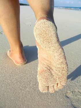
We want to get this report uploaded right after New Year's Day, and there's just one last subject we wanted to mention before doing so, and that is oolitic sand, which is the type of sand that is all around here. We had never understood before the origin of this interesting sand that is so different from what we are used to on California's beaches.
The word "oolitic" is a combination of "oo", the Greek word for egg, and "lite" or "lith", meaning rock. The sand is composed of aggregated "ooids" (OO-ids, not Oh-oids, we think), which in turn are tiny spherical grains of calcium carbonate (CaCO3). This Bahamian sand is, in other words, the result of a build-up from dissolved oceanic molecular (actually ionic) CaCO3, rather than, like California sand, a break-down of silicate rock by wind and wave action and other erosional processes, that is then carried to and deposited on beaches. While California sand is silica-based (silicon + oxygen, or SiO2, which, when melted and fused, is quartz or glass), Bahamian sand is calcareous (calcium/carbon based).
The ooids are made of CaCO3 from the ocean, which is present at very near saturation level in the Gulf Stream and other Bahamian waters. This water washes over the edge of the Bahamian Banks on each incoming tide in a very shallow sheet (no more than a few feet, under which is, of course, land. The water is so shallow and so clear that the sun shines right through it and strongly warms the bottom, which warms the water, which causes some of the water to evaporate, thus reducing the amount of water remaining and therefore increasing the concentration of whatever might be dissolved in it. Since the level of CaCO3 is saturated, it cannot remain fully dissolved in the reduced water volume, so it looks for any available particle upon which to precipitate out. Since such particulates are abundant in near-surface ocean water, small spherical grains of CaCO3 form around these nuclei, reaching diameters of around 0.013 inch (1/3 mm) before falling to the bottom as ooid silt. Once on the bottom, as long as there is some current to keep things stirred up a bit, these ooids tend to stick together to form larger grains, up to a millimeter or more, often in oval pellets or in larger agglomerates called grapestone having sizes of a mm or two. This sand is therefore quite coarse, with individual grains visibly apparent on whatever they may stick to, such as feet. You already saw one photo of this earlier, not very detailed. Here is a close-up of some of this sand that made it onto our deck via inadequately rinsed feet or footwear.
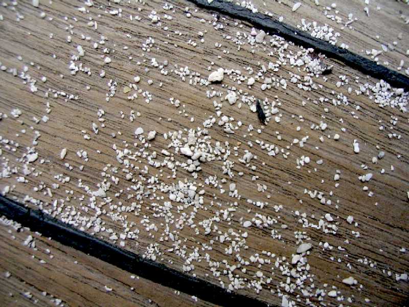
By way of scale, the teak deck strip in this photo is 1.5 inches wide bordered by sealer strips roughly 2 mm wide. Below is a blowup up the upper central region.
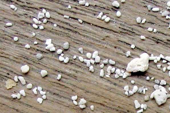
Here you can see everything from very small
spherical ooid grains (barely visible in the smaller grooves of the wood
in the upper right region of the photo) to ovoid agglomerated grains 1 mm
long or so, to larger irregular grains. Most grains fall in the 1 mm class.
The largest grain in this photo is 2 mm.
Aside from the obvious threat these grains represent to a teak deck (gaah!), one salient characteristic they have that is much different from sand in California is how quickly the grains form and how new the topmost sand levels are, often less than a century or two old. Since this sand is still quite soluble in fresh water, if it blows ashore it gets wet in rain, aggregates, and forms first calcareous sandstone and then limestone, which latter is fairly rapidly eroded into the fantastical shapes you've seen earlier.
And that's it for this report. We'll be in the Georgetown area and around Great Exuma Island through January, then moving onward again, weather permitting. Best wishes to you all. We hope you are enjoying these reports.
By the way, we've noted in our contact info
that you can now telephone us if you wish. We have a Bahamian cell phone
that, while it does not have coverage everywhere we go, does fine when
we are near a populated island. The number is 242-554-0815, before which
you must append a "1" or "01" depending on your phone company. Unfortunately,
in the type of snafu that is so common in less developed countries (which
this is, no matter what you may hear to the contrary), the voicemail service
we were told was included was not, so if you can't reach us, just keep trying
every day or so. We're keeping the phone on and charged 24/7. While our
cost to call you is fairly prohibitive (about $1/minute), yours to call
us seems to run right around 25¢/minute for most people who've called
us -- and wonder of wonders, it is, so far, FREE to us, even though the
BaTelCo literature says it is not supposed to be. Another 3rd world government
bureaucracy snafu, this time in our favor! We ain't complaining.