 __
__
Three weeks have gone by since we emailed our last update, and "a lot" or "not much" has happened depending on where you look. We have not left the Georgetown area at all during that time as various things have either prevented or militated against our departure. However, we are planning to leave tomorrow for our long-awaited trip around Great/Little Exuma Islands, a 92 mile clockwise loop that we plan to complete in eight days. It is time to get our next update started, because we'll need to email it in 10-12 days or so, when we finally leave Georgetown for good, heading north.
We have been here since December 18th, 38 days and counting, and every day and night during that time we have anchored in one of the three places we described in our last update: Volleyball Beach, Kidd Cove, and Crab Cay Hole #2. We have moved among these three often, sometimes daily, as we either seek shelter from weather (behind Crab Cay), indulge Tania's social calendar (Volleyball Beach), or go into town (Kidd Cove) for water, gasoline for the dinghy, propane for cooking, diesel fuel, groceries, Internet, Christmas presents, etc. We have also, during that time, taken three lovely daysails around the harbour (pictures later) -- mostly for Lane and Roxanne, who get really tired of not sailing.
Tania has been the social butterfly of the family during this period, having developed friendships with a group of kids her age who either live on boats anchored here or live ashore on Stocking Island as permanent residents. Since all are home-schooled, all keep the same schedule: school until noon, after which they are GONE. Whenever Wind Song has been anchored at Volleyball Beach, Tania has spent almost as much time off the boat as aboard, and that's including her hours asleep. Her typical day goes like this:
0730 Arise & dress
0800 Breakfast, cruiser net (VHF radio), wash/dry
dishes
0900 School
1200 Lunch and VHF radio to plan rest of day
with friends
1300 "Daylight Social Activities"
1730 (sunset) Dinner aboard Wind Song,
wash/dry dishes
1900 "Evening Social Activities"
2300 (or later) Back aboard, in bed
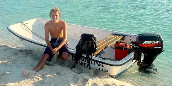
"Daylight Social Activities" can mean surfing, swimming, or boogie-boarding at "Ocean Side" (the NE or "ocean" side of Stocking Island), snorkeling in one of the several cuts between islands, dinghying the several miles SE to the Moriah Cay/Ferry area near the gap between Great and Little Exuma Islands, or something similar, daily when we are at Volleyball Beach, and lately even when we are not . . . because she's gotten hooked up with a young live-ashore fellow named Gregg who is willing to pound his way down here behind Crab Cay in his 12 foot Carolina Skiff, 2.5 miles through the chop each way, just to pick her up and drop her off. In this way Tania has managed to see a great deal more of the area than the rest of us.
"Evening Social Activities" include get-togethers or parties at one of the live-ashore kids' homes, bonfires on the beach (requires the prior permission of the owner of Stocking Island, who also owns Chat 'n' Chill Bar 'n' Grill), and (on Friday nights) a visit to the Two Turtles bar & night club in Georgetown, where IDs are not checked and a certain amount of underage drinking does occur. This latter does not include Tania (by her choice), and we have standing arrangements for how she can get back across the mile or so of often choppy and windswept harbor waters late at night in the event she considers her skiff driver or any of the passengers to be a danger to the rest. This has not occurred, and on the whole all these kids have acted very responsibly, particularly where being on small boats is concerned. Most of these young people have been on or around the ocean their entire lives, including motor and sailing yachts, daysailers, powered skiffs and dinghies, surfboards, boogie boards, windsurfers, wake boards, kite boards, water skis, swimming, snorkeling, diving, spearfishing, you name it, all in salt water. They are not neophytes.
By the way, generally speaking the kid with access to the largest, fastest, and most capable skiff ferries the rest, assuming he/she doesn't have to buy his/her own fuel, which is $3.80/gallon here. These are not "dinghies" of the inflatable sort, but 12 to 15 foot fiberglass skiffs (Carolina SkiffTM and Boston WhalerTM are the most popular brands) that have 15 to 50 horsepower motors and can, with care, safely carry six or seven people.
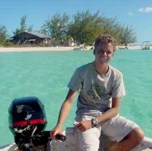
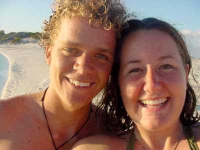
Tania's "young man" and the
key to her transportation and social life around here: Gregg
__
 __
__
Tania's school and social calendar has obviously driven a lot of what we've been doing with the boat. The rest of it is driven by either what we need from town to keep us going, or the need to hide from weather. In the former case we anchor in Kidd Cove just long enough to get done what we need done -- which is OK with Tania because 1) she can send off her school assignments and check her personal email, and 2) it is only a five minute skiff ride across the harbour from Volleyball Beach, so her friends will come pick her up and ferry her over. In the case of bad weather, however, we hole up behind Crab Cay, which Roxanne calls "Tania's vale of tears" because it is totally outside the teen social loop. She does, however, get a lot more schoolwork done there.
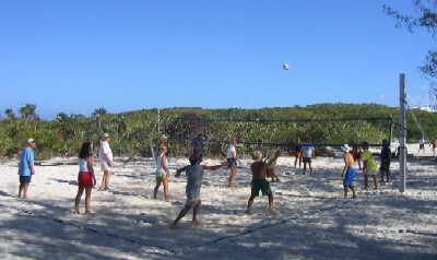
An amazing (to us) number of people come down here every year just to be here and nowhere else. There are people from New England who provision their boat in the States for seven or eight months (because a one or two month extension of the standard six month cruising permit is available just by asking), take ten days to sail directly to Georgetown nonstop starting November 1st, put a screw-type mooring down in the sand in Hole #1 right behind Chat 'n' Chill, and don't budge until June. They have 360 degree protection, solar panels, a wind generator, a reverse osmosis watermaker big enough to take showers every day, an icemaker, a refrigerator big enough to keep bread and produce as fresh as back home, a freezer big enough to keep eight months worth of meat, and so on. There is every form of community activity and that is what they come for. The cruiser community here is essentially a small American town of a few hundred people that just happens to disappear every summer and reconstitute itself every fall. They come here with building supplies aboard and they build stuff. They do construction projects. Volleyball nets, posts, and tensioners. Picnic tables and benches. Beach palapas. They come with giant domino sets that will accommodate eight players, and they play daily. Aside from the cruiser "fun volleyball" games daily, there are "regulation" players who play serious volleyball three hours a day seven days a week. There's the "watercolor group" that meets two or three times a week. There's a bridge group (cards). There's a yoga group that meets at 8 am seven days a week on another beach, weather permitting. (This is simultaneous with the daily cruiser's VHF net, and one wonders if some subtle point about the "otherness" of yoga is being made.) And of course, there's the annual Cruiser's Regatta, ten days of activities culminating in a sailboat race in the harbour, all of which benefits a local charity. A cruiser vs. native softball tournament is included. Also talent show. A volleyball tournament. Swimming. Sack races, three-legged races, scavenger hunts, a bocce tournament for the French folks (including Quebecois), and god knows what else, basically what you'd expect if you combined a mid-west American town with a yacht club on July 4th, except it goes on for ten straight days.
For the record, the rules of fun volleyball
are (roughly) as follows:
1) Anyone is welcome.
2) Each side must have nine people.
3) Teams are deconstituted, and reconstituted
differently, after each game. Everyone walks off the court at the end
of a game. This allows newcomers to be included.
4) Service must be underhand.
5) Number of hits per side is unlimited
except that no one person may hit the ball twice in a row.
6) A ball that bounces off the post or
net remains in play, AND counts as a hit, so the person that hit it there
may hit it again immediately.
7) While game score is kept, each game
stands alone, and the teams change, so the only reason to keep score is to
know when to stop playing. There are no dynasties.
8) There is no such thing as an illegal
type of hit, like a "throw" or a "carry". If the ball contacts your body and
leaves airborne, it's legal.
9) On service only, the receiving side
must hit the ball at least twice before it goes back over the net.
That's about it. It's inclusive rather than exclusive, it's people rather than teams, the point is fun rather than competition, and the most fun is when the score is close, the volleys are long, and close calls, desperation moves, lucky hits, and serendipity are all abundant.
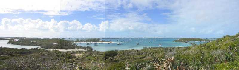
Here's an overview (WSW at
center) of the Stocking Island central anchorages. Hole #0 (left) is for
shore residents' boats only, no liveaboards.
Holes #1 (center) is "downtown".
Volleyball Beach is on the obvious sandspit. Chat 'n' Chill is also on the
spit just where the trees end.
Holes #2 and #3, off to the
right, contain mostly moorings.
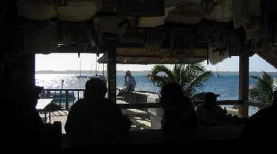
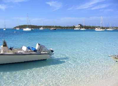
Chat 'n' Chill Bar 'n' Grill
on Volleyball Beach
Late afternoon view west from the bar out the front of Chat 'n' Chill.
 _
_
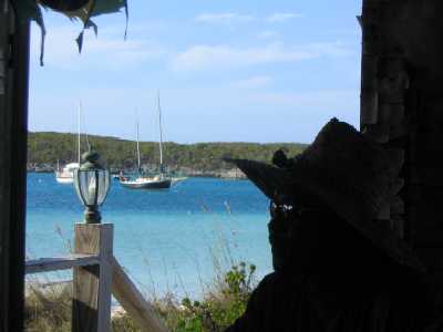
Views out the north side
of Chat 'n' Chill, looking NW. Wind Song is "in the frame" in both
(look for the dark hull).
 _
_
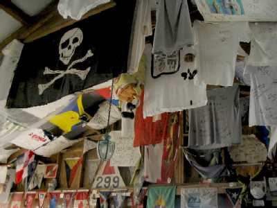
Cruiser memorabilia (below
left) decorate the bar walls and rafters.
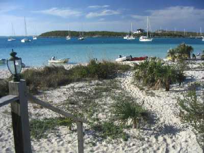
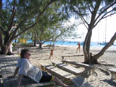
Out front (below right), one
of the more idyllic restaurant front entrances on this planet.
 _
_
Out to the side, the "fun
volleyball" game (below left) is in full swing,
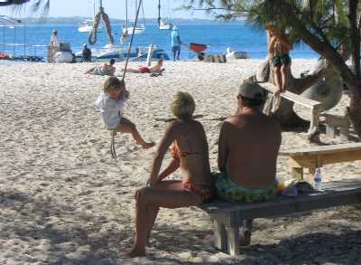
while a cruising couple teaches
their young daughter the joys of a rope swing (below right).
 _
_
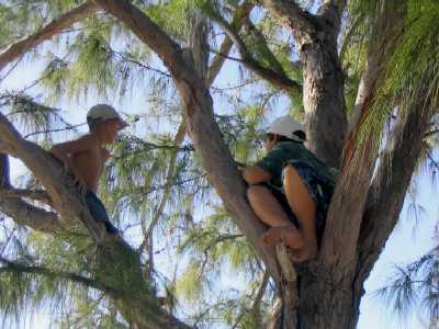
Above their heads (below
left) a pair of young boys establish their pirate lookout in the branches
of a casuarina tree,
while below them (below right)
a somewhat older boy-pirate contents himself with the view from a lower, more
stable vantage point.
(BTW, cruisers made all that
furniture. They've even constructed purpose-built bridge-playing tables &
benches.)
 _
_
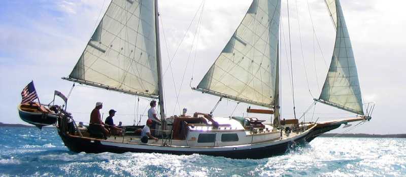
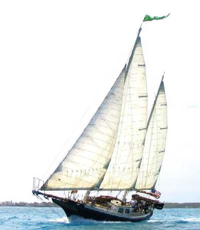
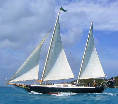
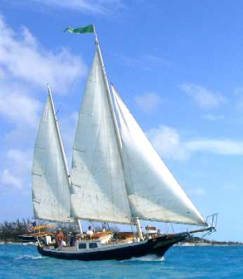
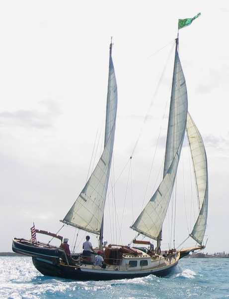
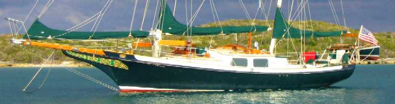
As mentioned above, we've been taking a few daysails when the weather backs off a bit. We invited Andy and Phil off of the Prout 38 catamaran Adventure to come along one day (Tania was off "flitting"), because we wanted to get photos with which to advertise Wind Song later this year, and we needed a stiff breeze and some extra crew for the purpose -- because someone (Lynn, in this case) had to be in the dinghy with the camera. Here are some samples. It was blowing 18-20 knots, and Wind Song was doing hull speed throughout.
 __
__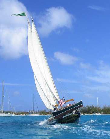
OK, sailing buffs, check the
boom alignment, above left, and the "fanning" of the booms and sails, above
right.
With this we hope to set some
traditional Chesapeake boatman's heart aflutter.
 __
__
Of course, we don't take pictures when we're either busy, or it's night time -- or both -- so you don't get to see some of the more entertaining moments -- or hours. One such period occured some days ago when the strongest front of the season so far passed through and found us inadequately situated.
(Chuck and Hal Kent, consider the following as having been written for your entertainment. Lane thought of you as it happened.)
It all started when our first mistake -- believing the weather forecast, which said the wind was NOT going to swing through the usual 360 degrees, but was going to go directly from ESE to N -- was compounded by our second mistake -- being at Volleyball Beach when it came -- and was rendered inevitable by our third mistake -- anchoring as if the forecast was true, and our fourth mistake -- NOT reanchoring entirely when mistakes 1, 2, and 3 caused us to swing afoul of one of the "fruit box" moorings.
But it was at night in a crowded cove. Pulling anchors up out of the ground wasn't a realistic option. We'd seen someone do this, and he hit three other boats before he fetched up on the sand. Lane had helped him kedge off and guided him by flashlight to a new spot, and he didn't want to put Wind Song through a similar experience. Being loose in an anchorage at night is bad enough, but being so in a gale is suicidal.
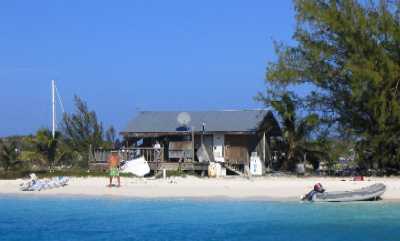
OK, first things first: what's a "fruit box"?
This is a fruit box:
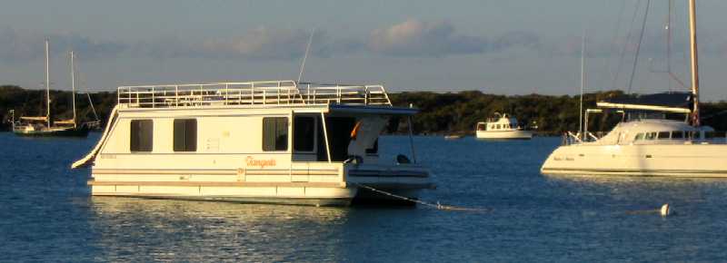
And this is why:
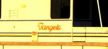
These are rental houseboats from Georgetown for use inside the greater Elizabeth Harbour area, and they all have "fruit" names (except for the unfortunately named "Sea Grape", which is named not for a fruit but for a form of seaweed). As pictured, they use those white-ball-with-blue-stripe moorings placed specifically for them, and every anchorage here has one or two -- including (as you've now guessed) Volleyball Beach. The mooring pictured above is in "Crab Cay Hole #2" -- locally known as the Cupcake Anchorage -- and is roughly 50 feet aft of Wind Song's stern as this is being written . . . so this time we won't hit it if we swing.
We made the mistake of anchoring too close to one of these moorings (which did not have a fruit box on it at the time), so that the wind, when it DID swing 360 degrees, swung our stern directly over it, fouling our rudder and propeller -- at night, in a crowd of other boats, in a howling gale, driving rain, and COLD (as cold goes around here, maybe 65 degrees, but with 35 knots of wind chill, which meant that standard tropical anchor drill garb -- a bathing suit -- would not suffice).
Hey, no biggie, we deployed our second anchor to help take tension at the bow, then used our third anchor to windward off the side of the stern to take tension off the fouled mooring pennant (all this by Lane, in the dinghy, in the rain and wind), after which Lane stripped to a bathing suit and went over Wind Song's side (where it was warm) to get the mooring free of her underpinnings, with light from our very effective deck lights plus a flashlight held helpfully over the transom by Roxanne. This worked well, and we were able to ease off the third anchor rode somewhat, as we were off the mooring ball and clear of it because we took up scope on anchors 1 and 2 -- remember this point for later -- but now starting to swing afoul of our friends Andy and Phil on Adventure. But hey again, no problem, just leave anchor #3 out there off the stern to keep us off them.
All this while Tania was partying ashore, for god's sake. She came back later, in a gale, ferried by a very indulgent Gregg in his skiff, hopped aboard before the next blast of rain hit, and calmly asked, "So what did you guys do this evening?" Sound of teeth grinding.
We all went to sleep while the howling outside continued, and since Lynn has over the weeks gone through the boat with a fine tooth comb removing, relocating, lubricating, or lashing down every last thing on board that can possibly move when the wind blows (this started even back in Florida, because she HATES the sound of the wind -- on a boat called Wind Song after all . . . ), we did not hear or feel anything when the wind hit a sustained, measured (by a guy named Ken on the sloop Dawn Mist) 49 knots for 45 seconds at about 0300, and, according to Ken (who was up and watching), broke our two main anchors free about 5 seconds into the 45 and sent Wind Song skittering shoreward until she fetched up on anchor #3 -- with her keel floating about one foot above the sand bar right off Chat 'n' Chill . . .
. . . until about 0530, an hour before low tide, when Lynn sat up suddenly in bed and said "Lane! Lane! We're on the bottom!" Which woke Lane up, whereupon he spent five seconds confirming Lynn's diagnosis (bump-bump, pause, bump-bump), said "shit!", pulled on his swim trunks, sweat shirt, and foulie jacket, flipped on the deck lights, grabbed a flashlight he'd laid out for the purpose, and launched himself up on deck.
It was not pretty. Wind Song was broadside against the sand bar. The rodes from anchors 1 and 2 were lying slack under her bow, having dragged due to inadequate scope (remember?), the #3 rode was bar-taut at an angle off the stern, and the sustained wind was around 35 knots. At least it was not raining.
Back in the dinghy again, Lane retrieved anchor #2, redeployed it 250 feet upwind right next to anchor #3, and then winched Wind Song off the sand. We were now hanging broadside to the wind on two anchors off the starboard side, one at the bow and one at the stern. With difficulty we retrieved the main anchor, which is large and on all chain, then slacked #3 off the stern until we were hanging only on #2, then redeployed #3 45 degrees to the right of #2 to add holding power and keep us from swinging into Adventure should the wind veer further. While this left us quite safe, it also left us quite unable to depart, because no matter which anchor we picked up first we'd swing into something, either Adventure or the sand. So we waited for dawn.
Around 0630 Phil appeared on Adventure's deck looking dumbstruck. Turns out he'd taken a peek outside around 0500, saw our predicament, knew what the tide was, figured we'd never get off by ourselves, and went back to sleep figuring he'd watch the festivities in the morning. Now here we were, floating. Much as Lane hated to do it -- he was determined to get us off under our own power or die trying, simply for the sake of pride -- he finally broke down and asked Phil if he would be willing to consider easing out another 30 feet of rode so we could swing in front of them and pick our anchors up safely one at a time. Through that simple expedient we got out of there.
We tell this story so you won't think we
lack entertainment out here. Otherwise you'd probably think we sit around
all day soaking up rays and wondering what we're going to do to make the
hours go by. Not a problem. Where entertainment is concerned, in the Bahamas
a little "pilot error" goes a long way. It's a pretty unforgiving place.
We were lucky this time -- it was only sand. The other side of the
cove is rock.
Saturday, January 29th, 2005
Spring must be on its way, because we just got three (count 'em) days of fair weather, two of which were usable for exploration.
Why only two? Because the foregoing days of NE wind had left so much sea running that both exits from the harbor were impassable for 24 hours after the winds abated -- and we mean impassable, cuz we tried. Both exits had six foot waves breaking across them, and the deeper water just inside was a washing machine of backwash off the reefs and rocks to leeward. We got within a mile of the left turn across the reef at the east "channel" and simply gave up, because there was no channel anywhere. No pictures, though. We were pretty busy at the time.
The next morning we tried the other (west) exit, and while we did find a channel of unbroken water there, there were still six foot standing waves on our beam as we motored along inside the reef. Wind Song was rolling rail to rail and taking green water over the bulwarks heading for the turn -- in dead calm conditions, windwise.
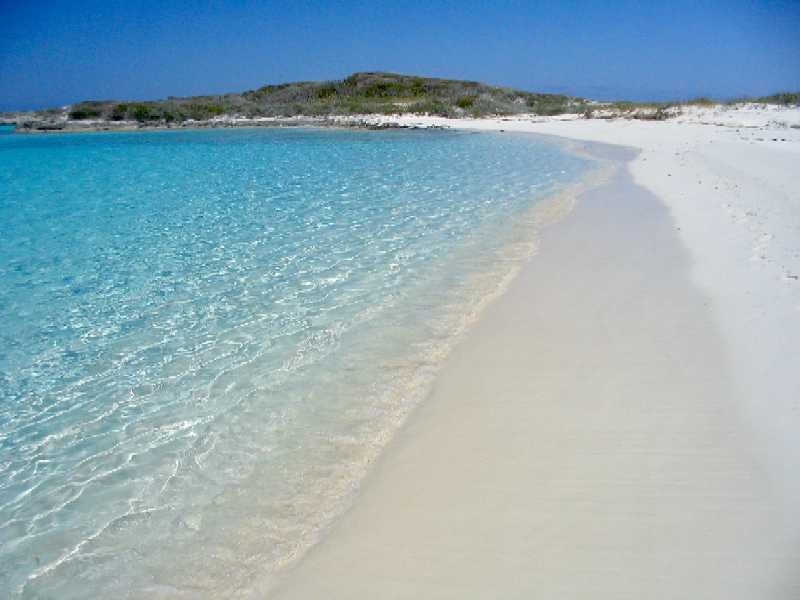
But we made it, and with only a two day window we abandoned (for now) our intention to sail around Great Exuma Island and headed 16 miles NW to a place we call "The Passage Through Heaven", where, 10 years ago, we had neither the time nor the shallow draft necessary to tarry. One of our intentions this trip was to go there and not just tarry, but wallow.
And for one blissful windfree, mostly swell-free day, we wallowed. After a night behind Square Rock Cay, we moved and anchored just inside a small exposed island called Boysie Cay, which at either end had narrow passes to the deep water outside, and therefore was fairly open to swell. On this day the swell was about one foot. Had it been more than two feet, we would have been uncomfortable. More than three and we'd have been endangered.
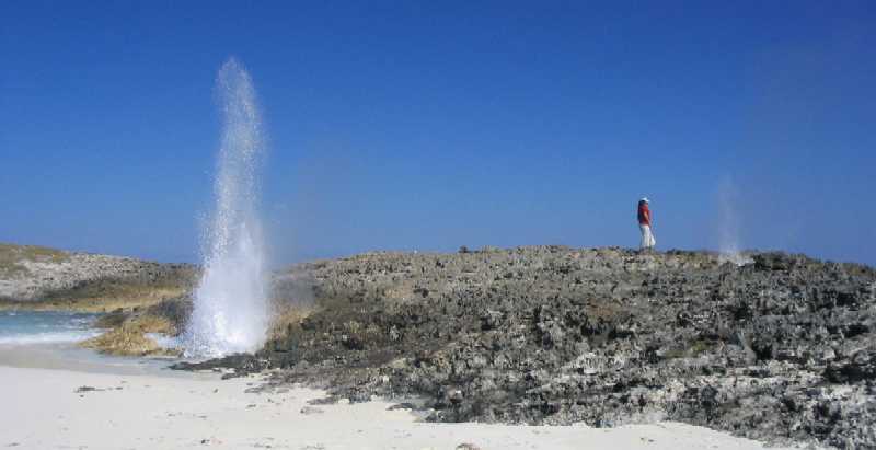
The swell wrapped around the ends and met in the middle, where it had formed a perfect little jutting sandbar beach. In addition, at one spot there was a very narrow (four feet) gap in the island where waves broke through and had formed another little private beach in the quiet water within, and where there were three of the most violent blowholes we have seen. At about mid-tide, the one-foot swells were producing howling geysers of water and mist as high as 40 feet in the air. We managed to capture photos of about half that.
These photos deserve to be large.
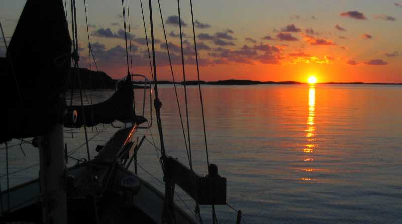
Sunrise behind Square Rock
Cay. We had to rise early to take advantage of the morning high tide to
get to the Boysie Cay anchorage half a mile away. This is an area where sandbars
build up along the edges of tidal flows through cuts -- so every cay tends
to have a sand bar behind it barring progress except at high tide.
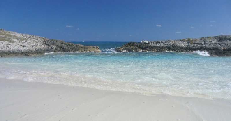
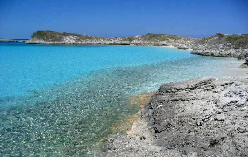
Boysie Cay, less than a mile
long, separates Square Rock Cut and Rat Cay Cut, which serve as passes for
yachts to the deep water of Exuma Sound. Shown is a four foot wide gap in
the island, the sandbar on the inside built up by wave action, and a sailboat
heading south offshore toward Georgetown.
Here's a view from the "side"
of the gap. Exuma Sound is just over the cay to the right, and water from
the "gap" is in the foreground.
And looking to the shallow
side . . .
To the right of the gap there
are three blowholes in a line above a single cavern exposed to the swell.
All three are visible here, though the second one, immediately to the right
of the big one on the left, is barely visible as it blows only air and mist
-- which it does vociferously.
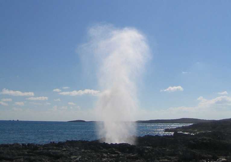
This is about a 20 foot plume.
It got to 40 feet at mid-tide . . . from a one foot swell.
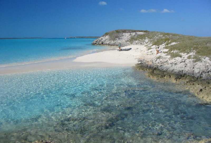
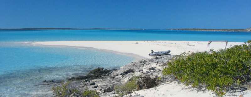
Just around the bend, that
perfect little beach midway between the cuts.
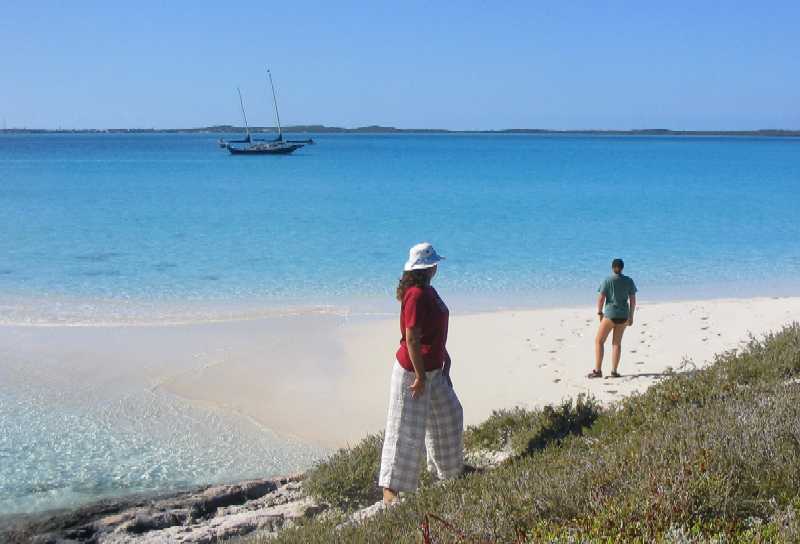
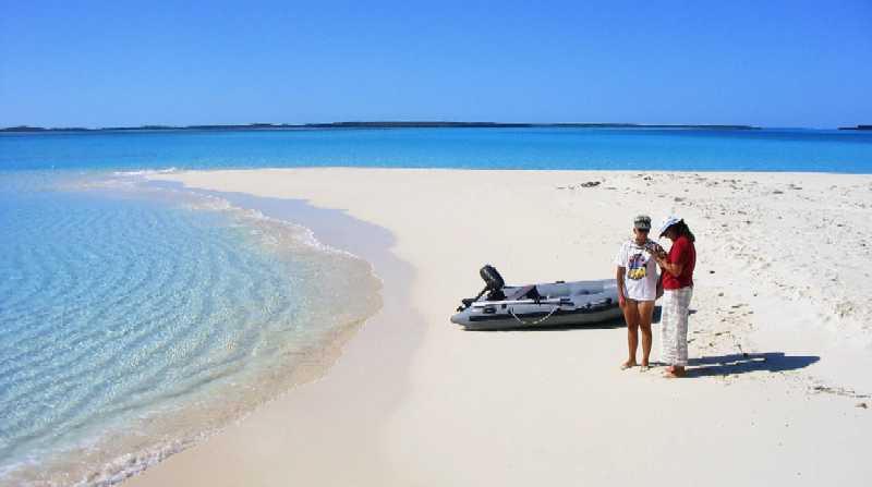
Lynn and Roxanne examine
a small piece of staghorn coral they found.
Note the distinct absence of
other boats. If this were your beach for a day, what would you
do?
Just on the other side, the
sandbar fades back into the rock of the cay. This is a perfect example of
the oolitic sand we mentioned in an earlier report -- sand literally formed
in place right out of the ocean water. It didn't get carried here,
it got made here.
The cay extends toward the
deep water of the cut, the source of the calcium carbonate-laden water that
makes all this sand on the bottom. It is worth noting that this stuff will
plate out on anything -- Wind Song's sides, the insides of her thruhull
fittings, etc. We just took apart her head and engine water intake fittings
to file off the carbonate deposits that get left there -- a regular maintenance
procedure in the Bahamas.
That whitish deposit above
the waterline on Wind Song's topsides is calcium carbonate . . .
rock. Takes polishing compound to get it off. Every dark-hulled boat
that's been down here awhile shows it. Doesn't show on white boats.
Volleyball Beach
Sunday, January 30th, 2005
Our itinerary is so hosed, we've gutted it and pretty much started over. Everything south of here -- Long Island, Crooked & Acklins Islands, and the Jumento Cays -- has been canned, and north of here all we're keeping is the Abaco Cays and the Bight of Abaco. Cat Island and Eleuthera are out. As of right now we have just under three months remaining before we must be back in Florida to put Tania on a plane to LA, and we need to reprovision in Nassau along the way north. Half our time in the Bahamas is gone, and we still haven't seen the back side of Exuma.
It helps that the weather does seem to be ameliorating. On the other hand Hog Cay Cut, east of here, that we have been planning to use to get to the Exuma backside, is reputed to be so dangerous in adverse conditions that three or four days of quiet weather are needed before it can be considered safe -- and quiet spells like that have not been happening. According to people we trust here who have done it, one should not attempt it in more than a few knots of wind, more than a foot of swell, or at any tide other than high slack.
So now our plan is to go the other way around and NOT close the loop, but rather go about halfway around counterclockwise, around the west end, and back, then head north up the Exumas without returning to Georgetown. We'll then spend another three weeks or so going up the chain, then over to Nassau for provisions, and then up to the Abacos by mid-March. Weather permitting, we'd like to leave in just a few more days.
There is a lot we need to give up here. It should be obvious by now to everyone reading these reports that we will not even remotely achieve our original plan. Out of nine major islands, island groups, or areas we intended to visit -- Andros, Exumas, Long Island, Crooked/Acklins, Jumentos, Cat Island, Eleuthera, Abacos, and the Bight of Abaco, plus a few remote outlying areas along the way -- we will visit only three. We don't really count our Andros "visit" as we failed to see most of it, especially the bights through the middle which were a key part of our plan. We spent ten years and a ton of money (for us) getting ready to do this, yet most of what we planned won't happen. Chances like this don't come along every day, and we're not getting younger.
So, how to go forward from here? Well, it's pretty simple. In the words of Werner Erhard, "Get off it and get on with it." In the words of Don Henley (fomerly of the music group The Eagles), "Get Over It". That is to say, move on. Be grateful for what we have, and have done, which ain't shabby by any metric. We get so lost in the disappointment of what we haven't or won't accomplish, or in how it has turned out compared to how we thought it would turn out, that we sometimes fail to take note of the simple fact that we are HERE, and the weather be damned. Lane says if someone had asked him if he'd still have gone if he'd known he'd spend half his trip holed up in Cupcake listening to the wind tear through the rigging, he'd have said "Hell yes. Absolutely. Compared to working? What a question." (Speaking of which, word has reached Lane that things have not been going at all well on the VIIRS project that he was working on before we left. Hoo boy. His friend Mark Frink, who replaced him has Technical Manager, may not be brimming over with joy at the opportunity.) (Mark, it is an opportunity. Trust me on this . . . )
"I mean . . . I mean . . . I mean, I'm sittin' here on the Group W bench . . . " (Arlo Guthrie) Gotta keep perspective. A few days ago our friends Bob and Barb, who have a 42 foot Colvin-designed steel schooner named Rhiannon that Bob built, stopped by after a morning of reef snorkeling and handed us three of the biggest lobsters you've ever seen, tails as big as Lane's bicep, *almost* more lobster than the four of us could eat -- but given our lack of refrigeration, we gorged ourselves. Things like that don't happen to us in El Segundo.
So this is it. No more whining. First day of the rest of our lives, and all that. We're taking it as it comes, making hay while the sun shines, getting off it and getting on with it, etc. etc. Time to wind things up here, send this report off, email Tania's schoolwork, get a final shipment from home (books), and get this boat moving again.
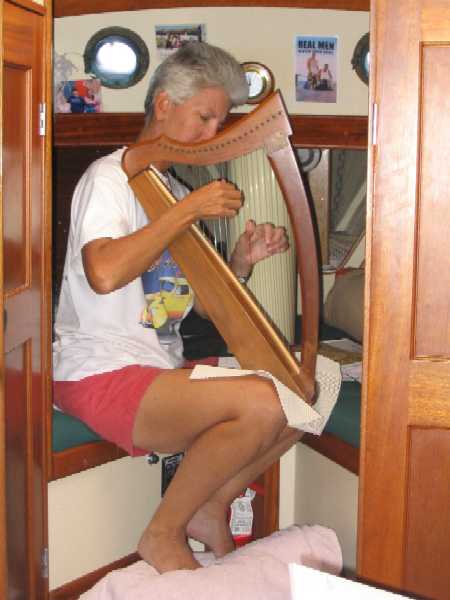
P.S. Lynn promised her harp teacher
we'd include a picture of Lynn playing her lap harp aboard Wind Song.
(Her teacher has our "big" harp.) She does play it -- usually in the V-berth,
because that's the one place on board that is generally unoccupied during
the day.