 _
_
We are about a night and a day of sailing away from Miami, Florida, sitting out a cold front passage awaiting the right weather for the run. We are alone in a fairly open but also fairly secure anchorage, as we have a cay close to the west and several miles of very shallow banks to the east, followed by a line of cays. We came up here yesterday from Nassau, a run of 40 miles in a northwesterly direction in an easterly breeze so light we had to motor the entire distance. The wind is now 15-20 knots from the SW, on its inexorable way clockwise around the compass rose as the front comes. We will leave here when it goes east of north, a fair wind for the overnight run to Bimini 85 miles west of us, and then immediately across the Gulf Stream to Miami in daylight, if conditions are still favorable -- or a stop in Bimini to wait if they are not.
It is worth mentioning that the 45 miles of ocean, traversed by the Gulf Stream, between Bimini and Florida is not like other pieces of ocean, because it is moving to the north at about three knots. This may not seem like much, but to ocean waves it wreaks havoc. While a 20 knot wind ordinarily produces only 5 foot seas, a 20 knot northerly blowing against the northbound Gulf Stream produces 9-13 foot seas that are steep, short, and breaking. Where 20 knots is ordinarily a brisk sailing breeze which no sailor in a well-found vessel would fear, against the Gulf Stream current it produces dangerous conditions that all sailors (and motorboaters) in this region religiously avoid. Wind Song being somewhat less than "ocean-capable", we'll wait for winds of 15 knots or less with no northerly component -- preferably at least 24 hours after a northerly wind last blew across the Stream. In this case it appears that may not occur for another week, because a "reinforcing front" is coming that will make the northwesterly winds after the front last until Monday, and we may not get easterlies until next Wednesday.
It should also be said that in cruising one does not sail the way one does back home. Back home the boat is not also your home. The winds and waters are familiar, the harbors are close and safe, the inevitable end of the day is a dock on flat calm water, one is always surrounded by other boaters, and serious help is a VHF radio call away. Out here, by contrast, one may enjoy sailing but one almost never sails for fun -- and one does not sail close to the edge, ever, if it can be avoided. If one is close to the edge, close to the performance limits of the boat, it is because the alternative is worse. Bravado and temerity are not common among cruising sailors.
At the end of our last report we were in Georgetown with three questions on our minds and no answers: 1) When shall we leave Georgetown?, 2) Is there anyplace else in the Bahamas we should visit before returning to Florida? and 3) By what route should we return to Florida? We now have answers for all three and good margin against our April 27 goal. The answers are 1) April 5th, 2) yes, of course, a zillion, but for this trip only the Berry Islands, and only for a brief stop on our way west, and 3) via the Exumas, Nassau, Chub Cay (Berry Islands), and Bimini -- the most direct route available, approximately 300 nautical miles, and also the route with the most numerous safe anchorages and the fewest overnight passages: one.
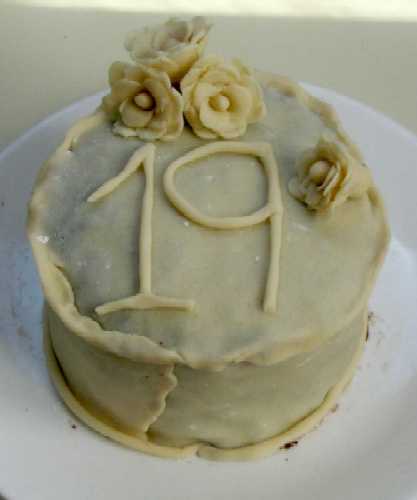
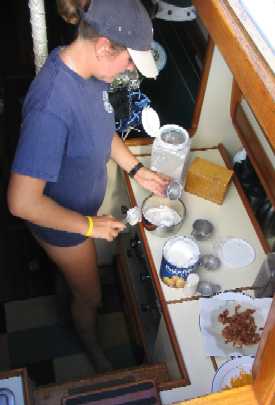
In Georgetown, March 25th marked the end of Roxanne's 19th year on this planet. For the occasion, at Roxanne's request Tania made a chocolate-raspberry layer cake covered with marzipan, which latter we had the luck to find at Exuma Market.
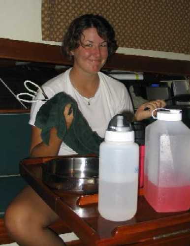
The cake . . . and Roxanne
drying dishes after dinner.
_
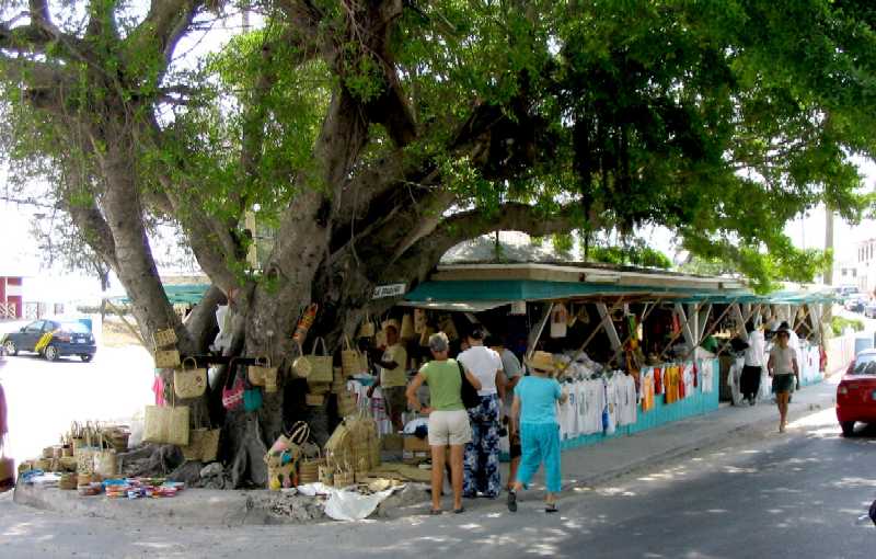
The Georgetown Straw Market,
home of native plaiting handcrafts, and the best T-shirt variety in town.
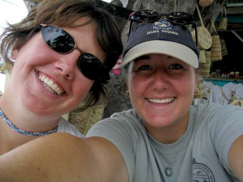
It seems like whenever the
girls get their hands on the camera, self-portraits like this proliferate.
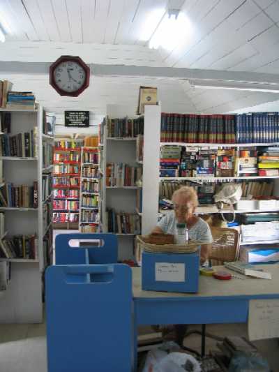
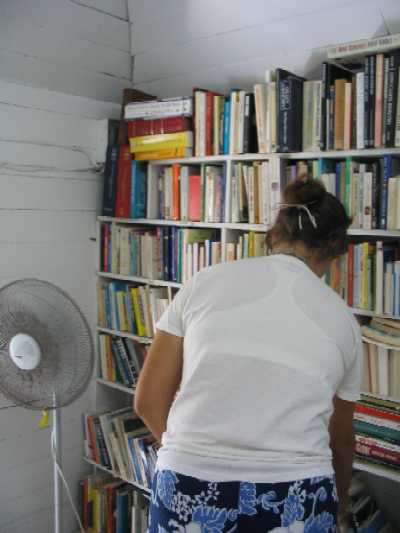
Below left, Georgetown lending
library & librarian. That's all of it, by the way. Below right, Roxanne
browses the shelves, always coming up with something interesting.
 _
_
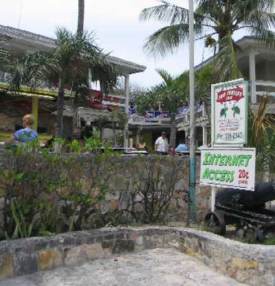
Below left, Two Turtles Inn
in Georgetown, where the teenage crowd goes on Friday nights, and where
underage drinking is common.
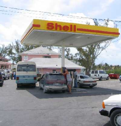
Below right, the Shell station
in town, with its own dinghy dock in Victoria Lake just to the right. On
seeing this picture, Tania said "Ah yes, the Shell station...the site of
many happy hours (well, minutes) with Gregg, filling diesel jerry cans."
Gregg's family's home on Stocking Island uses a diesel electric generator.
 _
_
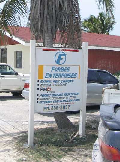
Below left, the street sign
for Forbes Enterprises, where we got Internet access and propane in G'town.
But look at what else its proprietor, Naaman Forbes, is into: pest control,
FedEx office, customs brokerage, carpet cleaning and tile, even an island
bus tour service (not listed) . . . as we read somewhere, "There's no such
thing as being too diversified in the Bahamas." All those businesses in
that little blue shack in back, about 15' x 20'. That's the tour bus on the
right.
 _
_
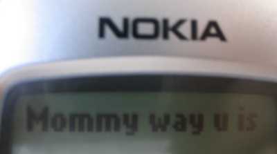
Literacy in the Bahamas.
Below left, a commercially available windshield shade. Below right, a cell
phone text message we received (wrong number).
 _
_
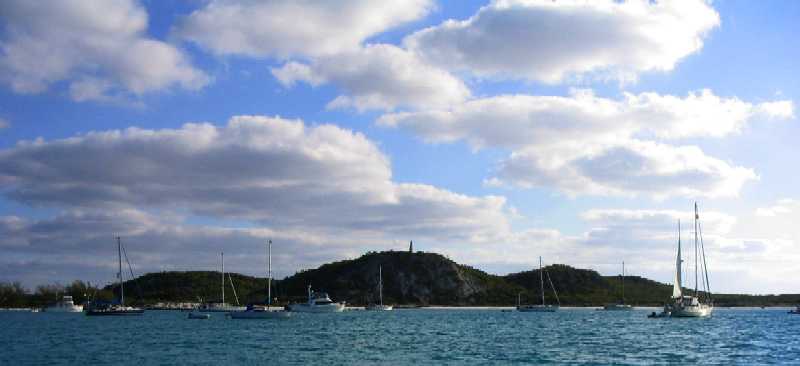
As mentioned, we left Georgetown on April 5th, in a 20 knot ENE'ly following a front. We set just the main and mizzen figuring that would be enough, navigated the five miles of reefs and shoals to Conch Cay Cut, and set off to the NW for 34 miles to Rudder Cut and onto the banks, to be followed by 5 miles inside the cays to our intended anchorage inside Galliot Cay. Half an hour later the wind was diminishing, as it does on occasion as the morning goes by, so Roxanne and Lane decided to set the jib as well. Then the wind came back, so we were under full sail in 20 knots on a beam reach apparent, and started surfing the 4'-6' swells and hitting hull speed and beyond -- and with Wind Song, fortunately, unlike many cruising sailboats, there actually is a "beyond". While her theoretical hull speed with a 31 foot waterline is 7.46 knots, we were getting into the mid-8's by the GPS. (The knotmeter has not worked for awhile, though Lane finally pulled it and fixed it two days ago.) In this configuration we blazed on up to Rudder Cut, sailed in, and then meandered up through the shallows in the lee of the cays. From our Georgetown anchorage to Rudder Cut we averaged over 7 knots, including the first five miles in the shoals, moving cautiously, and after raising the jib we averaged 7.5 knots.
Underway at 0825, we sail
past Monument Beach with the Stocking Island Beacon ("monument") on the
hill behind, and say goodbye.
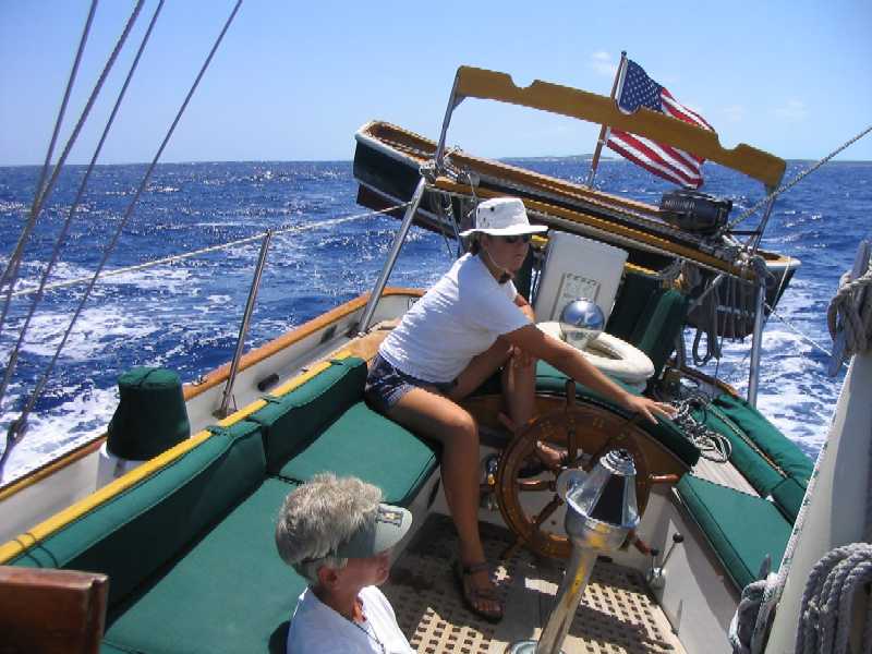
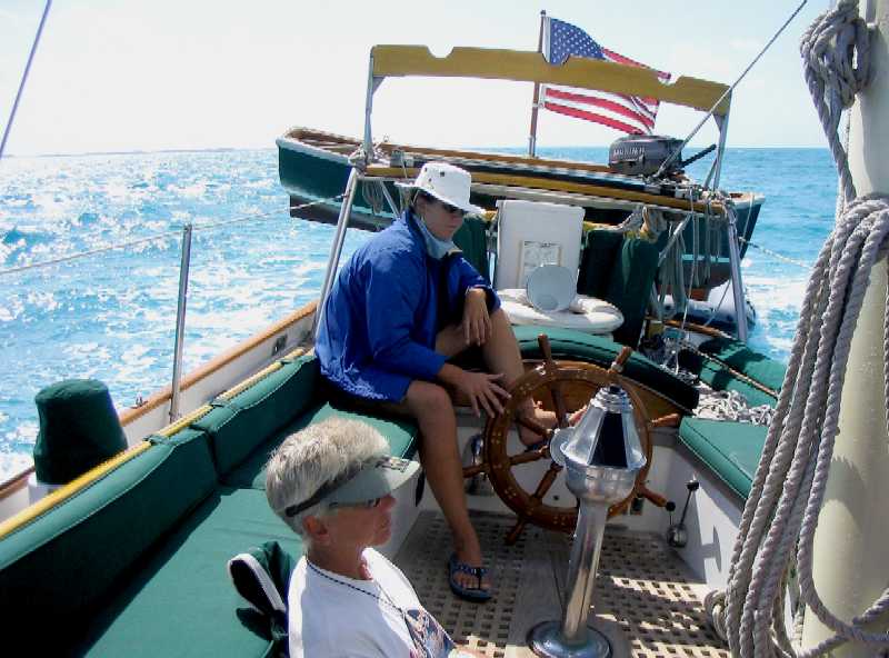
Roxanne plays the helm with
each wave as Wind Song surfs up the coast. Mom, who was in the midst
of a bad cold that we all caught at one time or another, sits as far down
out of the wind and motion as she can, soaking up sun and resting to the
extent possible.
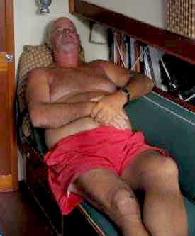
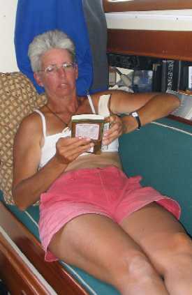
After we are at anchor, Lane
takes a nap, Lynn reads a book, and Tania makes a quiche for dinner -- with
real bacon and cheese!
Not very flattering photos,
granted -- we considered not including them -- but ya know what? This is
cruising, where clothes are purely utilitarian (and/or optional).
 _
_ _
_
The next day our goal was Sampson Cay 20 miles away, this time on the banks, not the open ocean. With a steady 20-25 knots blowing we settled for raising just the jib and mizzen, and had an absolutely delightful sail on a beam reach at a steady six knots under a clear, sunny sky across sparkling aqua waters about ten feet deep, coming to anchor in five feet at low water over clean white sand. Lynn was still not physically well, and again stayed low where wind and motion were minimized.
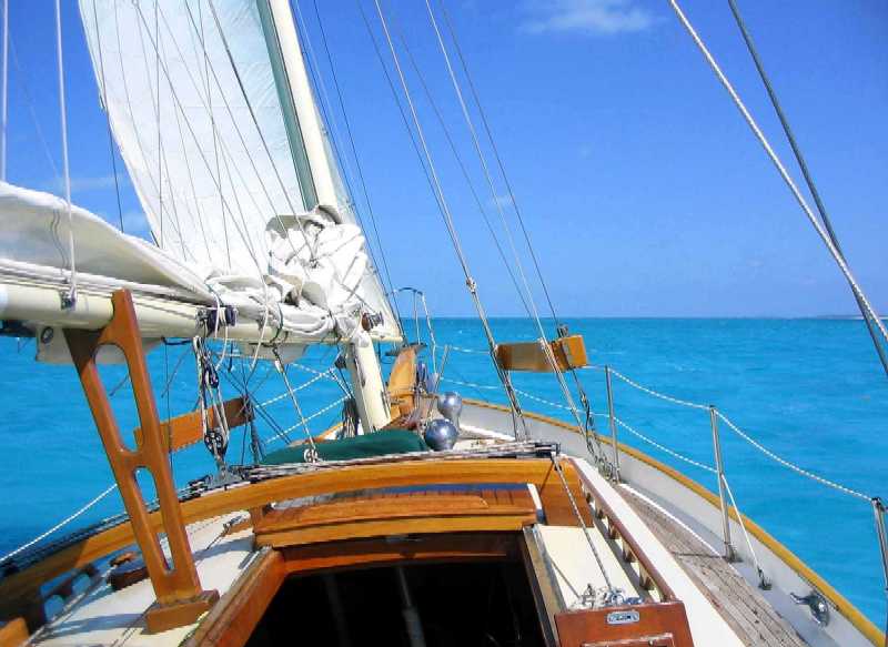
Next day, same players, same
positions, different ocean.
The view forward. Six knots
on a beam reach under mizzen and jib in protected water? That's about as
good as it gets.
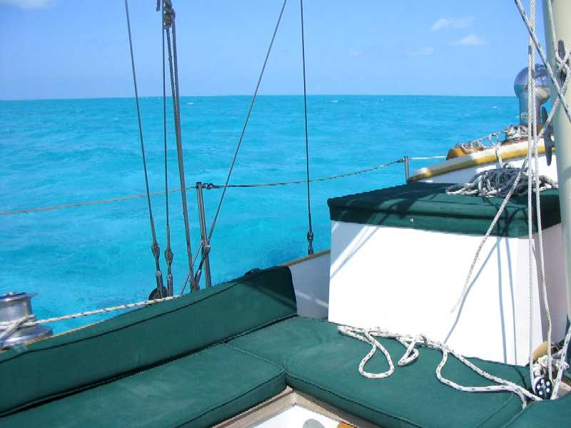
The view beyond the lee rail.
Like a toy boat in a bathtub, except this is a real boat, and we're adults.
Life is sweet.
Next day we did about the same thing from Sampson to Warderick Wells in Exuma Park, under jib and mizzen hitting 8.5 knots on the waves. While in the Park we were able to connect up with folks we know there to hear the latest on how things are going in the Park.
Our conclusion: not well. The Park is being guided in a new direction that we do not think is consistent with either its original purpose or the intentions of the many people who have supported it over the years -- which, as you may recall, does not include the Bahamas National Trust. Though the mooring field was full of boats, the only volunteers were Larry (who is sort of "permanent" and lives on shore in the "Gilligan shack") and either Glenn or Buzz, who now alternate days with each other just to keep their mooring free. The new "administrators", Tom and Judy, are busily putting their stamp on things, implementing sweeping changes some of which are consistent with new mandates by the head of the BNT but others are just their "bright ideas" that don't make sense to anyone else, including the interim Warden, Henry Nixon (who is full time Warden of the Great Inagua Pink Flamingo Park and Preserve). Their behavior seems to have mostly to do with possession, like dogs peeing to mark territory. Even Henry is in disagreement, but he didn't hire them and they're not his to fire. And the man who did, the head of the BNT, is far away in the vacuum of a Nassau government office, thinking only about how much money he might be able to squeeze out of Exuma Park. And even if it's conceivable there's a scenario under which that might be a good idea, his approach to the task is ill-conceived at best. He has started by alienating the only monied constituency he's got, namely foreign cruisers, who can easily sail past a Park that is only 22 miles long and stay where people treat them better. As we will.
So we stayed one night, loaded two jugs of water, and departed for Norman's Cay in the morning. It was a day we won't soon forget.
We took the ocean route in order to save a few miles, and didn't think it would be a problem as the wind was only predicted to be 15-20 knots and from almost dead astern, with 2-4 foot seas growing to 4-6. In order to avoid having the mizzen blanket the jib we left both of them down, raised just the mainsail, and took off at a fast pace. The wind then began to increase, reaching 30-35 knots with 7-8 foot seas, and we were on the edge of control. Worse, we were towing the inflatable dinghy, which persisted in surfing up on us between swells, then coming to a stop just as Wind Song surged forward again, often at 8-9 knots (and once at nearly ten!), yanking the dinghy tow rope with an awful jerk that seemed certain to tear out its tow fittings before the day was over -- and in those conditions, there was no way we were going to attempt retrieval of an errant inflatable.
Everything survived until we arrived at the maelstrom of Norman's Cut, a narrow, current-ridden channel literally between a rock and a hard place (a rocky cay to leeward and reefs to windward), all complicated by eight foot swells dumping onto a max ebb current. The result is what is called a "rage" around here, and when we made our hair-raising left turn into this mess -- narrowly missing entering at the wrong spot, across the reef -- the wind and seas came onto the beam, the dinghy promptly flipped, both tow fittings broke, the inflatable seat came out, and both it and the dinghy headed downwind toward the line of rocks and breaking waves on the lee side of the channel. Lane just hollered "Forget it! Let it go!" and surfed Wind Song into the calm of Norman's Cay at about eight knots.
So we dropped anchor with heavy hearts, heavier for the girls, who, unbeknownst to the parents, had just named the dinghy the day before -- named it Scooter for its sometimes erratic behavior under tow. Talk about irony. Lane was (and in fact still is) recovering from a massive cold he picked up diving in a Georgetown lagoon surrounded by residences and cruisers and with way too little tidal flushing, so he went straight below to sleep. Awaking at 4 pm, he determined that if there was any possibility Scooter could be found, it needed to be done before the wind shift predicted to occur that night, so he launched the (tippy, low-freeboard) hard-shell dinghy, mounted the motor on it, equipped himself with a bailer, spare gasoline, an anchor, a lifejacket, a handheld VHF radio, a powerful flashlight, a foulie jacket, and a couple lengths of rope for towing, and headed out into the gale and seas on the ocean side of the cay -- where the dinghy had certainly gone.
Two hours and three miles away downwind, having almost given up the search, he determined he would try one last beach about half a mile long and shaped like a hook out into the wind and swell, figuring if Scooter wasn't there, he was not to be found. And there, half-way down the beach, he sat high and dry on the sand, now right side up, undamaged except for the missing tow fittings. The inflatable tube seat, on the other hand, was nowhere in sight.
By this time it was 6 pm. It would be dark by 7, and Lane knew there was no way he was going to tow one dinghy behind the other three miles uipwind and upswell on the ocean side of the cay without having one or both dinghies swamp repeatedly. Knowing high tide was at 8 pm, he entered a narrow cut into the very shallow lagoon in the interior of Norman's Cay, and alternately motoring and wading he struck out to find the elusive channel through the flats that he had identified earlier on the chart and had memorized. He made it back to Wind Song by 7 pm. The VHF had allowed him to be in communication the whole time, so Lynn had not been overly worried.
His alternate plan, had this one failed, was to sleep out on the flats with the dinghies and try again with the morning high tide. It is just as well he didn't. That night there was an electrical storm of Biblical proportions.
We tied Scooter off behind Wind Song (using what for tie points? you might ask), raised the hardshell on its davits, and watched a monumental atmospheric electrical display that stretched over 15 or 20 miles of the Exumas and, in the end, succeeded in striking one sailboat. Not Wind Song, so you can relax. It was a boat up at Allan's Cay, where we have stayed several times. The girls were out on deck attempting to record the activity with the video capability of our digital camera, and we even figured out how to edit the "footage" (now there's an anachronism). CLICK HERE for a short video clip in .wmv (Windows Media Audio/Video) format of three "sheet lightning" (cloud-to-cloud) strikes just north of Norman's Cay anchorage. (NOTE: The clip may not play in Netscape. If you use Internet Explorer, you should be able to view it. Blow the window up to full screen for "maximum impact".)
We spent a lay day at Norman's awaiting favorable conditions for the run to Nassau, and took the opportunity to glue a new tow point onto Scooter. No, we didn't happen to have a spare -- this dinghy is as old as Tania, and we wouldn't have thought to carry that spare part in any case. No, the fact is, the dinghy came equipped with two tow points, one on each side of the bow, with a bridle between them, and it has always been Lane's opinion that it would tow better with just one tow point in the middle. As it turned out, one of the fittings came completely off the dinghy clean -- ruptured glue joint -- while the other broke. Lane simply glued the intact fitting under the bow tube, on center. It is arguable whether it is as strong, but we're not gonna tow this thing in open ocean ever again anyway, so it oughta be strong enough.
With this arrangement we towed it 45 miles to Nassau across the banks in very nearly a flat calm, and for this last trip under power from Nassau to here (Frazer's Hog Cay, across open ocean) we laid it across the stern deck deflated but not disassembled. We are a few miles east of Chub Cay, but we chose this over Chub because its protection in frontal winds is better.
Geographically the Berry Islands share much of the character of the Abacos, with weed and grass bottom rather than pure sand, and therefore green water rather than aqua. Here is how our anchorage looks. The bottom in the foreground is hard sand with short weeds a few inches tall dispersed 6"-10" apart. In the slightly deeper water in the distance, the bottom is solid weed in sand, so what your anchor bites into is root mass -- if your anchor is designed to do that. Ours, fortunately, is. We have had no trouble with it.
Friday, April 15, 2005 (Tax Day!)
We've had some time here, as you can see. Ashore there's not much to hold one's interest, just a graded dirt road around the swamp and through the underbrush. We are told, however, that on the other side of the island are probably the best bonefish flats on the planet.
We learned this from a bonefisherman, of course, so Lane finally got to ask the question he's wanted to ask for months: "Does anyone really catch bonefish?" Because quite frankly we've seen a lot of bonefishermen on this trip and we've never seen one catch anything. This guy assured us the answer is yes, and in fact on those very flats he catches (and releases) a half dozen to a dozen bonefish every time he goes out.
This guy and his wife (we didn't ask their names) have bought a four acre hilltop parcel on Frazer's Hog Cay with a ruined house on it that they intend to rebuild and extend. It was quite a Frank-Lloyd-Wrightian abode, with two wood-frame constructions extending from two native rock anchoring structures separated by a rock breezeway -- one section for the owner that included a great-room and kitchen, and the other a cottage for guests. The original was destroyed by hurricane Andrew, which we vaguely think we remember occurred in 1989 or so. The previous owners couldn't face the complete rebuild involved (nothing but the stone parts survived), and it has laid dormant since.
These folks seem fairly savvy, and certainly they've got the money for it, but the fact that only the stone survived Andrew has not deterred them from planning to rebuild in wood frame, nor has it induced them to re-site the house somewhere other than on the top of the hill. Hilltop sites are popular with foreigners because then you have views over water on two sides instead of just one, but you don't find Bahamians building houses there -- because they live here 365 days a year and have seen what hurricanes do to hilltops. The new American owners won't live here more than two or three months a year, as they also own homes in Vero Beach, FL and in France (not far from Geneva, Switzerland). Turns out he spent part of his youth in France and has always loved the place, and so he got a business degree in the States and went back to France for a career in investment banking and commercial real estate development.
His wife, a very trim and athletic Southern Belle moving gracefully into middle age, grew up in Georgia. She's one of those people for whom no place that lacks a vegetable garden can be called a home, so she planted one here at the first opportunity. As we were taking our leave she cut a sprig of broccoli and a few large leaves of mustard greens, which latter, like collard greens, are a southern staple with roots in slavery and no apparent attractions other than nutrition, hardiness, and ubiquity -- three characteristics likely to have attracted the attention of slaves. The broccoli was very fine. We lightly steamed the mustard greens, sprinkled them with vinegar as she instructed, and ate them dutifully. They had all the delicacy and nuance of a weed. Spinach is infinitely superior.
This couple has really taken on a major project, if for no other reason than that any construction project on a remote island is major. They can get their building materials delivered to Chub Cay via a GG Marine container vessel or the mail boat. The materials must then be transported by truck five miles to the property, then offloaded by hand and carried up the hill. Concrete does not come in ten cubic yard cement mixers, it comes in bags which must be carried up the hill one at a time. And of course, there is no truck for delivery, you have to provide that yourself too -- and transport it to Nassau by boat if it ever needs repair or service. On top of which, the Bahamian construction labor force (and by law they must be Bahamian) must be housed on site and fed three times a day, also by law because they must be transported here, there being no existing population of construction workers on this remote and almost uninhabited cay. With challenges and expenses such as these, you have to really want a house on a remote cay to go through it all. It does not seem to us as if bonefishing by itself could be enough of a lure, but there may be fishermen for whom it is.
It made us tired just listening to the plans, but then this is a guy who made a living in the real estate development business in France. If anything we read in the book A Year In Provence is common in general in France, it's gotta be pretty hard there too. Lane's take on it was that he'd rather have a boat to live on here, and store it on the hard in the Georgetown Marine boatyard when not in use. The boat could be a half million dollar catamaran with every amenity, and it would still be way cheaper.
~~~~~~~~~~~~~~~~~~~~~~~~~~~
One other thing we parents did recently was ask Roxanne and Tania what their reactions to the Bahamas and sailing and cruising have been now that we are about to leave the islands. We were surprised by the answers . . . and by which of them gave which answer.
Roxanne's reaction was twofold: first, that she has been surprised by how much she has enjoyed the sailing, and second, that she has not been enamored of the actual cruising. She says she likes the idea of sailing to explore, but would prefer to do it intensively a week or so at a time, with a return to civilization (which is a place with internet, showers, cool weather and really big bookstores) at the end -- and she would like to sail harder than cruisers tend to do when their boat is also their home. She says she probably would not choose to do an extended cruise like this again, but would instead look for opportunities to sail more intensely over shorter periods and longer distances from a pleasantly situated base of operations. Her plans in this direction would include sailing Lasers at St. John's during the school year, and short trips and possibly racing around Southern California in the summer - and, of course, crewing with the kids in the LAMI Topsail program.
Tania's reaction was that she just plain wants to come back to these islands, and is looking at doing so by boat. She is also attracted by the possibility of cruising further down-island into the Caribbean, and would consider single-handing. She's been asking about boat sizes and types for this sort of trip, and is starting to look into the associated expenses and logistics. She's asking "all the right questions".
Tania had another intriguing reaction: that
on this trip she has found there are things in life that attract her more
than money. This is interesting because of her singular interest thus far
in "getting rich". Here she has seen that money, and buying and owning stuff,
has until now looked good to her mostly because of a dearth of other things
that really interest her. We have to agree: money does help cover up
boredom -- but it doesn't provide inspiration.
25° 43.49' N, 79° 17.95' W
Bimini Bluewater Marina, Bimini, Bahamas
Wednesday, April 20, 2005
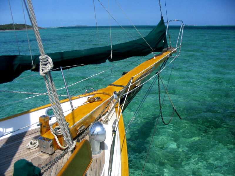
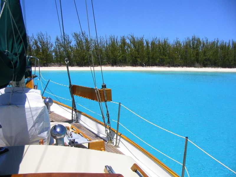
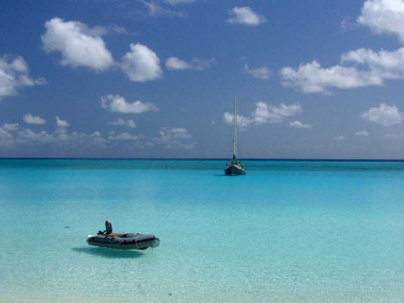
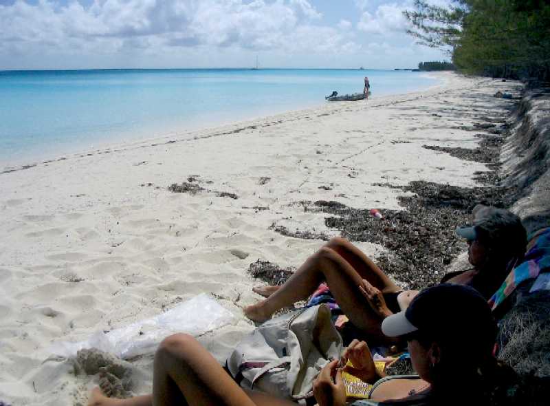
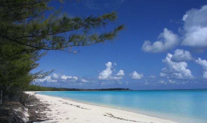
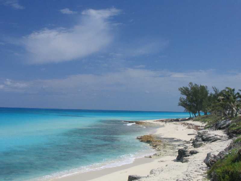
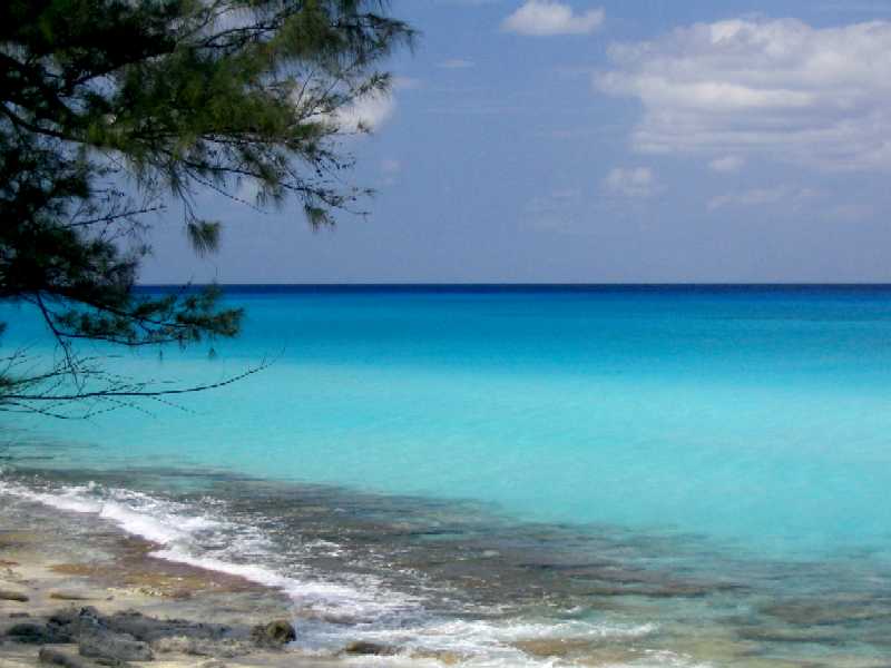
The front came, and with it the S-SW-W-NW-N clockwise wind rotation. We hung out at Frazer's Hog Cay for three days waiting for the wind to go east of north, then moved five miles further west to the west end of Chub Cay, where we figured there would be better protection from NNE on around. We needed water anyway, and there's a marina there. We figured to stay two more nights and leave when the wind got to NE, but after one night it backed to NNW where we were more exposed, so we nipped around the point to the south of the island and spent an exquisite afternoon in perfect protection off a perfect beach, as the following four photos attest.
Things were peachy until late afternoon when the wind shifted 50 degrees right and strengthened, leaving us exposed to possible building swell coming around the point in the above photo. We scooted back to the west end of Chub and spent a quiet night, planning to leave at first light for the 82 mile run to Nixon's Harbour on the south side of South Bimini Island, smack on the eastern edge of the Gulf Stream and only 45 miles from Miami.
This run had Lane worried because, while we normally would do this as an overnight to ensure a daylight arrival, the fact is Lane hates sailing at night and considers it substantially less safe than day sailing. But the fear of not making landfall before sunset is significant when an intricate shallow water approach is involved and visibility is gone and all you have are GPS waypoints and a depth sounder. In this case we decided to try it because the approach would be all in sand or weed bottom, no rock, and exposure to swell and chop would be mild because of the lee of S Bimini Island and the extent of the surrounding shadows.
As it turned out we had a fantastic day, sailing the entire distance at speeds varying from 5 to 7.5 knots, mostly upper 6's. We arrived just after sunset but before dusk, having averaged 6.0 knots from anchor-up to anchor-down. We spent another quiet night and awoke refreshed on Tuesday 4/19, and motored the remaining two miles into the protection of N Bimini Harbour, where we took a slip at Bimini Bluewater Marina for the two days prior to our planned Thursday 4/21 run for Fort Lauderdale (yes, our destination changed again). That would be tomorrow. Tonight is our last night in the Bahamas.
We're pretty sure of the weather window this time because (heh heh) we now once again have NOAA Weather Radio via VHF-FM marine radio (from Miami) . . . and will have for the rest of this trip, thank god. The good old US of A has its entire coastline 100% covered by NOAA marine weather forecasts that are generally very good out to three days and pretty good out to five days. Lane's apologies to his good friends at NGST and in government who believe the new NPOESS weather satellite system, which Lane's employer Northrup Grumman Space Technology is building, will extend our prediction capability out from seven to ten days, and he suggests that a good first step would be to get the five-day forecast right more often. That said, it is with great relief that we say Wind Song's weather information worries are now over.
It is also getting colder. We went up to the marina swimming pool yesterday afternoon, and only Lane went in -- and even he didn't stay long. The overnight low in Tallahassee and Jacksonville yesterday morning was 47 degrees! We expect to be at Oxford, MD in early to mid-June. We're hoping it won't be too hot by then.
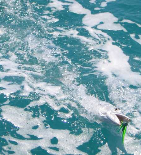
On the sail from Chub Cay
to Bimini, we caught this three foot barracuda and released it. Can't eat
them because of ciguatera. Getting the lure out of his toothy mouth bare-handed
was a challenge.
West coast of North Bimini
Island, looking north.
West coast of North Bimini
Island, looking south.
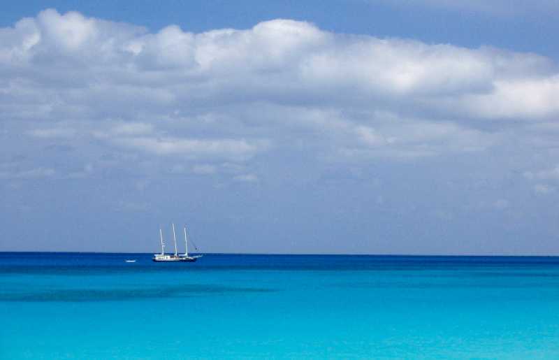
This three-masted schooner
came in off the Gulf Stream and anchored on the edge of the bank while we
watched. This view is just about exactly in the direction of Fort Lauderdale,
about 50 nautical miles distant. We'll be heading that way tomorrow morning.
We chose (again) to make landfall at Fort
Lauderdale because we have heard from two or three cruisers that there is
a very convenient and superbly protected anchorage there called Lake Sylvia
that is only two miles from the Port Everglades Inlet and is close walking
distance to many needed services. There is unfortunately a 48 hour anchoring
limit there that we understand it is not rigorously enforced, and in any event
we have identified a backup anchorage near a bridge abutment a mile further
north with marginally less protection but where there is no time limit. Maybe
we'll bop back and forth. Other than Lake Sylvia, Fort Lauderdale offers
little welcome to cruisers -- in fact, until we heard about it we had abandoned
Fort Lauderdale entirely in our plans and were heading for Lake Worth Inlet
and West Palm Beach, 50 miles further north -- but in view of Tania's
flight to LA from Lauderdale airport on May 1st this plan now seems to make
sense.
27° 39.6' N, 80° 22.3' W
Vero Beach Municipal Marina, Vero Beach,
FL
Wednesday, April 27, 2005
It's hard to believe it's only been a week since the above was written. It seems like a month. We left Bimini at 0700 the next morning, Thursday 4/21, motored across the Gulf Stream in *mostly* light and benign SE'ly conditions -- except for a slashing two-hour rainstorm with 20-25 knot northerly winds (against the current) that whipped up four foot seas within 15 minutes -- and entered Fort Lauderdale Inlet to another planet. A rich one, where "ordinary" cruisers such as ourselves, who, even if they have managed to take ten months off from work to go cruising are so poor they can only afford a 38 foot boat to do it in and no professional crew, are the riff raff, the undesirables, who bring so comparatively little money to town that they are literally more trouble than they are worth. Everything in Fort Lauderdale unsubtly encourages cruisers to simply MOVE ON.
We saw more megayachts in our first five minutes inside Fort Lauderdale Inlet than in our entire lives previously. (In this context, "megayacht" means over 100 feet and as large as 250 feet, with professional crews of five to twenty. These are ships, not boats. When they come into the entrance channel from the ocean, they make a formal Securité announcement over VHF channel 16 to warn everyone they're coming) We made our way to Lake Sylvia, a smallish patch of water behind the artificial islands -- on which everyone lives there, because everyone has to have a private dock -- where the holding is good and conditions quiet but where by law a vessel may anchor no more than 24 hours per calendar year, enforced by the marine police. The only dinghy dock in town, a mile away at the end of a long dead-end canal on the other side of the ICW, is owned by the Southport Raw Bar and is intended only for patrons. It costs $10 per day, payable in advance and redeemable at the restaurant that day only for food or drinks. You land, you pay, you eat.
Even though there was a shopping center nearby, crossing the very busy ICW in strong current and wind with the four of us in our tiny dinghy with its tiny motor was sufficiently scary, challenging, and wet that we resolved to conduct the minimum necessary business as expeditiously as possible and get out of there -- which, as mentioned, is the way the city likes it. The minimum business was to check in with Immigration (read Homeland Security) and Customs, and buy enough food to get us to the next available grocery store.
Check-in is more difficult since 9/11, and the entire ship's crew must go -- in this case either a ten-mile taxi ride to the airport or about three miles into the commercial port of Port Everglades (on foot, in our case) to spend ten minutes filling out a few papers. Partway through we managed to discover a Christian mission oriented toward ship crews that included, among other things, free shuttle service anywhere inside the Port. Once we found it we used it to cover about 75% of the distance, which limited our hike inside the port to about two miles, plus a mile each way to get to the Port gates and back. After a stop at West Marine Supply and Bluewater Books -- a wonderful marine bookstore where we spent more than we'd planned -- we were ready for a late lunch at the Raw Bar, which was very good.
After all this the girls volunteered to go do the shopping themselves, so they headed off on foot to the store while Lane took Lynn by dinghy the mile back to the boat, dodging traffic all the way, then returned alone to join the girls and help carry the groceries and ferry them all back to Wind Song. By the time we'd stowed everything we still weren't very hungry, so we settled for a batch of popcorn and a quiet evening of reading. Lane spent the evening cataloging the draw bridges between Fort Lauderdale and Vero Beach, where we'd decided to hole up at least until Tania is in the air to LA, and possibly until she returns on May 11th as well. The drawbridge count is 29 over 99 nautical miles -- 19 in the first 45. We decided to leave right after breakfast in the morning.
On Friday morning 4/23 we raised anchor and hit our first two bridges immediately. Going through them was quite easy, because it turns out that most of the bridges have scheduled opening times: either half-hourly on the hour and half hour, or half-hourly on the quarter and three-quarter hour, or every twenty minutes. In this way the bridge system has managed to structure its openings so that a boat traveling six statute miles an hour can hit every bridge with very little wait. It worked better than we imagined it could. One result is that powerful but tall motor vessels travel at the same speed as slow auxiliary-equipped sailboats because there's no point in arriving early for a bridge that won't open for you. For this reason, most boats tend to navigate the south Florida portion of the ICW in trains, bunching up on approach to a bridge so everyone can get through in one opening, then spreading out a bit afterwards. But heaven help you if you can't maintain six mph (5.2 knots), because your effective speed gets reduced to somewhere around 2.5 mph as you wait for bridges.
We took two long days to get to Vero Beach. Our first stop was North Lake Worth at ICW St M (statute mile) 1014. We should note that ICW mileages are measured in statute miles south from the southern city limit of Norfolk, VA. Government Cut in Miami is at St M 1089, and Fort Lauderdale is at 1070. Vero Beach is at 952. The distance from Fort Lauderdale to our final planned stop at Oxford, MD is 1216 St M or 1056 nmi. We have a long, long way to go. To put this in perspective, our total Bahamas mileage including two each Gulf Stream and Great Bahama Bank crossings (about 150 nmi each way) was 1247 miles. When we add in our distance in west Florida at the beginning, our total trip ends up around 2400 nmi of which less than half was actually in the Bahamas. So back when we said we were "going cruising in the Bahamas", we weren't being entirely accurate.
N Lake Worth is another of those places where cruisers are considered a mixed blessing. The anchorage, which is just off the ICW, is bisected by a marked N-S channel that heads under a low bridge and through a cut to a small body of water called Little Lake Worth. West of this channel the waters are controlled by the town of North Palm Beach, while the east side is controlled by the county. On the west side, your first night is free but after that it's $30 for the next four days, whether or not you stay that long, and $30 every five days after that. To anchor. There is a small beach near the bridge where dinghies can be landed, but theft is rampant and cables and locks are de riguer. Just one more indication that cruisers are not welcome.
Which is why the situation at Vero Beach is so interesting, because it is cruiser heaven. In fact, it's gotten the nickname "Velcro Beach" because so many cruisers get "stuck" there. The story is both a cautionary tale of how cruisers poison their own waters, literally as well as figuratively, and an example of a way to manage the situation so everyone wins rather than just shutting the area down.
In the Vero Beach inland waters there is a deep and extremely well protected anchorage area behind (east of) a swampy and uninhabited island east of the ICW channel. There is enough room for upwards of 100 boats to anchor safely in all but survival conditions. The bottom is a hard mud with good holding properties, which is rare around here. The beach is just a half mile to the east, and all the services one could hope for are a half mile to the west across one of two bridges that bracket the area on the north and south. Needless to say, this spot got popular -- and got abused.
For years, some cruisers would leave their boats here for the summer and return home to, say, Colorado, and their boats would founder in a storm or hurricane and either sink in place or get blown ashore and be wrecked. Their owners tended to have neither the inclination nor wherewithal to recover their boats, which by this time would be leaking oil, sewage, gasoline, and diesel fuel into the local waters, and the City of Vero Beach would have to pay to get the hulks removed and the pollution cleaned up, obviously at taxpayer expense. One can imagine that the local residents, particularly those whose million dollar homes face the inland waters, weren't thrilled, and for awhile it looked like things were going to go the way they had further south: police the situation and make sure cruisers can't get to anything they want, so they'll leave.
But somehow intelligence prevailed in Vero Beach, and a few people realized that it might be possible to manage the cruisers for the benefit of the city and the cruisers rather than just police them at city expense for the benefit of no one. It probably helped that Vero Beach is not quite as rich as Fort Lauderdale and North Palm Beach, so the resources cruisers potentially bring to the area were more atractive here. Be that as it may, Vero Beach approached the state of Florida, which controls these inland waters, and asked for control of this one body of water. Florida said "yes, for $50,000 a year". The city couldn't afford that, so the state -- where clearly still more intelligence (and political acument) prevailed, countered with "$1 per year, but you can't make a profit" -- because obviously the state would be performing a disservice to the state's citizens and businesses if it gave control of state waters to a city and let them profit by it.
So what we have here now is a non-profit city marina and mooring field with some very irregular fees -- $1.07 for mooring residents to take a shower (dock residents have it folded into the dock fees of $1.30/foot/day) -- all so the operation remains profit-neutral. Moorings are $10/day -- equal to what we paid in Ft Lauderdale for dinghy dockage alone -- for which cruisers get a free dinghy dock, free water, a fuel dock, free holding tank (sewage) pumpout, a laundromat, a lounge area with TV, a book exchange, access to a computer or wifi for $10/day, picnic areas, mail and package delivery, soft drink machines at $1 for a 20 oz bottle, parking for personal cars if they happen to have one, and most important, free van shuttle service over about half of Vero Beach city with free transfers into the city bus system that covers all the rest. There is so much demand now for this place that in the high season each mooring has two or even three boats rafted together. With 55 moorings that's up to 165 boats, 50% more than used to ever anchor here, and now in greater safety. We've already sat through one cold front here with good security, and another is due Saturday night.
Yesterday Roxanne and Tania took the van across the bridge to a local mall and basically spent the day, while Lynn and Lane later took the same van to the beach and had a lovely and reasonably priced lunch at a very nice beach restaurant overlooking the ocean, followed by sundaes in an ice cream parlor across the street. Today Roxanne has spent the morning up in the lounge on the Internet via wifi, catching up on email and handling scholarship and college correspondence while Lynn and Tania are at a local medical clinic getting treatment for a horrendous boil Tania developed from (the doctor thinks) possibly a spider bite. OK, so that's not a lot of fun, but we didn't have to rent a car or take a taxi. Where Tania's CA trip is concerned, our old friends Enterprise Rent-A-Car will bring us a car here to the marina, and we can park it here for as long as we have it. Fort Lauderdale International Airport is about two hours south.
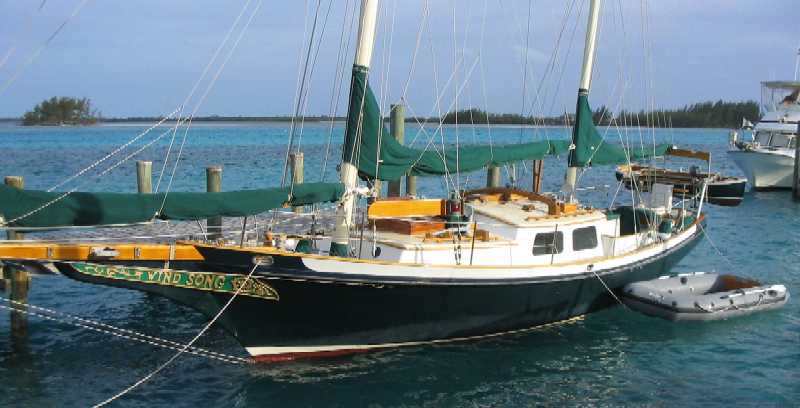
Wind Song enjoys a
quiet berth for her last night in the Bahamas
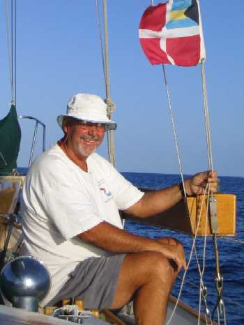
Below left, Lane takes down
our Bahamas courtesy flag as we leave Bahamian waters.
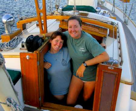
Below right, Roxanne and Tania
show sisterly comraderie as evening approaches in our first US anchorage
since November 2, 2004.
 _
_
Looking back at the entrance
to Lake Sylvia from inside. You're seeing about half the lake.
The mansions of Lake Sylvia
glow in reflected sunset -- with a cruising sailboat right in front of their
picture windows.
A private home faces the
ICW. Yes, that's a gold-plated Winged Victory statue. And by the way, how
many support columns per linear foot does a guardrail require? The design
brief here seems to have been "make sure it's the maximum number possible".
(below left) Vero Beach Municipal
Marina office and fuel dock. (below right) One of two transient visitor
docks.
 _
_
Vero Beach Municipal Marina
south mooring field. This is about half the moorings.
Waiting for the free shuttle
bus to the beach.
Our plans now are to stay here at least through May 2nd and very probably May 12th, then head rapidly north taking stops only at a few special places such as St Marys and Savannah, GA and Beaufort, NC. We expect to be in Oxford, MD by mid-June.