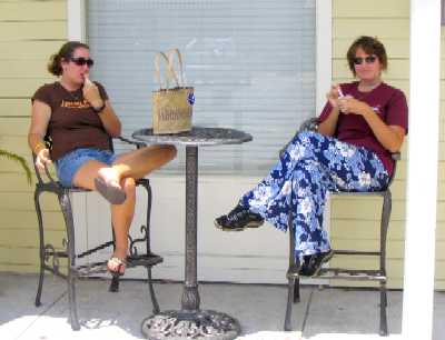
We are (mostly) motoring up the ICW towards the Chespeake Bay and Oxford, MD, aiming for a mid-June arrival there. As of today we have 453 nautical miles left to go. Last we wrote, we were in Vero Beach, FL (ICW StM 952) getting ready to send Tania off to LA for her AP tests and the SAT. This being, at 16 years of age, her first solo airline flight and 10 days away from the family compounded by the stress of testing, she was somewhat nervous. Now that it's over we can say she did great, and we picked up a more grown-up girl at Fort Lauderdale International Airport on May 11. While we don't have her AP scores yet we do have the SAT score, and again she did great. We expect the APs to follow suit.
While waiting for Tania's return Lynn tackled the white calcium carbide deposits that we picked up on our topsides in the Bahamas. She spent a couple days with a phosphoric acid-based hull cleaner (and rubber gloves), and it all came off fine. She followed with a "quick" polish job using a very effective polymer liquid polish from West Marine, and the topsides looked really top-notch afterwards, resulting in many approving comments and thumbs-ups from passing boaters in the following week or two after leaving Vero Beach. People really notice shiny topsides.
Meantime Roxanne and Lane attacked the worst of the damaged varnish. Before we left LA we had all the varnish done professionally using a new two-part polyurethane synthetic varnish called Bristol Finish, with which we have been overjoyed: barring physical damage such as from impact, abrasion, or chafe, it has been shown by independent tests to last in excess of five years without peeling, delaminating, or discoloring. In Wind Song's case it's been on about a year now, and the only places requiring attention were the bowsprit and forward bitts (damaged from rattling anchor chain impacts) and the bulwark caprail (damaged from anchor chain and rode, shoes and feet, and miscellaneous minor dings). When you think about how much varnish is on the outside of this boat, the fact that all the rest looks like new is something of a modern miracle.
We left Vero Beach the morning of May 14 with a fairly aggressive itinerary that would have us in Oxford by June 15. We only planned to stop and visit in Savannah, Georgetown SC, Beaufort (pronounced BOE fort) NC, and possibly Elizabeth City NC. As it has turned out we did spend a lay day touring Savannah, and decided on the spur of the moment to do likewise in Beaufort SC (that's BYEW fert) to visit with our old SoCal acquaintance Larry Hines at Port Royal Landing Marina, where he is now the Marina Manager. He was Dockmaster there in 1994 when we visited aboard Daybreak. Today is our third northbound day from there. In addition we have tentative plans to add a stop in the southern Chesapeake for a visit from Lane's cousin Randy Darnton, who is trying to scare up enough free time to drive the 250 miles from his home in Roanoke VA.
How to describe the ICW? One way to say it is, it's how you might imagine the canals of Holland to be if you'd only seen pictures: flat, grassy salt marsh crossed by lazy rivers and ruler-straight man-made canals, with a few trees here and there. No topography in excess of five feet -- in fact, the water height varies more with the tide than the land rises above it. Though there are things called rivers, bays, sounds, and creeks, these are tidal estuaries pure and simple. They start out pretty mild in southern to central Florida, where the tidal range is only two to two and a half feet, and become quite extensive in northern Florida, Georgia, and South Carolina, where the tidal range increases to a maximum of nine feet in southern Georgia and then decreases further north. This is all due to a concentration or "focusing" of the 12-hourly tidal "waves" in the center of the scoop of coastline that centers on the Florida-Georgia border. This scoop has the salubrious side effect of keeping the coast in that area almost entirely out of the path of Atlantic hurricanes. St Marys, GA, right at the focus of this curve, has not experienced a hurricane in over 200 years.
While this is a beautiful area once one gets used to the absence of relief, it is also hot, buggy, and sufficiently circuitous as to effectively preclude sailing. And since it is 954 nautical miles (1098 statute miles) from Vero Beach FL to Oxford MD, it's gonna get tedious no matter how pretty it is. We travel about eight to ten hours a day, making 50-75 StM each travel day, with some exceptions occasioned by stops, obstacles (e.g. a damaged bridge south of Savannah), or lack of anchorages. Our itinerary is based on a 30 nautical mile (34.5 StM) daily average, which we've managed to maintain so far. This is a lot easier to do with four competent helmspersons aboard. This is all manual steering, outdoors in the sun, rain, and wind. We have added a sailcloth sun awning over the cockpit, which also helps.
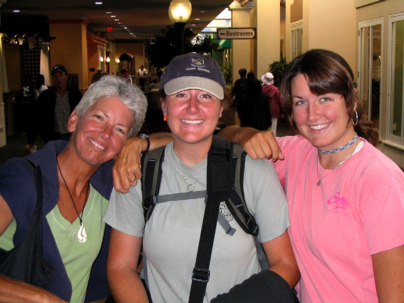
Tania at Fort Lauderdale Airport, surrounded by family, getting
ready to board her flight to LA
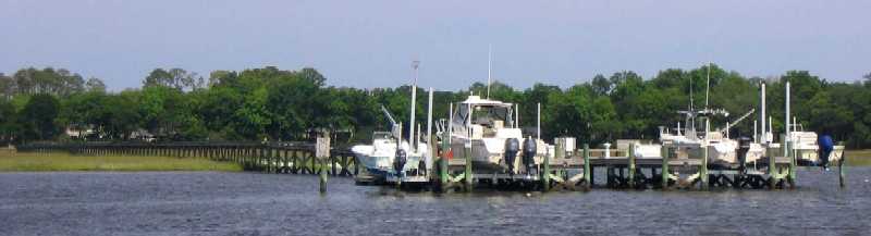
A few farewell pictures of Vero Beach Municipal Marina:
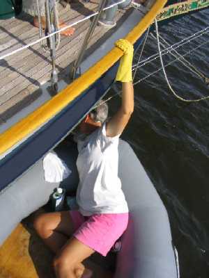
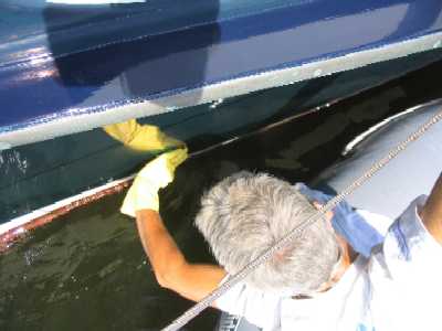
Lynn
tackles the topsides with phosphoric acid
 _
_
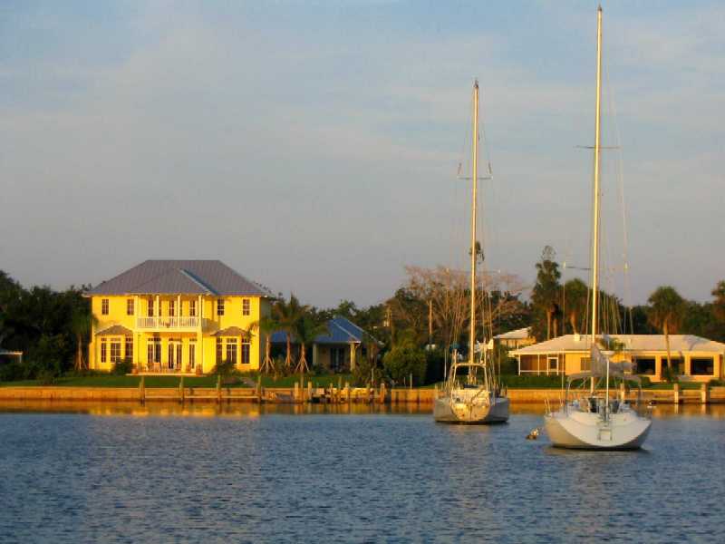
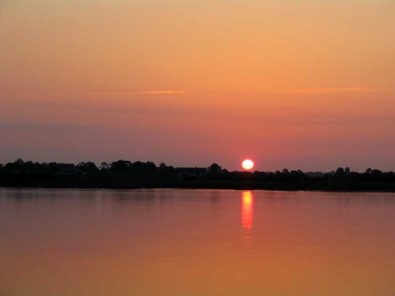
Sunset
in the north mooring field, taken from Wind Song
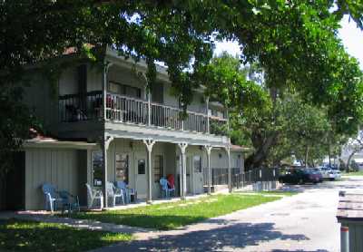
Below
left, the "clubhouse", including lounge with TV & Internet, laundromat,
bathrooms and showers. Marina offices above
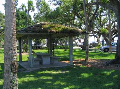
Below right, a picnic area for cruisers & tenants
 _
_
The
dinghy dock, around the corner on the north side of the marina, in a creek
Overview
north from state hwy 60 bridge, marina moorings as far as the eye can see.
Docks are at right center.
The ICW is to the left, out of view behind the forested
island.
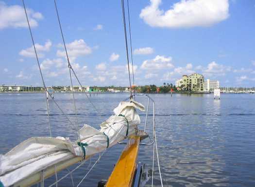
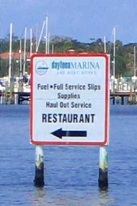
Northbound up the ICW from Vero Beach:
(below
left) Wind Song turns her nose toward a marina in Daytona Beach. What
are those signs left and right?
(below right) Highway billboards, that's what.
 _
_
Anchor
up before dawn in Daytona, the sun rises over the ICW as we hurry to catch
the 0730 opening of Bridge of Lions at St Augustine.
Many opening bridges shut down for 1.5 to 2.5 hours during
morning and evening rush, especially in more populous cities.
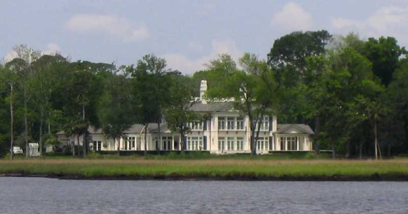
A modest
private home (no, it's not a hotel) on the ICW north of St Augustine, where
the landscape takes on a distinct Georgia flavor, namely
large tides that give rise to wide salt marshes between
"dry land" and the water. Where do these folks keep their boats? Read on.
Answer:
huge long causeways on wood pilings that lead to a pier equipped with lifts
to keep the boats out of the wakes and chop.
This pier is shared between two homes, because these causeways
aren't cheap: about $150 per piling, plus the structure they support.
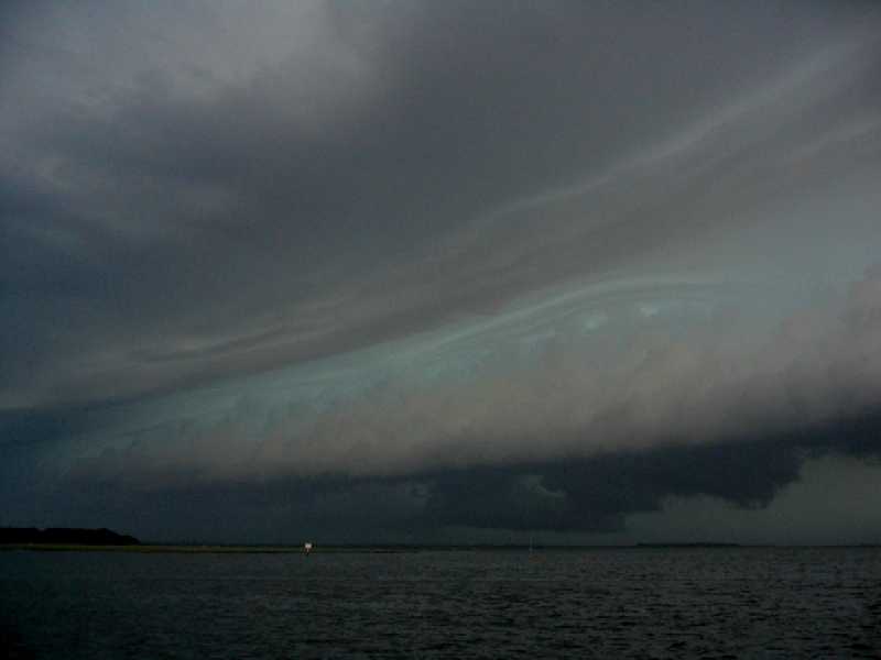
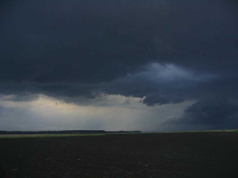
Can
you say "HEEEELLLPP!!? A violent afternoon thunderstorm, of which there are
way too many, over Fernandina Beach, FL. Notice the sailboat under power,
its mast a barely visible wisp (right-center under the lowest, blackest portion
of the cloud), hurrying to get his anchor down before the hammer falls. This
cloud had bad news written all over it, with roiling turbulence and dozens
of ground lightning strikes in the 20 minutes before it mercifully passed
over us with just a little rain. WHEW!
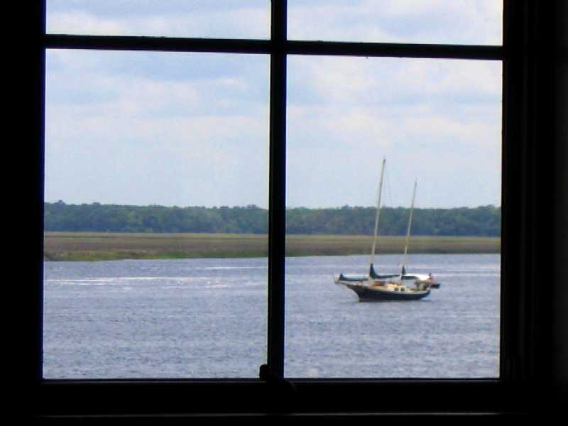
Wind
Song at anchor in the St Marys (GA) River as seen from the Cumberland
Island Visitor's Center and ferry dock.
The island is a six mile boat ride east from St Marys. BTW,
that land in the background is Florida. Wind Song's anchor is on the
boundary.
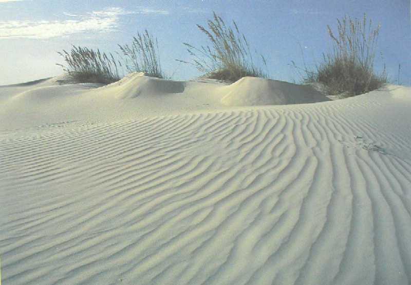
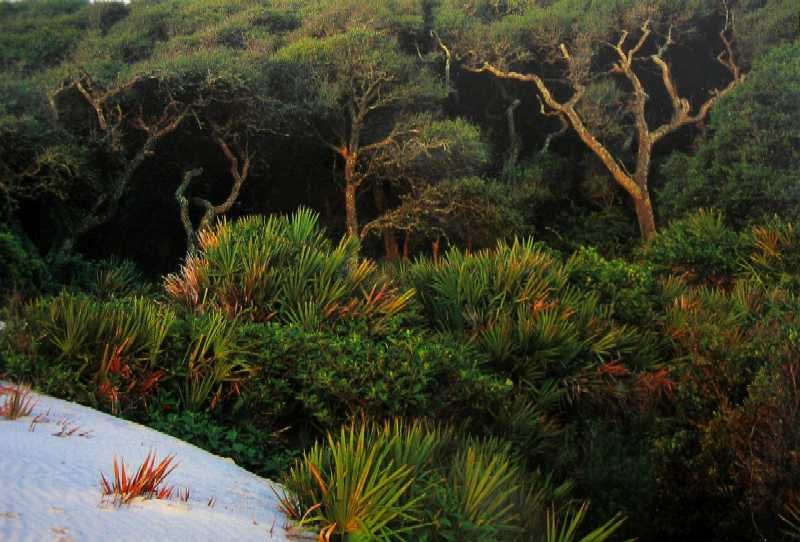
Cumberland
Island, 30 miles long N-S, is the southernmost of the Georgia "barrier islands",
and nicely exhibits the four canonical Georgia island habitats (named from
seaward): beach and dunes, palmetto thicket, oak and pine forest, and salt
marsh. Here is a photo of the dunes.
This
photo shows the first three habitats in one shot. Salt marshes you've seen
earlier -- and you'll see more!
Since we did not visit the island on this trip (we did when
aboard Daybreak), you may wonder where these pictures came from.
Simple. Lane photographed two postcards at the Visitor's
Center. Is that lame or what?
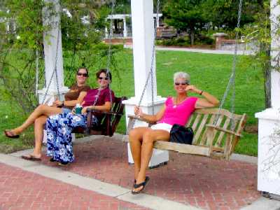
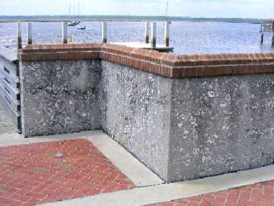
We
started our walking tour of St Marys, GA with a stroll through the waterfront
park, which included a pair of classic Southern swinging settees
and a sea wall made of "tabby", concrete with oyster shell
fill, a material that dates to earliest colonial times.
 _
_
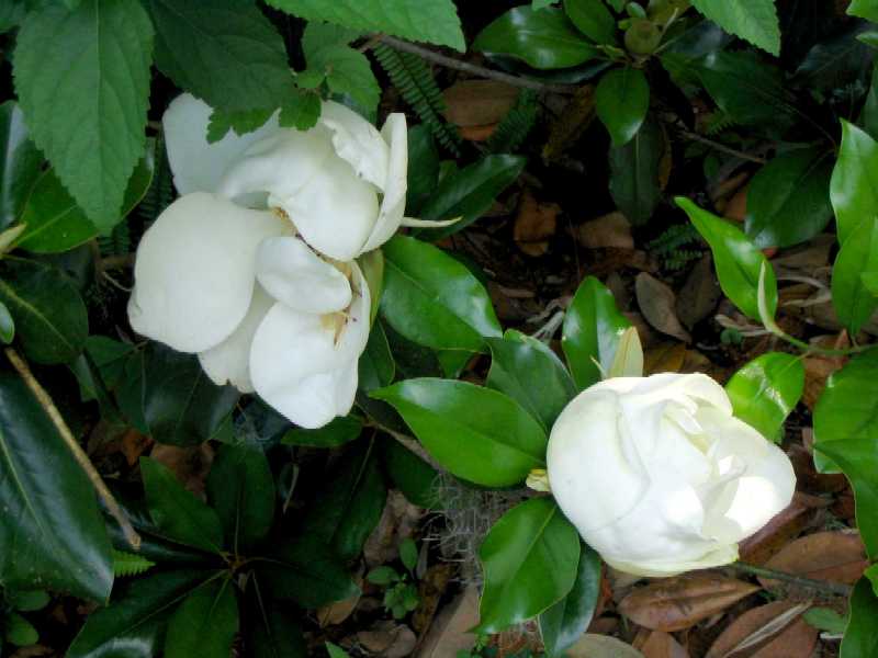
And
of course the heaven-scented magnolias were in bloom everywhere.
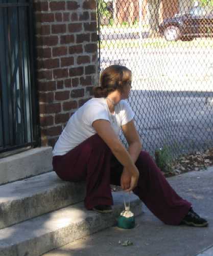
We
had lunch in a restaurant (below left) next door to the one we found so delightful
11 years ago after a year in Central America and three
months in the Bahamas.. Unfortunately, it had become a dive
bar in the interim. We had no complaints about its neighbor. This was followed
by --
ice cream cones (below right)! Air conditioning and rich
food, what a killer combination. It's no wonder our nation is turning to
sloth and obesity! Now back in the land of plenty, oddly it would seem we
are in a hurry to rejoin!
 _
_
On
our way further north, heading for Savannah, we took an anchorage in Redbird
Creek just off the ICW, and got clobbered by this mess,
45 knot winds that sent Wind Song careening sideways
from one end of her tether to the other, followed by a full pelting white-out
of rain that
reduced visibility to about thirty feet. This creek was
barely wide enough to let Wind Song swing 360 degrees with her rudder
missing the mud
on either side at low tide (9' tides here). This photo was
taken just before the wind reached full force. Scary. No fun. Thoughts of
life ashore.
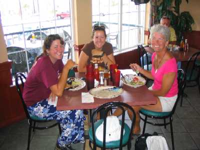
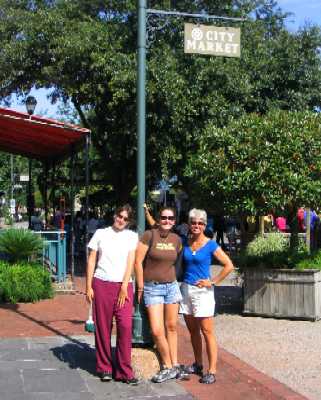
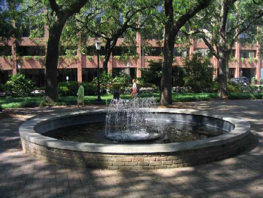
From Redbird Creek we headed up to an anchorage right next to the ICW at Isle of Hope, GA, from which we mounted our day trip to Savannah -- on a Sunday, just like last time. We started with a taxi to the Savannah Visitor's Center, followed by a walking tour of old downtown Savannah, which is exceptionally well preserved and at the same time fully integrated into the modern city. This is a town that was very well designed in the first place by James Oglethorpe. It suffered two virtually complete burnings and was rebuilt each time, the most recent culminating around 1870. Not long thereafter the citizens of Savannah realized they had something worth preserving into the future, and so formed the Savannah Preservation Committee over a century ago. It lives and operates to this day, and has done commendable work indeed.
We splurged on goodies during our tour -- lunch out, ice cream, candy, books, souvenirs -- and took the bus back to the marina in the evening, walking the final 1.5 miles as the bus didn't go all the way on Sunday evening.
Lynn
and the girls sit beneath a gigantic mural in the Savannah Visitor's Center,
planning our walking tour route.

We started at
the City Market (below left), two-block plaza of restaurants and shops. Then
we headed for the waterfront, along the way passing through several of the
park-like squares that dot the Savannah cityscape (below right). These squares
are dispersed through the old city about every two or three blocks, each centering
on a main thoroughfare and forcing vehicle traffic around the sides --though
pedestrians can walk straight through on paved paths without evenb deviating
course by a few feet. James Oglethorpe's underlying purpose was to slow down
invading armies -- remember, Florida just to the south was Spanish at the
time. Now the squares serve simply to break up the endless "walled alley"
vistas that characterize most modern cities.
 _
_
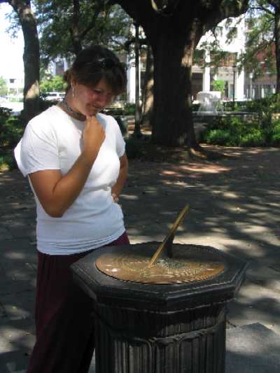
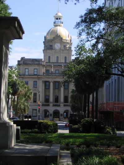
Below
left, Roxanne puzzles over a sundial (no Daylight Savings Time here). Talk
about analog!
Below right, the Georgia State Capitol.
 _
_
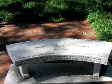
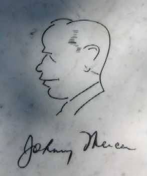
In
one of the squares, a simple marble bench. But wait, it's a memorial to Johnny
Mercer! Composer of the immortal song "Moon River" and others ("Accentuate
The Positive", "Autumn Leaves", "Charade", "Jeepers Creepers", etc.), he was
a Savannah native son. We ate lunch in a restaurant that played nothing but
Johnny Mercer tunes all day every day, sung by various artists -- the same
two CDs, endlessly. The waitress said that after a week on the job you don't
even hear it anymore.
 _
_
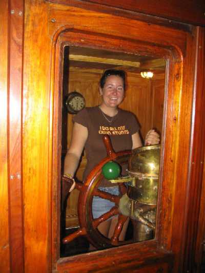
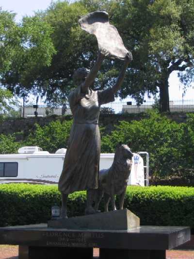
After
a riverfront stroll we walked back up to the Ships Of The Sea Maritime Museum,
where Tania tried out the wheelhouse of an ancient tug.
Below right, a statue of Florence Martus, "Savanah's Waving
Girl", on the riverfront. Florence's beau had left Savannah aboard a ship
in the
late 1800's, and for years Florence waved a yellow scarf
at every ship entering Savannah, hoping to find him again.
 _
_
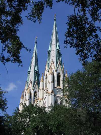
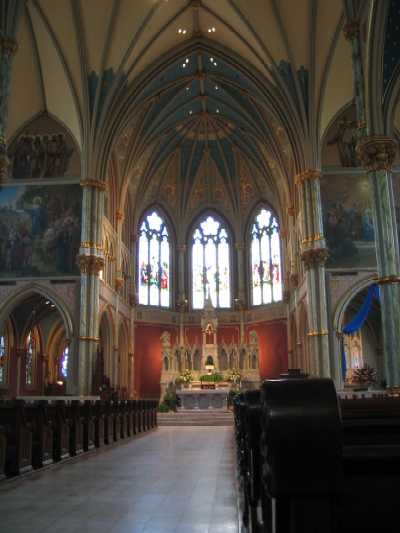
Afterwards
while returning to the waterfront area for lunch, we visited this cathedral
out of architectural interest (it was open to the public).
We're embarrassed to say we did not record the denomination
or historical period of the structure.
 _
_
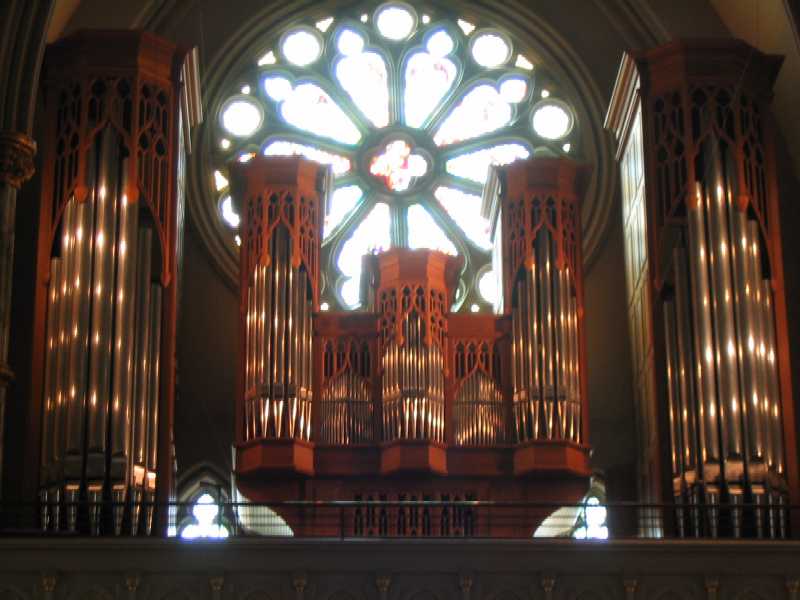
Lane
was intent on getting a photo of this stained glass window when he peered
into the surrounding shadows and caught his breath. "To heck with the window,
look at that organ!" So he opened up the exposure two stops and captured it.
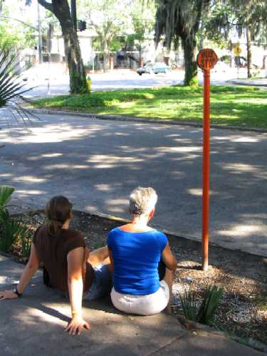
Lynn
and the girls waiting in the heat of the late afternoon for the bus back to
the marina where we landed our dinghy.
 _
_
At this point,
in order to continue north we were forced to go "outside" on the open ocean,
as there was a damaged bridge just north of us that could not open. This meant
44 nautical miles (50.6 statute miles) in strong wind, steep seas, and adverse
current (out against the flood, in against the ebb, naturally), to make 25.5
statute miles on the ICW. This brought us to an anchorage in Bull Creek at
StM 566, a short 26 mile morning jaunt away from Beaufort, SC, which we accomplished
the next morning.