Update 02
Sunday 4/26/2009
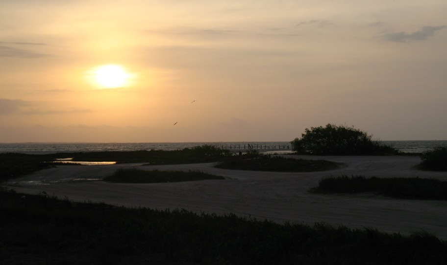
Just a quick preview of things to come -- this was how the sky looked as dusk approached in Alpine, TX.
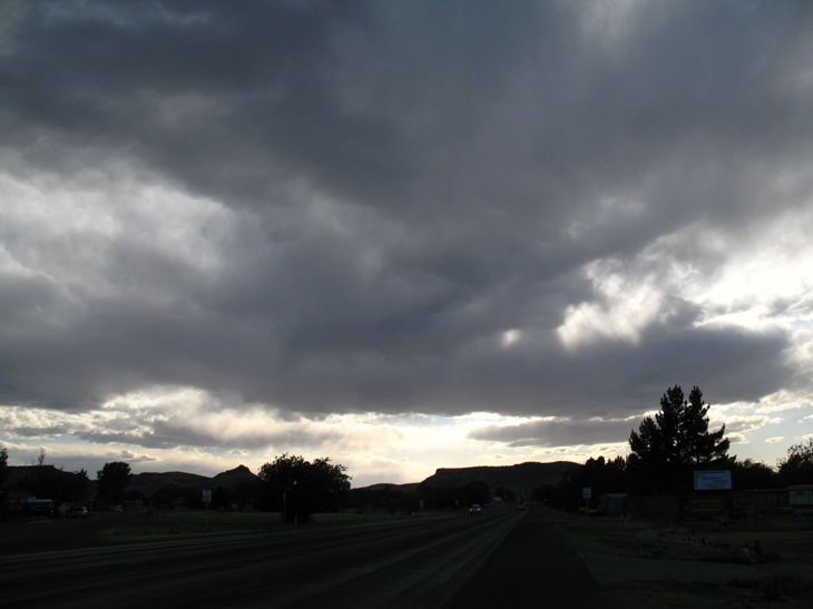
This presaged what I was to experience the next day. This night, severe weather warnings were posted all over southern and southeastern Texas, and the TV showed RV's flipped over, roofs ripped off of houses, and so on.
Monday 4/27/2009
Well, for all the evening's preamble, things didn't look so bad in the morning.
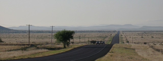
But I want to draw your attention to those mists in the distant mountains. Notice the road is going downhill, and remember that Alpine was at 4600 feet. Those mists are clouds from the lowlands beyond those mountains, spilling up into them. When I got there they were actually fog. Then I rode further down, and got below them.
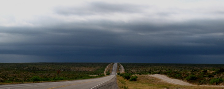
Now this is looking a bit more ominous, especially for someone who had never ridden in serious rain! Still going downhill, and there's nothing of substance between here and the Gulf of Mexico, from which a warm moist air mass is pushing hard northward. I got to about where the skyline is in this photo and stopped to put on my rain gear. About 10 minutes farther on the rain came honking down, and there was a pucker moment as my facemask fogged up completely in about 15 seconds (at 50 mph) and I was in the process of ripping it off my helmet when the first motion upward cleared the mask as ventilation entered from below. Whew! So I continued at reduced speed, partly due to the rain but mostly because the wind was gusting 25-30 mph from the left side, and the bike was all over the pavement. 50 mph seemed like a nice compromise except I still had 250 miles to go! Could be a long day.
No photography was possible thenceforward, and in fact there was nothing to photograph because it all just kept looking exactly like the picture above, on and on and on -- except I'd REALLY like to have taken a picture of the bridge crossing over the Amistad Reservoir on the Pecos River, in Amistad National Recreation Area. The bridge was about 200 feet above the lake, and the shore was sheer rock cliffs 200 feet high. Unfortunately the bridge was also under reconstruction, with single-lane traffic, and what with all the construction equipment there were no pedestrians allowed on the bridge and no way to stop in the middle.
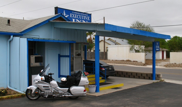
So I headed onward and eastward to lovely Carrizo Springs, TX, where the Executive Inn, not living up to its name, turned out to be everything I've come to expect from small towns in the middle of nowhere.
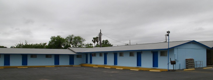
Cinder block modern. Looks kinda like a jail. I checked in at the inviting front office . . .
. . . and parked in front of my Deluxe King Bed room.
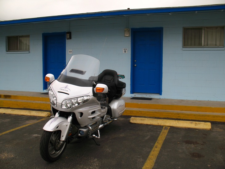
Hey, it wasn't all that bad, and for a tidy $50 it sure beat camping. I've been in much worse. I slept pretty well given that this had been a long hard day and the next one would be shorter (and reportedly rain-free). I had a quesadilla for dinner at Andy's Restaurant, turned in early, and got up "late" (7 am).
Tuesday 4/28/2009
On the itinerary this is advertised as a 214 mile day, but I was holding out the option of extending it down to the Gulf Coast barrier islands and then taking the Port Aransas ferry back to the mainland, which would add 40-50 miles at the end.
Not far out of Carrizo Springs heading south, in a very small hamlet (really a ghost town) called Catarina, TX, I came upon this wonderful old relic.
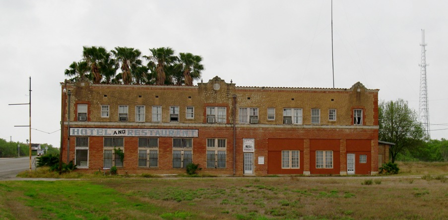
I didn't have time to explore the place, but there was a lot more to it than meets the eye in this view. It could be a magnificent hotel restored, but who'd come? It leads one to wonder why it was there in the first place, and why no one goes there anymore.
I have a theory: good highways and fast, reliable, comfortable cars. I'll bet more people stopped more places when roads were rutted and bumpy and cars were slow, open, windy, uncomfortable, un-air-conditioned, prone to overheating, and got less than 100 miles on a tank of gas.
As mile after similar mile unfolded of the same short trees, scrub and cacti on both sides of the road, something showed up that brought to mind the Monty Python line "And now for something completely different".
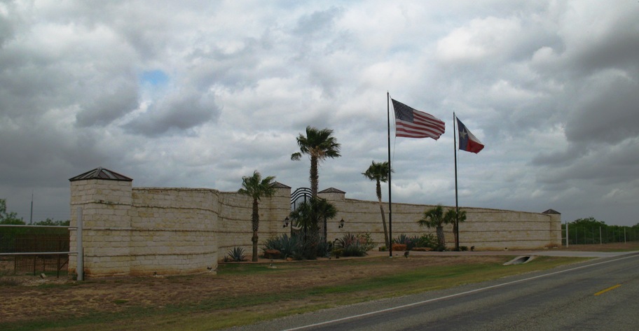
Huh? I about got whiplash as I shot past. Jamming on my brakes and flipping a quick U-y, I moved tentatively closer, thinking that anyone behind flags that big and walls and a gate that high was probably heavily armed.
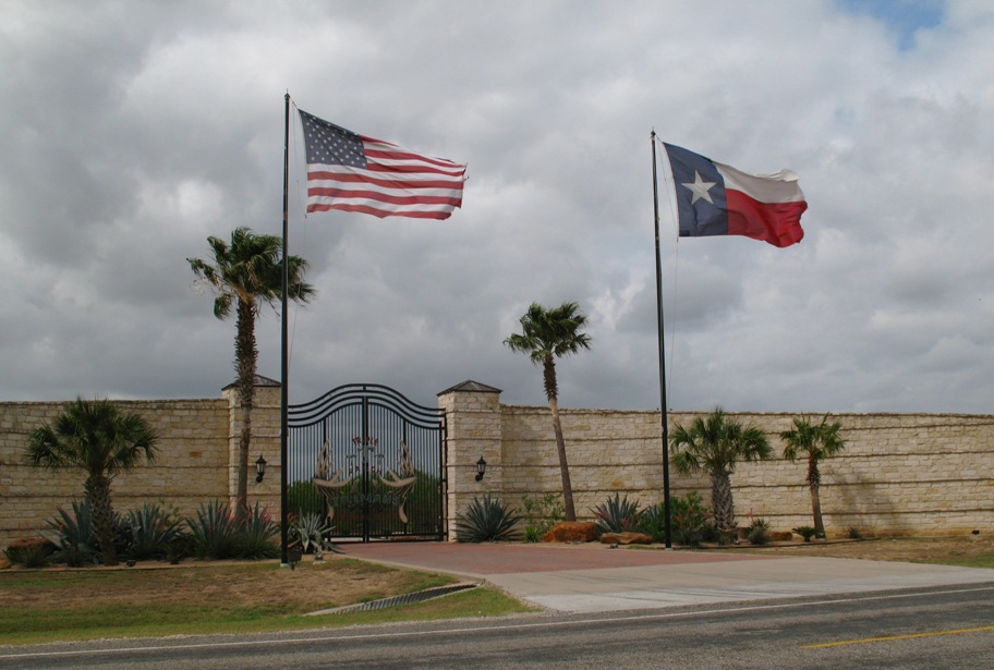
So far so good. Now let's see what's in there.
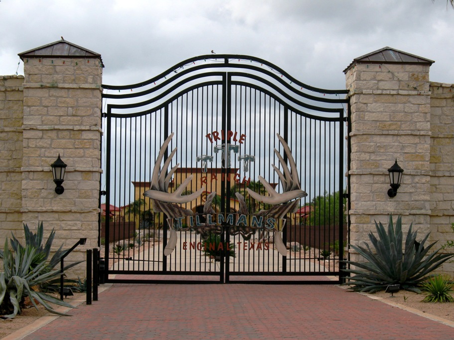
The Tillmans, Encinal, Texas. Three of them, I guess, in a stucco mansion about as tall as the gate. I was about to sidle up and photograph the house through the bars but thought better of it, since a speeding bullet could easily beat me to my bike, which wasn't even pointed the right way for a fast get-away.
Ony in Texas.
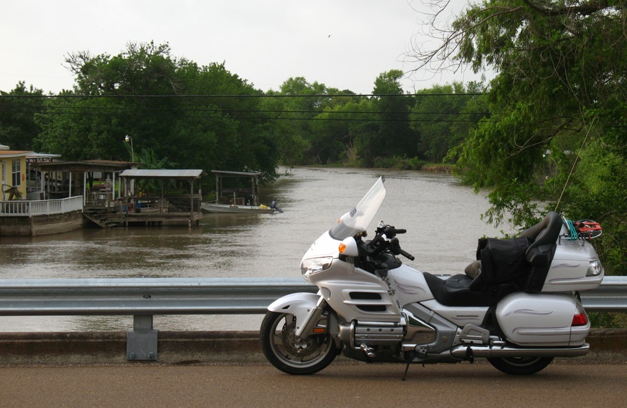
Next stop . . . yes, I had the time, and the inclination, so after a McDonald's Southwestern Chicken salad I drove right past the south side of Corpus Christi and out to Padre Island, which, if you turn left when you get there, turns into Mustang Island which ends at Port Aransas. On the way, I took one of the beach access roads out so I could get these shots of my bike, as close to the Gulf of Mexico as it's ever likely to get again.
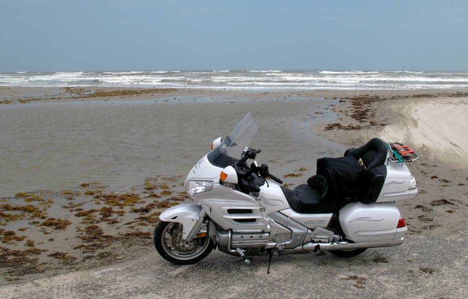
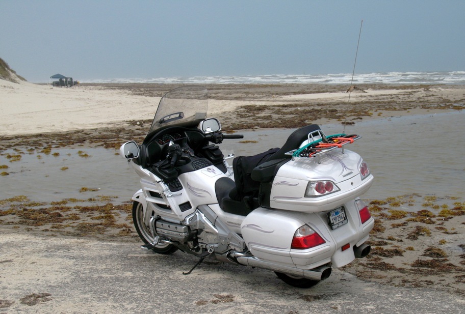
Hey, it's my bike and my web site. I get two pix if I want.
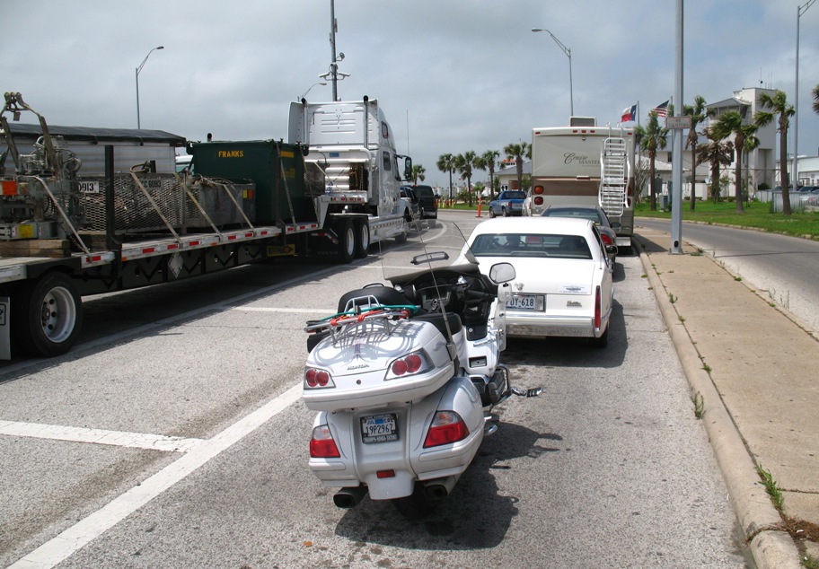
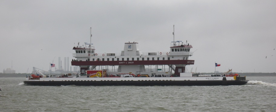
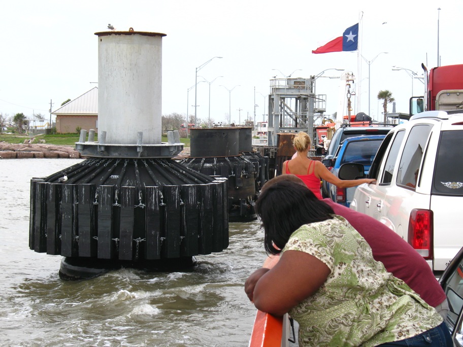
At Port Aransas, further land travel is blocked by Aransas Pass, an inlet from the Gulf. But there's a ferry! Actually, there are four. No kidding. And all ferries in Texas are free and run all the time as long as there are cars. Which is a lot of the time and that's why there are four ferries. Pretty darn cool. Here are two of them.
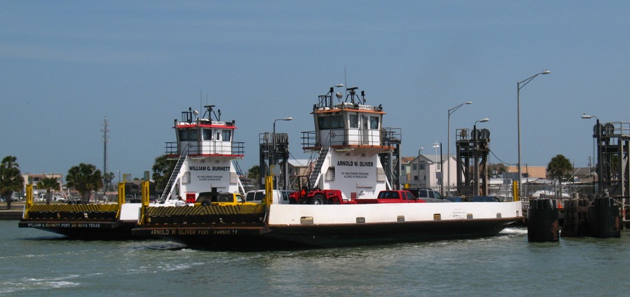
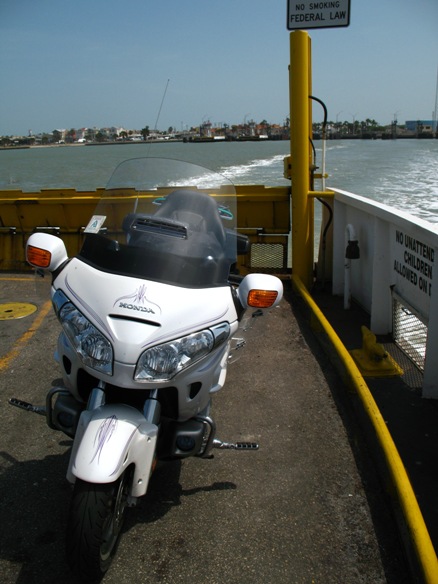
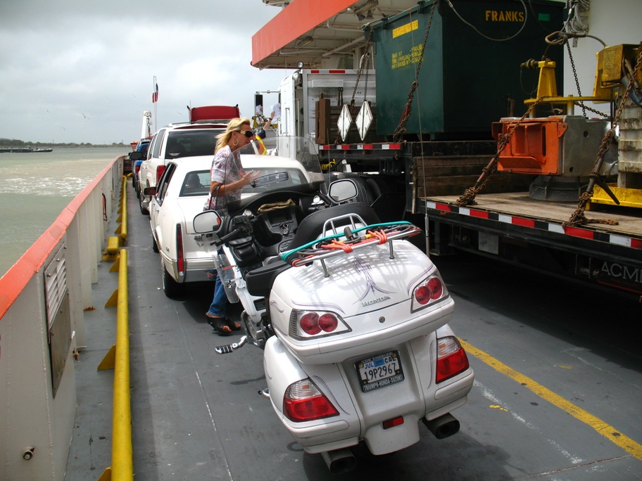
These two were arriving. There were two others loading when I drove up. One closed up its gate, but the fourth started loading just a couple minutes later. Each held about 16 vehicles in four lanes. We loaded and pushed off . . .
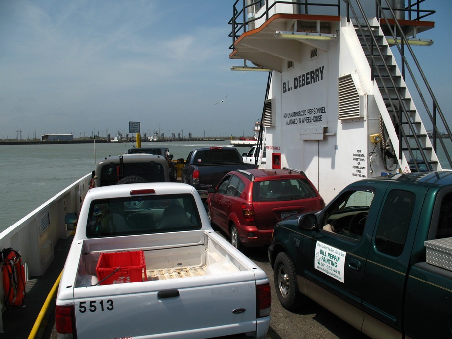
. . . and I barely had time to get off the bike and shoot one more pic before we arrived on the other side!
Wednesday 4/29/2009
This has been a long, warm, humid, eventful day. It took 10 1/2 hours for 280 miles, which means I took almost all back roads and stopped for pictures and to consult my iPhone's GPS a lot.
Here's the summary of the landscape: very flat, very wet, and darned close to sea level no matter where you go. There's a reason I-10 is located 25 miles inland from this coast! But I didn't take I-10 today. I tried to stay as close to the beach as possible.
Until I got to Surfside, about 160 miles from Fulton and last night's hotel, that meant no closer than about 10 miles. But then I got to run right along the beach -- and it was an eye-opener. For the people in this area, the words "Hurricane Ike" still strike fear.
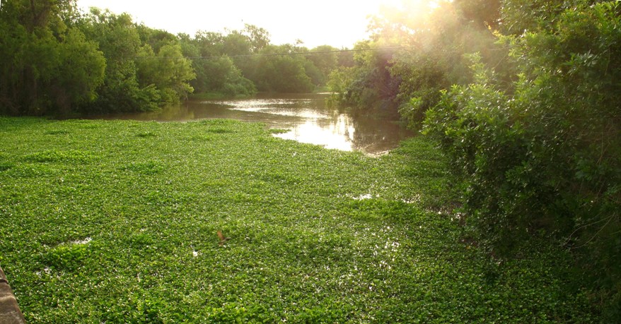
But let's start out scenic and move to devastation later. Only a few minutes from the hotel this scene begged to be captured . . .
. . . which, among other things, seems to say "humidity" to me. I guess ya had ta be there. Then right after that, this one . . .
. . . which says "Redneck Heaven". And then this one . . .
. . . which just says "Oh my god it's hot!" There were some BIG fish in this creek, and they were jumping.
When I finally reached Surfside, I got a good overview from the 65 foot bridge over the Intracoastal Waterway (ICW).
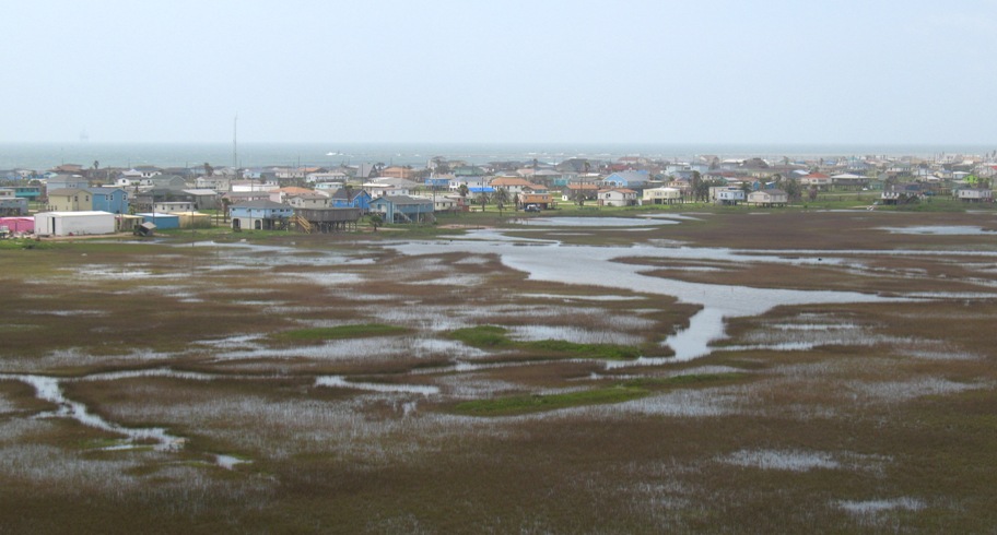
You can see that there's a small strip of land -- sand dunes about four feet high -- that separate (barely) the ocean from the salt marsh. So that's where they put the houses. If you look closely, you can see that most of them are built on stilts. BTW, that haze in the air is humidity. Lots of it.
We'll get back to stilts soon, but first, a view straight down the bridge:
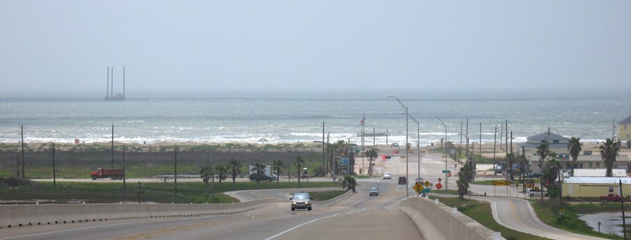
That intersecting road a the bottom is the Blue Water Highway, a misnomer if ever there was one (the water in these parts ain't blue), but real estate interests take a lotta license hereabouts. (OBTW, that thing out on the water is a dredger. It goes slowly from place to place, drops those huge pilings into the bottom, then drops a tube the size of a sewer main down to the bottom, sucks up the muck, and sends it through another pipe off to the side somewhere.)
The road I'm on continues right down onto the beach, so I decided to photograph my bike by the sand -- what there was of it. First, I had to convince this lady to let me do so without paying the annual fee to get onto the beach.

Her name is Maryann, and she was a good sport about it. We talked for awhile, during which she allowed as how I was "fulla prunes" if I thought she was gonna believe I used to design electro-optical sensors (cameras) for satellites. No, I'm NOT a rocket scientist, Maryann, though I know quite a few of them and even have an itty bitty understanding of the subject, but yes, Maryann, I REALLY DID earn my living designing space cameras and instruments! She said that was the tallest tale she'd EVER heard, and she'd heard them all. She finally let me go take my picture . . .
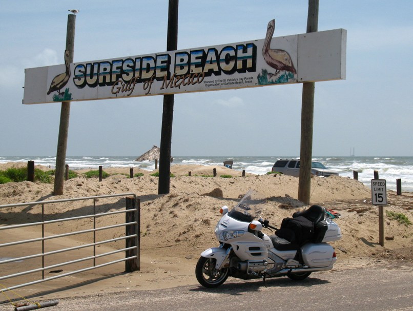
. . . after which we talked for another 20-25 minutes. And that's when Maryann reminded me about Hurricane Ike, and questioned my sanity for wanting to drive right through about 60 miles of the worst destruction imaginable. But that just made me want to do it MORE!
So to set the stage, look at this pic of the ocean . . .
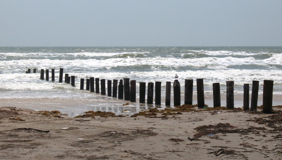
. . . which was taken standing next to the back of my bike, about five feet from the end of the pavement at Surfside Beach. What you should know is, there used to be beach there. Used to be, before Ike. Now there's a whole lot less.
It wasn't so bad at first, but as I moseyed east (well, northeast), here's where there used to be a large apartment or condo complex.
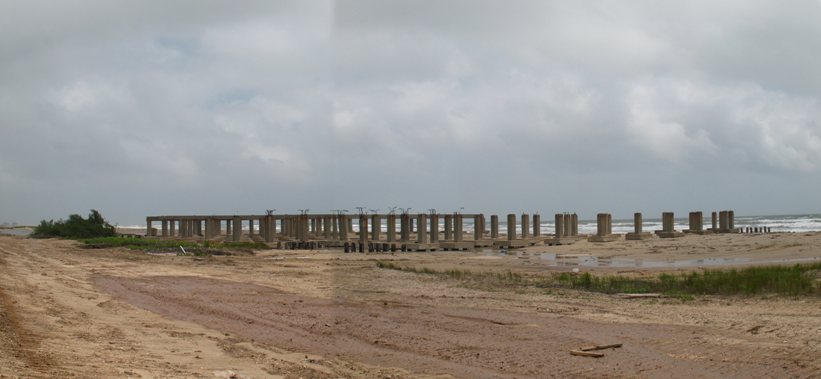
Unlike most of the structures that *used* to be along this stretch, this one was on concrete pilings. The others, everything went, pilings and all. This one, the pilings were supposed to protect the building. Look how that worked out. I want you to commit this to memory for the next time some realtor is trying to sell you beachside property (and believe me, there are a LOTLOTLOT of them around Galveston!)
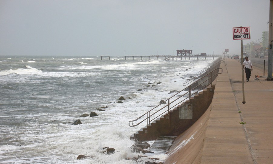
Along this 40 mile stretch of sand, some houses were still standing or even (gulp) *new* (I kid you not), some were gone, and some were ruined and uninhabitable but still (mostly) there -- at least the pieces. It didn't seem quite as bad as Maryann had indicated. I got to greater Galveston, where they'd long ago taken extreme measures to keep the ocean at bay:
I got to the ferry terminal for the Galveston - Port Bolivar (that's "BALL-i-ver" to you) ferry . . .
. . . and we boarded the ferry. Then this guy pulled in . . .
. . . and parked his prodigious bulk right next to my little eggshell of a bike.
This is what these ferries look like on the water.
When they dock, they use these big rollers to help them into the right position regardless of current or wind . . .
And sometimes they use them a little TOO hard!
So I disembarked at Port Bolivar, on the north(east) side of the Houston ship channel, and headed up the rest ot the Blue Water Highway, the part that extends along what is called the Bolivar ("BALL-i-ver") peninsula.
And what I saw there reminded me (I'd known this, just forgot it) that when the eye of Hurricane Ike hit the Houston ship channel at midnight on September 13th, 2008, the weak (left) side of the hurricane hit Galveston, while the much stronger "dangerous" right side hit the Bolivar Peninsula.
Here's how you can tell: there's nothing left.
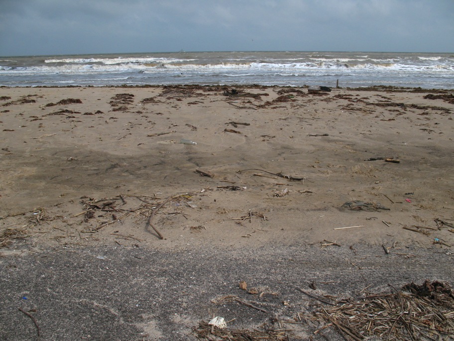
That's not hyperbole. Look at this.
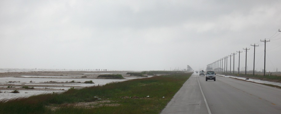
This is about 20 miles into a 27 mile stretch of beach from Port Bolivar NE-ward. And it all looks like this. That's the ocean on the left, then a small strip of sand, then pools of standing ocean water where the houses used to be, then the road. The houses that used to be on the beach got washed/blown across the road into the salt marsh on the other side (and yes, those power poles are new). There was so much debris and, well, crap, that it had to be literally sanitized, so they bulldozed the amalgam of busted houses and salt marsh flora right down to bare mud, put the scrapings in huge piles, and burned it. And then carted what remained away, leaving bare, flat dirt/mud behind, no vegetation. I haven't got a photo of it, but it is amazing to see a 27 mile swath an 1/8th of a mile wide, just . . . bare.
At the "end" -- i.e. where the Blue Water Highway (TX-87) hits TX-124, turns left, and heads north to meet I-10 -- well, it's not quite the end, because there's more beach road down there, but it deadends. It also has not been restored -- and there are no houses left there either.
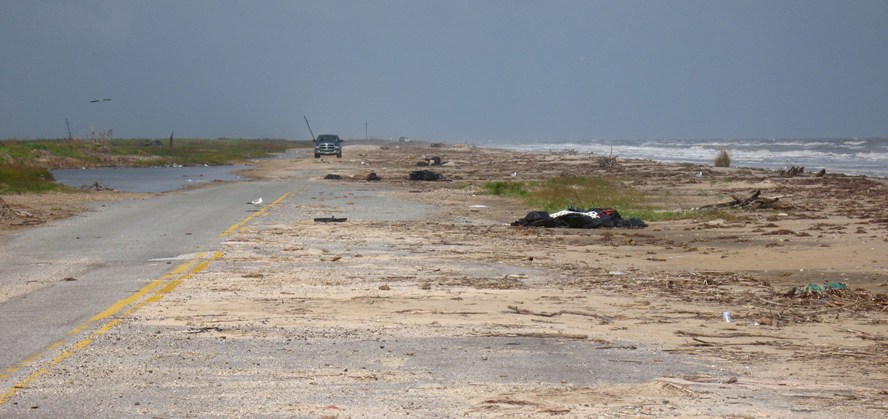
Note that there's, oh, maybe fifty feet of sand between the road and actual water -- where there used to be houses. Here's a view directly to sea from my parked bike. That's pavement in the foreground.
And clearly, the water has been over the road (what's left of it) recently. Like two days ago, when I was driving down from Alpine to Carrizo Springs, getting rained on and blown around.
So no sane person would build on this beach ever again, right? RIGHT??
Wrong. You just (imagine I'm a real estate developer now) need TALLER STILTS!
Not eight foot stilts. That wasn't enough. You need twelve feet. Even sixteen feet. And not wood. Stressed concrete. And in the sixteen foot high garages you get inside those stilts, you could . . . put your cars on LIFTS! Even your RVs. You could raise them above the flood water. You could hole up in your concrete mansion and RIDE OUT THE STORM!
Seriously. I saw the model homes today. If I hadn't, I woudn't believe it. And guess whose tax dollars are supporting a lot of this?
Okay, 'nuff a that.
Tomorrow I ride 200 easy freeway miles followed by 111 on what I think are good (four-lane) surface roads. Through the Mississippi River Delta and New Orleans ("NAW luns"). Should be a piece a cake.
-- Lane