Update 04
Monday 5/4/2009
Day 12
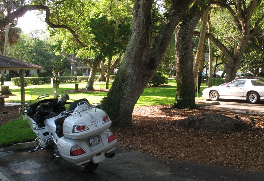
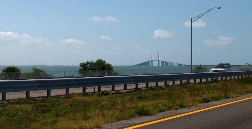
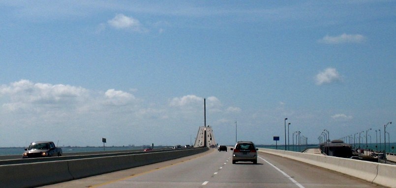
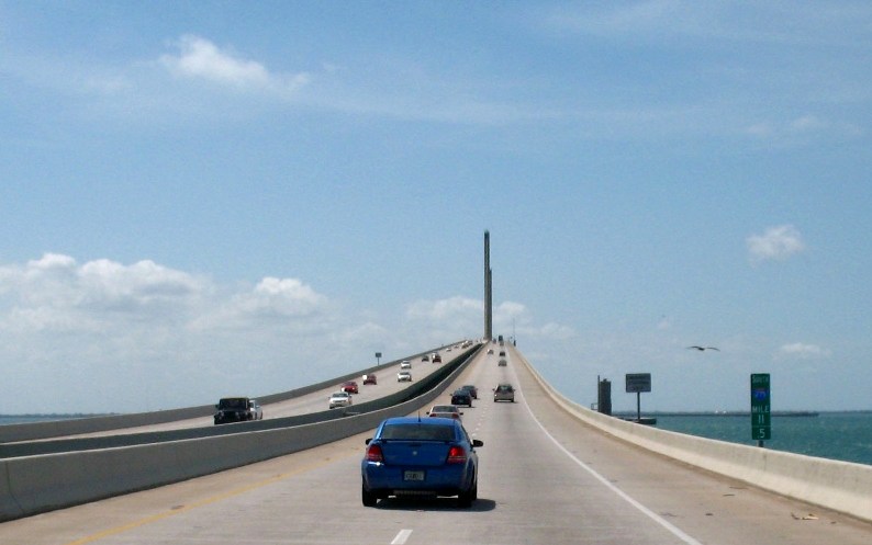
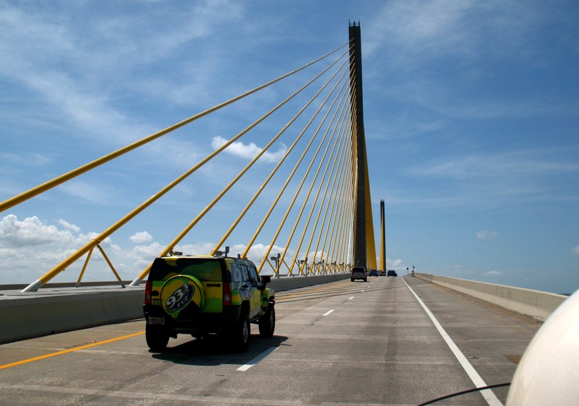
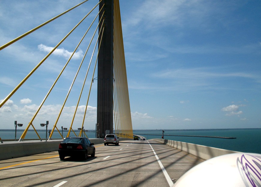
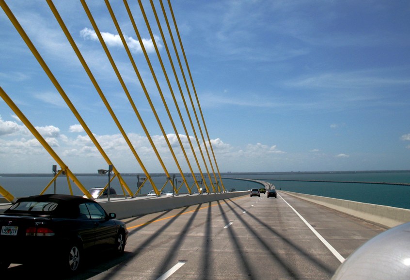
Having already seen much of the area we were to traverse this day (twice, from two different boats), we elected to make time south via Interstate highways and get to our day's destination in the Everglades. The "high" point (pun intended) was the Tampa Bay Sunshine Skyway bridge, which runs for several miles southwest from St. Petersburg to the southern side of the bay at Terra Cela (near Bradenton). We'd sailed underneath this bridge on Wind Song in October 2004, and this closed a loop of sorts. Here's a "slide show" of the bridge.
From this point we still had 100 miles to go, to arrive here:
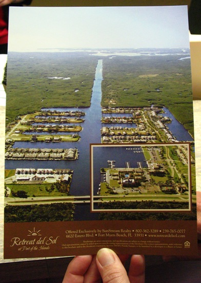
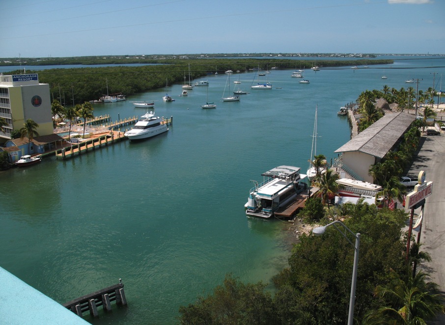
This is Port Of The Islands Resort and Marina, a lovely aerial view obviously copied from a brochure. Zooming in on that lower right corner . . .
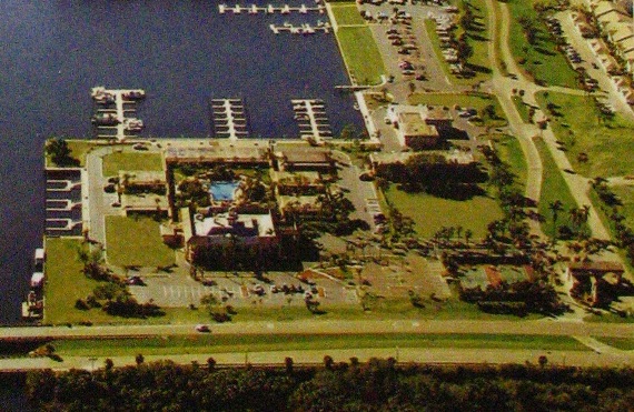
. . . we were in the building just above the pool in the photo, looking out on the marina.
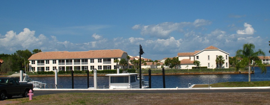
This place is hurting economically, having been built and sold in stages over about four years. The final stage was condos, which were presold for a $20,000 security payment just before the real estate bust and ensuing economic meltdown, so needless to say most of those payments were forfeited when the buyers walked away, leaving the developer unable to pay the contractor, and leaving many of the buildings empty, without power, lights, or AC. All the buildings in both these photos, for example:
We heard all this news from a guy who lives in the complex and gives Everglades tours aboard a pontoon boat. He said the whole thing was playing out in the courts, and would be for probably two more years.
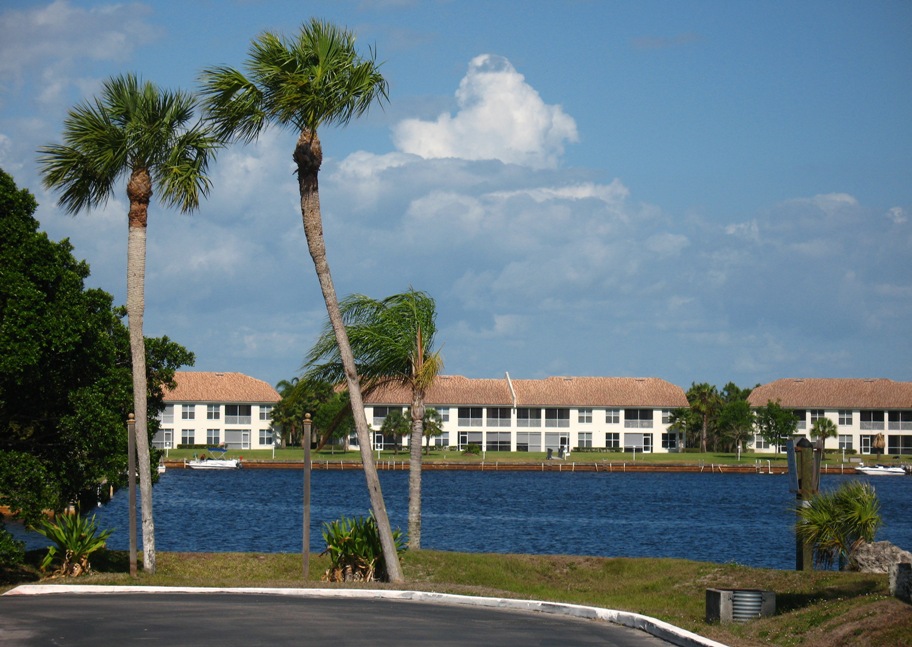
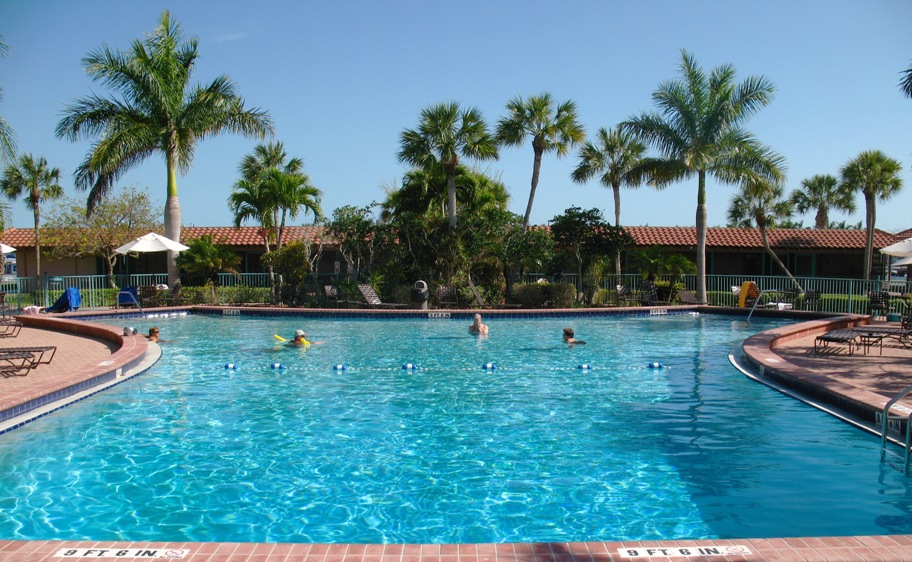
As far as we were concerned, the parts we wanted still worked:
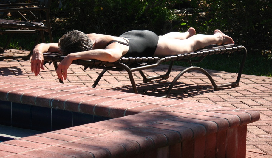
Here's the view from our room's south-facing screen porch:
That'll do!
Tuesday 5/5/2009
Day 13
This day was scheduled as 215 miles from the Port Of The Islands resort to Key West. The first half of that is just a straight line across the Everglades, and the second half is the "Overseas Highway" from Key Largo to Key West. What a ride.
Let's start with an observation: Recently, 30,000 acres of the southern Everglades -- south of the Tamiami Trail, the road we were riding -- burned. Yes, burned.
In its natural state, I believe you could take an acetylene torch to the southern Everglades and ignite nothing. I mean, it's a swamp, right? "River Of Grass" and all that. Well, not really. Not any more. You see, when you build east-west roads across the 'Glades (and subdivisions, condo developments, sugar cane fields, etc etc) you dam up the River Of Grass. And when you drive the Tamiami Trail, which is built on a roadbed several feet above the surrounding "land" and quite literally transects lower Florida, you can see it plain as day. Here, on the morning we were riding, is the north (upstream) side of the road.
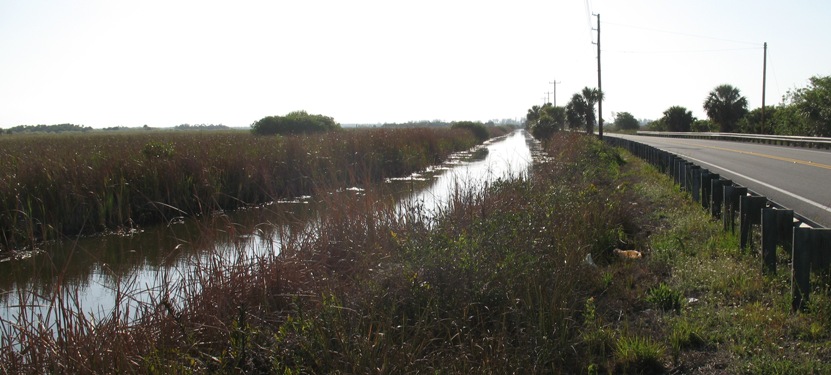
Lots of water, standing there, unable to move further south. Yes, there are culverts under the road . . . every mile or two. Not nearly enough. The foliage on this side (bulrushes) is clearly "swampy".
Now the south (downstream) side.
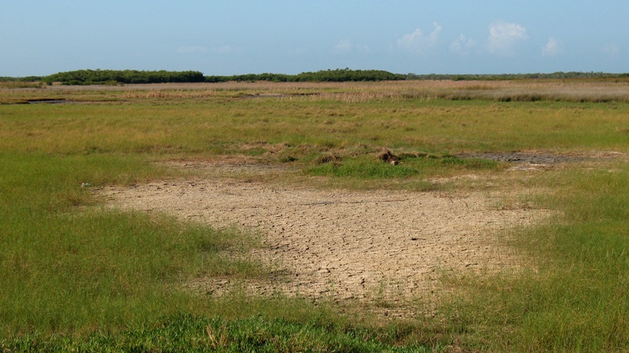
Are there any questions?
Any questions you may have are well and fully answered in Carl Hiaason's book "Paradise Screwed: Selected Columns of Carl Hiaasen:
So this is wilderness, right? No houses, no people, no . . . wait, what's this?
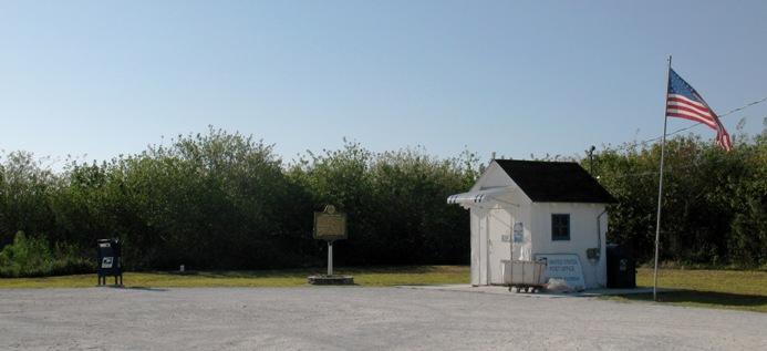
It's a freaking POST OFFICE. On a gravel turnout. In the middle of the Everglades. Not a relic: you can mail -- or receive -- a letter here.
We finally got through the 'Glades and into the region of Homestead, FL, where, once again, the shelves in the convenience stores tell you who the customers are.
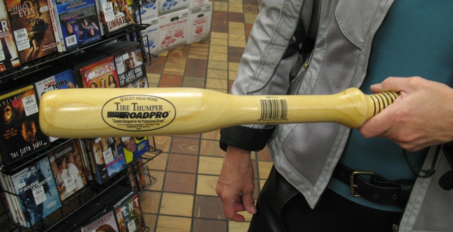
No kidding. Think of this as a sawed-off baseball bat. If you're a trucker and you want to see if you have any flat tires -- well, you see, for every pair of wheels, if one tire is flat you can't tell, because the other one holds the axle up. The flat one just sits there, looking normal. So you walk around the truck and whack all the tires with this. Beats checking the inflations -- I mean, that takes TIME, and time is one thing a truck driver does not have much of.
In case you thought this was just a gag, right next to the tire thumpers are these:
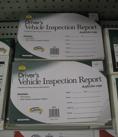
OK, truckers really do shop here.
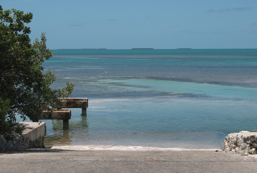
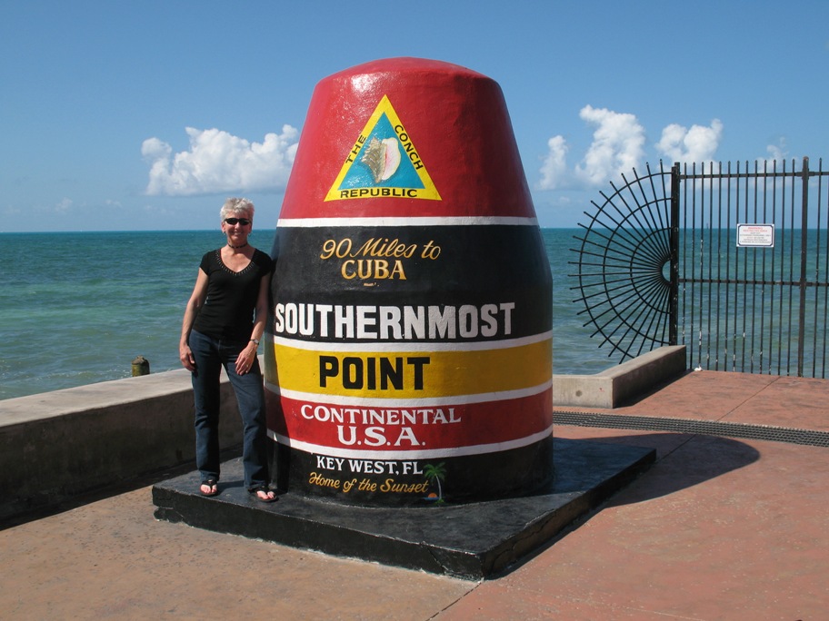
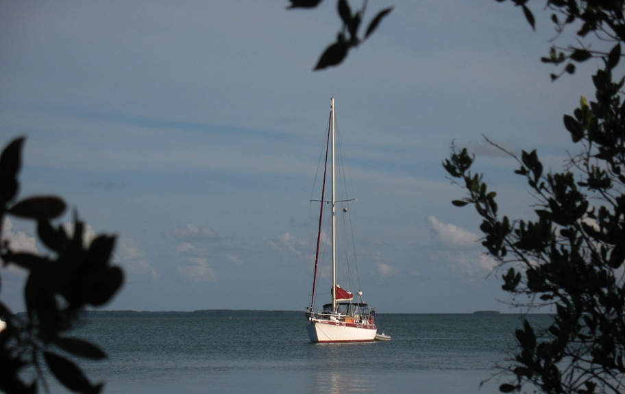
So we pointed the bike south to Key Largo and, after a stop at a Starbucks for coffee and an egg sandwich, we headed southwest down the "Key chain". Our first noteworthy point of interest is where we, once again, crossed our Wind Song track from 2004 at Snake River. In 2004 we had headed east from Marathon (Boot Key Harbor) on the inside (north side) of the Keys, and had come out to the ocean through the Snake River drawbridge. Here's a view of the channel looking north from the drawbridge, at the (Florida) Bay side.
We had anchored the previous night in that cove at the upper right of the photo. That morning we went through the bridge and out here:
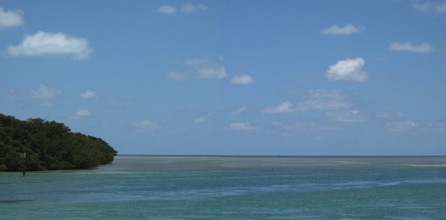
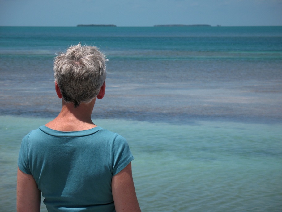
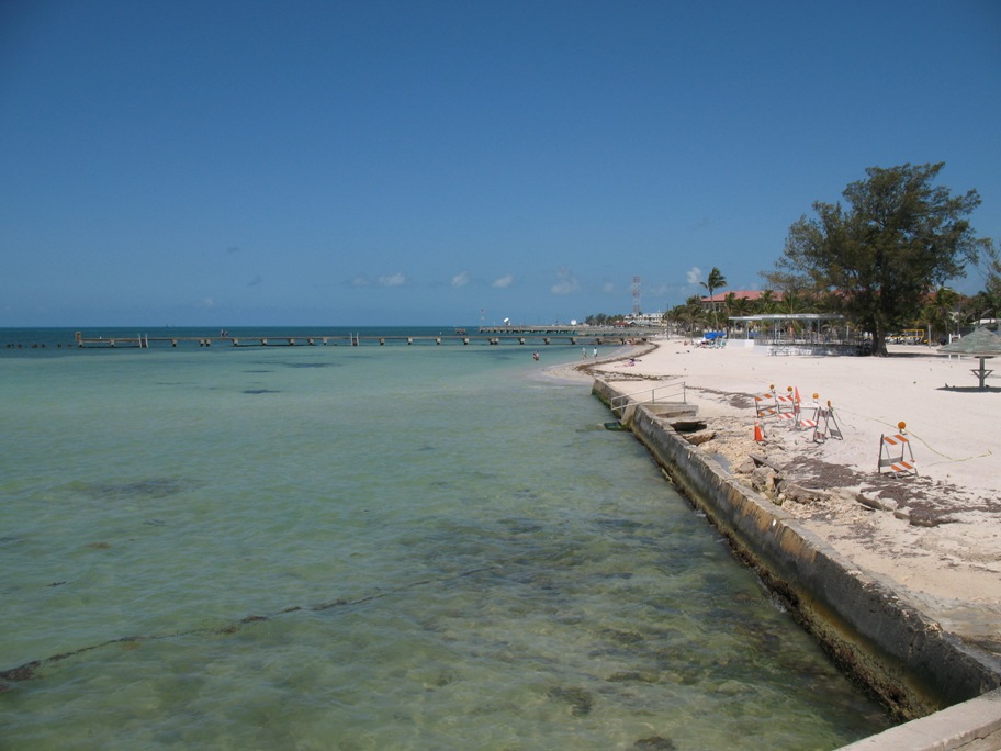
This, friends, is what the end of the land and the beginning of the ocean looks like in the Florida Keys: a bunch of shallows, and then, in the distance, deep water. That's the Gulf Stream out there, going from right to left (west to east) at about 2.5 knots. And unseen in the distance, a little over 100 miles away, is Cuba.
So there we are, driving along with water on both sides: the "Bay side", to the right going west . . .
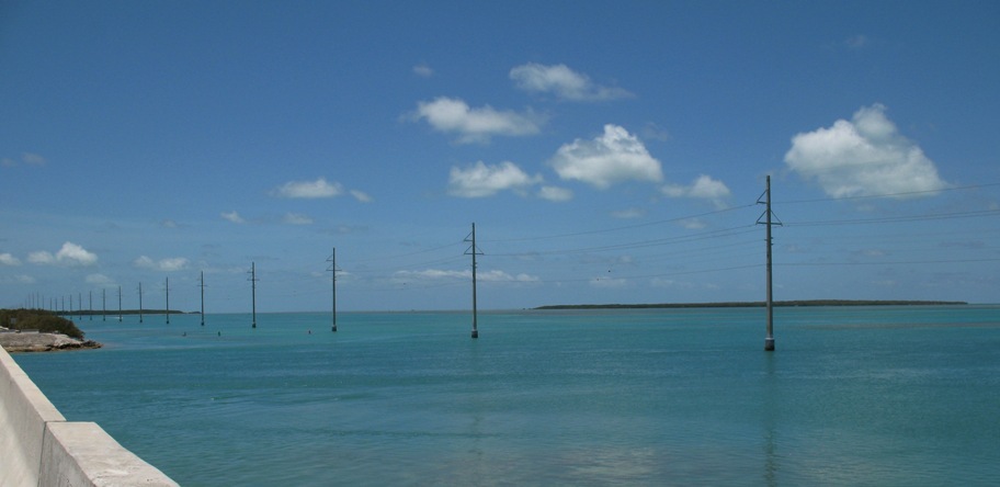
. . . and the "Ocean side" to the left . . .
. . . and often, as is the case here, no land under the road. This stretch is on pilings about fifteen feet high -- higher than any hurricane storm surge ever gets.
Oh yes, parts of the road do get submerged sometimes in hurricanes -- the parts on land, nearly all of which is no more than four or five feet above a normal high tide. But a Category Five hurricane can have a twelve to fifteen foot surge. (Hurricane Wilma, a Cat 5 hurricane when it hit Cozumel and the Yucatan, turned right and hit the Floriday Keys as a Cat 2-3 in 2005. The land-based portions Overseas Highway were inundated -- as was roughly half of the island of Key West!)
None of this stops people from building new homes in the area . . . this one, for example.
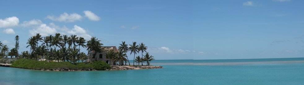
What's the altitude of that foundation above water? Three feet?
Ah well, it's pretty idyllic, and that's a fact. Look at this boat launch ramp, which runs right into Florida Bay on the north side of the highway.
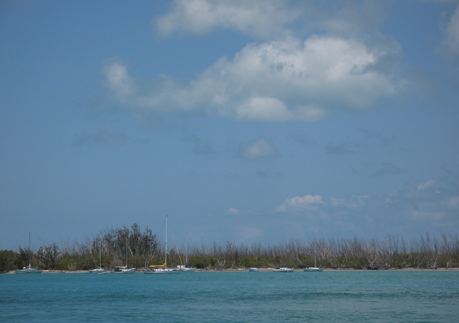
And a couple miles off, a couple of the many mangrove keys strewn across Florida Bay, perfect for bonefishing.
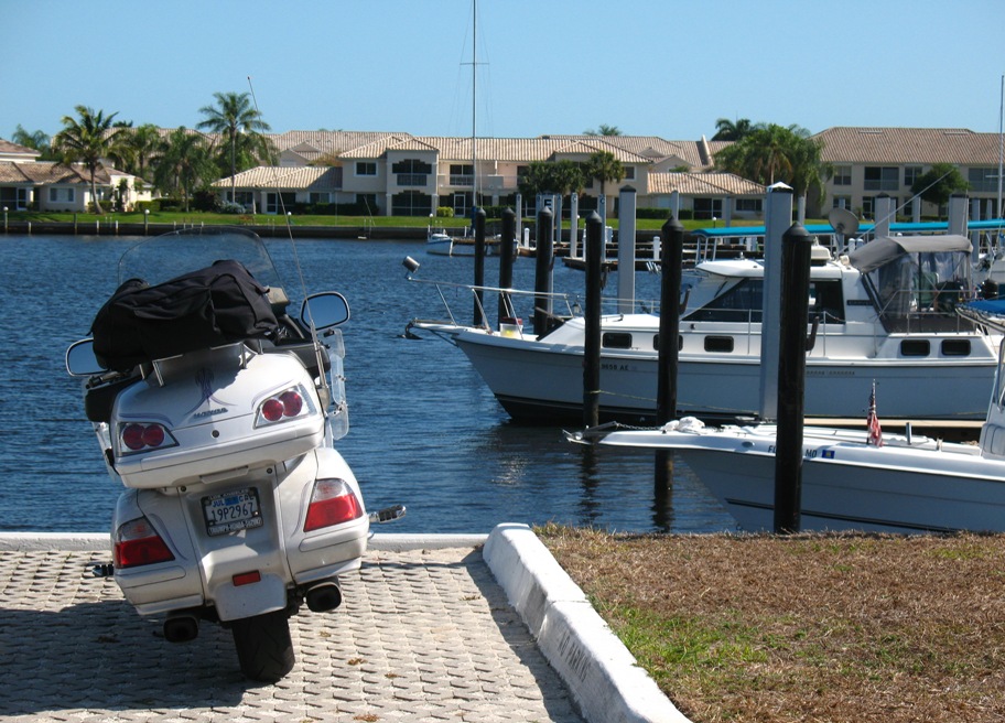
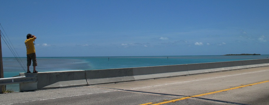
And, of course, we must have picture of Lynn and the bike!

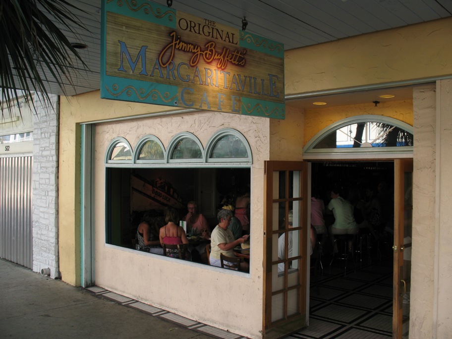
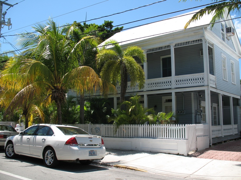
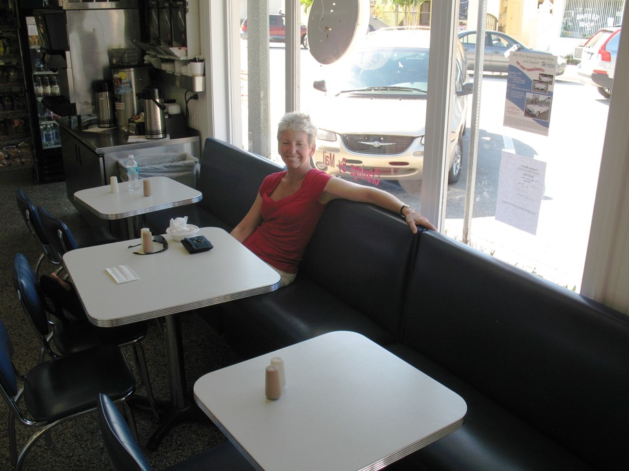
We did finally arrive in Key West, and after checking into our hotel room we walked the few scant blocks down to Duval Street, where all the bars and eateries are. One of the most quintessential (though by far not the best, nor the cheapest) is Margaritaville, one of Jummy Buffett's many sources of income other than singing.
Inside, in a mural that backs one of the larger booths in Margaritaville, is a view of the mangroves of Florida Bay.
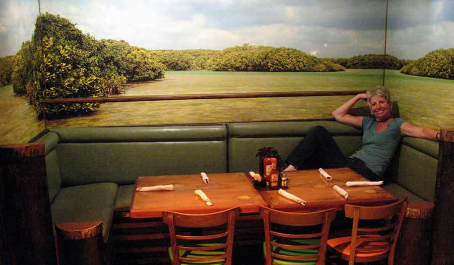
We ate "Cheeseburgers In Paradise", we drank margaritas ("that frozen concoction that helps us hang on"), and walked back to the hotel to sleep.
Wednesday 5/6/2009
Day 14
A "lay day" in Key West, just a day to do whatever we wanted around town. We started with one of the first places all tourists there go. I mean, there was a line for people to take pictures of themselves.
Now obviously this is on the south side of Key West, and so faces the ocean, not the Bay. And yes, Cuba is out there, over the horizon.
These two pics were taken during a coastal tour of Key West on the bike.
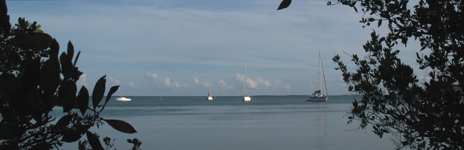
These are cruising boats literally "holed up" out of the weather in a cove on the north side of Key West.
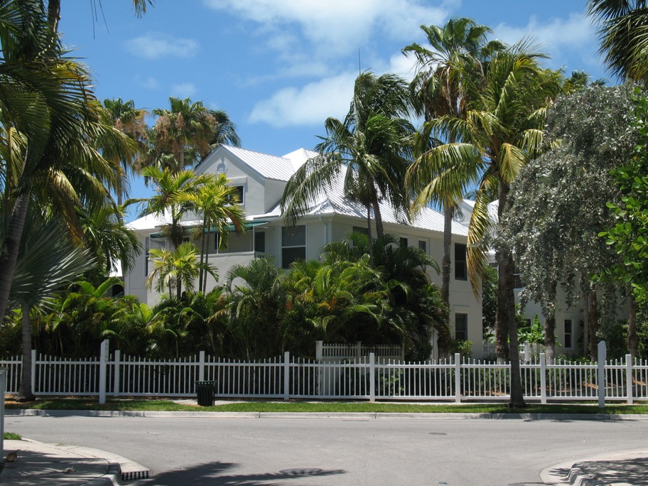
Here is just one of a great many picturesque -- and ex$pen$ive! -- gracious old homes in Key West.
Actually, a surprising number of such homes were indeed for sale. One like this (a century old, built of wood, in great shape) would be $2+ million. In more dilapidated shape but suitable to be converted to a bed and breakfast, $1.6 M. As near as we could determine, none were selling. Remember, unless your body fat percentage is darn near zero, you can't live in this town half the year. Too hot! So this would be your "winter retreat". Personally I can't afford $2M for a second home, but I guess there are folks who can . . .
Speaking of winter retreats, we went into what is known as the "Truman Annex", an enclave of perfectly restored old homes along the "old harbor", like this one.
One of these homes is the Navy building used by Harry S. Truman as a "winter retreat", aka "Little White House", although in his case the "retreat" part was so he could get some work done!
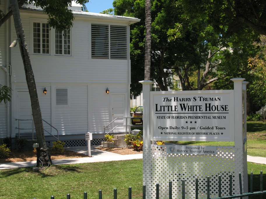
He actually worked extremely hard and was phenomenally productive during the 175 days he spent here in the course of his eight years as President. We took the tour, you see, so now we know all about it. Very interesting.
For dinner we did NOT return to Margaritaville, instead soliciting the advice of the counterperson at a local internet cafe that I spent some time in writing while Lynn played tourist. This young woman tended to dine in "under $10" establishments, and recommended Caroline's for burgers and beer, so that's where we went. Compared to Margaritaville: better food, more of it, and cheaper drinks. We enjoyed the "officially largest burger in Key West". It surely was.
Thursday 5/7/2009
Day 15
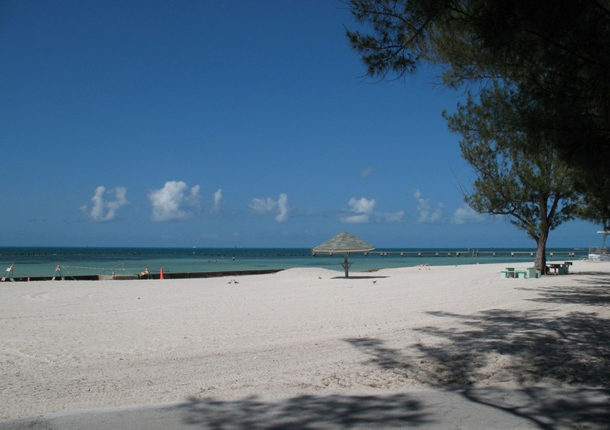
This was a long, hot day to go 320 miles from Key West to Vero Beach, FL, and a change to my original itinerary (new version here). This was a way to a) get ourselves well past Miami in one day, b) revisit a favorite stop during our 2004-2005 cruise on Wind Song, and 3) get ourselves another lay day, this time by the beach. So we booked ourselves into the Vero Beach Holiday Inn Ocean Drive, which is right on the beach and smack in the heart of a cutsie little tourist area we discovered in 2005.
On our way out of the Keys I got these two photos of cruising boats anchored "inside" the keys, especially for my cousin Randy, who is reading this.
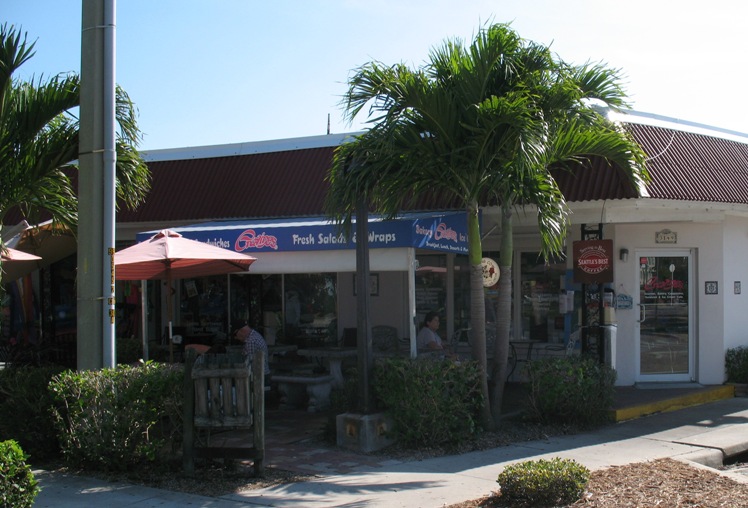
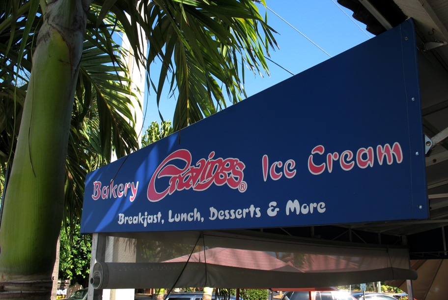
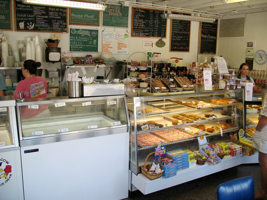
After checkng in, our first stop was this little ice cream shop, "Cravings", which was a favorite retreat from the heat in 2005 when Wind Song was on a mooring at Vero Beach City Marina. Our girls will both remember it from these five photos, which have been included especially for them.
It being hot as I said, next stop was the pool.
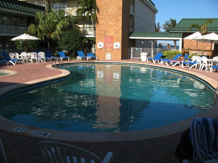
While refreshing, the water had to be around 94 degrees. The pool was advertised online as "heated", but I did not believe they meant all year! Fortunately, right behind that white metal fence behind the pool was gate to the beach. In fact, that wooden structure you see just beyond the breezeway is the stairway over the small sand berm ("dune", but it scarcely deserves the name) and down to the beach -- where the water was about, oh, 75 degrees -- the warmest the ocean in Los Angeles ever gets! I went in and body-surfed the small three-foot waves for about half an hour. Very nice!
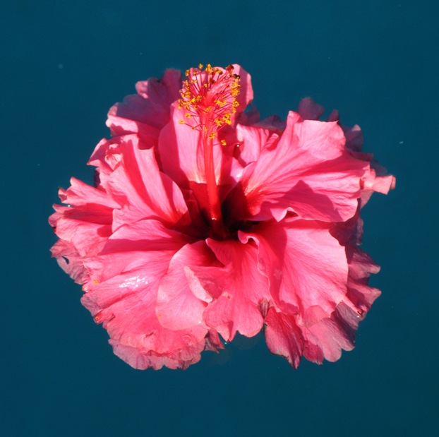
Back at the pool a very young girl, who was just learning to overcome her shyness around strangers, had been playing with a flower she'd picked, and gave it to me when her parents packed her up to leave. Such a lovely gift, I floated it in the pool.
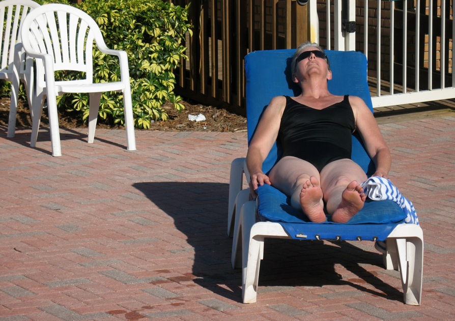
While I was lying in the shade, trying to stay cool, Lynn as usual was out in the sun trying to stay warm -- and she hadn't even been in the ocean!
Friday 5/8/2009
Day 16
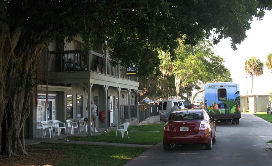
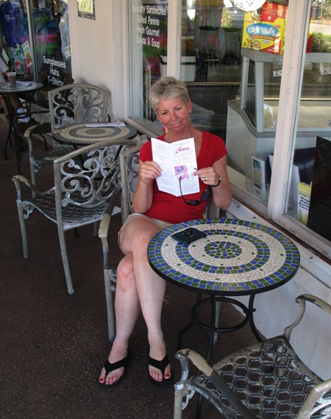
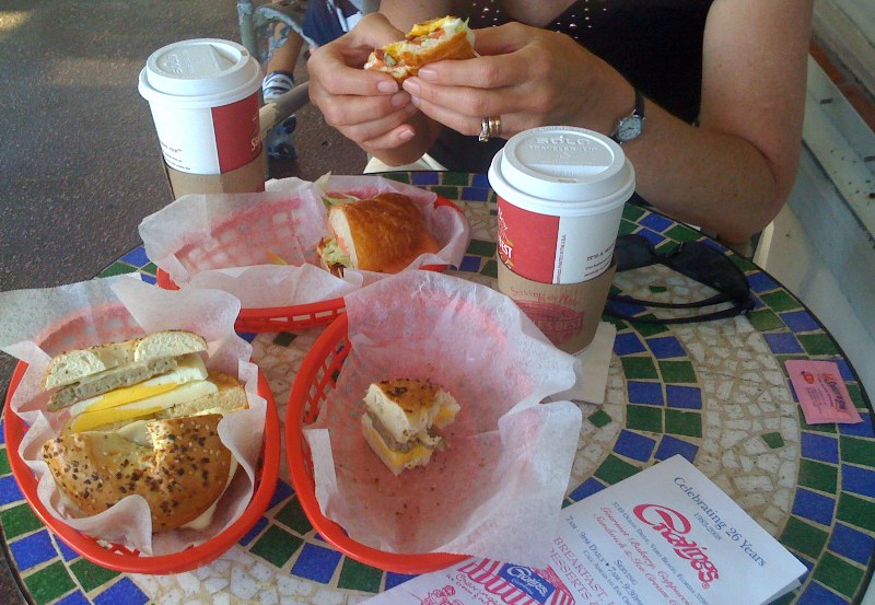
This is a lay day for us, and after sleeping in (which means 7 am for us) we headed back to Cravings (two blocks away) to try their coffee and breakfast sandwiches, both of which were excellent.
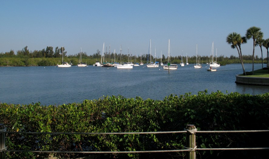
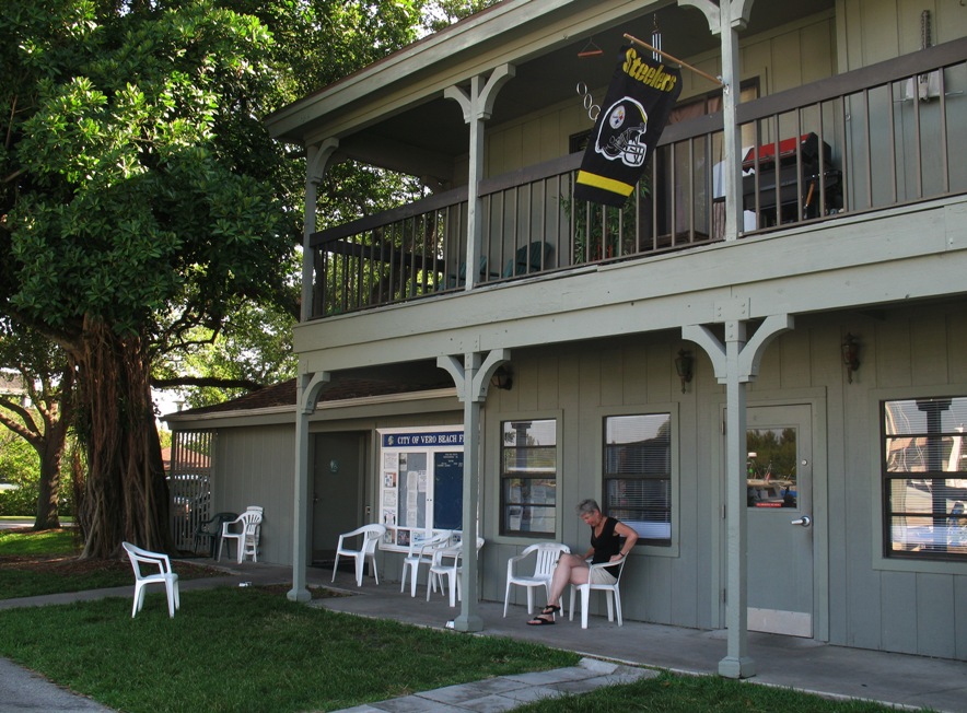
Then we headed west a few blocks to visit the Vero Beach City Marina, where we had spent about a month in spring of 2005. This place has a set-up that should be a model for anywhere in Florida that has transient yachts, but for various reasons isn't. Florida politics is, well, still politics.
The thing is, transient yachts (and yachties) are widely reviled throughout Florida's protected inner waters. What do yachties want? Quiet water for their vessel and access to transportation, shopping, Internet, bathrooms, showers, and laundry. What do most communities want? For transient yachties to vanish from the face of the Earth. Shore-based residents and the cities they live in don't own the water (or the ground the yachties' anchors are buried in), but the State of Florida does. Of course, there are many arms of the State government, and they don't agree on much. All that said, somehow the City of Vero Beach decided, all on its own, that this clash with the cruisers was silly and that there had to be another way. The truth was, cruisers do have *some* money to spend, and Vero Beach ain't Fort Lauderdale (where "boats" start at 100 feet long and go up from there) and wouldn't mind the business. They already had a "normal" marina, where many yachties cannot afford to stay, but they also had a large, well-protected area of water just off the Intracoastal Waterway (ICW) where transient cruisers liked to anchor. Vero Beach did the following:
a)
Leased this area from the State,
b) Made anchoring there illegal (as it is in all of Vero Beach),
c) Installed moorings,
d) Rented those moorings to transient yachts at rates they could afford (including a liveaboard fee),
e) Made overboard discharge illegal (as it is everywhere in the ICW, but it is widely ignored),
f) Provided holding tank pumpout as part of the liveaboard fee,
g) Provided a "clubhouse" with bathrooms, showers, laundry, computers, and Internet (all part of the fee),
h) Provided free Shuttle Bus service both east (to shopping) and west (to the beach and restaurants) from the marina, and
i) New this year, wifi throughout the mooring field -- Internet on your boat!