Update 14
Tuesday 6/16/2009
Day 55 (9 days to Lynn's arrival)
Ashland, WI to Bemidji, MN, 225 miles
I made it uneventfully through several hours of continuous moderate rain with blessedly mild temperatures. Never got below 59 F (except in Duluth, where Lake Superior drove the temp down to 53), and I was able to drive 60-65 mph without much trouble. I took three stops along the way for coffee to stay warm.
Today's prediction was 50-60% chance of rain all day in Bemidji. Tomorrow is supposed to be "a few showers", 30% chance of rain, and temps in the 60's. Should be OK. If conditions are favorable, I may try to take two hops in one day (total 325 miles) to Minot, ND. I'm feeling a bit "under the weather" with a slight cold that limits my endurance, so we'll see.
Didn't take pictures, obviously, but there wasn't much to see anyway. Beautiful, but not really photogenic. Just lots of forest and a lot of lakes. Oh, and the Mississippi River, which I crossed! It was just a big grassy swamp, but it was clear from the distance between the "banks" (~ 1/4 mile) that it does fill up sometimes. Not something I'd want to live next to!
I met a guy yesterday on a Gold Wing out of Seattle who was "taking a lap around the country". He passed me between Munising, MI and Ashland, WI but got stopped by road construction a few miles farther, so I chatted him up. He was headed to Fargo, ND that same day. That's a good 500+ miles. Not for me, thank you. Interestingly, he had a Garmin 376 GPS on his handlebars right next to a tiny ham radio, and they were linked together and to a web site, so his wife could monitor the site and always see where he was. Pretty clever. I'd be happy just to have a GPS with locally resident maps (not dependent on cell coverage).
Catching up on my backlog:
Friday 6/12/2009
Day 51
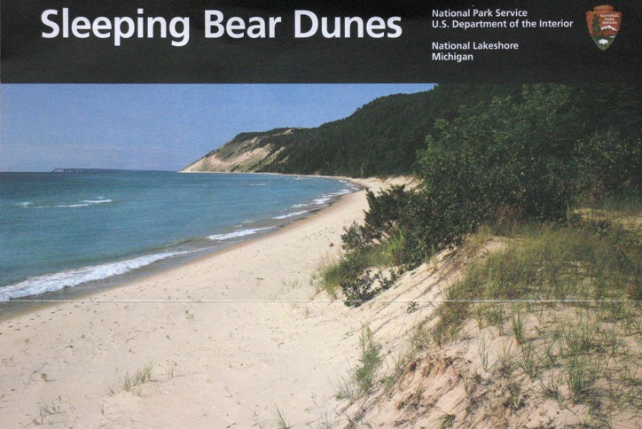
Sleeping Bear Dunes (SBD) National Lakeshore
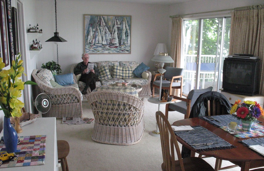
Let me start with a few photos of Don & Joyce's summer house on Suttons Bay. This is the "front", the morning after I arrived.
The back, which faces the bay.

Living/dining room, which also faces the bay.
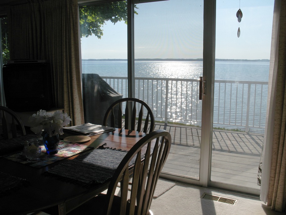
View from dining table -- taken days later, on the first cloudless morning we had during my stay.
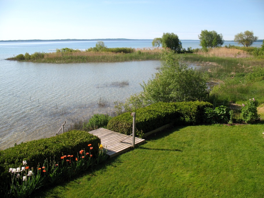
View SE. That grassy spit was the site of a swan's nest of unhatched eggs. Swans mate for life. She'd been sitting for days before I arrived, to the point that Joyce was sure the embryos were dead, but we were all surprised on my next-to-last day there when two chicks appeared one morning, swimming next to their mom and dad.
Sleeping Bear Dunes National Lakeshore (http://www.nps.gov/SLBE/), lying on Lake Michigan about 25 miles SW of Suttons Bay, is part of the National Park system of federally protected lands, i.e. your National Parks pass (you do have one, right?) gets you in. This lakeshore is representative of a number of similar locations on leeward shores of the Great Lakes. Lake Superior, for example, has similar dunes within Pictured Rocks National Lakeshore (http://www.nps.gov/piro/). These dunes are formed via wave action on the pebbly foreshore below the dunes, forming sand that blows inland to make dunes. This process marches ever leeward with the prevailing winds, because as pebbles get ground to fine sand and blown inland, the waves undermine the windward-facing dune slipface, producing a very tall pile of sand at the angle of repose with essentially no beach at the bottom. One such slope in SBD is 450 feet high and accessible only from above.
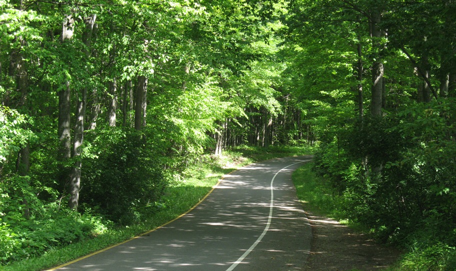
Inland of the dunes is a cedar-spruce forest, through which we drove to get to the dunes.
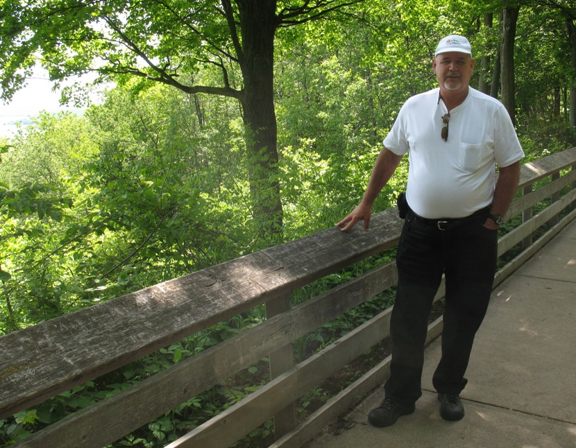
Joyce decided a picture should be taken of me, just in case anyone thinks this is all made up from Google Earth pix.
When we finally we got to the dune overlook, this is what we saw. The dune drops precipitously right over that edge.
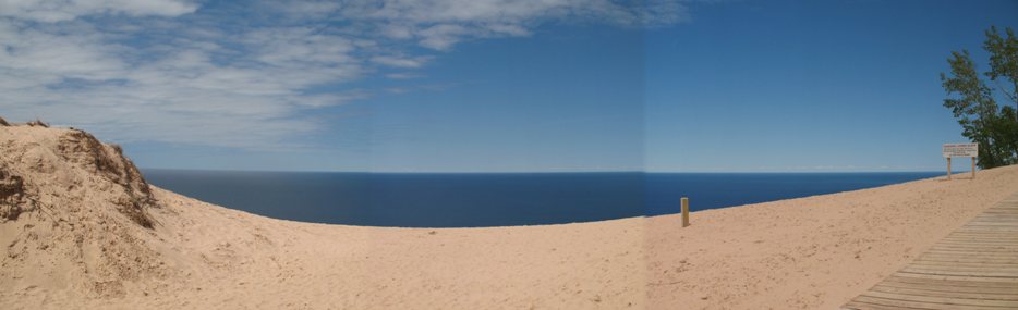
There's an overlook platform that hangs in the air over the drop.
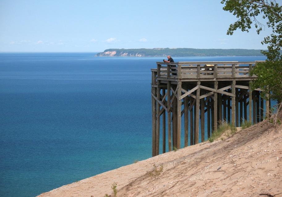
That point of land in the background is actually one of two offshore islands, North and South Manitou Islands, which are also part of the Park.
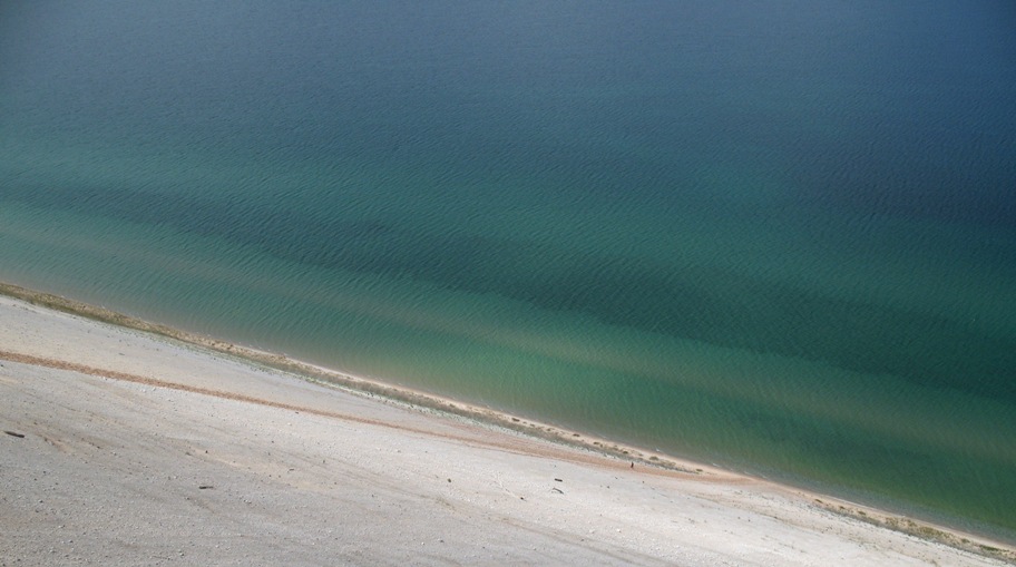
This is looking straight down from the panorama two pix up. If you go down there and can't get back up (it's hard), rescue will not be forthcoming any time soon.

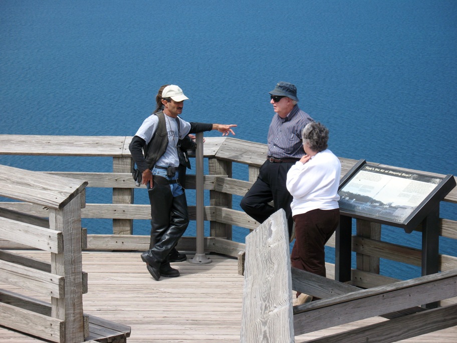
Don and Joyce, two of the most gregarious people I've ever known, took the opportunity to chat up a motorcyclist and his wife who were visiting from Georgia. Wherever we went, it was normal to see my aunt and uncle initiate conversation with anyone they bumped into. And quite often, common ground is discovered almost immediately. Don & Joyce's granddaughter went to college not far from where these folks live.
OK, here it is, the way down. Like I said, not much beach down there!
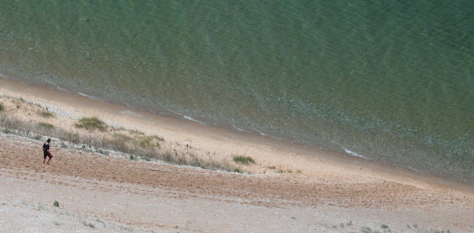
In the photo above, you may have missed this detail. This is going to be one tired fellow in the not too distant future.
By the way, in the photo above you can see the swath of pebbles just underwater near the shore. These are slowly being converted to sand as I described.
Looking north, that small tree-tufted hump is what's left of Sleeping Bear Dune, which has eroded significantly in recent years, as you might expect. It won't be there at all in a few more decades. In fact, the slipface in this photo is moving to the right an inch or two a year.
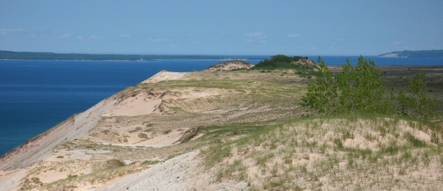
The name Sleeping Bear Dune comes from a Native American legend wherein a mother bear and her two cubs were driven into the water on the far (west) side of Lake Michigan by a forest fire, and swam across to this (east) side to escape. The mother reached shore first, and lay down to await her cubs -- and fell asleep. The cubs never arrived, having drowned not far from shore. The mother became Sleeping Bear Dune, and her drowned cubs became North and South Manitou Islands, visible above offshore.
From here we drove inland to the "back" side of the dunes, where there is a dune one can start climbing from the bottom.
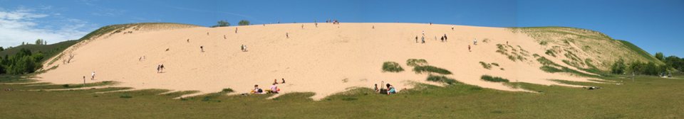
That suited me, so I climbed it and took a picture of Glen Lakes (behind me in the above shot) from the top.
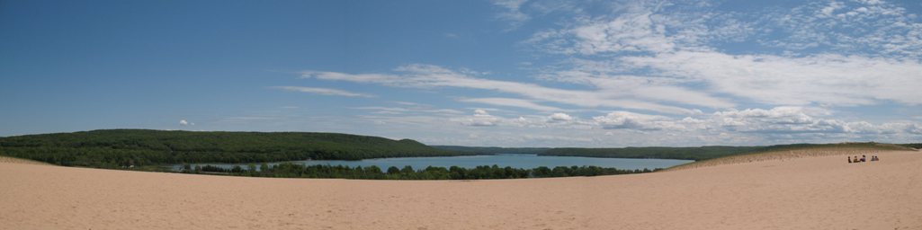
I should point out that I am not the only Darnton to have climbed this dune. Beyond it about 1.5 miles is the Lake Michigan shoreline, and one Peter Darnton, in about 1937 when he would have been 14, took off from a family picnic to climb that dune and walk to said shoreline. Sometime after he disappeared from view his father, C.T. (Tom) Darnton (remember him?) noticed the absence, asked his daughter Barbara where he went, got an answer he didn't like, and headed out after him with Barbara in tow. Memories are hazy -- no one knows whether Peter made it to Lake Michigan or not -- but what is clear is that his father found him and was "not amused". Barabara relayed this story to my uncle Donald, who told me.
Peter, of course, was my father, a man with a strong streak of independence coupled with sufficient competence to pull off most anything that he tried, as well as sufficient self-knowledge to know when he hadn't the necessary competence. (I like to think I've carried on that tradition at some level. My brother too, in spades.) I can imagine him bridling at the notion that he should have asked his father's permission before going, especially since he probably wouldn't have received it. Tom Darnton was less independently-minded (he was a banker, remember, and that spells conformity) -- as well as less comfortable with the Great Outdoors and the notion of Adventuring In It. Later my father would, as he described it to me, "put some distance between me and my father". When I asked him how he chose California, he answered that 2500 miles seemed like just about enough.
I benefited from this experience. I was WAAAAAY more rebellious than my Dad, not to mention less aware of my limits. He was, in hindsight, very understanding with me, though I did find the limits of his tolerance and transgress them. In the end I did not require a 2500 mile buffer. 200 was enough.
From here we went a few miles further north to the historic Glen Haven Life-Saving Station, a place once equipped to attempt the rescue (from te beach) of people on foundered vessels. We walked out to the lakeshore, where Joyce encouraged me to dip my fingers in the water,just to say I had, so I did. Then she followed suit, and this photo was taken at that exact moment.
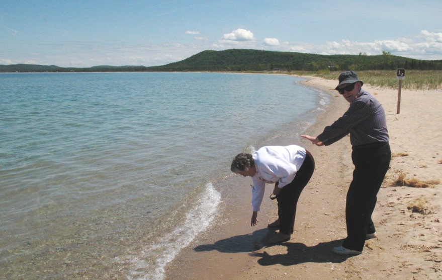
He was joking, of course. I don't know if Joyce knows this happened. I expect I'll know pretty soon.
Saturday 6/13/2009
Day 52
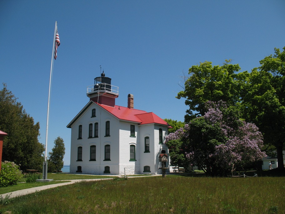
Grand Traverse Lighthouse
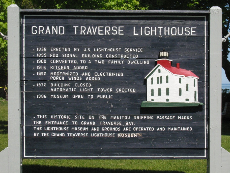
This lighthouse, part of Leelenau State Park, sits at the end of the Leelenau Peninsula, the finger of land forming the west side of Grand Traverse Bay.
I entered the Museum inside, climbed up to the light tower, and was presented with this view of the new (in 1972) automated light that replaced the one I'm standing in. Same 6 second flash spacing and everything. Much higher intensity lamp, much smaller Fresnel lens. Something's been lost here, wouldn't you say?
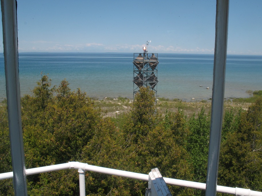
BTW, it took me about 20 tries to get that photo at the exact moment the new light was on! The flash was short.
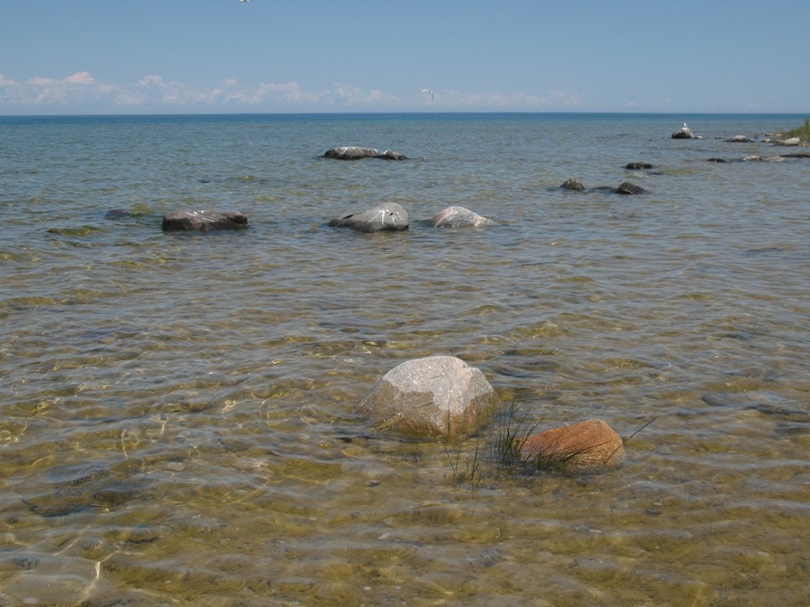
This peninsula, like all the others in the neighborhood, doesn't just stop abruptly. It kinda slowly peters out underwater for a few hundred yards.
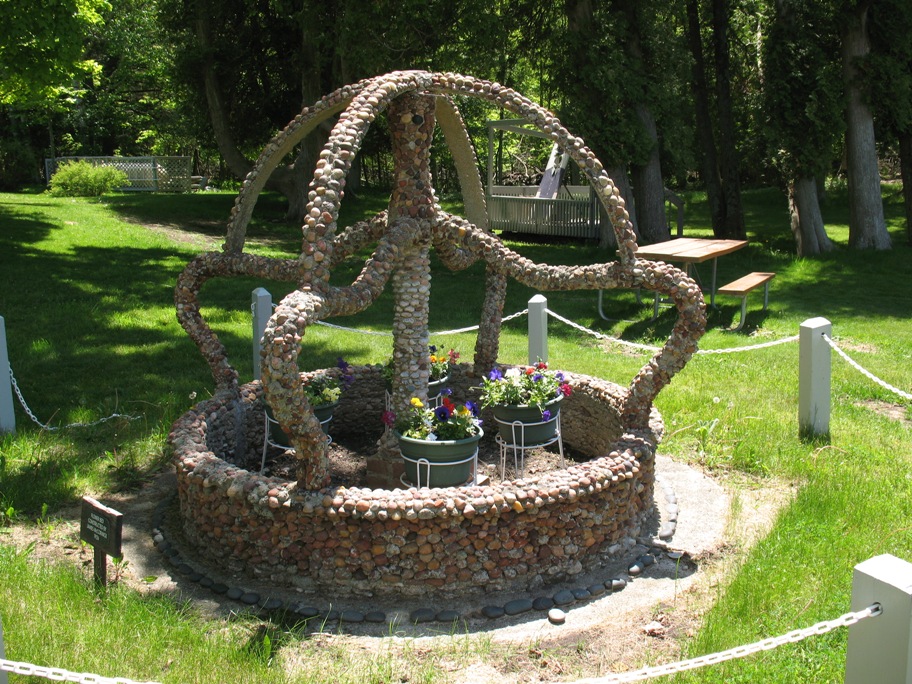
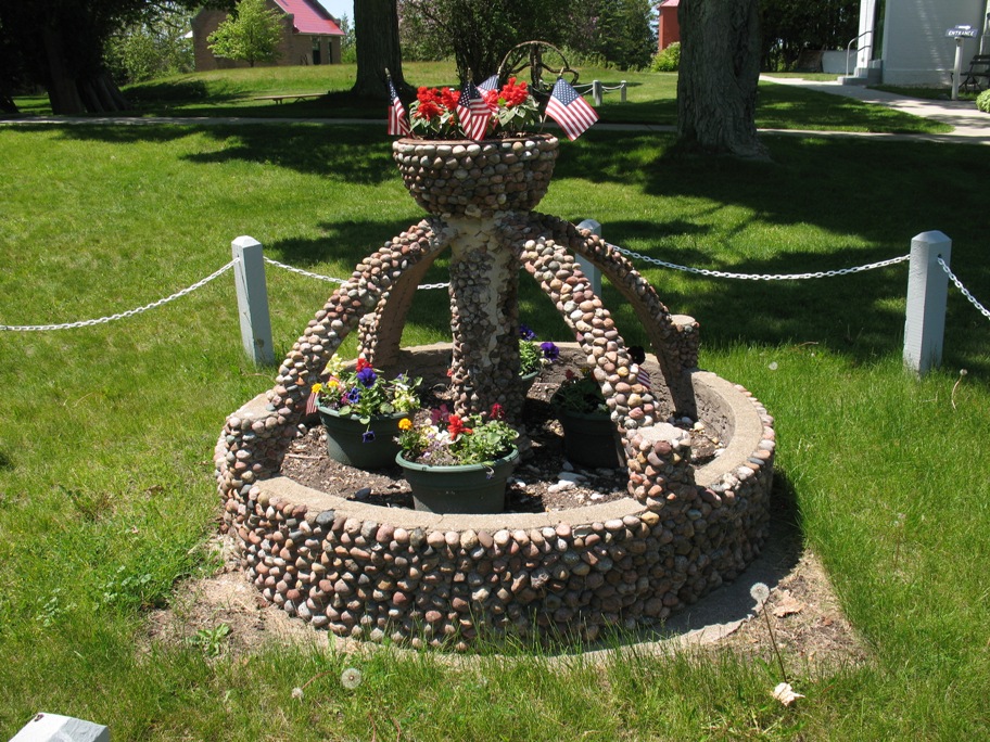
These next three photos are proof positive that Lighthouse Keepers had time on their hands. These two fountains/planters were the work of the most recent Keeper: black iron heated red-hot, bent and welded, then covered in river stones with cement for mortar.
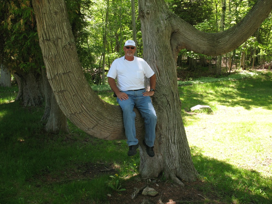
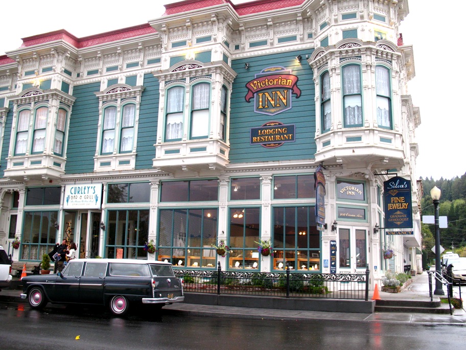
Joyce insisted I get in this tree and get my picture taken. Don took it. I think maybe she still thinks of me as ten years old. I was born when Don was 17. I'll be 60 next month. If my itinerary holds up, I'll celebrate my birthday in Crescent City, CA.
If so, maybe I'll stay at the Victorian Inn in Ferndale! Lynn and I stayed there in October 2007. Drove there in our Cecker wagon. Here's a photo with the car in front.
Hey, that's a Sunday! Maybe I could get there a day early (or two -- that's a Friday-off weekend for Northrop Grumman) and Lynn could . . . fly up for the weekend. How cool would that be!
I just went and checked it out. $325 round trip from LAX. Hey Lynn, what do you think? Should I make reservations?