Update 15
Wednesday 6/17/2009
Day 56 (8 days to Lynn's arrival)
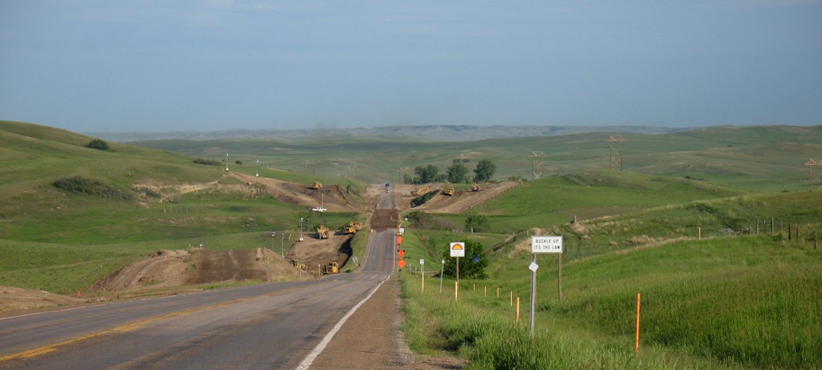
Bemidji, MN to Williston, ND, 446 miles
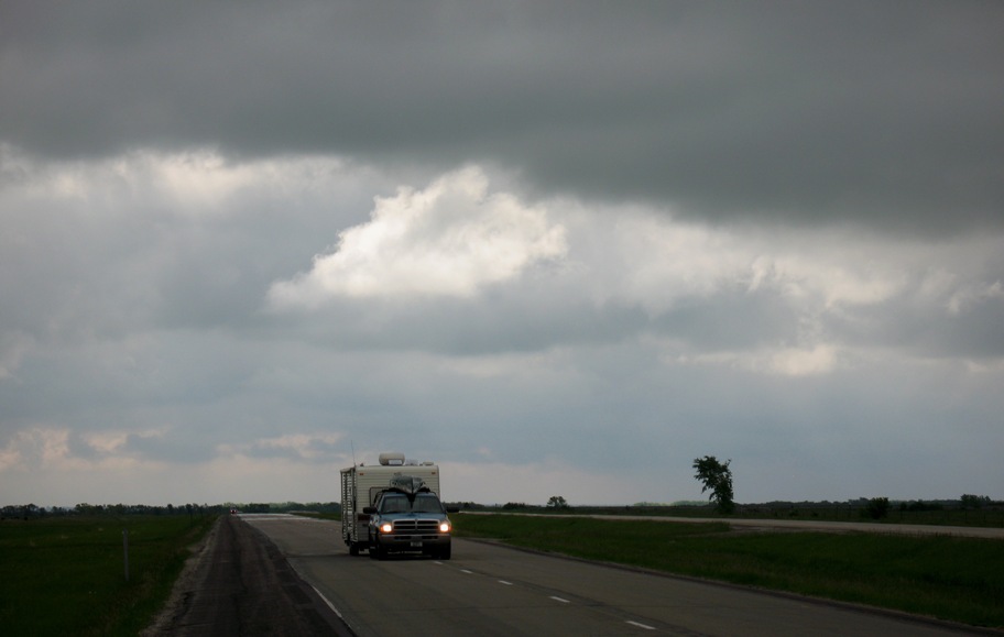
Plans changed today. This occurred because a) the morning rain abated for a fine day of riding, and b) I discovered there's really not much to see in North Dakota, so all there is to do is ride. I ended up combining three planned days into one, bypassing the dubious pleasures of Grand Forks and Minot for the equally dubious (but at least further west) pleasure of Williston, where this is being written.
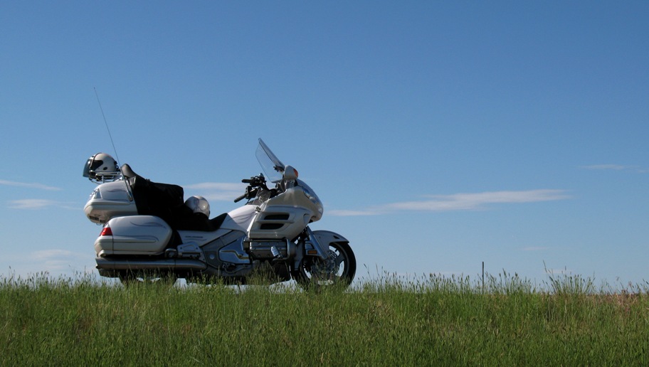
We'll start off on a humorous note. I found this in the hotel parking lot this morning in Bemidji.
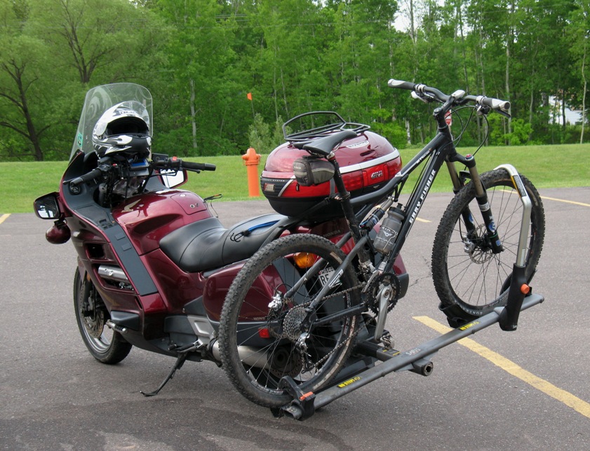
I neither know nor want to know what happens when this guy hits a turn going too fast, but I bet it's thrilling. Honda ST1300 Sport Tourer. How much two-wheeling does one person need at a time?
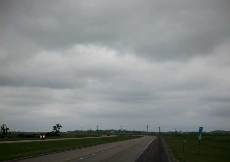
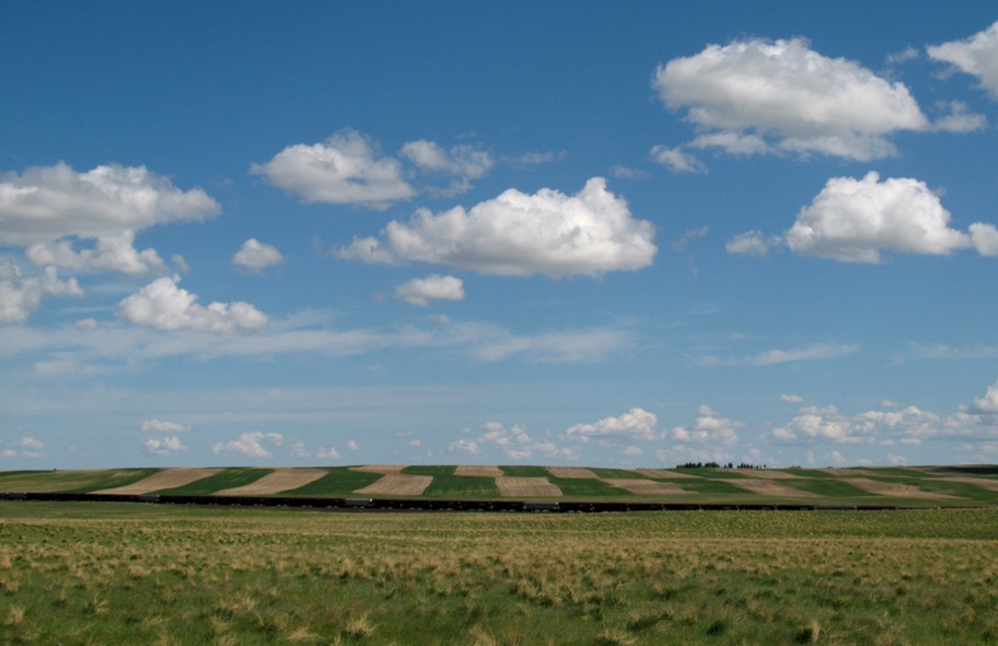
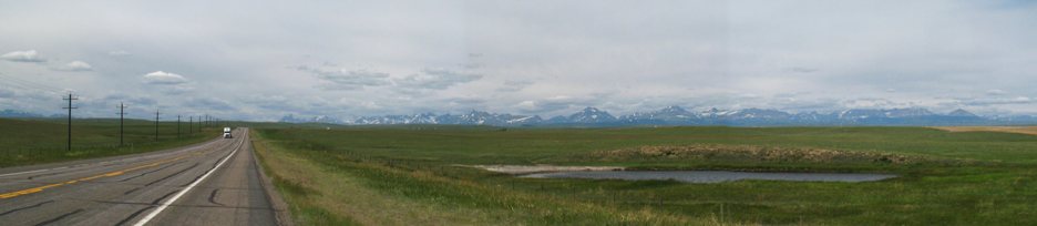
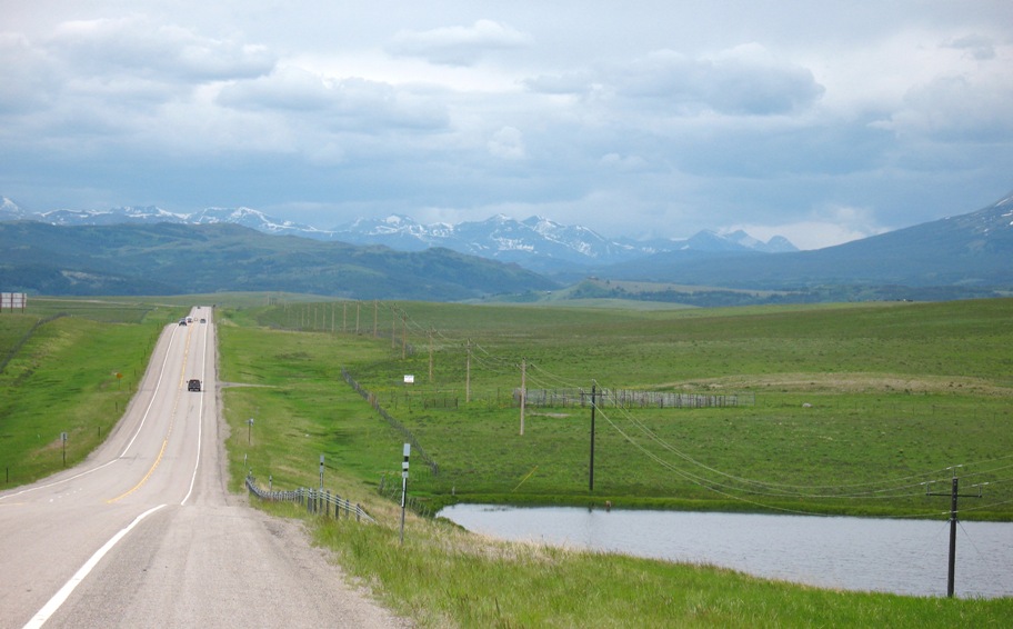
Looking east in North Dakota after the rain stopped. Not much to see.
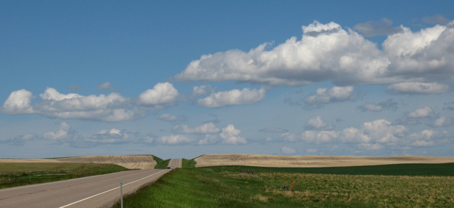
Not much to the west either, except a couple eastbound Harleys. This went on for 400 miles. Only in the last 50 miles to Williston did the landscape change appreciably. Hey, at least it's green!
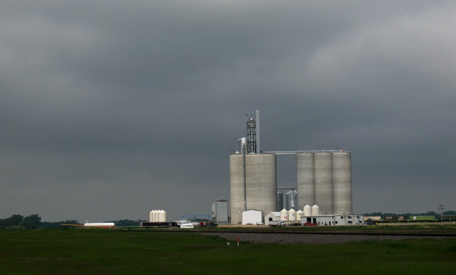
An isolated spot of sunshine brightens the view of this, umm . . . gee, I don't know. Anyone?
There was one noteworthy landscape feature: LOTS of lakes and ponds. Minnesota is known as the "Land of Ten Thousand Lakes", and the east half of North Dakota is just the same. And now I know why.
This entire area used to be under a glacier, which turned the Earth's surface into something akin to coarsely sanded bubble gum. I mean, it's not exactly flat, but it's level. It consists of small rolling hills no higher than twenty feet separated by equally small hollows. But here's the thing: Because the overall topography is level, the hollows fill with water that has nowhere to go. The larger ones are actual lakes (definition: you can boat on them), or ponds (definition: you can wade or fish in them), but the smaller ones are more like ephemeral puddles. And they are EVERYWHERE, because every rain fills them up. These shallow puddles vary in size as the rain comes and goes, but they're never really gone, so if one is a farmer (and everyone here is), you have to farm around them. And then there are the ones that never really become puddles or ponds, and instead are just bogs. Since the (divided) US Highway 2 is slightly elevated on gravel fill, bogs form on both sides and in the center divider, full of reeds and unmowed grasses. You can tell the bogs because their vegetation is taller and lusher than elsewhere.
So farmers cultivate oddly-shaped fields with curvy edges and donut holes everywhere. Only the hills get farmed. Naturally the farmer wants to plow and plant as much area as he can, but he doesn't want to waste time, fuel, and seed to plant areas that are likely to become submerged at some point in the future. In this delicate balancing act it is obvious just by looking that these farmers know in minute detail every square foot of their land and the behavior of every puddle or bog. Because every square foot is going to experience a different total moisture through the season -- and at different times.
Now that I'm in Williston, I guess my next move is to drive to Havre, MT tomorrow (302 miles) and then Browning, MT (just east of Glacier National Park, 161 miles) Friday. Saturday I plan to expand what would otherwise be a short-ish drive (144 miles) over the Continental Divide south of Glacier to Eureka, MT by exploring some areas in southern Glacier Park that Lynn and I will not get a chance to explore later when we are together. If nothing goes wrong and I don't get, say, snowed on, I'd be arriving in northen Idaho two days earlier than planned. Two extra days to hang out with my friends Warren and Jean Hodges in their huge retirement home in the woods near Lake Pend d'Oreille (pronounced POND er ay). Tough duty!
(BTW, I can't shorten my overall itinerary because I have several commitments between here and LA that are fixed on the calendar.
I'm going to post this now but add to it between here and Idaho. All of you on my email list will receive alerts when it changes.
Thursday 6/18/2009
Day 57 (7 days to Lynn's arrival)
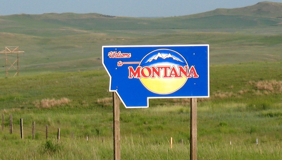
Williston, ND, to Havre, MT, 304 miles
Rolling hills in North Dakota.
Entering Montana, this sun soon disappeared behind clouds.
Then it rained half the day and was cloudy the other half. The sun is just appearing outside my hotel room window as I write (5:15 pm local time). The forecast is for more of the same the next three days, i.e. all the way to Idaho. The good news is, I'm getting pretty good at it. I get myself into proper attire *before* the rain comes, and when it hits I don't even flinch anymore. I drive until I need to stop, and when I do it's at a gas station under a roof. Then I regroup at my leisure (taking up space at the pump -- everyone does it around here), shake off, grab some coffee, drink, re-gird, and head out again. I can do 45 minutes to an hour before it's too much.
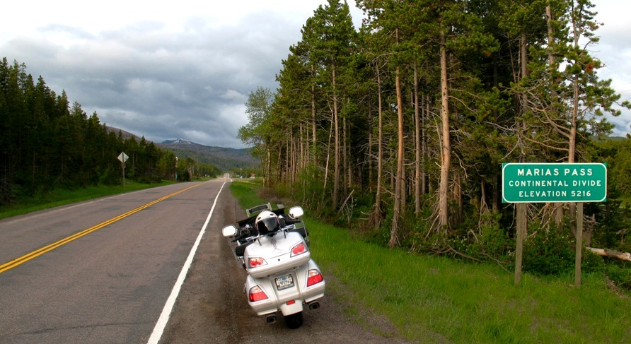
Marias Pass (5213') over the Rockies south of Glacier National Park could be interesting. That's two days away. Remember, while timberline in Colorado and in the Sierras is at about 10,500 to 11,000 feet, in Glacier NP (of which Marias Pass is on the southern boundary) it's at 5500. On that note, Logan Pass, which is the highest point on the famous Going-To-The-Sun Highway across the middle of the Park, is at 6600', corresponding roughly to 12,500 in the Rockies. At this moment that road is still closed due to avalanches. Note I did not say "avalanche danger", because right now they are a certainty. The road *might* be open when Lynn and I are ready to drive it on July 1st! It has been, as they say, "a late winter".
Earlier today I was stopped by a young-adult flagman for some road construction, and he strolled over to chat. Turns out he was born and raised in Havre, MT, my destination for the day. Apparently not one to sugar-coat anything, he described Havre as "a shit-hole town". I ask his opinion of Browning and he said the same thing. Thinking maybe he was just there at a bad time in his life (his entire adolescence), I reserved judgement, but now having seen it I'm inclined to agree. The "business section", 1st Street or US Highway 2 on the north side of town, is roughly 50% Indian casinos. I drove the entire four-mile stretch through town, and back, looking for a grocery store, and didn't see one (turns out there is one, but I'd missed it twice. It's all basically cheap hotels, fast food, bars, and casinos. The flag-kid told me to make sure I took all my stuff off the bike and inside my room, because "the Indians will steal anything." *sigh*
It was from this kid that I learned US Highway 2 across Montana is known as "The Hi-Line". Which is why, when I got to Havre and saw the sign announcing it to be "The Pride Of The Hi-Line" I knew not to expect too much. And was not disappointed.
Tomorrow the plan is to go 161 miles to Browning, MT, just east of Glacier Park. It's short because I expect a) to be cold (Browning is at 4380', whereas right now I'm at 2481'), b) probably to be wet, and c) to be stopping for photos if I can. The last stretch should be scenic, approaching the mountains.
More tomorrow afternoon.
Friday 6/19/2009
Day 58 (6 days to Lynn's arrival)
Havre, MT to East Glacier, MT, 175 miles
I made a hotel reservation for East Glacier, 12 miles beyond Browning, mostly because when I went online I couldn't find a hotel worth staying at in Browning.
Yesterday's weather prediction was overly gloomy. It turned out quite well. High clouds made poor light for photography, but a few tweaks with a photo editor have made them at least semi-presentable. The landscape started out just more of the same rolling hills. As Minnesota became North Dakota became Montana the land has become more denuded of trees, until in central Montana all the land is in agriculture. But there was still, as you might say, no relief from the absence of relief.
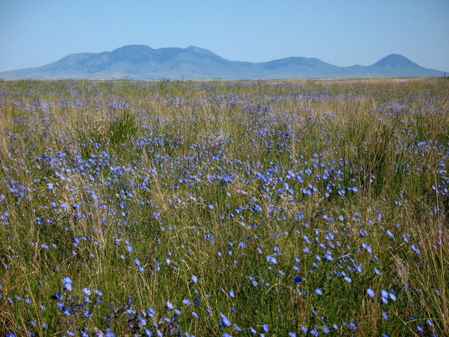
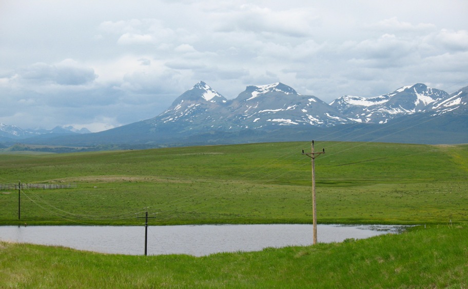
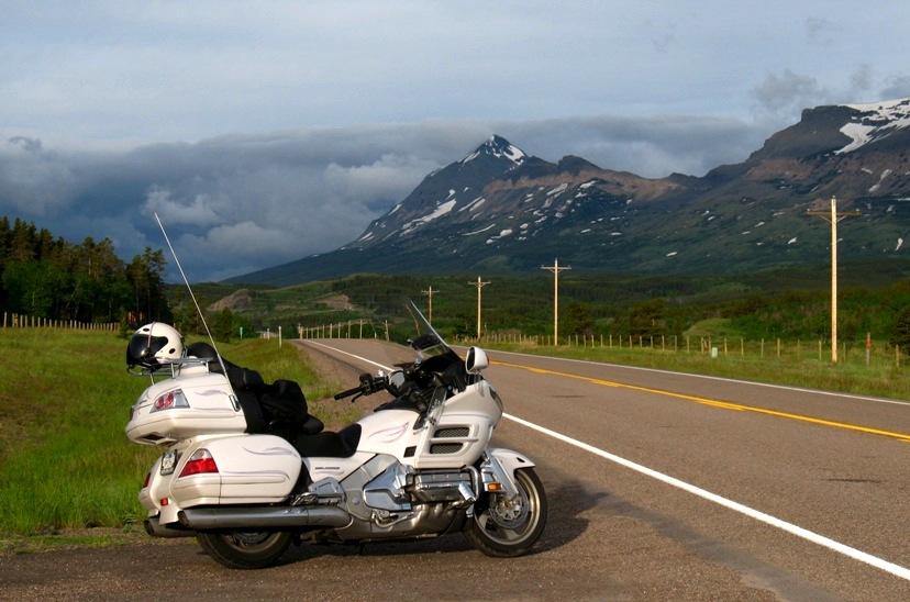
I knew at some point I would be seeing the Rocky Mountains of Glacier Naional Park, but I did not expect much before then. I was surprised by this 25 miles west of Havre (pronounce HAV ver by the distinctly non-Francophile Montanans).
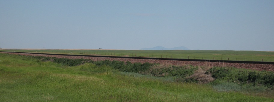
Look closely above the horizon just right of center. That is the first real relief I've seen since the Adirondacks.
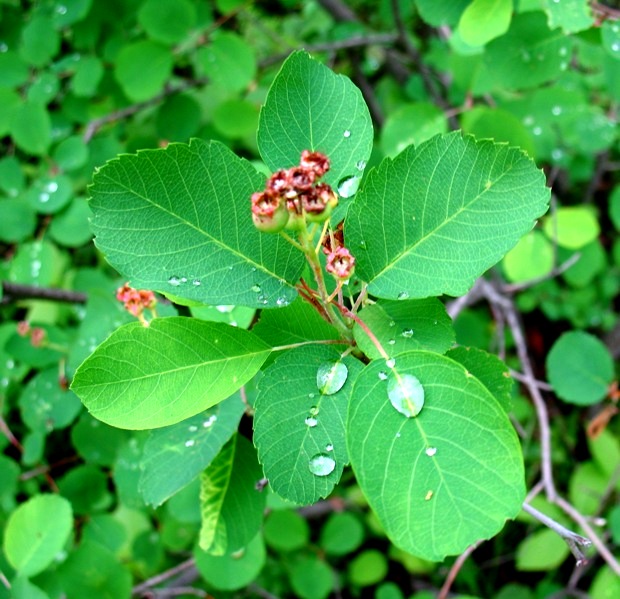
It took 50 miles of driving to get even with this mountain. Its origin is a mystery to me. A hundred miles further west are the Rockies, and the nearest mountains eastward are 2000 miles away. Just this one lone remnant. Nice flowers, though
This bike has now taken me over 9,400 miles on this trip without the slightest hiccup. Granted, it should -- that's why I bought it new, and it only has 19,000 miles on it -- but I'm thankful everyday for its reliability. It is extremely well designed and engineered.
From space (on Google Earth) the farmland in this area has a distinctive striped appearance unlike other areas of the country.
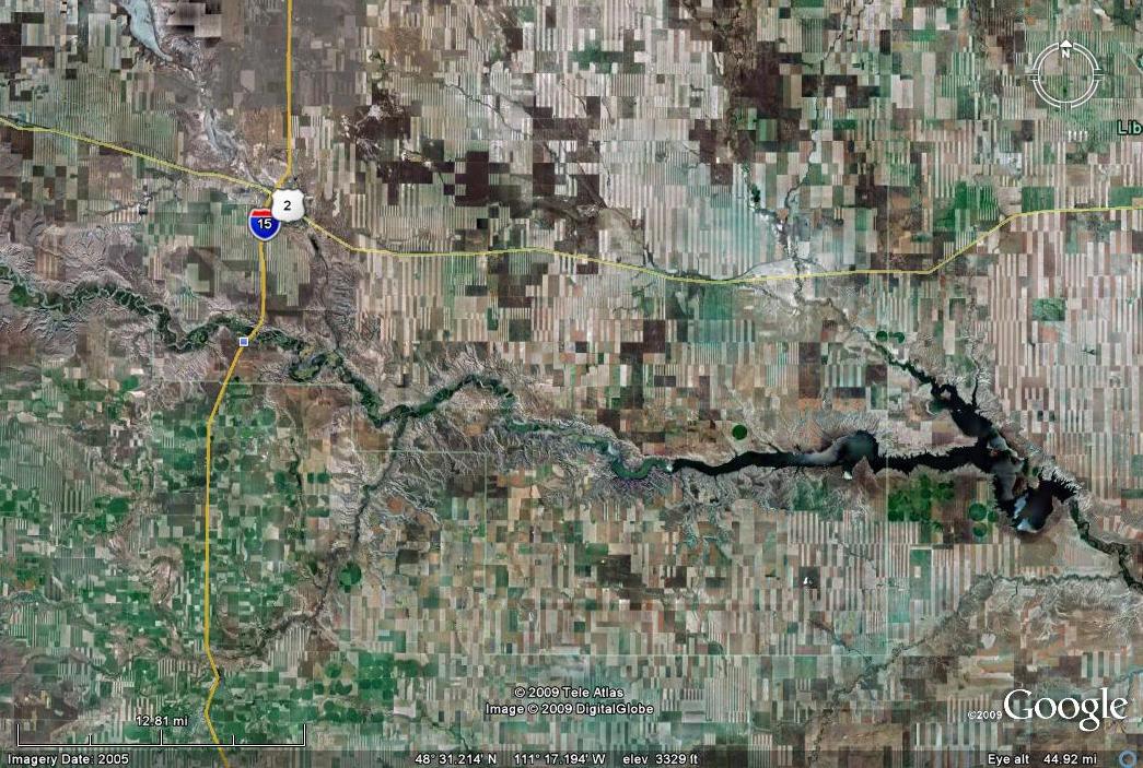
The lower left area of the image shows some different, more normal patterns, including circular watering patterns that are limited to very flat country. But most of the fields are very stripey, all north-south, and the spatial frequencies vary. ("Spatial frequency" is a fancy optics term I learned during my working years to sound erudite.) (I suppose the same could be said for the word "erudite".)
Now I know why. It appears the farmers let half the land lie fallow every year, but they do it in N-S strips. (Why N-S?) The dark green areas are newly planted crops. The light-colored areas are stubble from last Fall's harvest. The widths of the strips vary. After riding through a hundred miles of this, I would swear the farmers compete with each other in the artistry of their patterns. I guess they plow and plant a lot of acreage. I bet their Spring days out here in the fields are long and boring. I bet they really enjoy having something to occupy their minds.
And on westward, waiting for the mountains to appear. Like Waiting For Godot.
Except, unlike Godot, the mountains finally appeared. As someone who's lived most of his life in California, this is a sight for sore eyes.
The land starts to hump up into foothills the closer I get to Glacier Park.
That river valley off to the left is where I'll go tomorrow to get through these mountains.
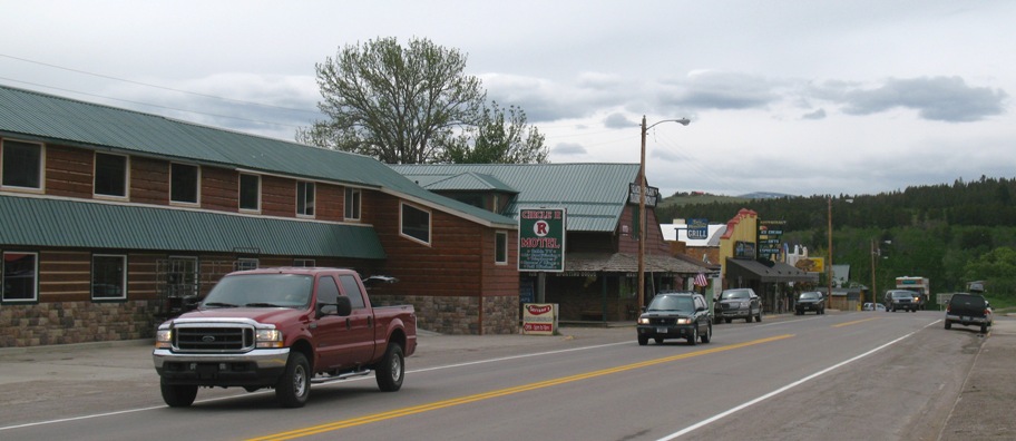
Just before Glacier National Park, the tiny town of East Glacier, MT shows up. All one block of it. It has hotels, restaurants, bars, and a small grocery store. And a train station. Everything you need, and all accessible on foot.
Behind the train station (which is just out of the above picture to the right), up a hill, and totally invisible from the street, is this:
So totally invisible that I didn't see it. At all. Didn't even know it was there. And it's huge! I got this photo off Google Earth, courtesy of "chrismw1".
By contrast, this rustic old establishment, now being rebuilt and refurnished, is my home for the night. It's being run by a bright young couple with lots of energy.
Here's the motel's "old section" that is being refurbished.
I'm staying in this "new" section". I was pretty happy with my room, and the price. This establishment, open 365 days a year like the rest of the town, is REALLY set up for snow. The exterior stair is covered, and the "porch" area in front of the ground floor rooms is fully enclosed, with windows. Inside those windows, two beach chairs and a small table are provided outside each room . . . for . . . sunning? They do face west . . .
Tomorrow I will cross the Continental divide over Marias Pass and end up in Libby, MT after a detour to the north through Eureka, MT and then south along the edge of Koocanusa Reservoir. Between now and tomorrow, see if you can guess how Koocanusa Reservoir got it's name (hint: it's created by a dam on the Kootenai River).
BTW, I learned from the unusually (and delightfully) perky hostess at this motel that the latest estimate for when the Going-To-The-Sun Highway through Glacier Park will open is July 1st. Turns out that is the day Lynn and I are scheduled to ride it. If it's not open by then . . . well, let's just intend that it will be.
Saturday 6/20/2009
Day 59 (5 days to Lynn's arrival)
East Glacier, MT to Libby, MT, 204 miles
Yesterday's weather forecast was once again in error, in my favor again. It was supposed to rain but it didn't. Lots of clouds, but not one drop. However, in the early morning as I headed up the hill toward Marias Pass, it did look ominous in the west.
Got there with no problem. Not much to look at, though it does beat eastern Montana!
On the way down the west side, I found this creek coming down a steep canyon, under the bridge I'm standing on, and out the other side into the Middle Fork of the Flathead River. All very normal. There was just one thing that puzzled me. About two thirds of the way up in the first picture . . .
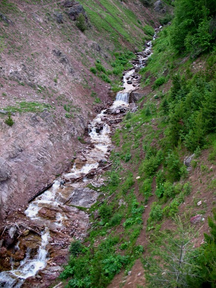
. . . what is this doing here?
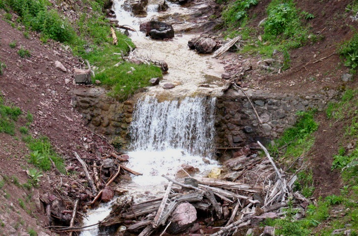
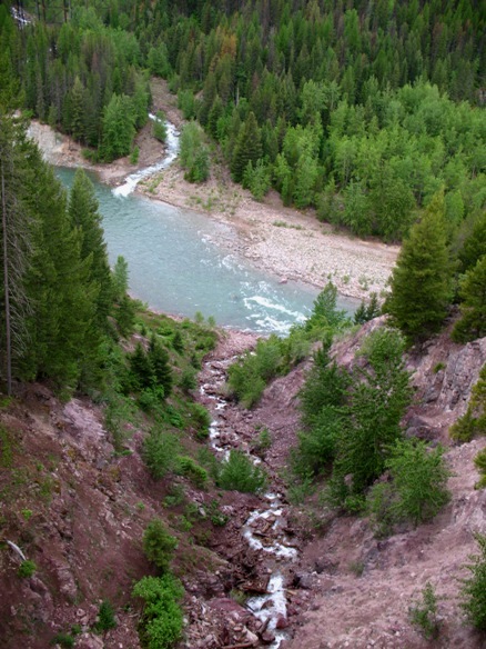
The Flathead River gains steam fast. It starts way back in the mountains at about 7500' and is a significant river as it exits the mountains near the town of Columbia Falls. From there it heads south past Kalispell into Flathead Lake.
I took this because it was there.
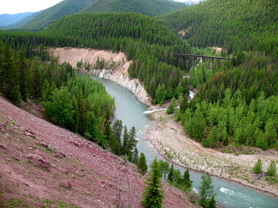
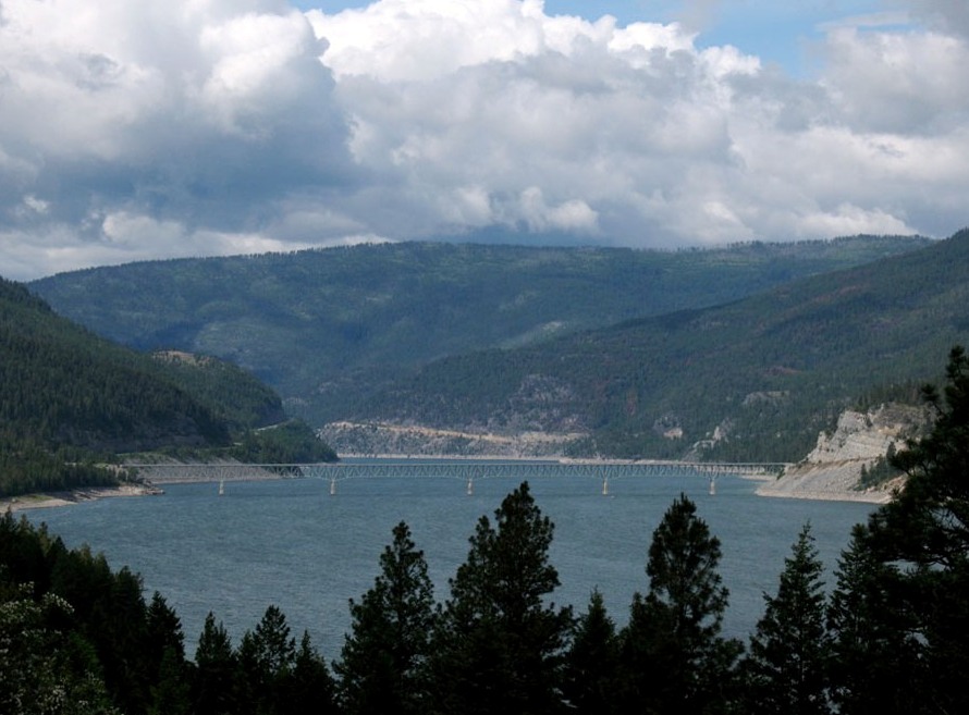
I turned north at Whitefish, MT in order to go see Eureka, MT and follow the Kootenai River (and Koocanusa Reservoir) south again into Libby, MT. Just west of Eureka I ran into the reservoir, which runs 50 miles from this spot to Libby. What is not so clear unless one consults a map is that by the time it gets here the Lake has already been in existence for nearly 50 miles, from roughly the town of Wardner, British Columbia, Canada. This spot here is 9 miles south of the Canadian border.
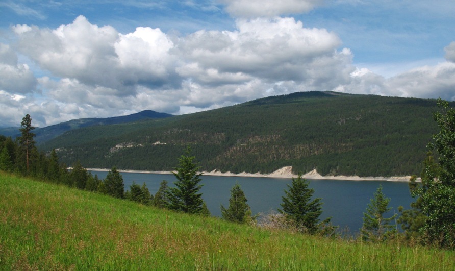
So this reservoir extends some 100 miles from Libby Dam north (to the right in the above photo), and half of it is in Canada. That must have required a bit of international cooperation. As a tribute to that cooperation it is called Koocanusa Reservoir . . . for KOOtenai CANada USA. Really.
A few miles farther south is this bridge, roughly at the midpoint between the dam to the south and the only other bridge across the lake, to the north near Elko, BC. Since there are roads along both shores of the lake, this makes sense.
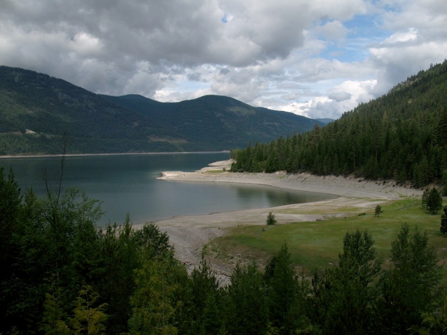
A scenic bay where a side creek enters the lake.
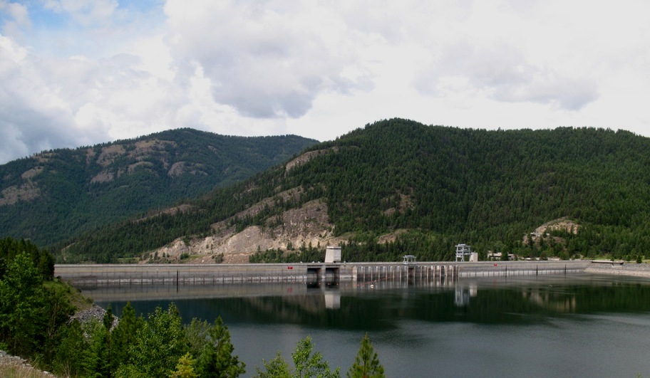
Libby Dam, which is about ten miles from Libby as the crow flies, twenty by road. I wonder if the USA shares with Canada the power generated here?
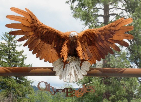
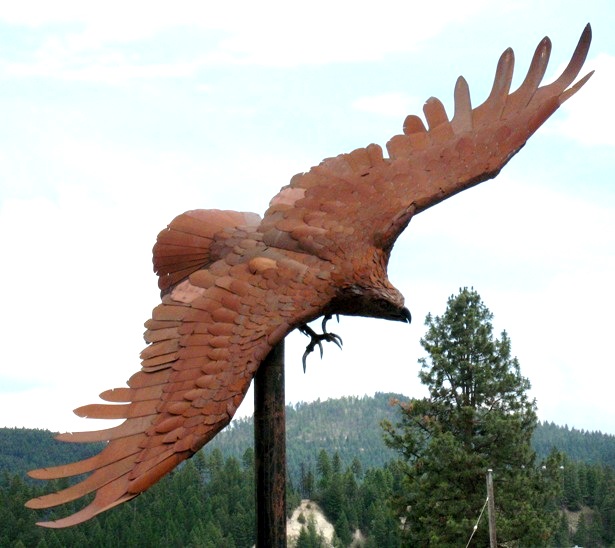
In Libby there's a guy who makes eagle sculptures. Really BIG sculptures (see two pix below), like 20 feet wing tip to wing tip. I first saw one of these in Havre, MT outside some no-name establishment, and I had no idea what the deal was. Here in Libby I ran into a talkative guy named Larry King (no relation to the TV personality, I'm guessing) who passed on this and many other tidbits of info and opinion. One example: "I voted for Bush twice and thought he did a good job." It was hard to let that lie, so I said "Well, he was hampered a bit by being sort of a one-thing-at-a-time guy." Something of an understatement. We agreed on that view -- and that Obama came in with a To Do list as long as your arm trying to do it all at once. Interesting conversation. Larry likes Libby, enjoys living there, and I can see why. It's a nice little town, and very different than the towns I've been riding through on "The Hi-Line", i.e. US Highway 2. I also met a lady who moved here from San Jose, California. I think I'll stay in El Segundo.
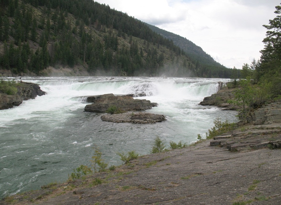
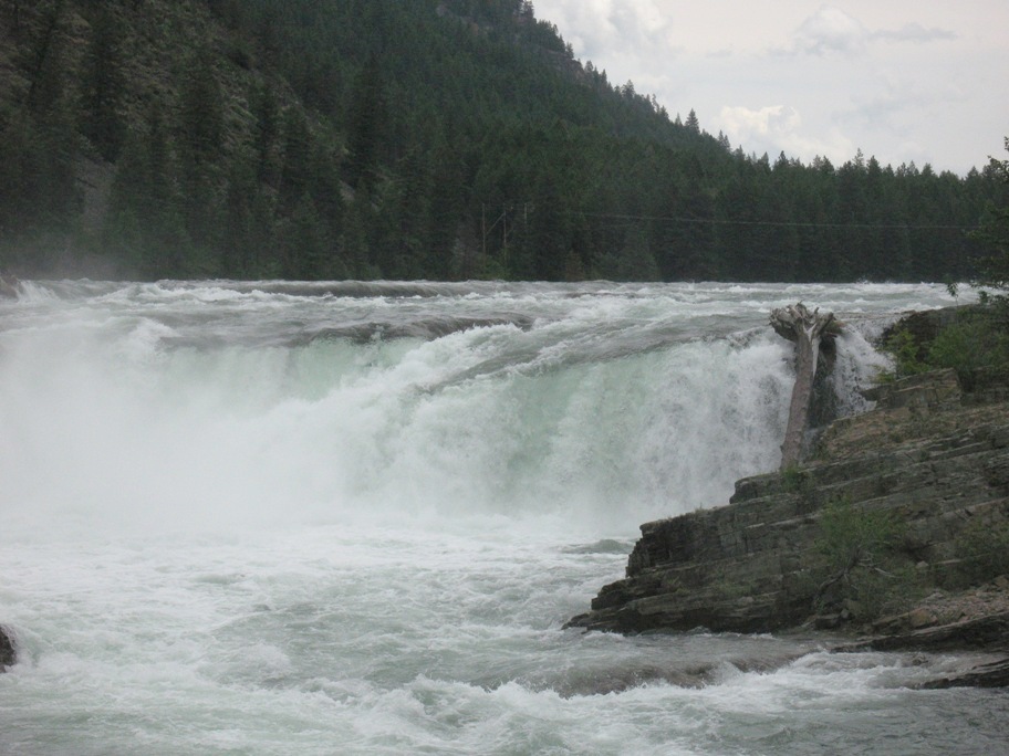
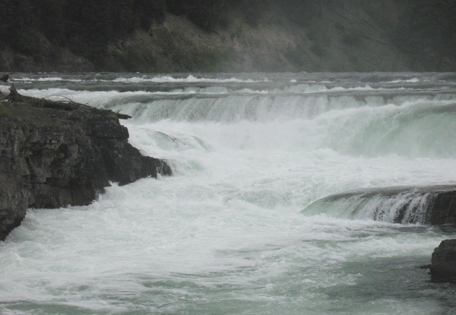
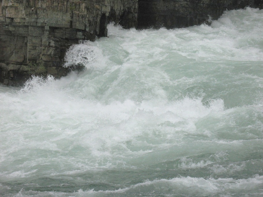
I had some time to kill because my hotel room wasn't ready, so I took a bit of Larry's advice and headed 12 miles west to Kootenai Falls County Park. Look at these four pictures. I don't know if it comes across in the photos, but this is some seriously dangerous water. You fall in here and you will not survive. As Larry said, "They'll search for days and finally find your body six miles downstream." According to warning signs at the Park, this has happened to 14 people. The highest single drop is this one (below), about 20-25 feet, but if you look closely at what's above this ledge, it's clear that if you fell in upstream you'd be dead before you ever got here. And it's worse downstream. This water is moving so fast it doesn't so much fall off these ledges as leap.
So . . . why are these two young men standing literally with the toes of their shoes on the edge of the rock, ten feet above water over a sheer drop?
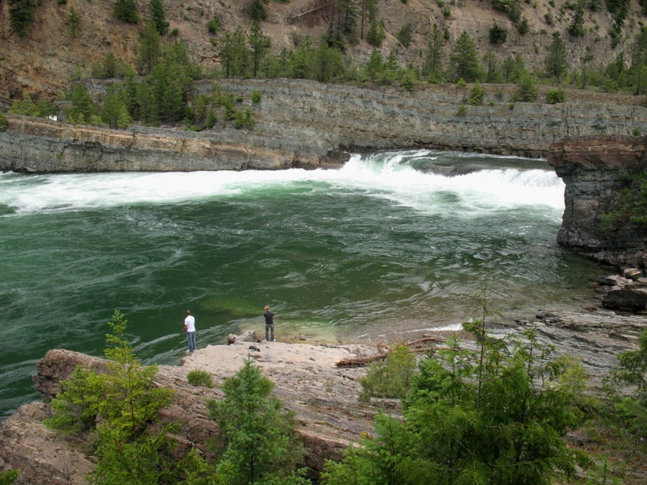
Perhaps the words "young" and "men" explain it. Because nothing else could.
Take a look at that green water in front of them. That's a counter-clockwise-spinning whirlpool that would take them directly to the rapids were they to fall in. And no, they would not be able to swim to the shore at right before that happened. Not in tennies and jeans. That water's moving too fast.
I looked long and hard at this place to try to see what I would do if I fell in. I mean, assuming the water temperature didn't paralyze me immediately. I looked at my heavy motorcycle shoes, my jeans, my heavy, baggy fluourescent lime green rain overpants that are zipped and snapped at the ankles like a sea anchor . . . no, I'd be a goner. I went nowhere near that edge.
Tomorrow I'll be in Sagle, Idaho with our (Lynn's and my) good friends Warren and Jean Hodges. I've been looking forward to this for a long time. I'm going to go ahead and wrap up this update now, because I don't know what the internet situation is at Warren & Jean's. The upload can only be done from my computer, as it requires an FTP capability most computers don't have.