Update 16
Sunday 6/21/2009
Day 60
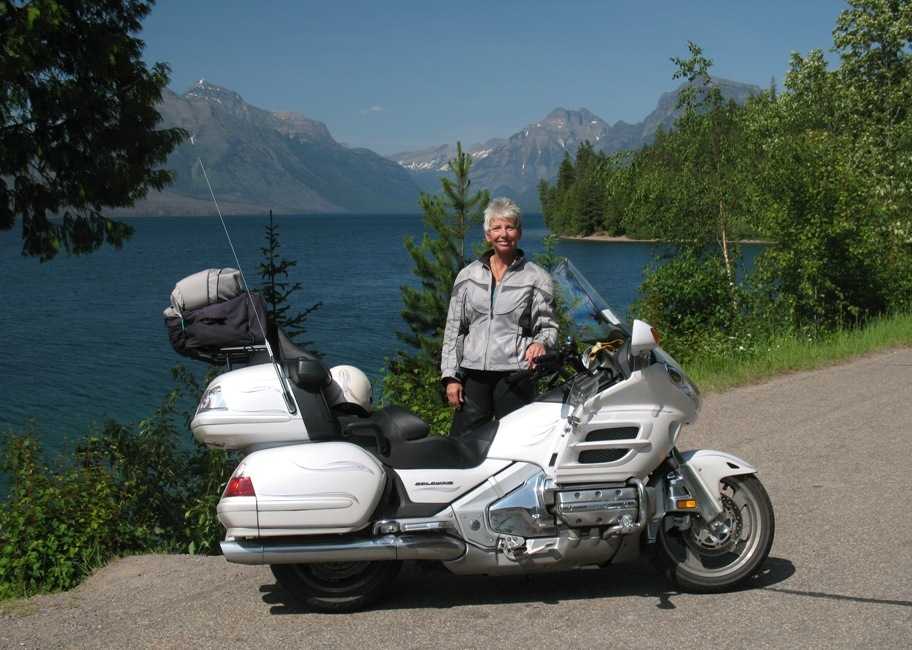
Libby, MT to Sagle, ID, 130 miles
Ths update is going to be so long -- 59 photos -- and is so overdue, that I'm going to have to concentrate on the photos without a lot of commentary on cultural or geographic details. (I hope. Sometimes I just can't help myself.) Also, for those of you who are struggling with dial-up internet, I've added a step in my processing and substantially compressed the images without, I think, much degrading their viewability on your screen.
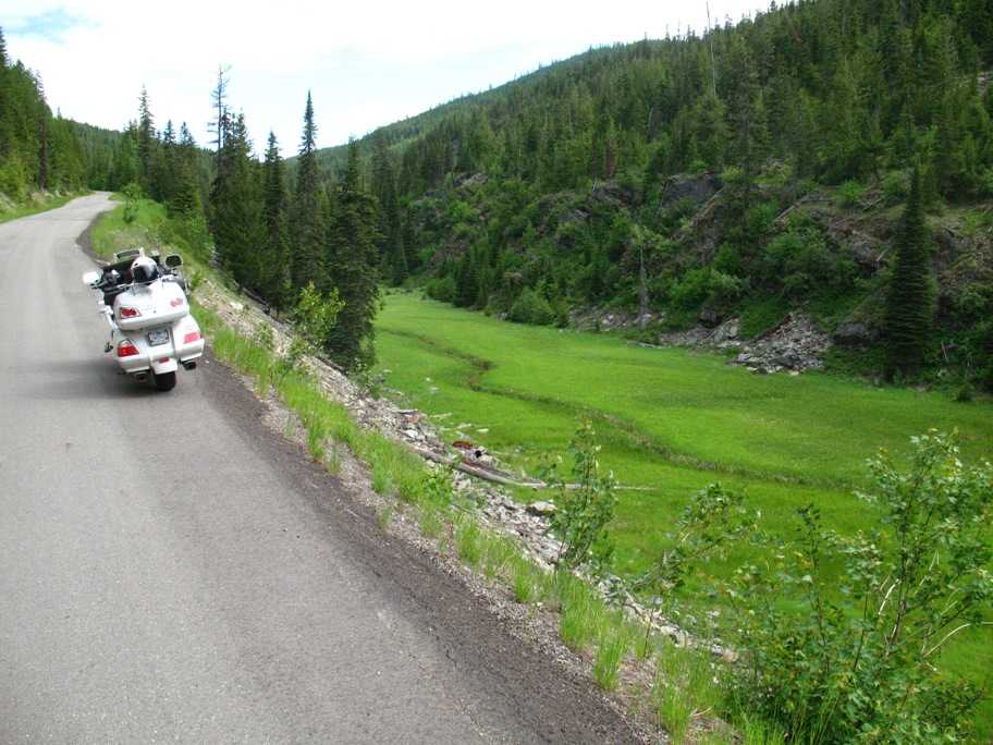
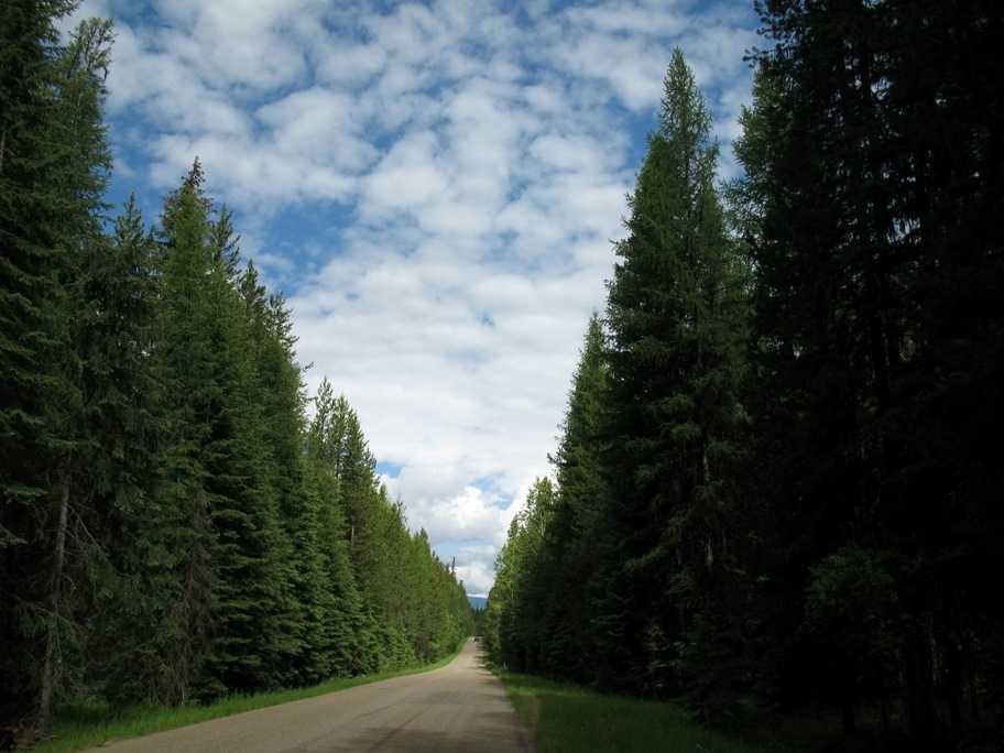
This day was only 130 miles because, like yesterday, I lengthened it by traveling via a tiny burg near the Canadian border -- in this case Yaak, MT -- in order to see some scenery I'd have missed otherwise. This involved 50 miles of one-lane mountain road crossing a ridge going north . . .
. . . and then down into the valley where Yaak sits on the other side.
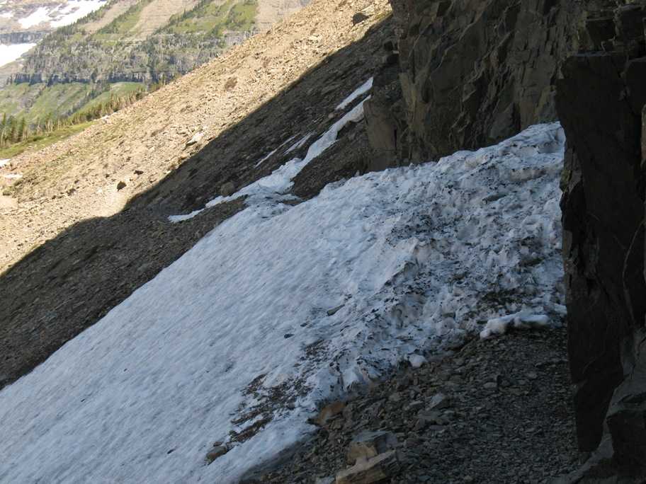
A lot of the road looked just like this. Remind you of South Carolina? Except it's COOL! And the trees are evergreens.
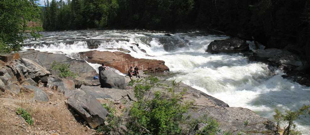
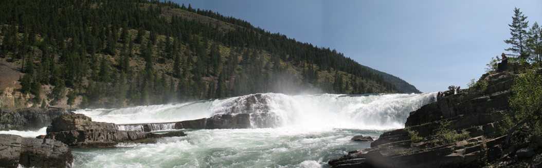
Like Kootenai Falls yesterday, these small falls on the way south from Yaak cascade over successive layers of sedimentary rock.
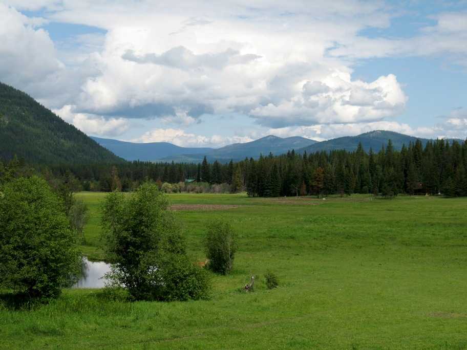
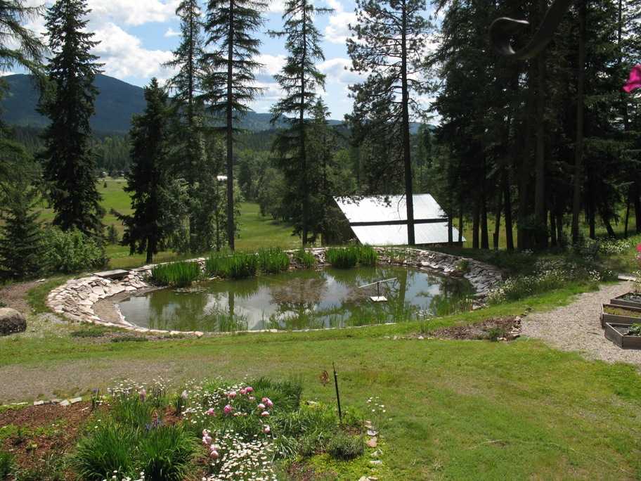
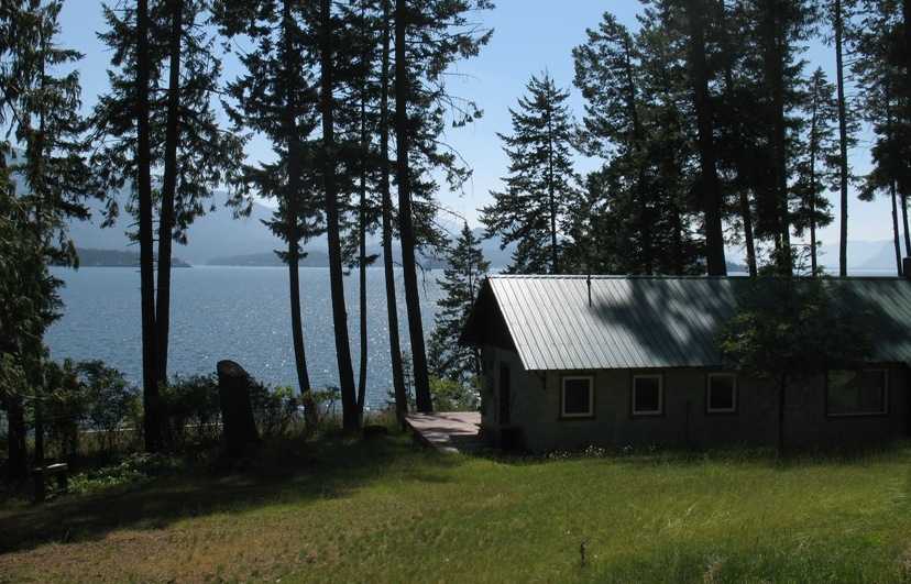
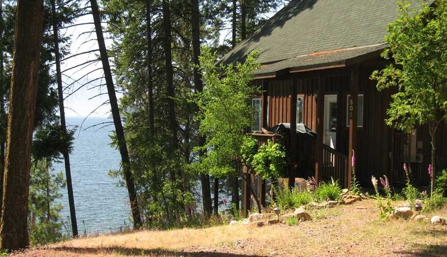
Arriving in Sagle, ID, this is the view from Warren and Jean's living room out over their property. Warren dug, lined, filled, landscaped, and stocked that pond.
Thursday 6/25/2009
Day 64
Sagle, ID
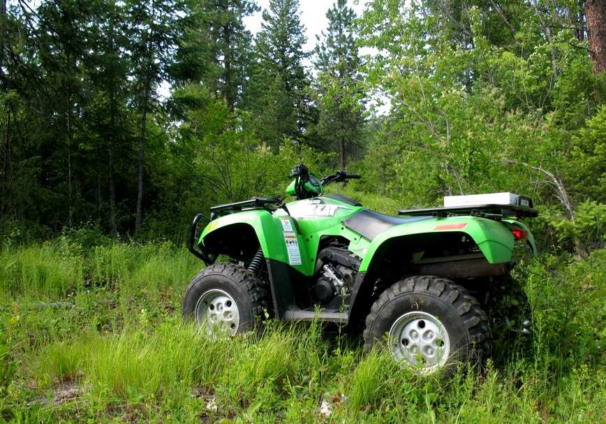
Warren gave me the use of his 650 cc Arctic Cat ATV to explore the hills behind his house.
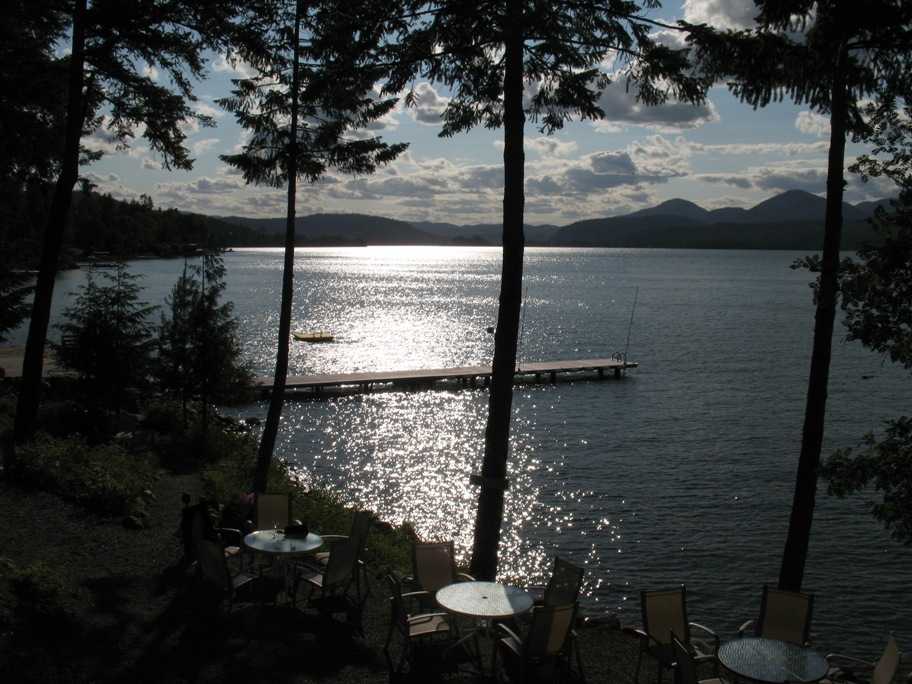
In the evening we attended a reception at a restaurant called 41 South, located right on the outlet of Lake Pend d'Oreille.
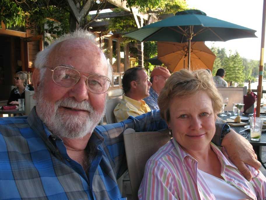
Warren and Jean Hodges, my gracious hosts.
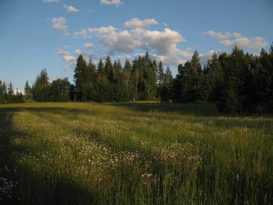
Late sun on a spring meadow in Northern Idaho.
Friday-Saturday, 6/26-27/2009
Days 65-66
Sagle, ID to Spokane, WA to Clarkston, WA, to Sagle, ID, 249 miles
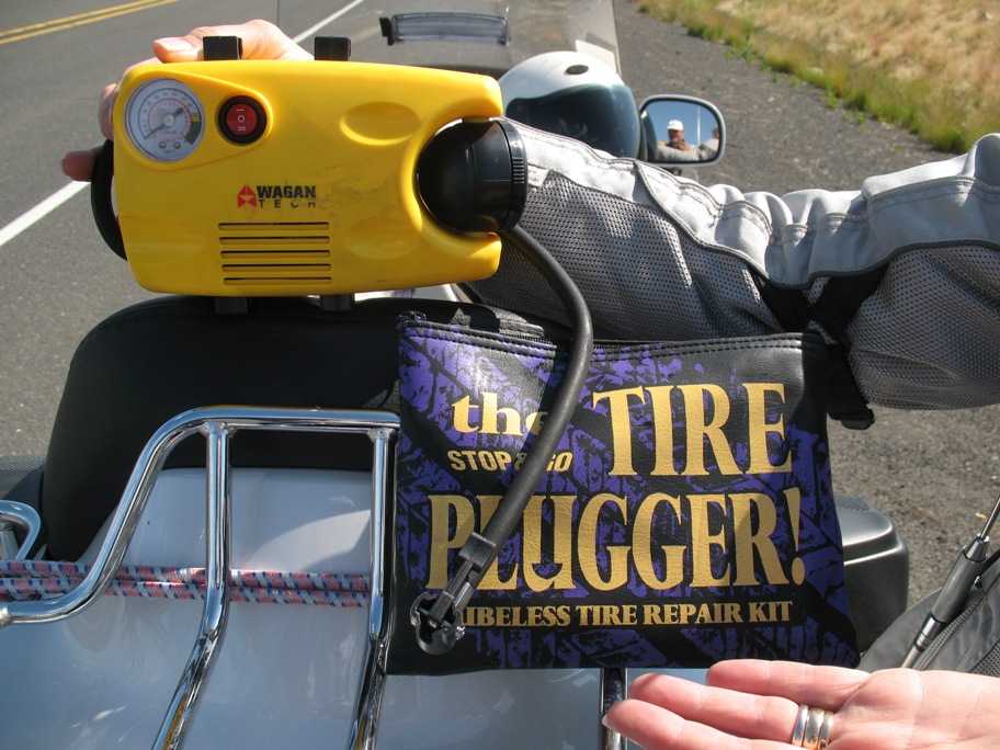
I rode 72 miles from Sagle to pick Lynn up at Spokane airport to start our two week Northwestern Tour. Then we headed south for Clarkston, WA to visit our old friends from Maryland, Larry and Maryann Garges. We were halfway there doing 60 mph when the rear tire started getting soft, and then got hot enough to smell. I pulled over and found that a largish bolt had blasted its way through the two-day-old tire. By "largish" I mean just about the diameter of the largest hole my tire plugging kit was meant to plug. Let's say at least #10. Larger than a four inch nail.
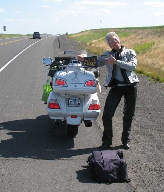
However, I had the kit and a 12 VDC inflator, so I attempted the repair. Pretty shaky. We made it the remaining 60 miles to Clarkston with only two reinflations, and the tire cord was so damaged that the tire had a 1/16th inch high spot for several inches around the puncture. So we bump-bumped our way to Clarkston at reduced speeds.
I didn't have much attention left for photos as we limped to Clarkston, but my trusty Gold Book, which lists all Gold Wing Road Riders Association members in North America as well as all Honda motorcycle dealers and shops, showed a Mac's Cycle in Clarkston, and they were open on Saturdays. So I showed up 15 minutes before they opened (I was second in line), hoping without much hope that they a) had a tire in stock, and b) had time on a busy summer Saturday to install it -- preferably that morning, as Lynn and I were due back in Sagle that evening. At first it looked bleak, but I kept my mouth shut and let the Service Manager wade through his appointments, and not very much later he found a way to squeeze me in less than an hour into his work day -- and was done an hour and a half later! By noon Lynn and I were on our way.
By the way, for the Gold Wing riders reading this, the Service Manager told me that the Dunlop D250s I have on the bike (original equipment, and one of only two tires Honda recommends) are garbage, that they at Mac's Cycle have seen so many problems with bubbles developing on the INSIDE of the tire, resulting in tire failure due to delamination, that they do not carry D250s and refuse to install them. They showed me a Dunlop Elite 3 which by appearance was about twice as much tire (thicker, heavier, stiffer), and was more reasonably priced than any tire I've ever gotten from a dealer to boot. I was overjoyed.
We made it back to Sagle in plenty of time for dinner with Warren and Jean before toddling off to bed.
Sunday, 6/28/2009
Days 67
Sagle, ID
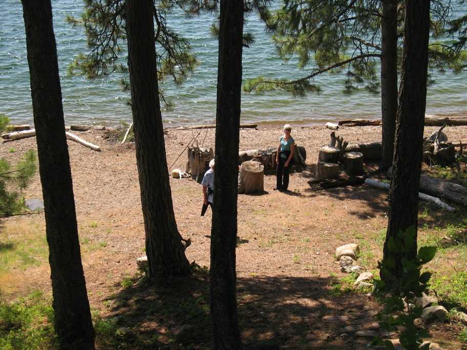
Lynn and her sisters and cousins had a "family meeting" planned for this morning relating to a 37 acre Lake Pend d'Oreille family waterfront property her grandfather originally owned. Here's the original cinderblock house her grandfather built and summered in with his wife for many years.
Lynn's cousin Dave, who lives with his wife Carol three hours away in Richland, WA, built this house next to it.
The gravel "beach" below the houses.
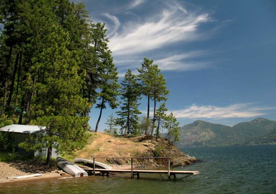
The boathouse (where a small outboard runabout is kept) and dock.
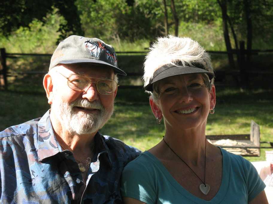
That evening there was a picnic planned at Garfield Bay (on the lake) for a small group of Warren and Jean's friends to celebrate Jean's birthday (um, her 39th, if you must know . . . )
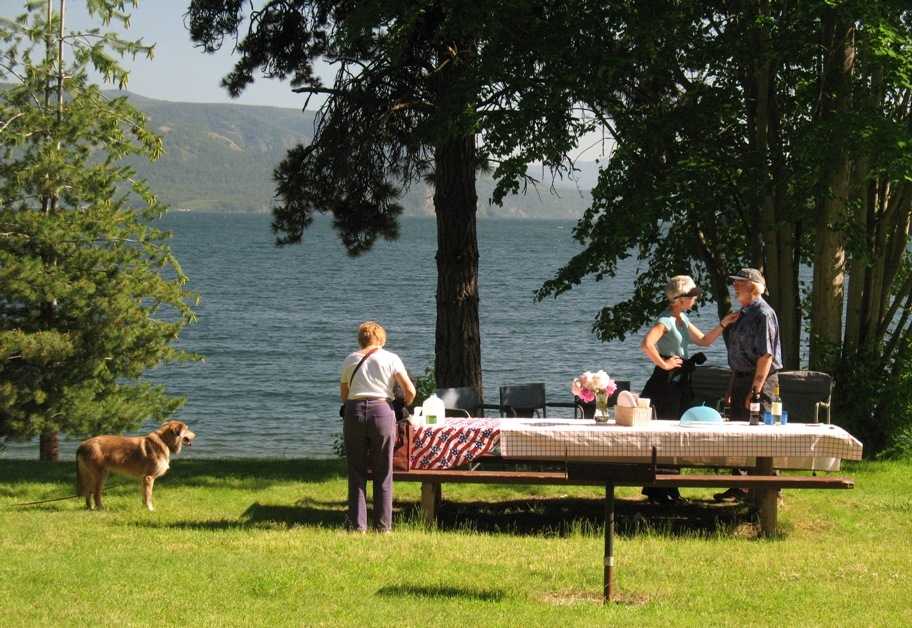
Naturally their dogs were in attendance -- Yukon (Alaskan Husky) and Cody (Heinz 57 from the pound). Guess which one is better behaved. -- Warren and Jean, being childless together, have always had big outdoor dogs in their life.
Warren and Lynn. Warren spent much of his career integrating scientific instruments onto NASA satellites and the Space Shuttle.
Sunday, 6/29/2009
Days 68
Sagle, ID to Lake McDonald, Glacier National Park, MT, 223 miles
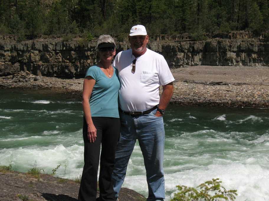
We retraced some of the territory I'd traversed earlier, including Kootenai Falls. This time we found an obliging fellow tourist to take our picture above the rapids.
Kootenai Falls in better light (and weather) than I'd had on my way west.
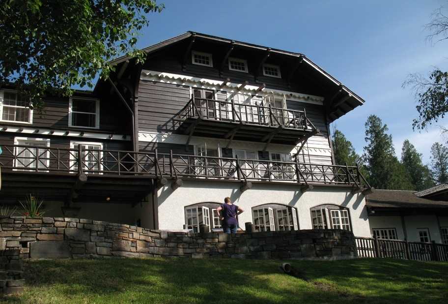
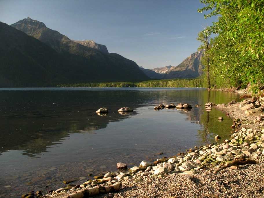
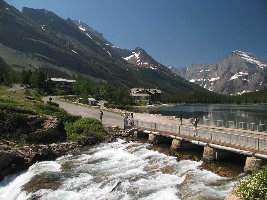
We arrive at Lake McDonald, in Glacier National Park -- actually, Glacier-Waterton International Peace Park -- more on that later.
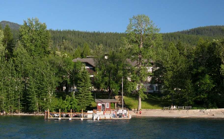
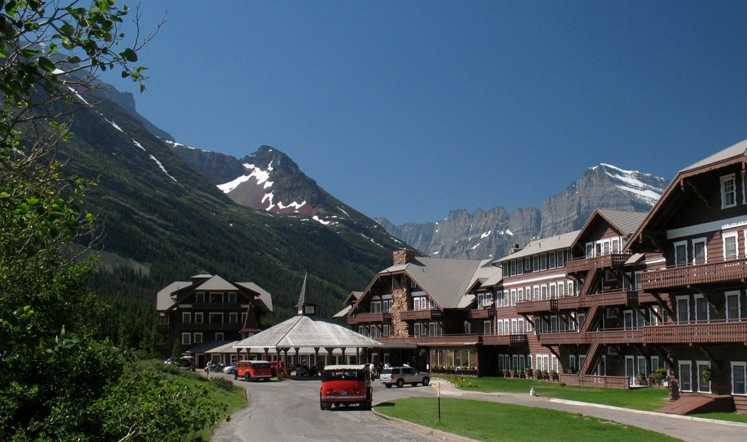
A piece of Lake McDonald Lodge. Shrouded as it is by trees, not all of it can be seen at once from the lakeside.
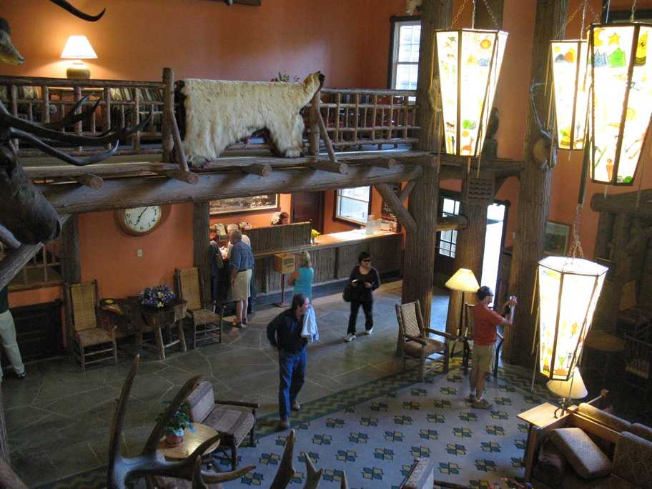
The lobby and main desk.
The grand fireplace.

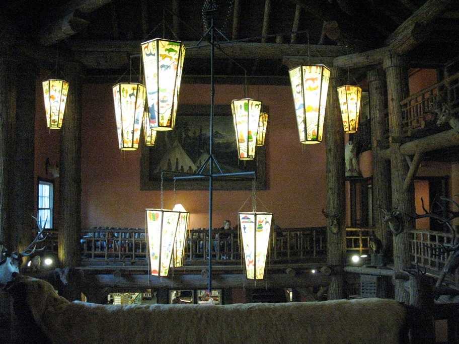
Interesting chandeliers hang abve the heads of the guests.
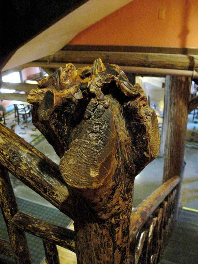
Bannister post = stump of a tree. Tres rustique. You know, it's worth mentioning that all these 1900's-era lodges were built by the Great Northern Railroad to lure vacationing tourists -- via train, of course. Typically they were built in a single season, roughly May-September, by several hundred men working night and day, all from local trees converted to lumber on the spot with a portable lumber mill brought there in parts by boat.
Lake McDonald late afternoon light.
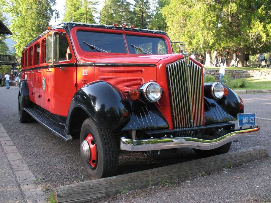
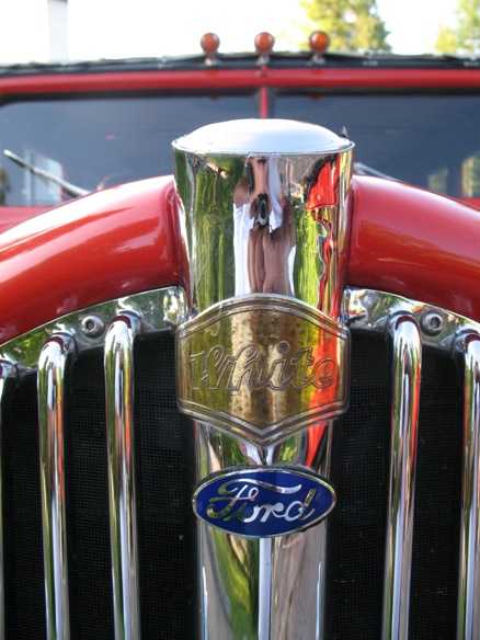
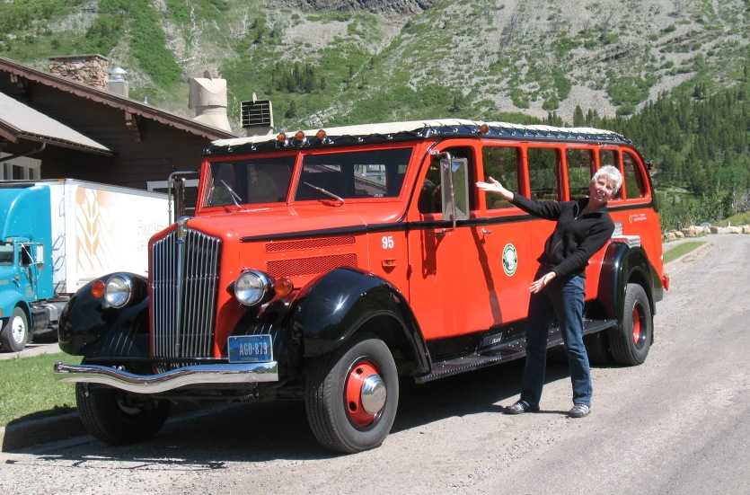
One of the famous Red Buses, aka "Jammers" -- the latter for the fact that they had non-synchromesh manual transmissions and were used to ferry tourists over Logan Pass and back, a treacherous road involving much "gear jamming". The drivers were also called Jammers. Originally made by the White Company (of modern-day White truck fame), they've been restored by the Ford Motor Company at a cost of $1M each (and there's about a dozen of them) and had their entire drive trains replaced by modern equipment (V8s, automatic transmissions, disk brakes) and fueled by propane.
This gives Ford the right to put their logo on the radiator grille below the White logo.
Late afternoon outside our tiny cabin away from the main Lodge.
Tuesday, 6/30/2009
Day 69
Lake McDonald, Going-To-The-Sun Road
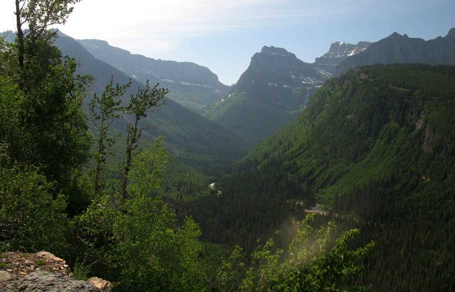
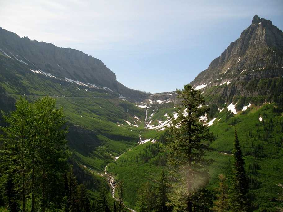
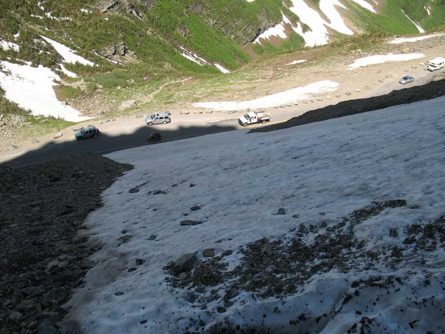
We spent the first part of the day riding up to Logan Pass and back, an altitude gain of 3400' (3200' to 6646') up the precipitous Going-To-The-Sun Road, which, until three days before, had been underneath a recent snow avalanche, and which besides that was under massive reconstruction to correct a number of significant structural defects which had developed over the years. Predictable defects. UNAVOIDABLE defects. Gives you a warm feeling, doesn't it? I tell you, it does one's peace of mind no good to drive this road while in possession of any significant understanding of geophysics.
Lake McDonald, where we came from, is down around that bend to the right. Logan Pass is in the distance, upper center. The road snakes up along the left-side valley wall.
Part way up, looking down toward Lake McDonald, still hidden around that last left bend.
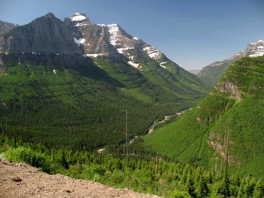
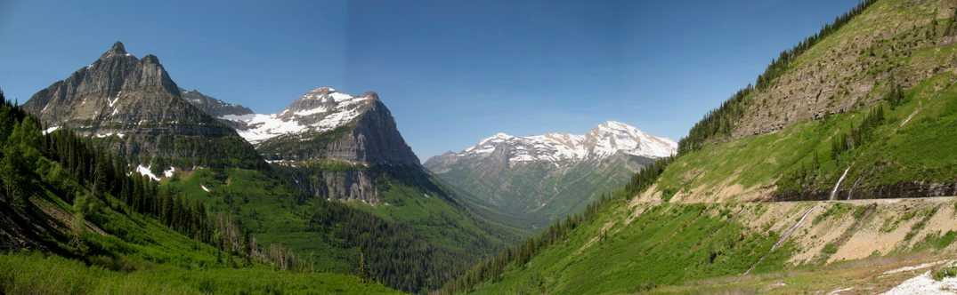
Avalanche City. That wall with the road on it is called the Garden Wall, and snow has a hard time saying put on it, which is why the road doesn't open until at least mid-June each year, and this year, June 27th. BTW, see that low rock headwall immediately to the left of the pass? (barely left of center) It has a barely discernable dark horizontal slash across it, just above the road. That's a trail cut. I'll show you details in a minute.
View back down from near the pass.
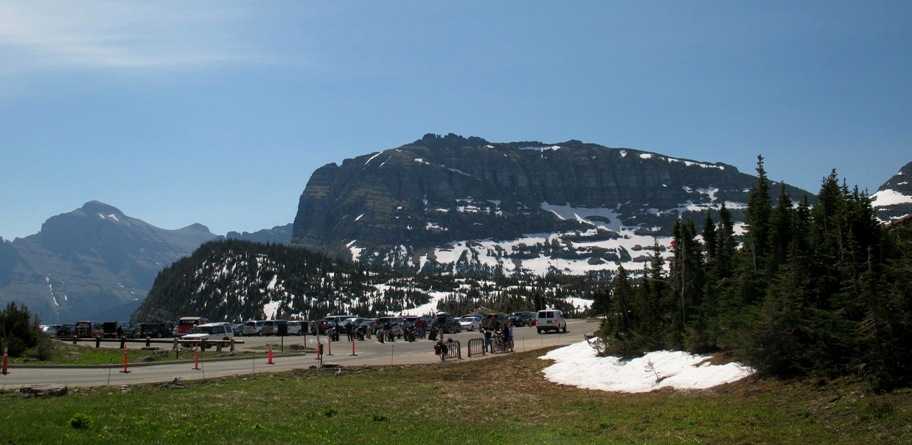
Logan Pass parking area. There's a nice Visitor's Center, wild flowers, and benign snow slopes for playing with children.
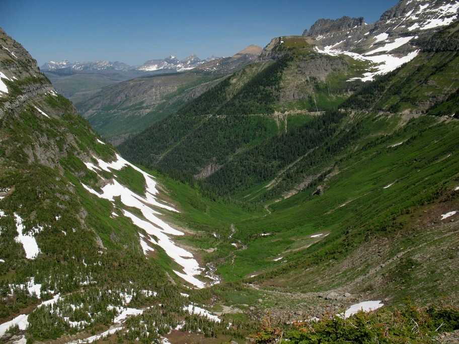
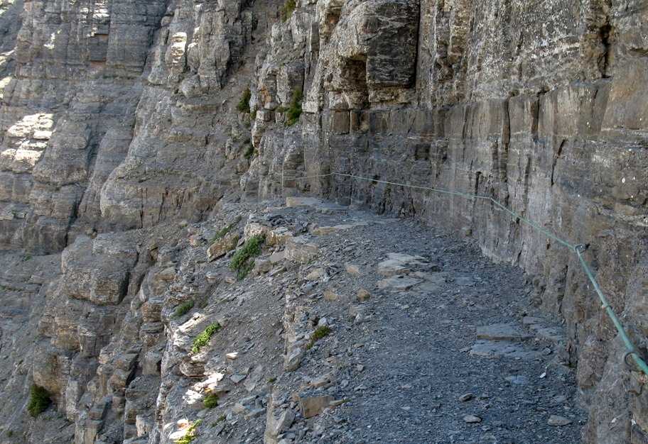
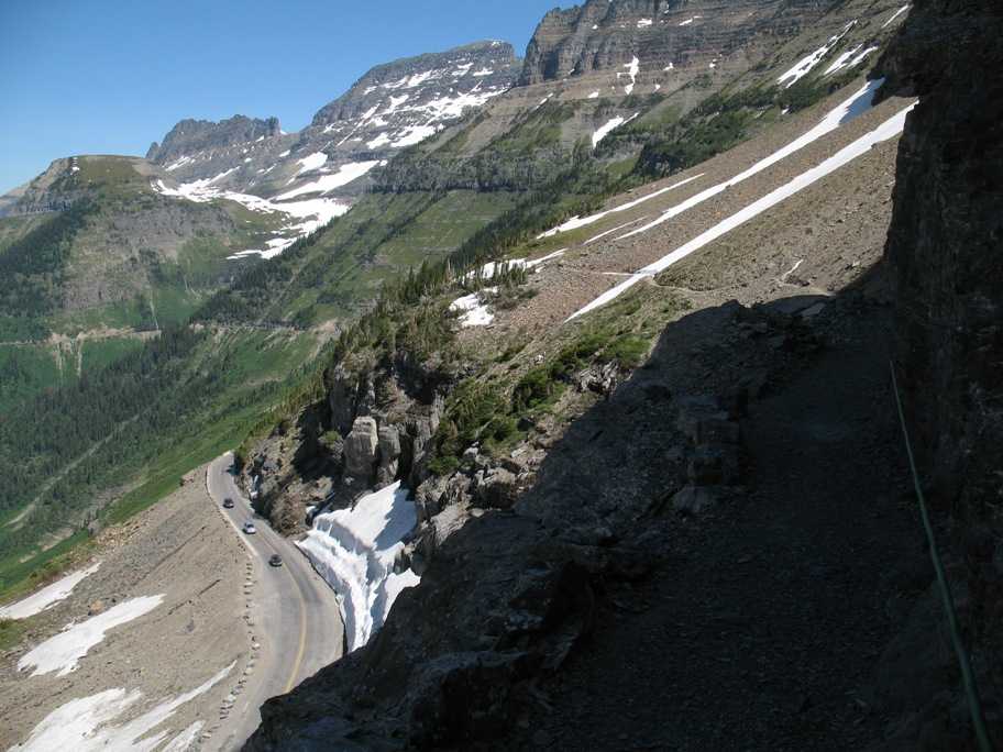
View down from the lip of the pass. Immediately to my right as I took this photo is the trail cut I mentioned -- the High Line Trail.
Here it is. Lynn waited in the sun up at the Vistor Center while I hike a mile or so along this trail for old times' sake. My dad and I did it when I was an early adolescent. Yes, it's a very steep wall, nearly sheer, and that cable staked to the wall is for hanging onto if you're prone to vertigo.
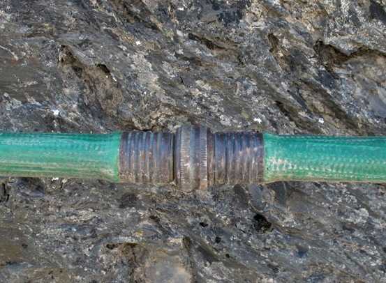
The cable is covered with plain old plastic 3/4" garden hose.
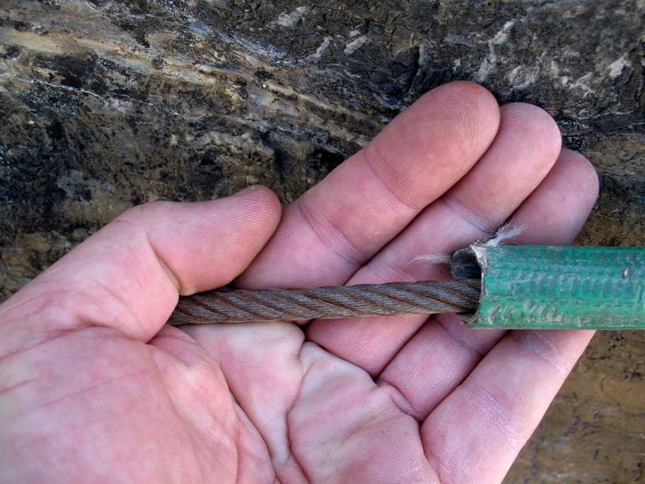
3/8" steel cable. Tensile strength over 20,000 pounds. That oughta do.
The exposure is a bit breathtaking.
Hmm. Old snow. Shouldn't be too tough . . .
. . . except this is the price of a slip. I hugged the wall and passed the patch safely.
I finally found some sun, stopped to take this photo, then backtracked to the pass where Lynn was coing unglued over the fact that I'd been gone an hour -- exactly what I'd planned to spend, but it seems I'd failed to tell her so.
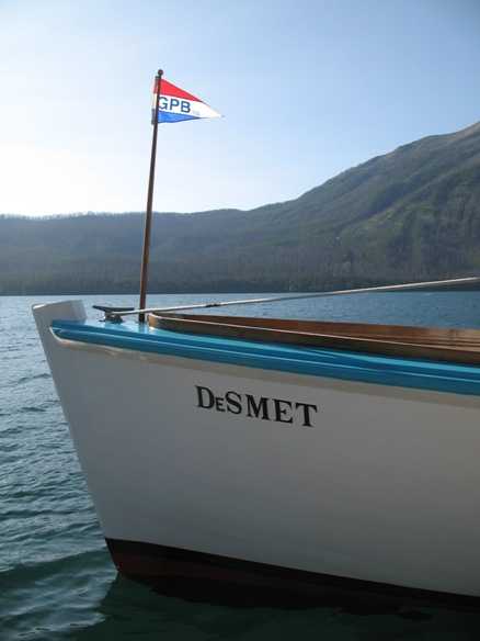
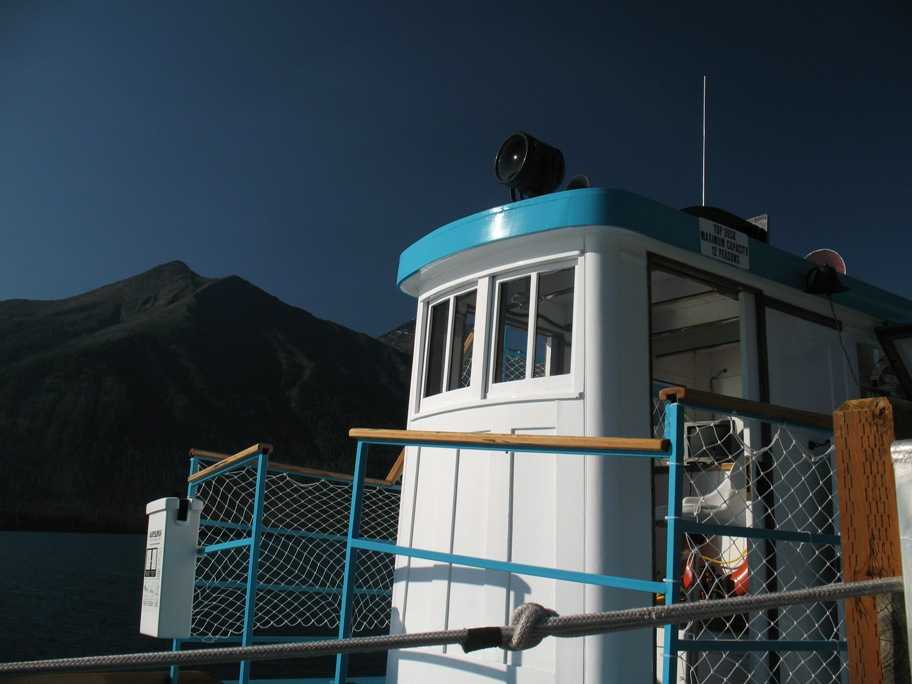
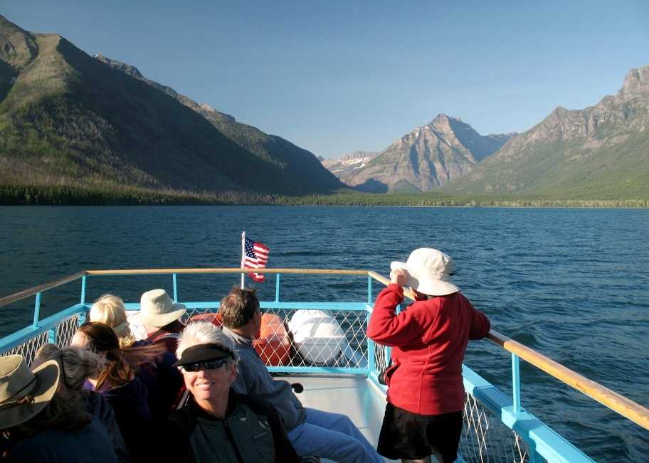
We headed back to Lake McDonald just in time to catch the last cruise of the day aboard the historic wooden launch DeSmet, built around 1930 and still putt-putting along at around 6 knots.
DeSmet's pilot house.
The best view one can get of Lake McDonald Lodge, shrouded by trees. Pretty odd to see a lodge built in 1914 and not see the trees in front of it cut down for the view -- although on hot days it's probably pretty nice this way.
Lynn and north end of the lake.
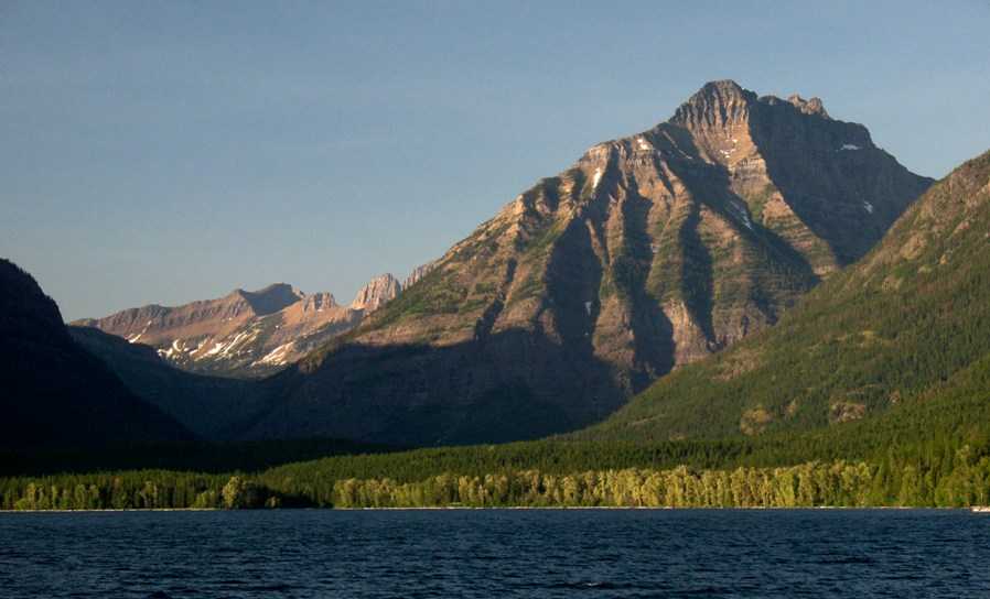
Setting sun lights up the mountains.
Wednesday, 7/1/2009
Day 70
Lake McDonald to Many Glacier, 60 miles
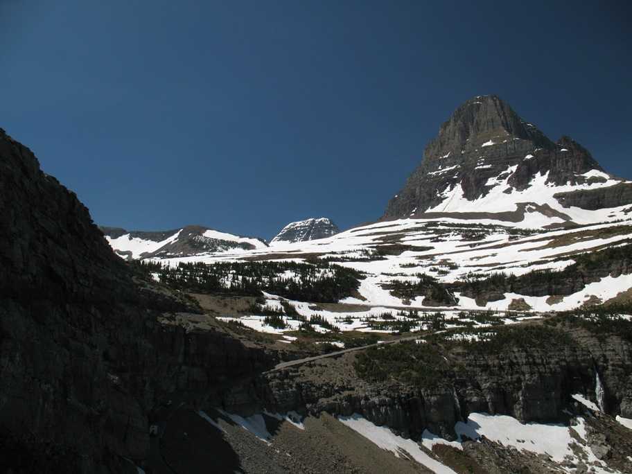
The ride back over Logan Pass (in better light and weather) was uneventful. On the east side we passed this classic vista of Saint Mary Lake on the way to Many Glacier.
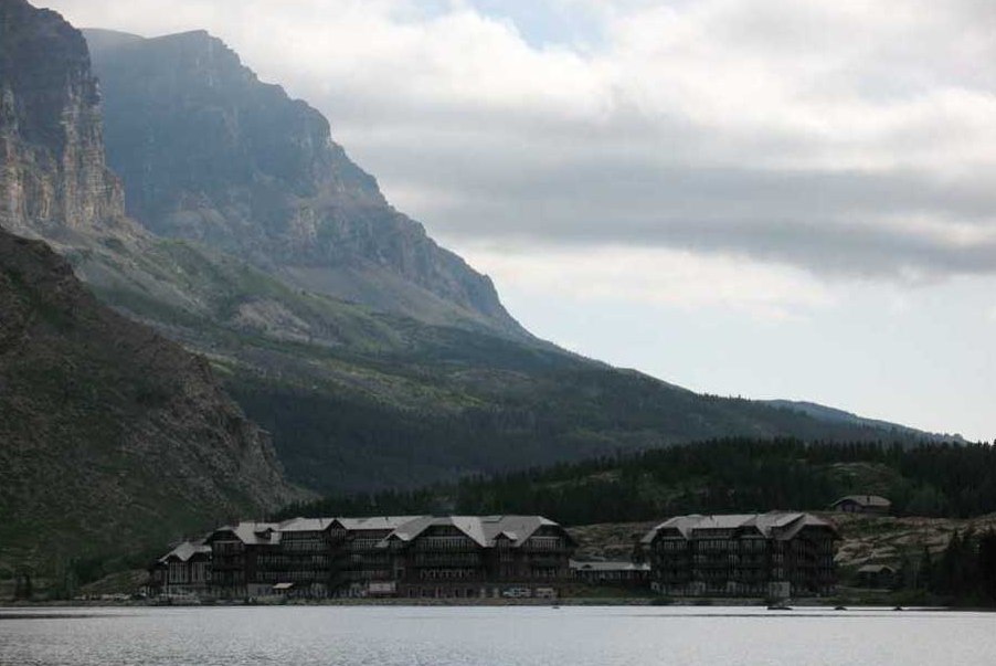
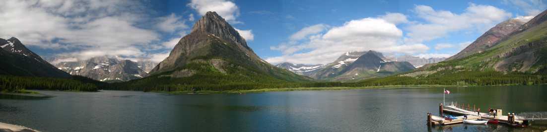
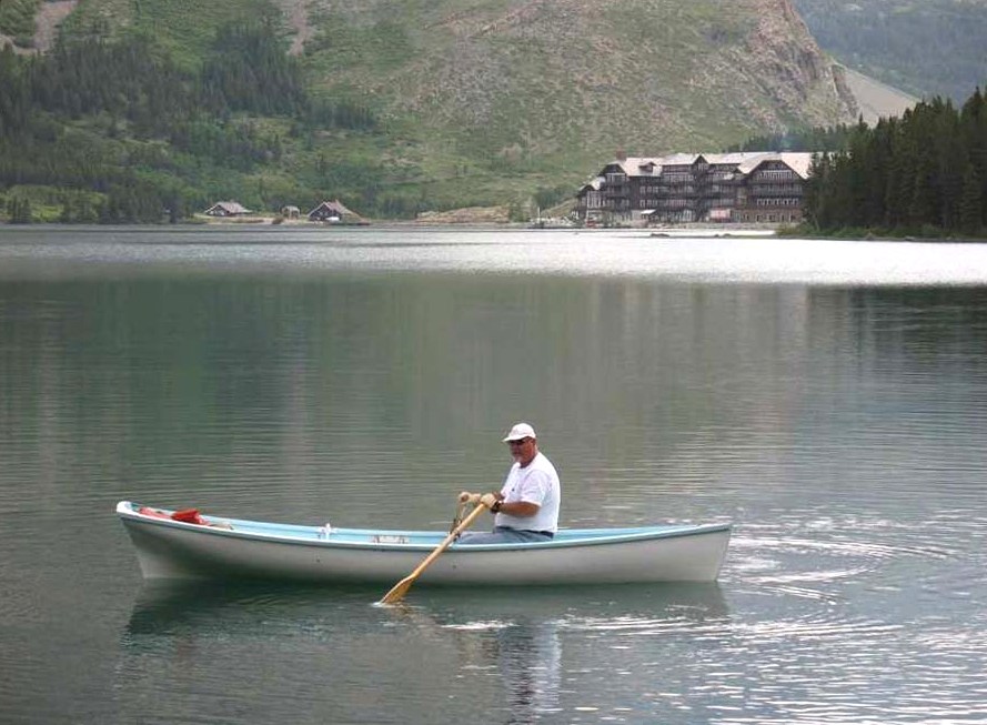
We arrived safely at Swiftcurrent Lake (so named because of this outlet) and the Many Glacier Hotel seen here on the lakeshore.
This hotel, even moreso than others we visited, goes all-out on the Swiss chalet theme, including fondue on the menu.
The Red Buses visit here as well as all other destinations within Glacier-Waterton International Peace Park.
Here's the Many Glacier Hotel from across the lake. This place was built in one season by 400 men working 24/7. All the wall paneling was rough-cut board lumber, and by "rough-cut" I mean the saw blade used to slice them off the tree was about six feet in diameter, judging by the cut marks. And none of it was finished, i.e. sanded, splinters removed, etc. It was slapped up on the building as fast as it could be cut, then whitewashed in place (on interior walls). You could hang your sweater on the splinters sticking out.
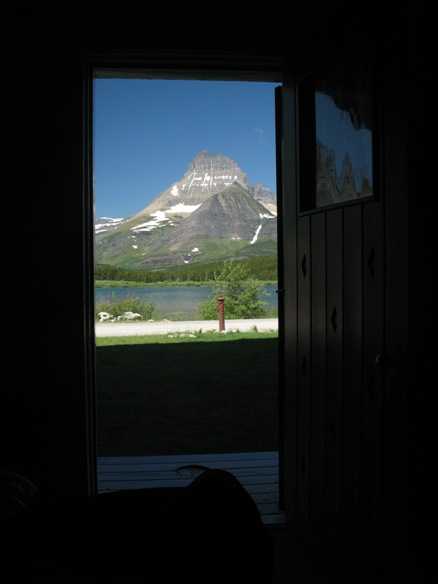
We had a ground floor room facing the lake across a lawn. This view is through our back door.
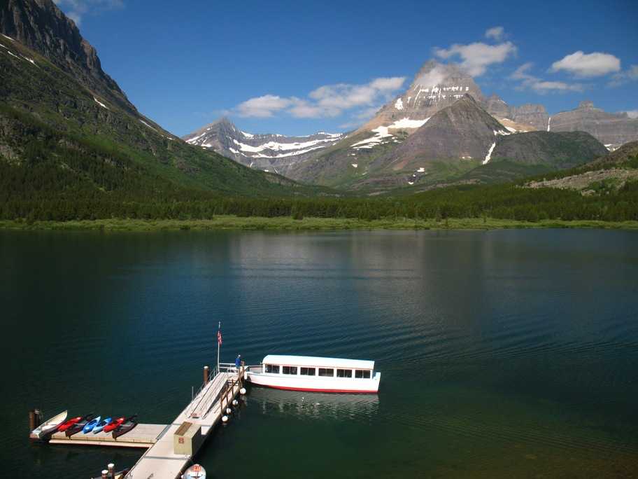
This launch takes hikers to the end of this lake (to the left), where a short walk of a couple hundred yards brings them to Lake Josephine, where another launch takes them to the other end, from which the hike to Grinnell Lake and Grinnell Glacier is reduced to 0.9 mile from the 3.5 miles you'd walk without the boats. Sweet.
The main floor veranda, equipped with the most comfortable Adirondack chairs we've experienced, combines with the amazing view to produce a sort of sybaritic reverie bordering on stupor that could last for hours. It certainly did for us.
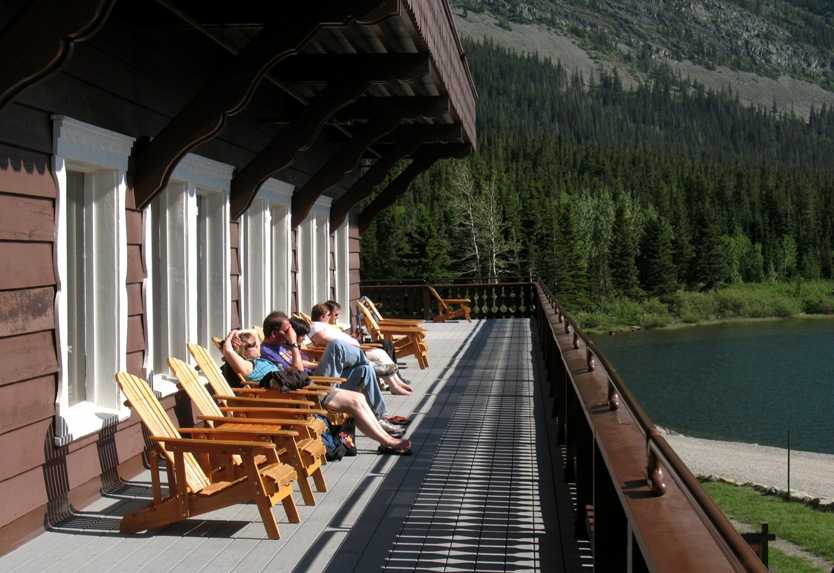
Here's the view. Couple this with warm sun and a drink or two, and there goes the afternoon.
Thursday, 7/2/2009
Day 71
Many Glacier
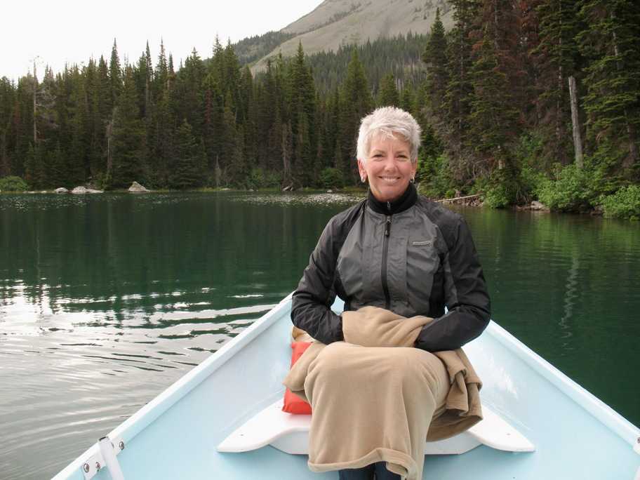
We rented this lovely Whitehall rowing skiff and toured the lake perimeter. Boy did this get my boating juices flowing again! I've never rowed a sweeter boat. I've got to own a boat like this with a small sailing rig. I even went online to see if any existed. One does. Ye gods, it costs more than our Gold Wing!
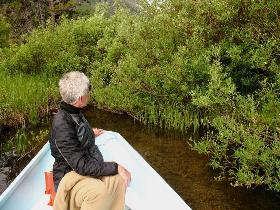
Lynn, bundled up on this chilly morning. We were the first folks at the boat dock by far. Had the lake to ourselves for nearly two hours.
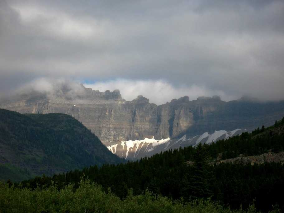
Cloudy weather made for some pretty "keyhole" shots of glaciated ridges.
Since the boat drew less than eight inches of water, I poked it into all the nooks and crannies I could find. It's not that big a lake.
Fantastic place. We'll go back. From here we went to Waterton Lake and the Prince of Wales Hotel, which is shown in Update #17.
A word on these Parks. Glacier-Waterton International Peace Park is a joint US-Canada national park, and two of its lakes, Waterton and Cameron, cross the border. In fact, you can hike from one country to the other via the south end of Waterton Lake -- and there's a roadless border crossing there! You'd better have packed your passport. Only other access to it is by boat from Waterton, on the Canada side. We took that boat -- details will be in Update #18.