Update 17
Saturday 7/4/2009
Day 73
Waterton Lake, Alberta, Canada
Yes, this is Update 17, and yes, you have not seen an Update 16. I'm ridiculously behind, but Update 16 is in work. Excuses? Well, the only good one is I get less done when Lynn's around, because when she's here, there are better things to do than edit photos. But clearly that does not explain the four days in Sagle, ID before she arrived, for which I plead plain laziness.
But I cannot leave this place and especially the Prince of Wales Hotel without publishing some photos, because this is simply a spectacular spot, and this hotel has the best seat there is.
In the as-yet-unfinished Update 16 I would have described arriving in Sagle, ID, staying with my friends Warren and Jean Hodges, getting new tires front and rear on the bike, going to pick up Lynn at Spokane Airport, getting a bad flat on the rear on the way to visit our friends Larry and Maryann Garges in Clarkston, WA, plugging the flat (barely -- it still leaked) on the side of the highway, getting another new $300 rear tire in Clarkston (BIG kudos to the Service Manager at Mac's Cycle www.macscycle.com, who had a full shop on a busy Saturday morning and every excuse he needed not to take on this extra aggravation, but did so anyway and had me out of there in an hour and a half after a job that I know takes a full hour by the flat rate manual. Wow.), etc etc, and finally visiting Glacier National Park, Montana. We spent two days in Lake McDonald Lodge in a tiny no-view cabin, drove the spectacular Going-To-The-Sun Road over Logan Pass and down the east side to "Many Glacier", spent two days at the Many Glacier Hotel on jewel-like Swiftcurrent Lake beneath soaring Swiss Alp-like peaks, then came here yesterday. This place kinda takes your breath away.
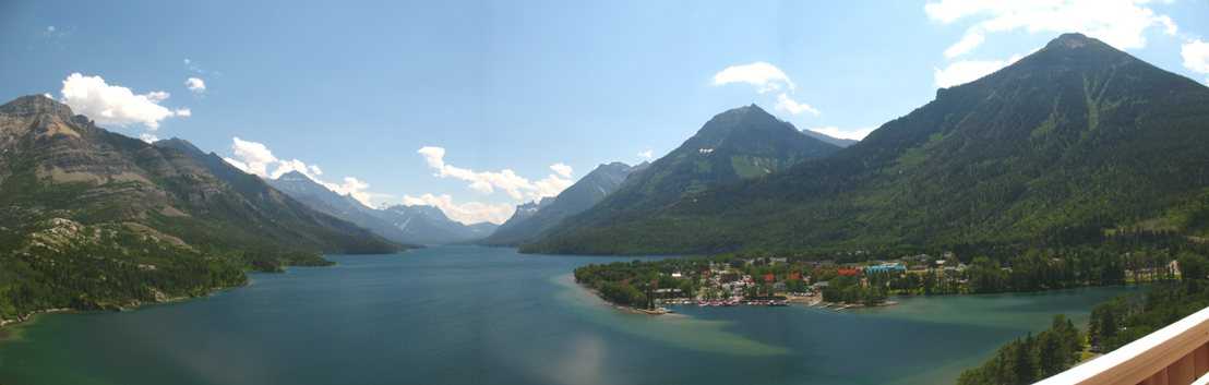
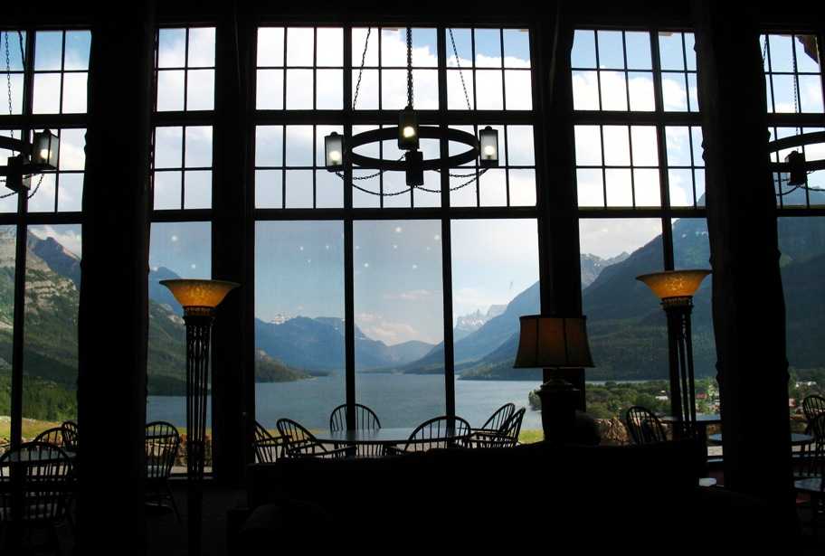
As I write this in our snug bedroom on the sixth floor of the Prince of Wales Hotel in Waterton National Park (Canada), to my left is a window that sits two hundred and fifty feet above glacier-carved Waterton Lake valley and looks directly south down its ten mile length, all the way into the US. A bit west is the tiny, quaint town of Waterton, complete with a small marina and a gorgeous 1927 wooden tour boat that will take us the length of the lake and back this evening as the sun sets. Behind me, our bathroom window looks east over Lower Waterton Lake and the rolling hills north of these mountains.
This is what we saw coming into the area after crossing into Canada earlier in the morning. See that doll house on the grassy hill?
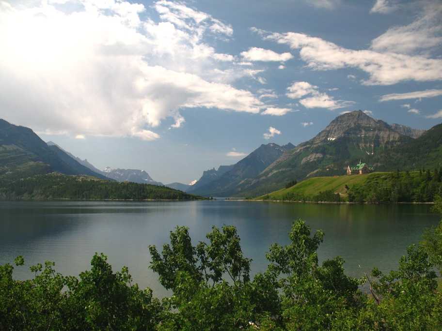
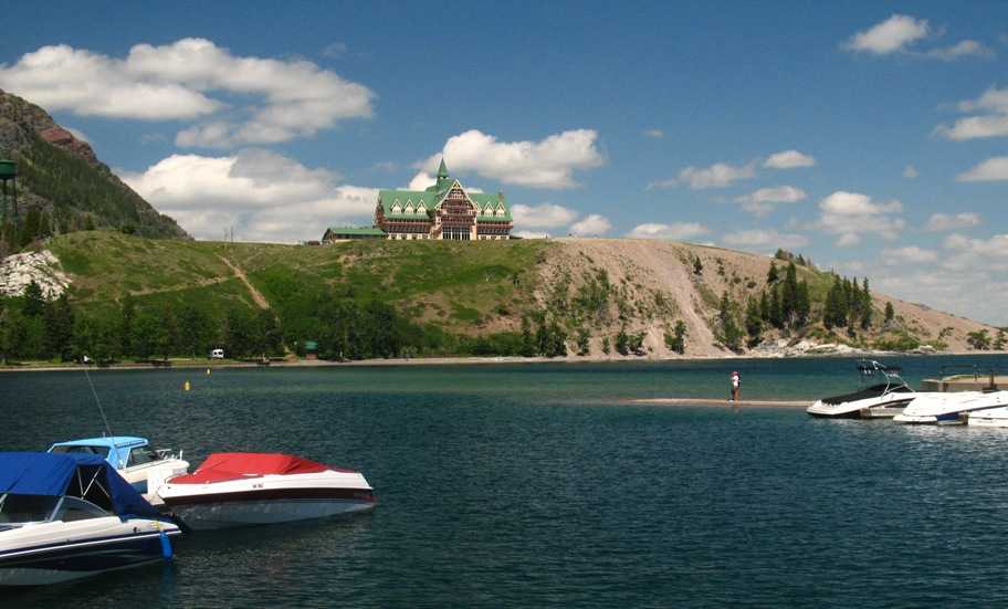
Some doll house. Seven stories (six in use), 86 rooms, and an amazing view in every direction. South is best.
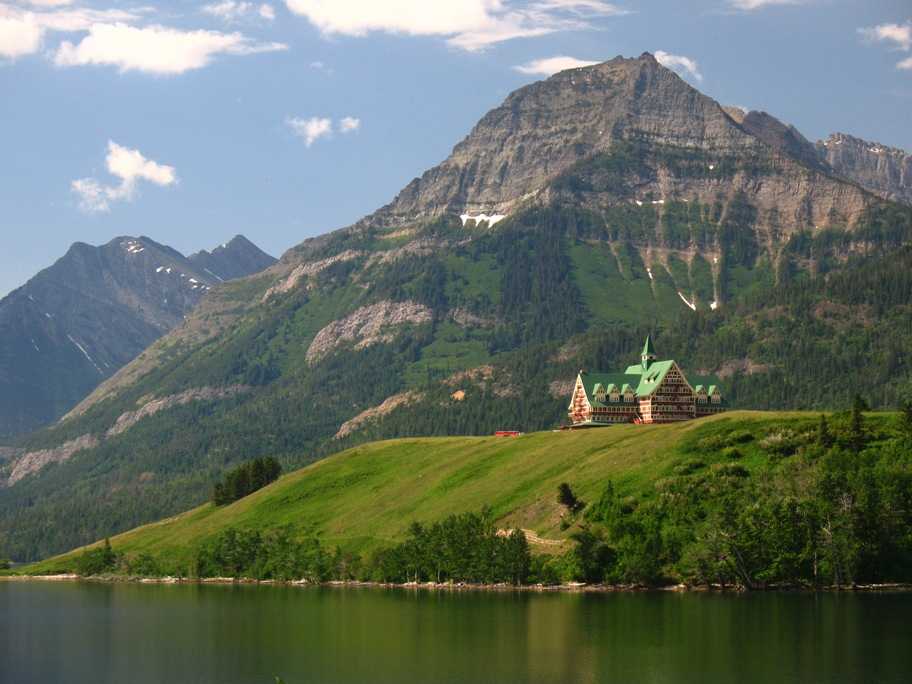
That hill is two hundred feet high, and we are another 50 feet up on the next-to-the-highest floor, looking down Waterton Lake which is out of sight in the left distance in the above photo.
The "front" (entrance) side faces north, away from the lake. Half of the hotel's 86 rooms face this way -- but not ours.
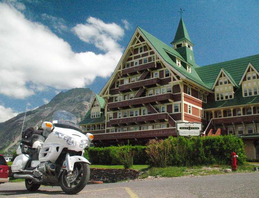
Our room is on the right end of the uppermost fire escape balcony within the main (sunlit) gable. These are the "cheap seats", because, um, there's no elevator.
Well, actually there is, but it is manually operated and only by hotel bell staff, and only two people with luggage can fit inside with the operator, and it only goes to the fourth floor. Naturally we requested a ride! We were told it is the oldest operating elevator in the western hemisphere.
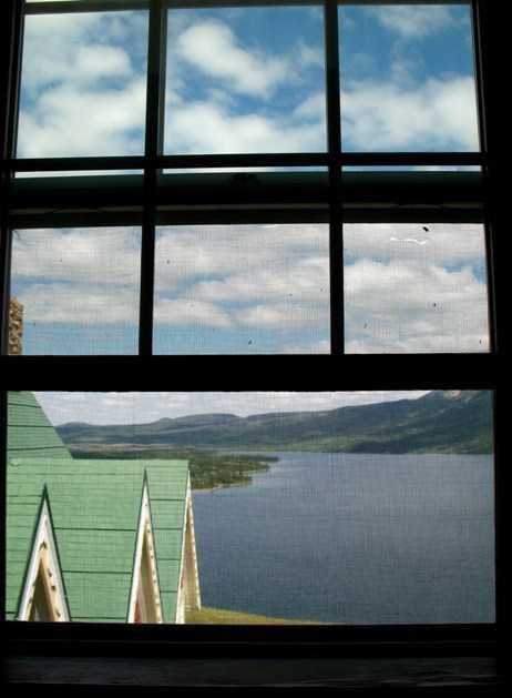
View south out our bedroom window, and view east out our bathroom window.
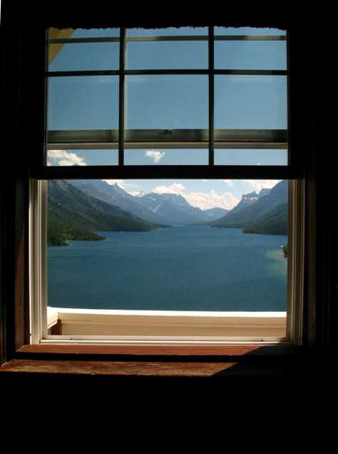
The bedroom window had a screen in it that rather hampered the viewing and photo opportunities, so I removed the screen in order to get this pan -- then left it out for the duration of our stay. That's the town of Waterton, right center, with its very well-protected little harbor.
Here's the view back to the hotel from the harbor.
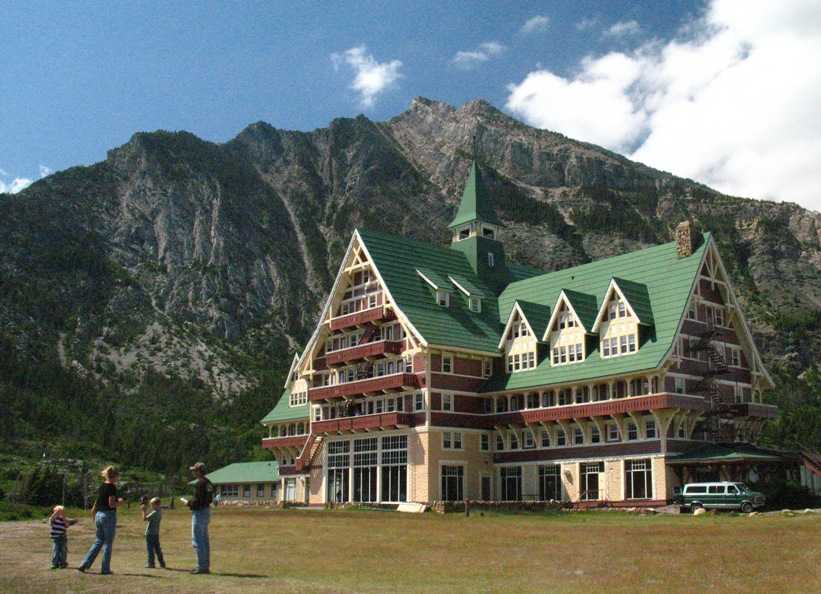
You'd expect a spectacular lobby view, and you would not be disappointed. From 2-5 pm every day the hotel serves High Tea at those tables. We started today with a leisurely cup of coffee with no one around, on a couch just this side of those tables. Rising earlier than everyone else has its merits.
Then we got on the bike and headed ten miles west to Cameron Lake, where my family camped back when I was a youngish teenager.
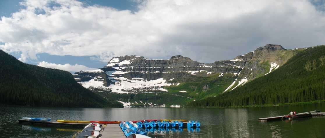
This view, like Waterton, is to the south, because that's the way the glaciers carved this area. Just like the finger lakes region of upstate New York. The Alberta-British Columbia border runs right up the ridgeline to the right, and it meets the US-Canada border at the low spot on the skyline, right-center. The latter border comes down to the lake as it heads east and just clips a hundred or so feet of it.
I mention all this so the next photo will make sense. I believe my brother Eric may recognize it immediately.
This is because, on that same trip when our family camped just a few feet to the right of where I'm standing here, Eric, also in his early teens then, got it into his head that we could cut across to that ridge at a low spot on another trail, intersect that ridgeline, follow it right up to Forum Peak (left center), and possibly all the way to the US border, which is just out of sight to the left. This would be rendered simplicity itself since, at that time, Canada clearcut a sixty foot wide swath along every one of its international and Provincial borders -- by hand. So we would simply stroll up the clearcut to timberline, walk a short distance on rock, and presto! We'd be there.
As you might anticipate (though we didn't), it didn't quite work out that way. Before we got to timberline we encountered two steep rocky gullies, and the second one proved too much for us. Not wanting to backtrack all the way down the ridge again, we decided to go cross-country directly (direttissima, in mountaineering lingo) down to the lakeshore, where a trail would take us back to the campground. This also turned out to be ill-advised, and as can often be the case in wilderness, once you make a move you may find you can't go back. We ended up sliding most of the way down the hill on the tops of willows and other underbrush, getting scraped up in the process. I believe that for about half the descent our feet never touched the ground, and were often several feet above it -- that's how thick the willows were.
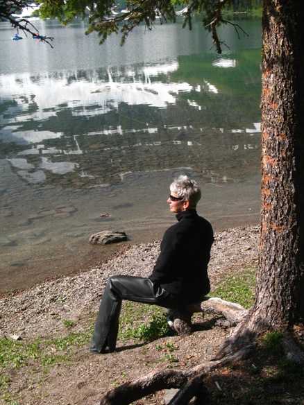
Good times. Here's Lynn enjoying the view.
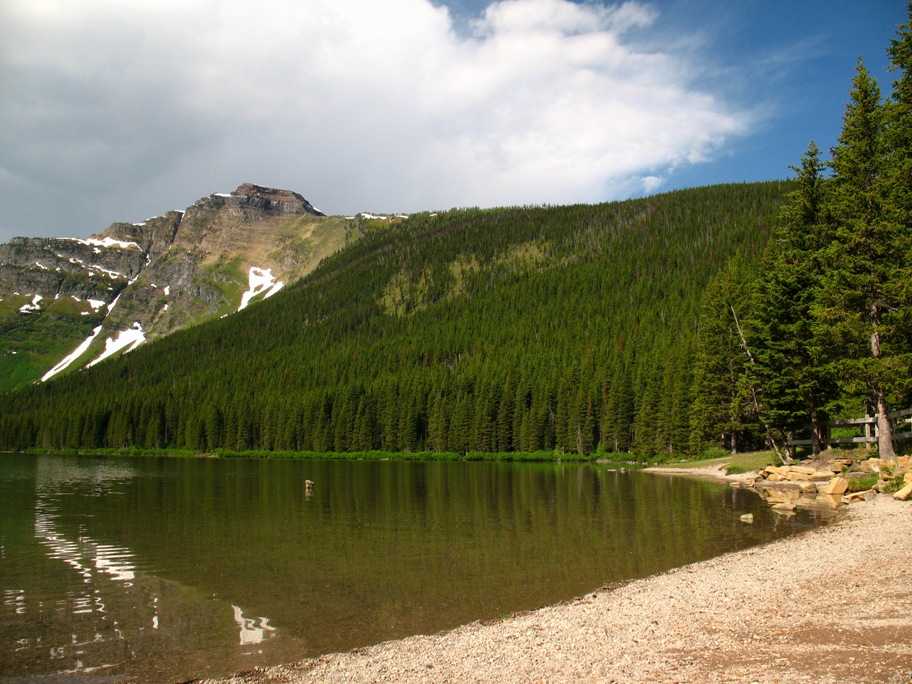
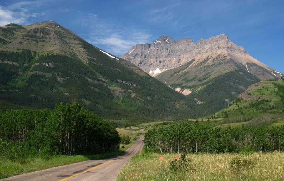
From there we backtracked to the main Waterton road and took another ten mile side road west to Red Rock Canyon. This was typical of our scenery along the way.
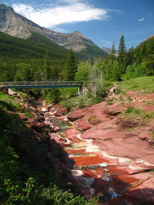
And this is Red Rock Canyon, a short stretch of river cut that reveals the bright red rock beneath the vegetated surface. Farther upstream the cut becomes a deep gorge, but it was too dark to photograph from the footbridge over the chasm.
As I finish this it is Sunday July 5th, Day 74, and we are in Calgary, Alberta, Canada, right in the middle of Calgary Stampede, a rodeo and associated entertainment that consumes the whole city and lasts about ten days! A bonafide Big Deal. It's on TV too. We're lucky we got this hotel room during Stampede.
Tomorrow, a ride up through Banff to Lake Louise and Deer Lodge for two nights. For now, it's time to get the elusive Update #16 completed! We have wifi here, and that's been rare, as you know.