Update 18
Saturday 7/4/2009 (continued)
Day 73
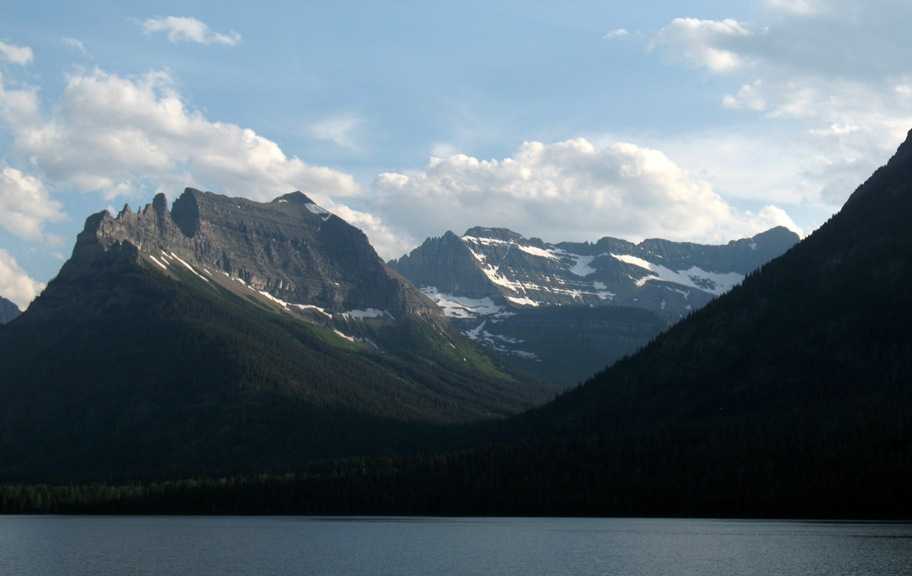
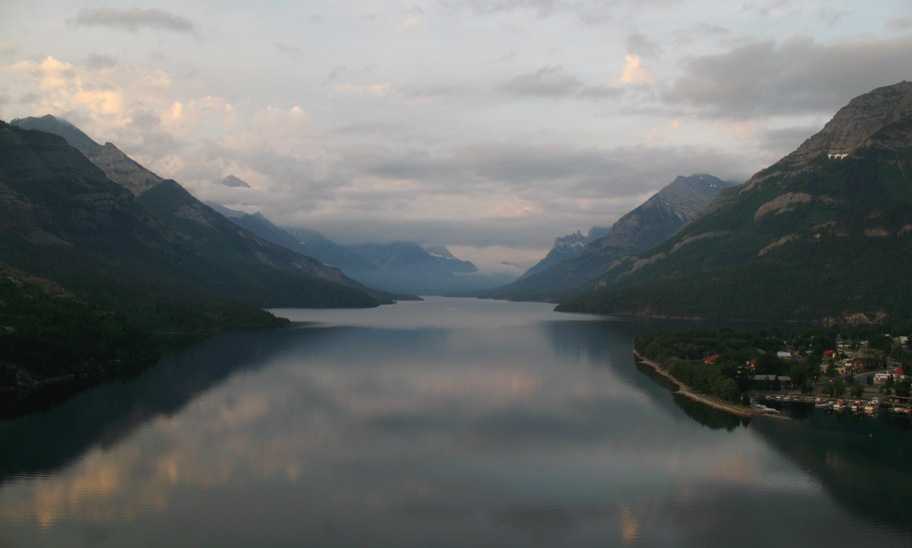
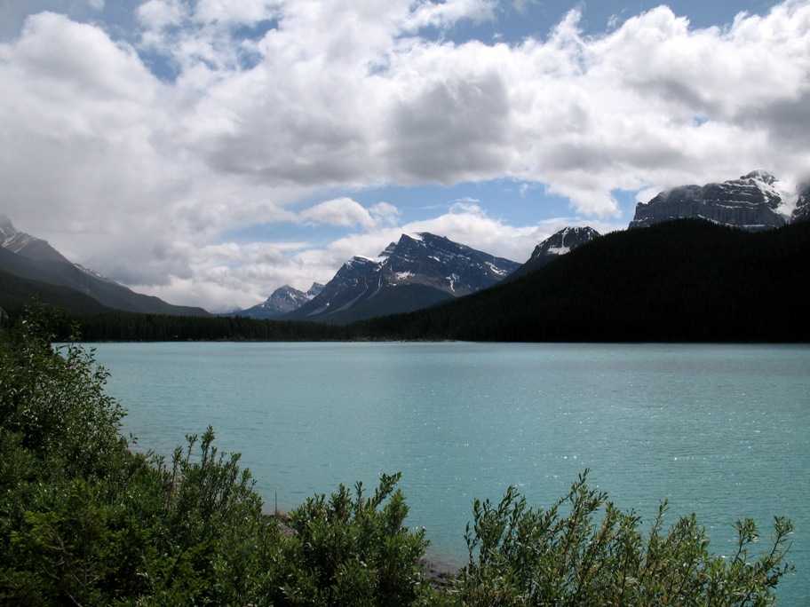
Waterton Lake, Alberta, Canada
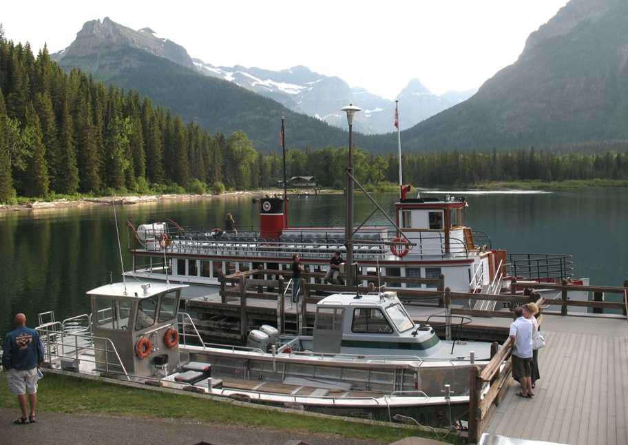
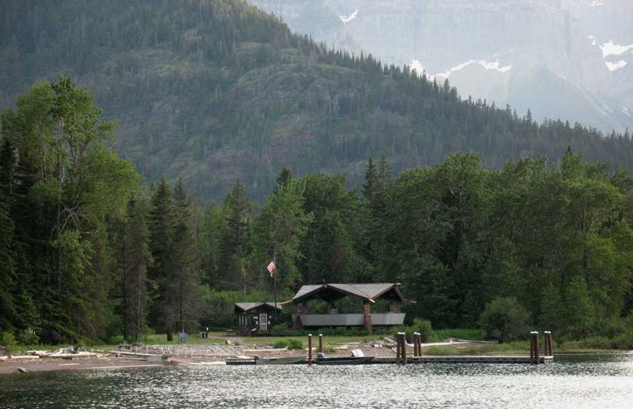
After we got back to the Prince of Wales hotel from Red Rock Canyon (see Update 17), we bought tickets for the 7-9 pm cruise down the length of Waterton Lake and back, aboard the historic 78 foot wooden tour yacht "International" (because the southern end of the Lake is in the US).
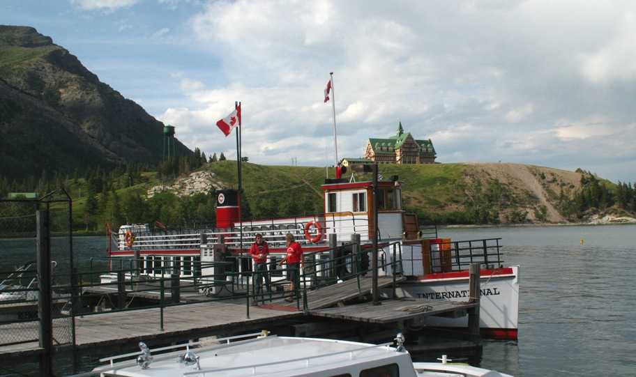
The boat has an interesting story. Recalling that Waterton (Canadian) National Park is a cooperative venture with the US Glacier National Park, the US wanted to build a tour boat to take people down the lake. But they insisted it had to be a US-flagged vessel, which meant it had to be built in the US. But it also had to be built on Waterton Lake because there is no way to transport such a vessel to the lake from elsewhere, nor any way to launch it once you got it there. But there were (and still are) no roads to anywhere on the US end of the lake, nor any boatbuilding facility there. So the US decided to BUILD a boatbuilding and marine railway launching facility down at the southern (US) end, and to transport all the materials and tools necessary to do so and build the boat too. In 1927. Here's the result:
This facility also serves as winter storage for the boat, which is about 8 months of the year. The International is a 78 foot boat with no place to go but back and forth 20 miles, four times a day, two hours each.
And by the way, because it's US-flagged it must have a US captain. The current captain has been running this route for 20 years now. That's 9760 trips, by my math. And he says he's not bored.
So we departed.
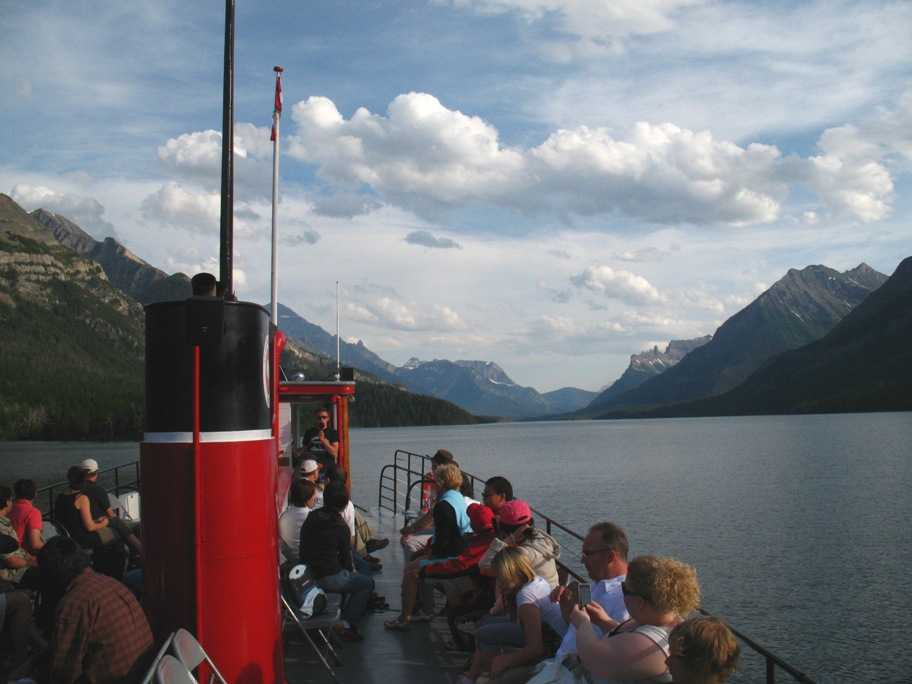
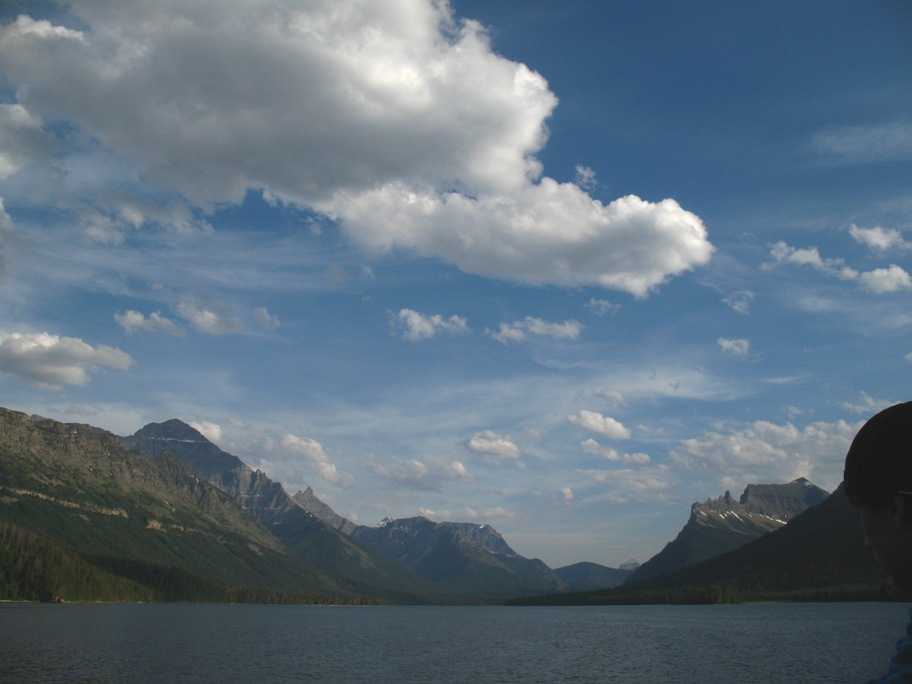
You can see from the above picture that this lake sits in a classic U-shaped glacial valley. What is not so clear (but will be in a moment) is that all the side valleys were also glacier-carved, and those glaciers flowed into the main Waterton glacier. But since the side glaciers were smaller and lighter, the valleys they carved were not as deep, and now that all the glaciers are gone these side valleys "hang" above Waterton Lake. Like this:
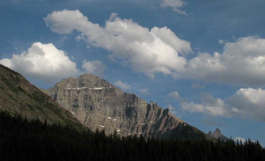
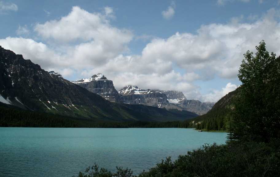
Here's another interesting feature. If you look about halfway down this mountain's face, you'll see a darker horizontal band with narrow light-colored rock layers above and below it.
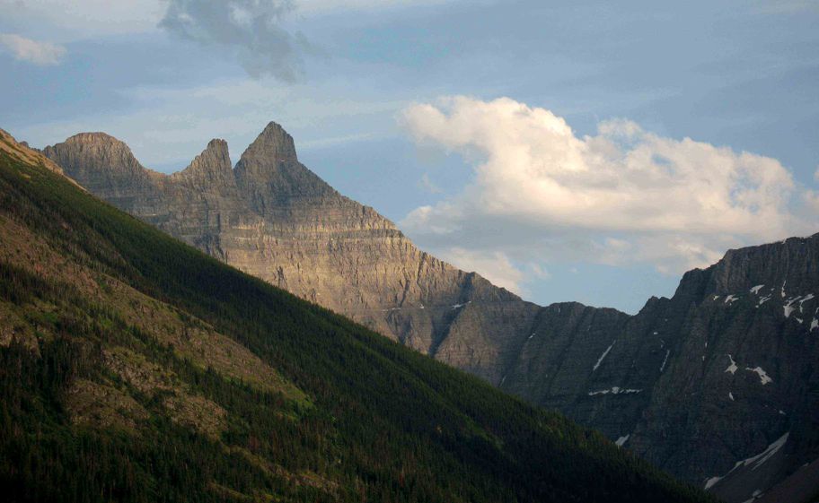
Behind this mountain (barely visible above) is another mountain of a similar "stripe":
The source of this stripe, which occurs throughout Glacier and Waterton Parks at the same altitude, was igneous intrusion into a fracture plane in the original sedimentary rock. Said in English, that means the rock, which started out as layers of sediment in a large sea, had a horizontal crack or flaw into which magma (lava) flowed from below, and it forced the crack open and filled it up with what is now solid igneous rock. Since the magma was hot at the time, it heated and "metamorphosed" the limestone on either side (top and bottom), creating those light stripes.
We finally got to the south end of the lake . . .
. . . and a couple hundred yards away (behind the boat in the above picture) there's a building with a US flag. Here's a close-up:
That, my friends, is an official, bonafide Homeland Security US Border Station that can only be reached by boat or on foot. You'd best be carrying your passport if you show up there!
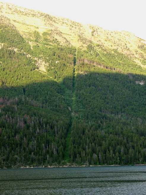
In an earlier update I mentioned that Canada clearcuts its borders with a 60 foot swath and marks them. Here's the US-Canada border where it comes down to the lake on the west side. That obelisk is the marker.
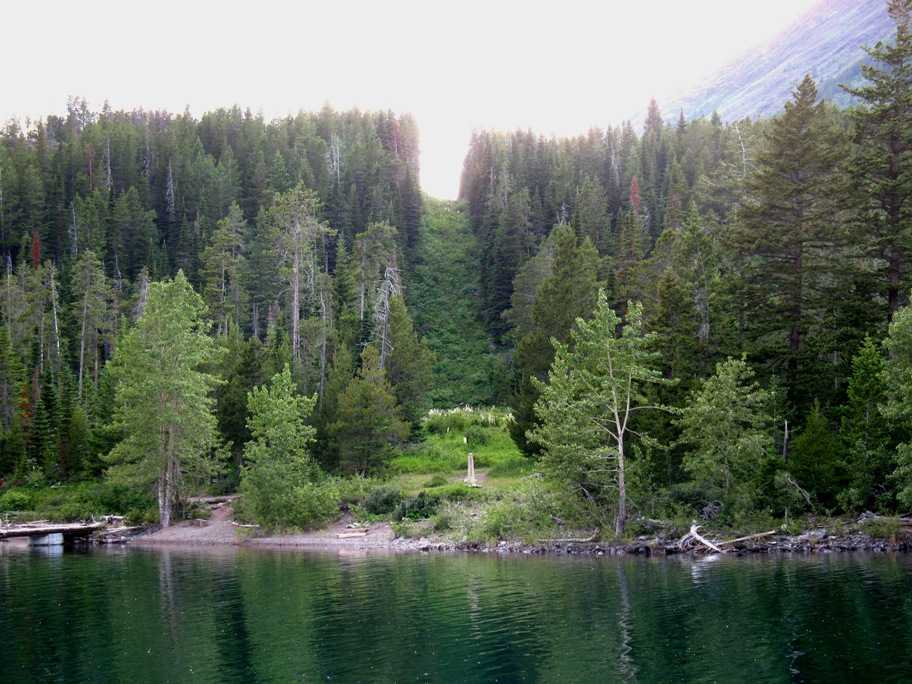
Naturally there's a corresponding clearcut and marker (the latter barely visible here) on the east shoreline.
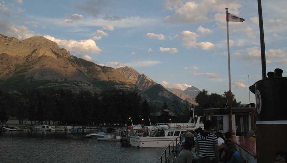
We got back to the dock at Waterton at 9 pm, just as the sun was setting. By the way, that Canadian flag you see is the "courtesy flag". All foreign ships in a country other than their own carry one, and it is always smaller and higher than the ship's "ensign" (flag of origin). The ensign (US flag in this case) is much larger and at the stern.
Sunday 7/5/2009
Day 74
Waterton Lake to Calgary, Alberta, Canada, 170 miles
In the morning Lynn insisted that I get a photo of our funky free-standing shower. This old design operates on the assumption that you're young, vigorous, and aren't going to slip and fall, because if you do there's nothing to grab that'll hold you up. Other than that it was a pretty good shower!

We also took one last photo out the window of our Prince of Wales Hotel room at sunrise before we left.
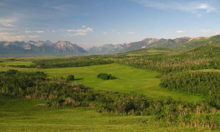
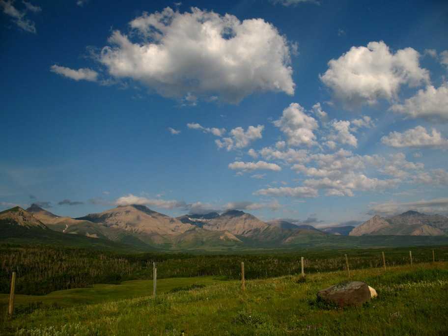
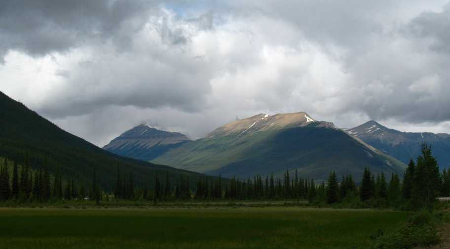
North of Waterton the Rocky Mountains slant off to the north-northeast while the road to Calgary slants slowly downhill east of the Rockies and the landscape trends from foothills to agricultural plain. These next two photos, taken within twenty miles of Waterton, show an almost fairytale hilly ranching landscape backed by the
mountains. This is where the Marlboro Man comes from.
North of here the land began to look a lot like I-5 between Grapevine and Livermore, CA, so I saw no need for photos. Calgary itself is a sprawling city amid vast expanses of ranch and farm land, with mountains to the west, very much like Denver, CO.
Monday 7/6/2009
Day 75
Calgary to Lake Louise, Alberta, Canada, 114 miles
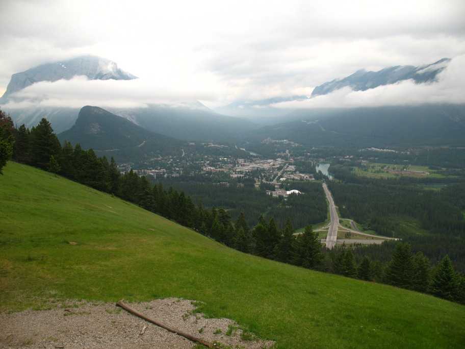
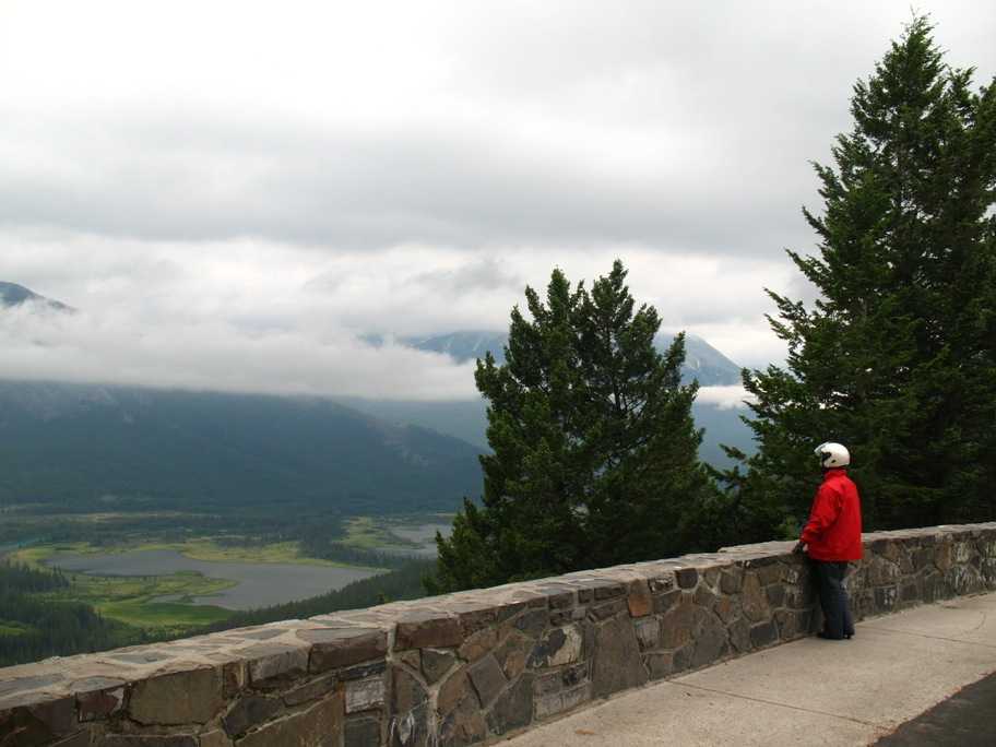
The weather was getting dicey and rain was predicted, so we suited up and got an early start hoping to beat the worst of it. As it happened we had clouds the whole way and began to get some rain on our way up the hill to Lake Louise, but the thunder, lightning, and torrential downpour held off until about five seconds after we had parked at Deer Lodge at about 11 am. We grabbed our stuff and bolted for the door. On our way up there we had taken a side trip up to the Mt.Norquay Ski Area near Banff and got these photos from an overlook above the valley where Banff sits. That's Canada Hwy 1 down there, our route. Looking south here.
Tuesday 7/7/2009
Day 76
Lake Louise and the Icefields Parkway, Alberta, Canada, 160 miles
This is what Lake Louise looked like later that afternoon, during a brief break in the rain. Actually, it didn't even look this good. Actually, it was so blah that I didn't even take a photo. This one's off Google Earth (Panoramio).
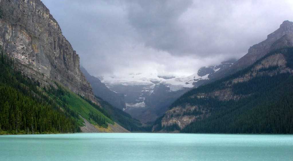
While I'm at it, I might as well show you what the Lake looks like as the weather improves. Here are three more shots from Google Earth.
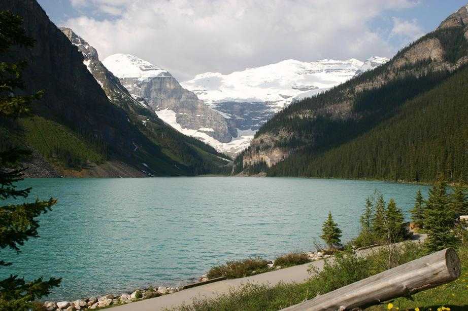
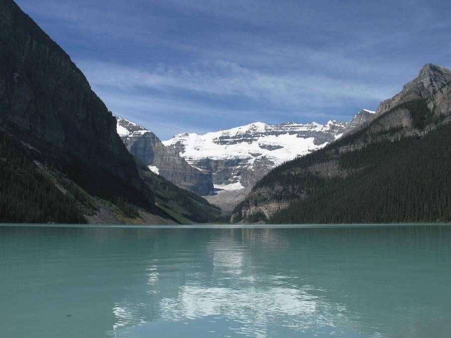
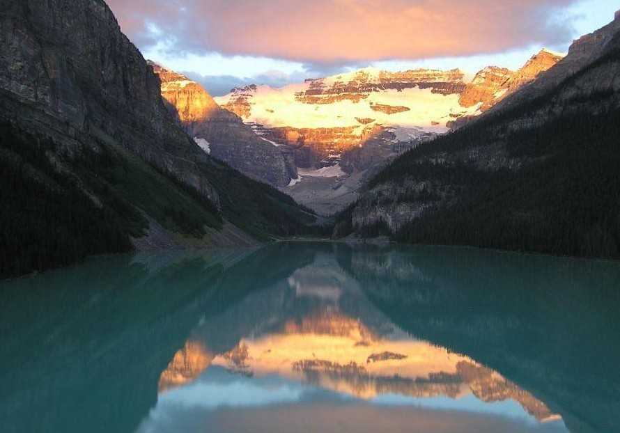
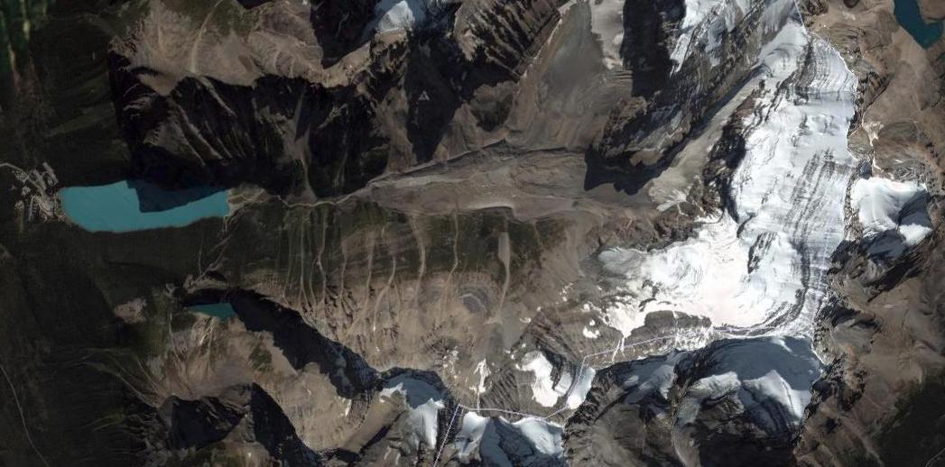
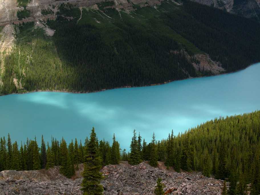
By the way, the crest of that cirque is at 11,340 feet, whereas the lake is at 5794 feet. You're looking up 5500 feet. The end of the lake is 1.1 mile away while the cirque wall is 4.5 miles away. Here's what it looks like from space -- Lake Louise to the left, cirque wall at right. The lake, which is the pale powdery blue color it is because of all the glacial silt in the water, is fed by no fewer than eight glaciers.
On the shore at the foot of the lake is Chateau Lake Louise, currently owned by Fairmont hotels. As best I can describe it, it is as if the Las Vegas Bellagio Resort Casino had been relocated to a lake in the Swiss Alps.
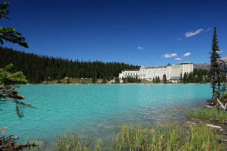
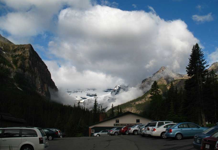
This little "chateau' costs $500 and up per night, lake view rooms higher. This made little sense to us, and after visiting and having drinks and hors d'ouevres in it we still felt the same way. We much preferred Deer Lodge, which was a whole five minute walk from the shoreline in front of the Chateau. Here's an overview.
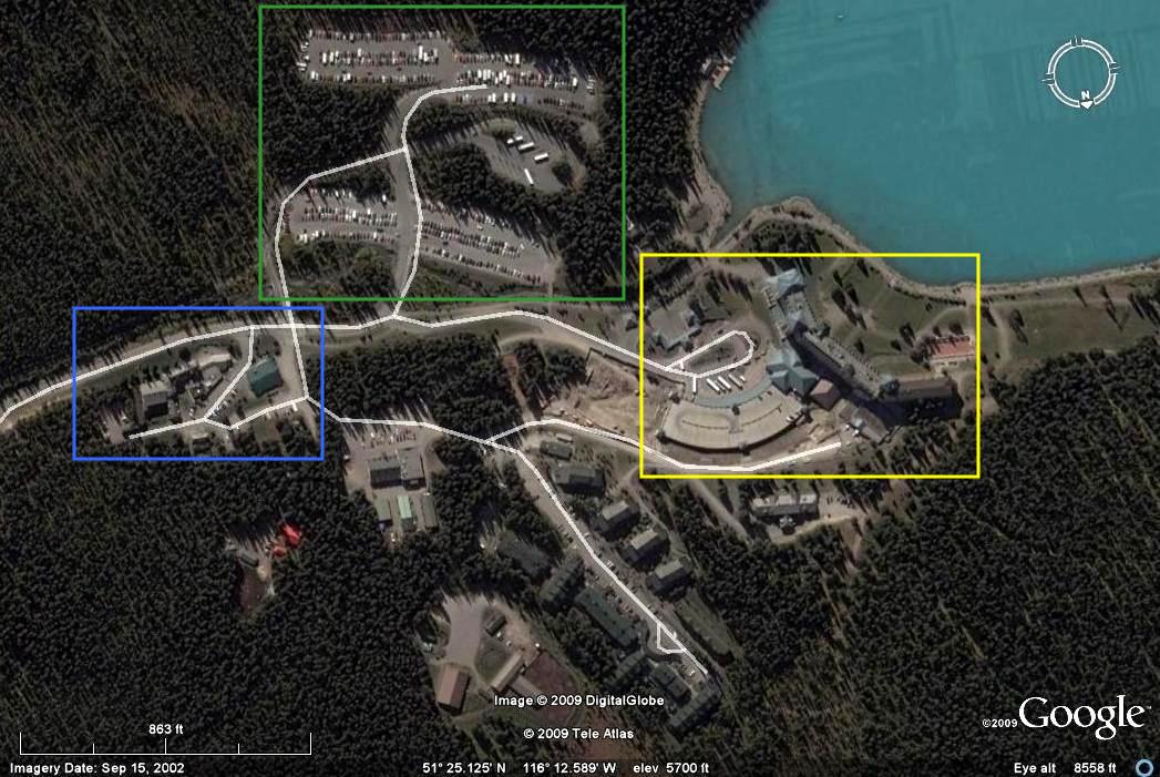
The yellow box is the Chateau, the blue box is Deer Lodge (founded, by the way, by a woman who thought there ought to be a less expensive place for Lake Louise visitors to stay), and the green box is public parking for folks who've chosen to stay in the even less expensive lodgings three miles down the hill in Lake Louise Village, just off the Canada Highway 1. There were many hundreds such people, most of them European or Asian.
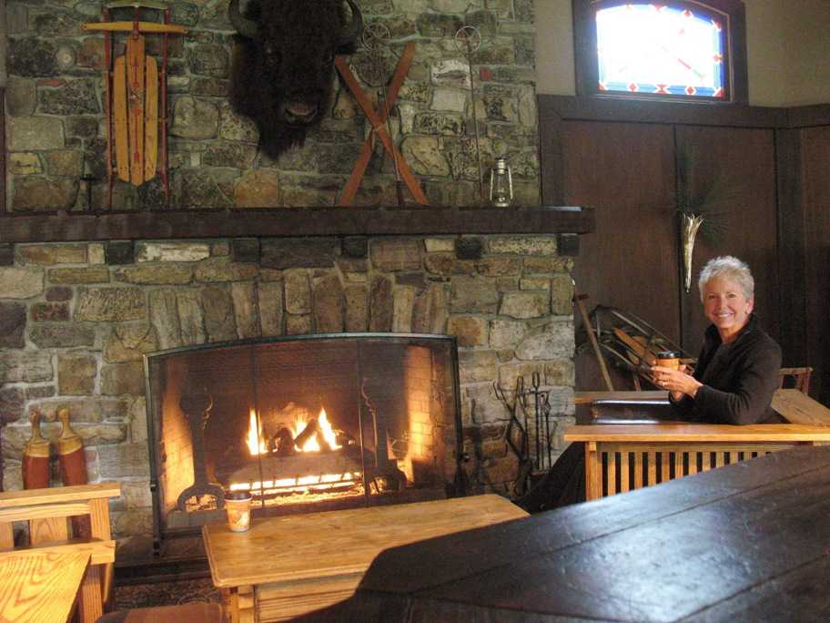
Deer Lodge was simply perfect, having the rustic elegance of a hunting lodge coupled with excellent food and first class service. (Sadly, however, they hadn't the faintest clue how to make a decent Long Island Iced Tea.) Here Lynn is warming up by the fire in the lounge adjacent to the lobby. Having arrive five hours before we could check in, we spent the afternoon here on our first day, with good coffee, wifi, and a buffalo head. Sweet.
This is what the view up toward Lake Louise from Deer Lodge looked like in the morning -- after it rained all afternoon and night.
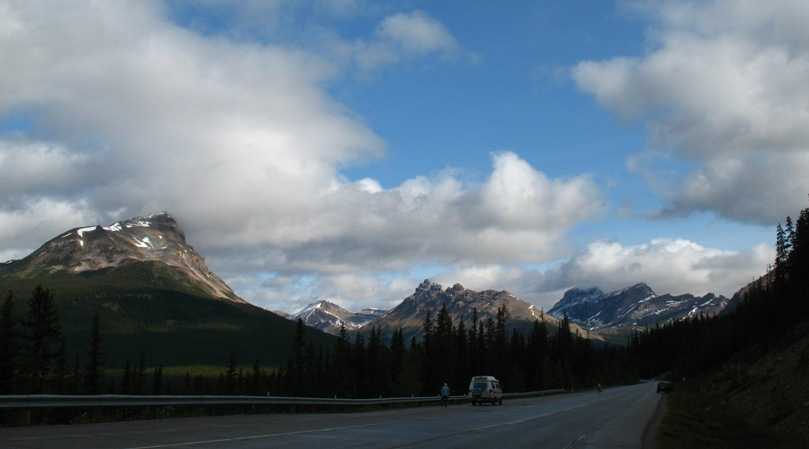
We decided we would brave the cold and rain and drive up the Icefields Parkway as far as the Athabasca Glacier, halfway to Jasper. Boy were we glad we did! This road was simply spectacular, the most beautiful road I've driven short of the Denali Highway in Alaska. The trip was 80 miles each way, and the photo ops never stopped. Some of these photos, I don't even know where they are. I simply lost track. I'm just gonna paste them in and see if I can label them afterwards.
The road a few miles north of Lake Louise Village on Alberta Highway 93. This road goes 150 miles from Lake Louise to Jasper traveling along a high, narrow, rolling valley that runs right up the crest, with mountains on both sides and lakes and rivers in the valley itself.
By the way, a geographical note: While we all know that in the US the Rocky Mountains are the Continental Divide separating rivers that run west to the Pacific or east/south to the Gulf of Mexico. (East of the Appalachians the rivers flow east to the Atlantic.) What is less well known is that there is another divide that runs along the US-Canada border, and north of it (and east of the Rockies) rivers flow north & east to Hudson Bay. (West of the Rockies all rivers flow to the Pacific.) So ever since we left Glacier National Park and entered Waterton Park, the water flows north.
Crowfoot Glacier -- for obvious reasons.
Bow Lake and Bow Glacier, sourced by the Wapta Icefield.
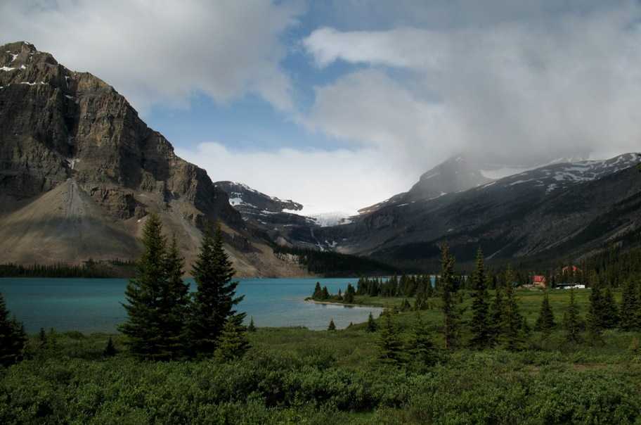
I should say a word about "icefields" and "glaciers": An icefield is a huge area of very thick ice (300 - 1000 feet in this area) that sits on a flattish area on top of a mountain range but doesn't move. Well, more accurately, it accumulates ice at such a rate, year upon year, that it gets too thick to keep acting like a solid and begins to act like a giant glob of Silly Putty (a very slow liquid) and sort of "subsides", flowing in all directions. When its edges reach the edge of the mountains, either huge pieces of it break off and fall over the edge, or, if there's a valley available, the ice flows down the valley as a glacier.
So icefields are the source of glaciers. In the picture above, that high glacier is just a tiny piece of a huge icefield behind that lip -- the Wapta Icefield.
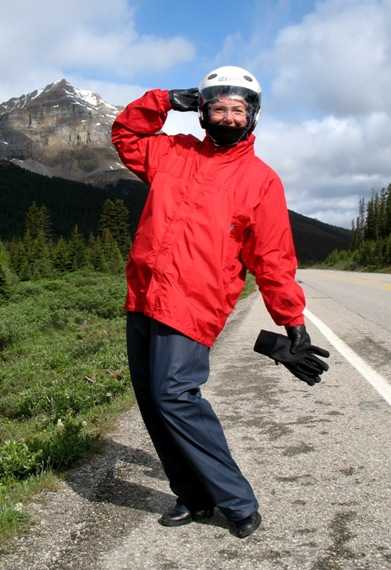
Lynn models her rain suit -- inexpensive waterproof pants that are large enough to go over "everything" (long underwear, jeans, and thick leather chaps), and my red Goretex mountaineering parka that, likewise, is so big it fits over three layers of Lynn's warm undergarments plus her motorcycle jacket liner (also waterproof), and her armored motorcycle jacket -- and it has a hood she puts inside her helmet. She also has a four-layer polypro "neck gaiter"or "snood" for added warmth and wind protection. She's holding my "light" rain gloves, which can go over her motorcycle gloves if things get really bad. (I have a heavier pair.)
Looking back SSW down the canyon we've ascended from Lake Louise Village.
Bow Summit above Peyto Lake (out of view to the right).
Peyto Lake in patchy sun. This is a glacial lake. It really is that color.
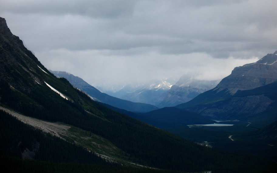
I dunno. Somewhere just south of the Saskatchewan River crossing.

Patchy sun on mountains above a grass-filled lake (the work of beavers). But look carefully, dead center in the photo, at the spire sticking up from a mountain several miles behind the one in the foreground. Anyone wanna go try and climb that? Sorry I couldn't get more photos of it -- the clouds shifted so fast that, even though I saw it from several other spots along the road, I could never get a lens on it before it vanished.
Near the Saskatchewan River. This many-threaded river is really starting to look like Alaska.
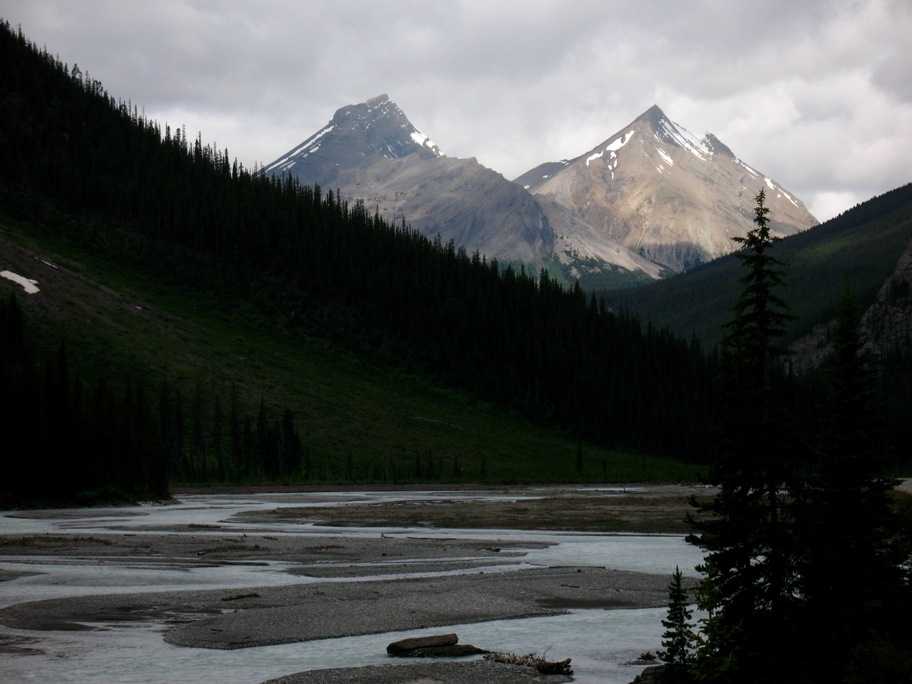
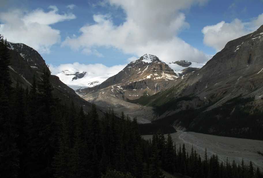
Mistaya Canyon, I think.
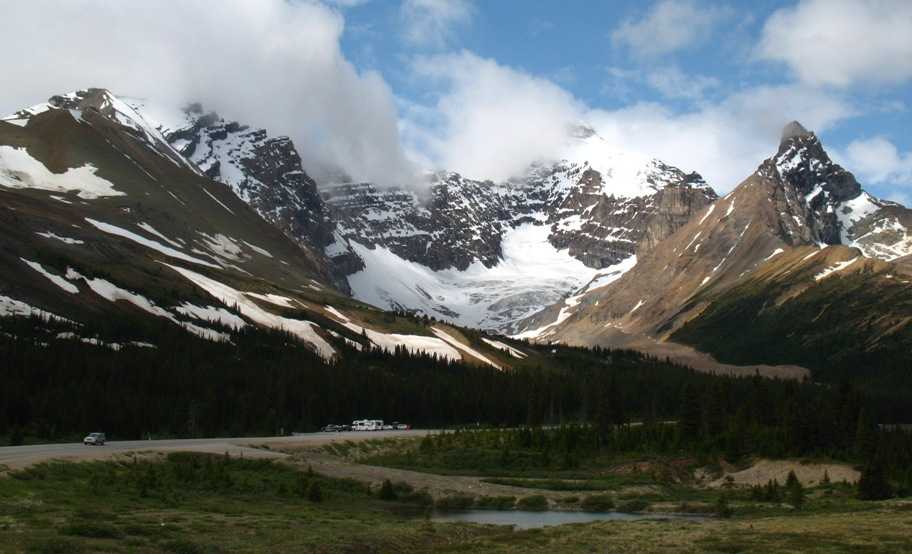
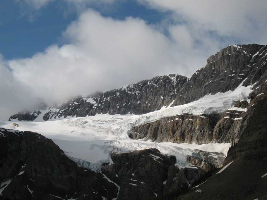
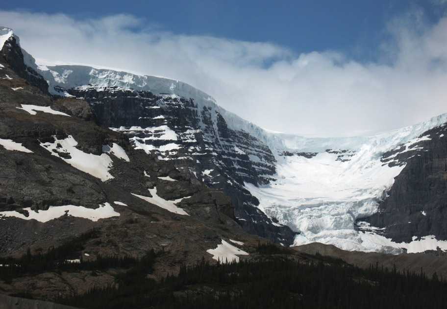
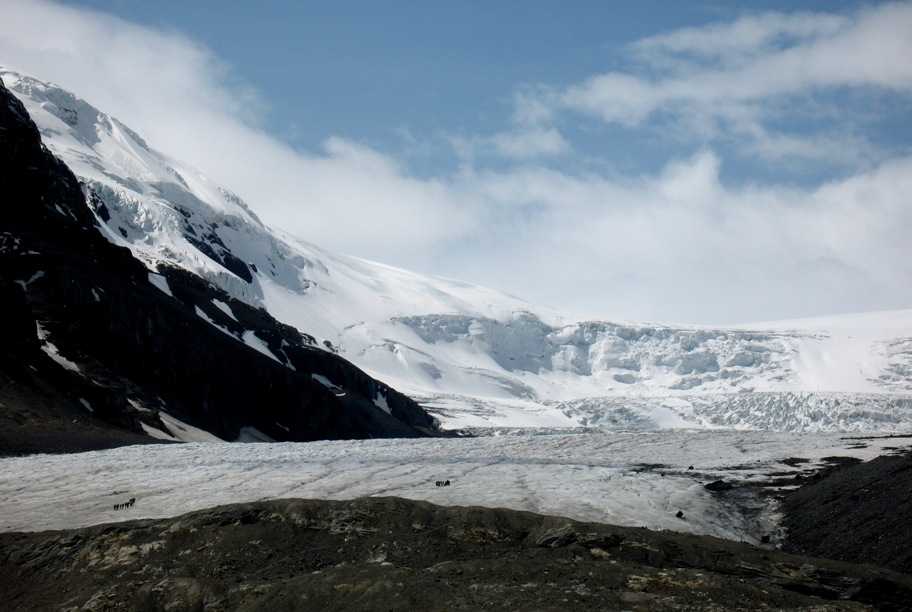
The Athabasca Glacier, coming down from the Columbia Icefield, which is that broken mess spilling over the lip. The Columbia Icefield is twenty miles across and spawns 40 or 50 glaciers and uncounted icefalls.
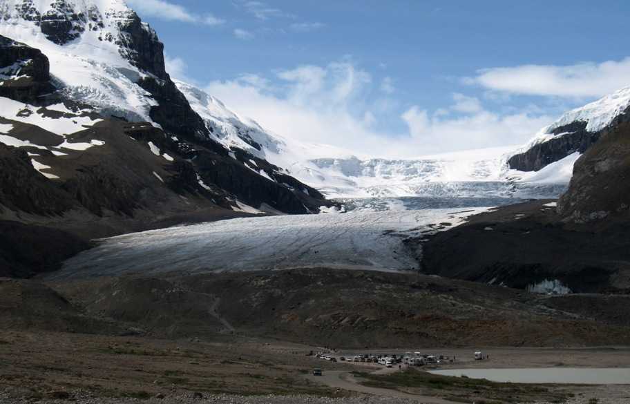
Speaking of icefalls, that is an icefall -- where the icefield encounters an edge and simply breaks off going over it.
Two hiking parties on Athabasca Glacier. There are also huge six-wheeled monster snow buses that take less ambulatory people up a groomed road on the ice. This glacier moves several centimeters per year, which is fairly fast. Even so, it's melting back much faster than that. In the last 5 years it's lost a kilometer of length and half its thickness.
Heading south again, spotty sun lights up the road and river.
Bow Lake again, I think. Two views, south and north.
We got back to Deer Lodge in time for hot showers after a cold day, cocktails and hors d'ouevres in the bar, and a wonderful dinner in the Deer Lodge dining room.
Wednesday 7/8/2009
Day 77
Lake Louise to Sagle, ID, 290 miles
We decided we'd try to make Sagle in one day, hoping the weather didn't stop us. We knew the worst weather would be up in the mountains, in the first half of the day, and that Sagle was supposed to be partly cloudy and warmer. So we left early and encountered no discomforts more serious than a few hunger pangs and coffee cravings when we found ourselves in a 70 mile stretch of mountain road devoid of services. But we made it just fine.
Monday 7/13/2009
Day 82
Sagle, ID, to Missoula, MT, 195 miles
Lynn returned to El Segundo yesterday. Last night as Warren and Jean and I tried to sleep we had thunder and lightning and pounding downpours for several hours, and a power outage for a couple hours as well. This morning the sky was briefly dry but started raining again before I could get moving, so I packed in rain, had some coffee, and set out with some trepidation. Suffice it to say it was a long cold wet day on a very slippery twisty mountain road (ID/MT Hwy 200). Survival. Not fun. I didn't quite have enough warm clothing on, so about 50 miles along I pulled into a gas station, grabbed all my long underwear plus my waterproof socks (my feet had been swimming in my shoes), went into the men's room to change from the skin out, and upgraded to my heaviest, driest gloves. With this plus coffee and some carbs I made it through. It's 9 pm and I've been at this update since 4:00. The next three days I'll be meandering slowly towards Bozeman via back roads and several crossings of the Continental Divide. Tomorrow: Salmon, ID. Wednesday: Butte, MT. Thursday: Bozeman, MT via Helena and US highways 12 and 89. A total of 688 miles to get to where I could have gotten in 400 miles on I-90. But I don't have to be there until Thursday, and there's a lot to see that I haven't seen. Then I see Lynn and Tania for another Darnton wedding, and Tania and I will head slowly home together on the bike.