Day 92
Omak, WA to Oak Harbor, WA, 204 miles
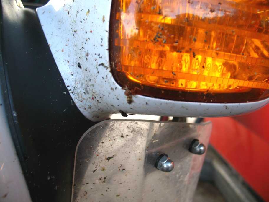
Tania felt a need to document this mess before we left Omak in the morning. I have to clean this up when I get home. No point in doing it now -- there's more where this came from.
From Omak we gained elevation (and lost temperature) fairly rapidly, until we were presented with this lovely view of the North Cascade range, which we were about to cross.
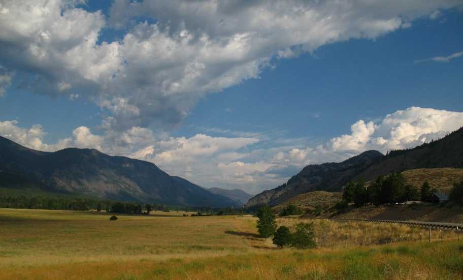
This is the upslope toward Washington Pass (5477') and Rainy Pass (4855'), from which latter WA Hwy 20 descends a long, narrow canyon.
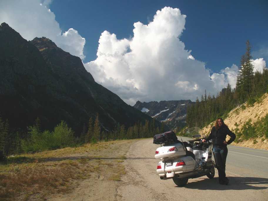
One caveat: that canyon has all the moisture rushing up it that the northwest wind from the North Pacific High and the Humboldt Current can push. Rainy Pass is not misnamed, though for us the rain held off until we'd crossed it. This photo shows what I think is 9060' Jack Mountain, though I'm not sure. What I am sure about is the rain behind the mountain's shoulder, visible here, which lasted to the canyon bottom and, in the end, happily inconvenienced us very little except to preclude photography.
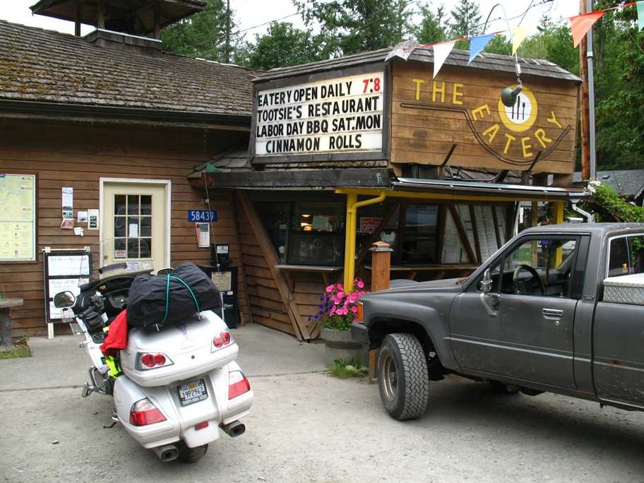
Our dampened spirits were raised appreciably by this congenial spot. Tootsie Clark's father's mother first opened a roadhouse in this area in 1888. Tootsie's still running this one, The Eatery, and she's in her 80's. We saw her in action in the kitchen, and she was showing the lazy youngsters just exactly how to run a business, by god. Here's a link.
http://www.sunset.com/food-wine/flavors-of-the-west/eatery-pecan-pie-00400000012923/
We had a nice late breakfast and left with no complaints. The rain had cleaned up the bike a little, for which I was grateful.
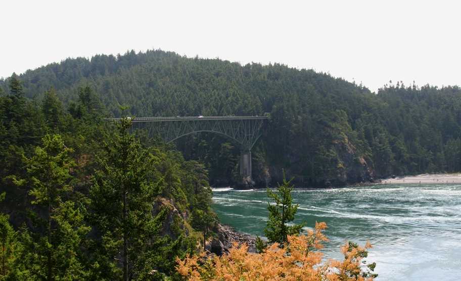
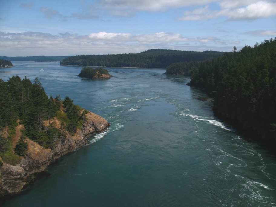
Another couple hours brought us past I-5 and onto Fidalgo Island in Puget Sound. We continued west a few more miles until the road bent south and I made, as I describe it, my Third and Final Left Turn of the trip, the first having been at Key West and the second at Eastport, ME. We headed south for home at last. We rode on down to the Deception Pass bridge which crosses to Whidbey Island north of Seattle. It's called "deception" because, like many such places in the northwest, early explorers were looking for a "Northwest Passage" and kept being disappointed. This one really had them interested because the water simply howls in and out of this narrow strait -- max currents reach 15 knots, and the water gets really tortured.
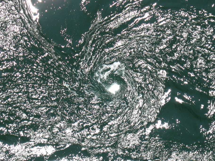
This is a taste of what I mean by "tortured". This is no place to be in anything but a fast powerboat except at slack tide. The bridge sits 180 feet above this maelstrom.
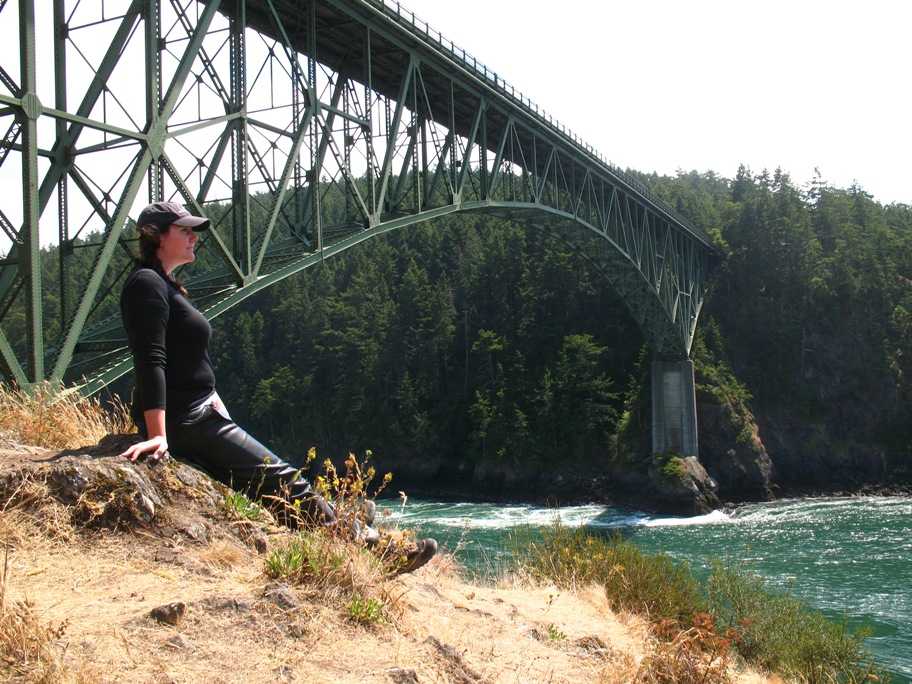
Ever since Tania was old enough to understand that being in a photogragh made you the center of attention -- with a certain permanence -- she's been demanding "Take a picture of ME, Daddy!" This hasn't changed. However, proud as I am of my daughter, in this photo I want to draw your attention diagonally down and to the right to the base of the bridge support. Look what is happeneing to the water level. There's a two or three foot drop from right to left, the direction of water flow. This is ocean, not river.
This is not pretty, but still photos just don't give an adequate impression. For that reason (and I hope you have broadband, because if you don't, you're probably already pretty unhappy with me) I have included a 15 second, 4.6 MB video clip. For maximum appreciation, blow this up to full screen, repeat it about five times, and look carefully at the boils and trailing vortices. Then imagine being in a boat down there.
Click HERE for the video
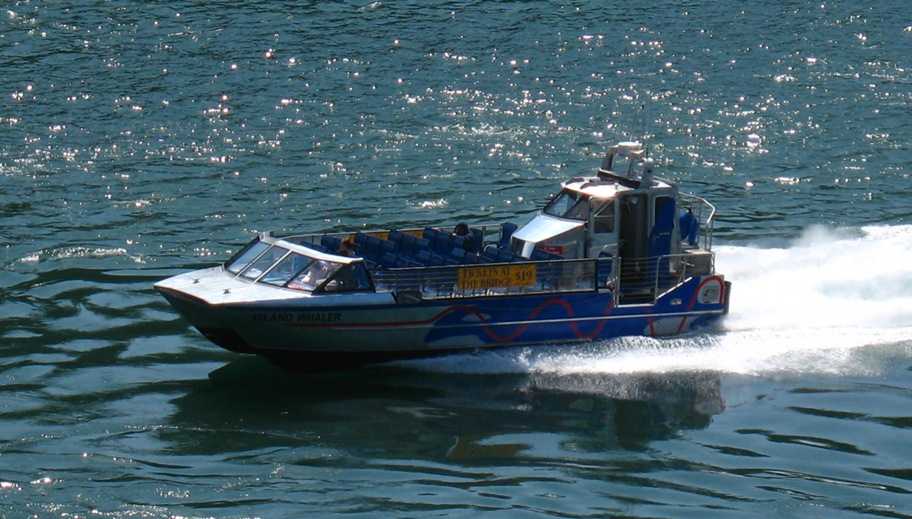
Speaking of fast motorboats, here's a tunnel-hull jet boat that'll take you through and back for $19. Not too many takers this day.
Here's the outwash on the downstream side (inland, in this case)
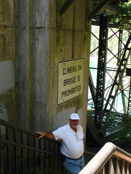
There's pedestrian access to the bridge along walkways carefully separated from traffic -- of which there is enough that crossing the roadway on foot is dangerous. This is why the Washington State Park Service has thoughtfully provided stairs down and a path under the bridge at each end, to get to the other side. Of course, this puts you close enough to the bridge understructure to reach out and touch -- or (if you're like me), climb on. Naturally the authorities discourage this. In my case, mostly what discouraged me was being three days shy of 60 and still 70 lbs overweight.
When I was (much) younger and stupider, I had fewer such impediments, and one day, when my family was camped in nearby Deception Pass State Park campground, my brother Eric and I decided it would be fun to hike to the base of this cliff (photo below), traverse a dozen or so yards to the left (right in this photo) until we were directly above the water that ends up in that boil you saw in the video, and then climb the cliff. As is so often the case in climbing, this went OK at first, but the rock was rotten compared to the Sierra granite we were used to, and it was below timberline and all overgrown with trees and bushes and loose dirt. So when we came to what appeared to be a nearly impossible move to crest the brink and reach (relative) safety, we realized that we could no longer safely downclimb. Bear in mind, this was free climbing, no ropes.
In the end my brother attempted the move while I pushed him from below. He made it, in the process destroyed the only remaining good foothold on that sorry slope. Leaving me stranded, unable to move up or down. As the afternoon waned. And the tide dropped. So I'd hit rock, not water, if I fell.
Eric prudently concluded there was nothing he could do except run for help in the form of my father, who, after an eternity, arrived above me on the hiking trail from which this photo was taken. My recollection is hazy, but I think maybe he'd scrounged up some rope, because he managed to get down far enough to reach my hand, and hauled me to safety. We hiked back to camp in a very stony silence. But we lived through it.

So you know, in ways this incident some 45-50 years ago throws my whole motorcycle trip into some kind of perspective.
From here we headed on down the few remaining miles to Oak Harbor for the night.
Friday 7/24/2009
Day 93
Oak Harbor, WA to Tacoma, WA, 105 miles
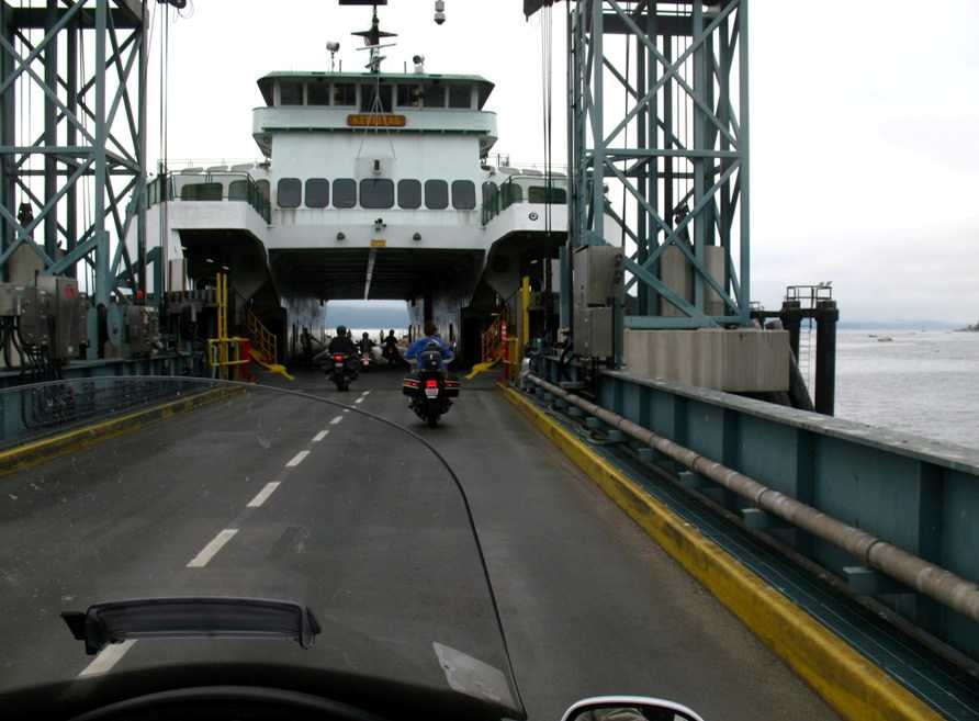
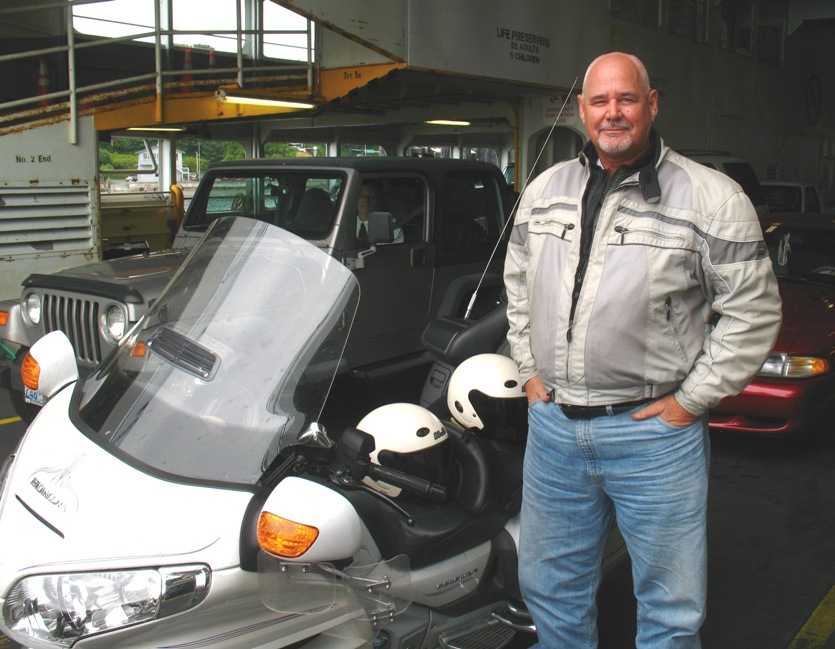
The distance to Tacoma was short, but we had plans that required an early start and arrival. First, we had a ferry to catch from the southern tip of Whidbey Island over to the mainland and I-5. Tania had surreptitiously gotten the camera ready to take this shot as we rode aboard. Motorcycles go first!
See, now that Tania's aboard, I get my picture taken a lot more! I'm looking pretty smug here -- don't know why. Maybe it's just how much of me I see in her.
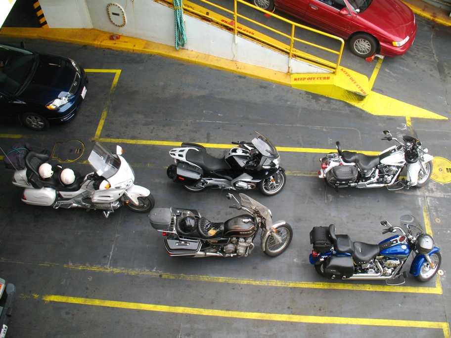
We had company: two Harleys, a new R1200 BMW, and . . . yes, that's an ancient and well-used Honda CB750K that hasn't seen a garage or carport in a long time. The youngish guy riding it was wearing hiking shorts and Teva sandals -- in damp 55 degree weather. These Seattle-ites have different thermostats than you or I.
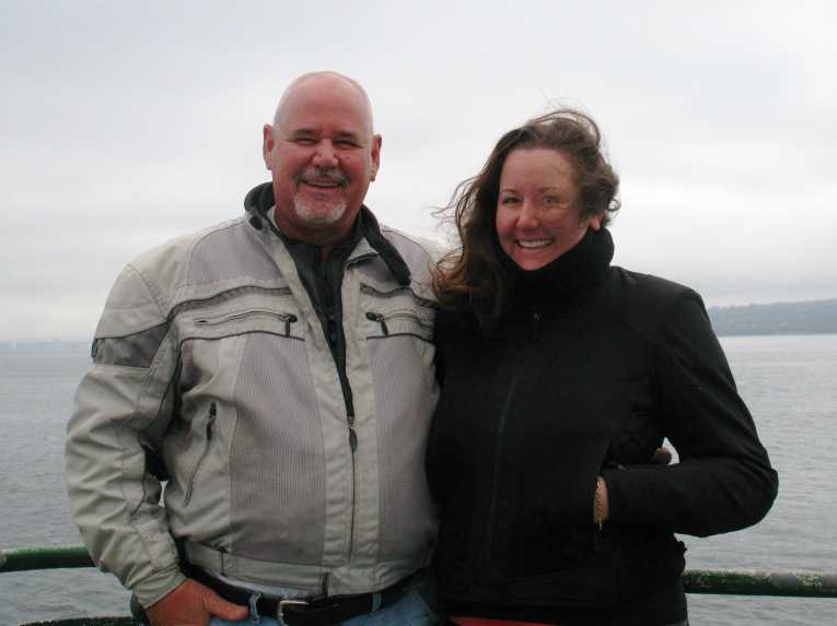
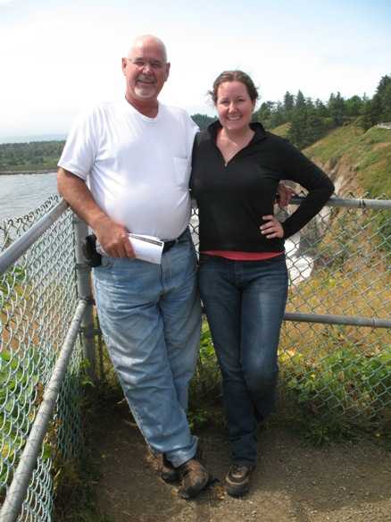
We found an obliging soul to take our picture together, which often turns out badly, but this time it was resurrectable with some heavy editing. It's gratifying for me to say that my daughter and I spent 2500 miles together on that bike with neither mishap nor argument and we were still smiling at the end.
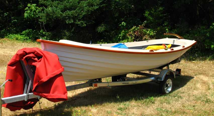
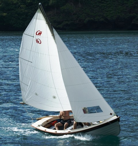
As I said, we had plans. First stop after reaching Tacoma was Gig Harbor, about ten miles to the north, where lies Gig Harbor Boat Works (http://www.ghboats.com/index.shtm). This is their 17 foot Jersey Skiff. Pretty darn sweet. The sail rig is collapsed inside the boat here. I intend to buy one soon.
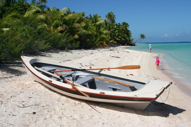
Here's what it looks like in action. The one on the right is in the South Pacific. Dare I ask how it got there?
Tania also planned to visit with a friend of hers from school who lived in Tacoma, so I dropped her off there and retired to the hotel to work on photo editing.
Saturday 7/25/2009
Day 94
Tacoma, WA to Astoria, OR, 149 miles
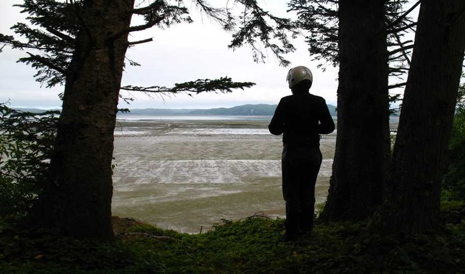
The ride from Tacoma west to Aberdeen was uneventful. Aberdeen lies at the root or vertex of huge Gray's Harbor, a triangular gash in the coast that receives the Chehalis River and sends it out to sea. Our road, WA-105, trails along the southern shore, often barely above high water. Most of this bay is tidal flats, as the low-tide photo below attests.
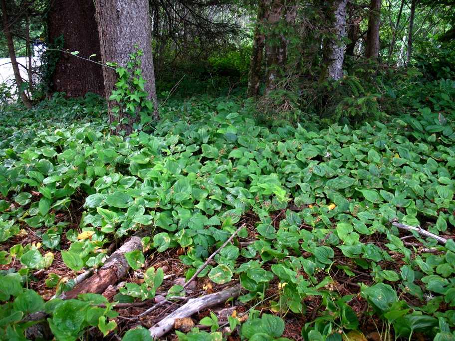
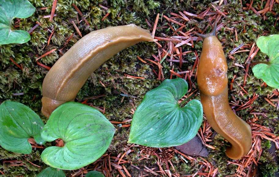
That forest carpet below Tania's feet is really lush . . .
. . . and shelters the ubiquitous Banana Slug. These guys just love cool, moist environs. So watch where you step.
Down the coast another 60 miles or so hooked us up to US-101 (that's right, it turns into the Ventura Freeway in LA) and brought us around the bottom of Willapa Bay to the root of a twenty-mile-long sandspit peninsula that you can literally drive the length of on the beach at low tide. When we arrived the tide was rising, and not low enough for me to consider going out there any farther than this, but it was worth a photo.
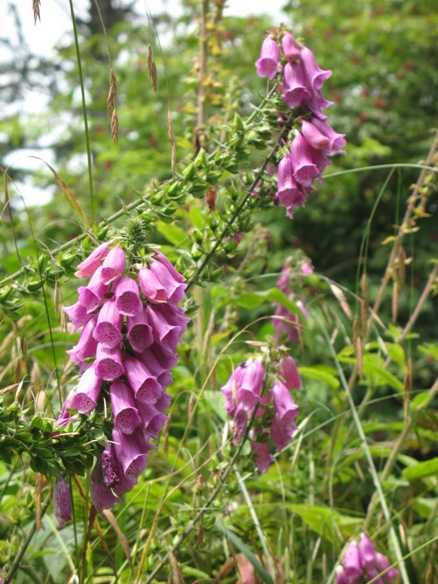
This same northern, fog-bound, rain-forest-like environment that produces banana slugs also produces foxgloves! Don't see too many of these in California.
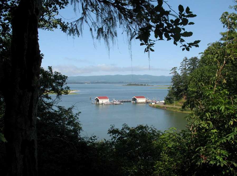
Just south of this point, the same sandspit extends to Cape Disappointment (so named in 1792 by English navigator and explorer George Vancouver because, um, Northwest Passage, etc . . . ), which is the north side of the mouth of the Columbia River. Which, by the way, is a Really Big River. Think Mississippi, Missouri, or Ohio. Same class. The Columbia extends east two thirds the length of the Washington-Oregon border, then turns north, heads into Canada almost touching Idaho on the way, and keeps on going another several hundred miles. It drains an area the size of one quarter of the continental US, including a several hundred mile stretch of the Rocky Mountains. The river at its mouth is five miles wide. The sea conditions on the sand bars offshore there, created by storm swells from the Gulf of Alaska, are among the worst in the world -- so bad, in fact, that the US Coast Guard has chosen that grim piece of ocean to train its life-saving crews, and where it tests its 37 foot life-saving vessels that can turn completely over in waves, come back up, keep going, and never miss a beat. Their diesel engines run upside down. I've seen video. They drop rescue swimmers off in twenty foot surf -- in winter -- and then retrieve them. Godamighty. Below is the harbor where they keep these boats, just inside Cape Disappointment.
Another obliging tourist got this endearing photo of me and Tania out at the end of Cape Disappointment.
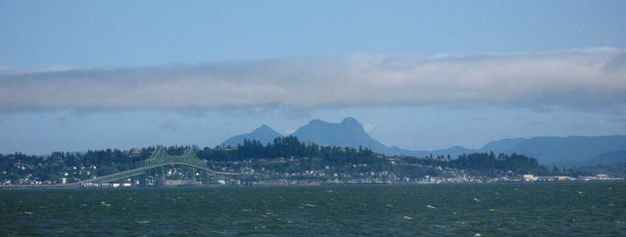
And that, south across the Columbia River on the Oregon side, is Astoria, where we would spent the night.
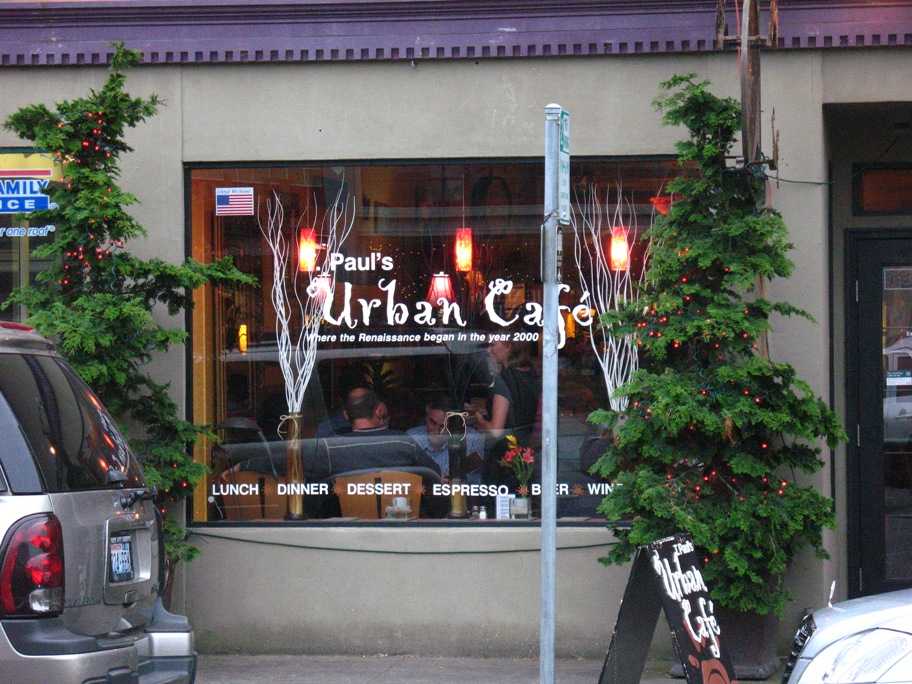
We had dinner here at T. Paul's Urban Cafe in old downtown Astoria. (Well, perhaps I shouldn't say "old", because there is no "new" downtown Astoria.) Tania and I agree this is the best small town eatery we've experienced anywhere, and certainly beat everywhere else we ate for 2500 miles. Delightful, and delightfully inexpensive. All pleasure, no pain.
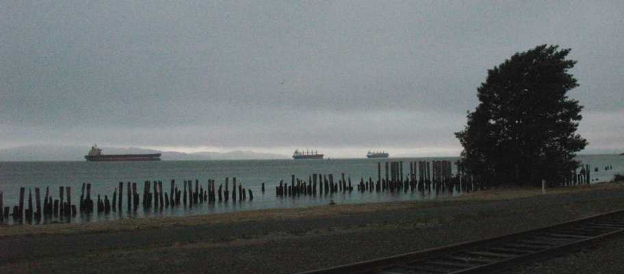
Astoria is reputedly the oldest non-native US settlement west of the Rockies, and exists because the Columbia River provides the best natural harbor between San Francisco and the Juan de Fuca Strait (serving Seattle, Washington and Victoria & Vancouver, Canada). Even with the bars breaking 20 feet, there's still a navigable deep water channel under all conditions, carved by the central core of the river's current. The bars are on the sides. The ships shown below are anchored in the River just north of Astoria, waiting their turn to dock and load.
The city was named after the American investor (and first millionaire) John Jacob Astor. He founded Fort Astoria here in 1810 to serve his fledgling fur company. After various hiccups, including early failure of Astor's fur trade and subsequent British ownership of the town (and the fur trade), in1818 Astoria was back in US possession and was incorporated in Oregon in 1876. The economy centered on fishing and lumber -- there were about 30 canneries there when WWII ended -- but these folded one by one until by 1980 there were none. The timber industry did likewise. Astoria Plywood Mill, the city's largest employer, closed in 1989, and the Burlington Northern and Santa Fe Railroad stopped serving Astoria in 1996. And remember, BNSF RR was the same company responsible for all those big chalet-type hotels Lynn and I stayed at in Glacier, Waterton, and Lake Louise. Stopping service to Astoria must have been pretty traumatic for everyone. For reasons I haven't quite plumbed, all remaining shipping moved 100 miles upstream to Portland, completing Astoria's diminution.
Today tourism, a small-time art scene, and some light manufacturing are all that support the city. Since 1982 it has become a cruise ship port of call, not exactly sure why cuz there ain't much there to see. The downtown is tiny, and the area appears to have become relatively poor amid the aging trappings of an earlier affluence. I would say the gray in this photo, and the incessant northwest wind bending the tree southeastward (toward Portland, same direction the ships are pointing), are suitably symbolic.
Sunday 7/26/2009
Day 95
Astoria, OR to Reedsport, OR, 206 miles
Tania and I had taken to breakfasting in Starbucks after returning to the west coast (there are very few Starbucks franchises east of the Rockies), but in Oregon it seems the only Starbucks stores are "abridged versions" inside Safeway stores, so we bailed on that and went looking for alternatives. While driving back west on Marine Dr (one of a pair of east-west streets running one way in opposite directions through downtown, the other being Commercial Dr) Tania spied the Astoria Coffee House (http://www.astoriacoffeehouse.com) on a cross street and we tried it. Another excellent find. These two places alone almost make Astoria worth an overnight stop.
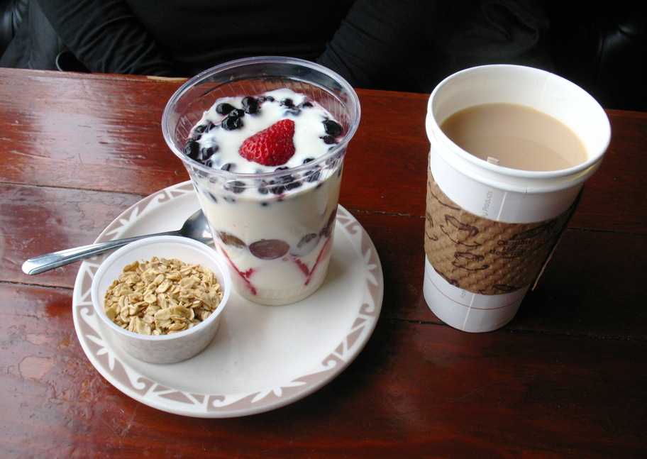
Tania's breakfast of a fruit & yogurt parfait with granola and tea was not only delicious but picturesque.
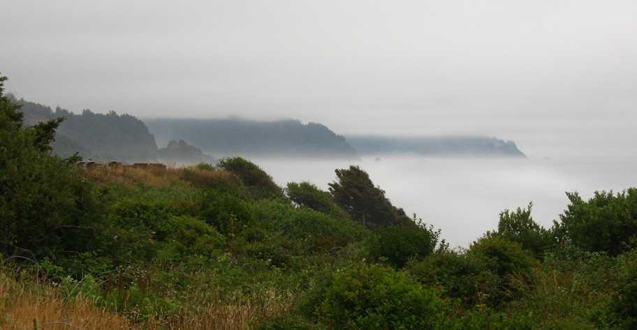
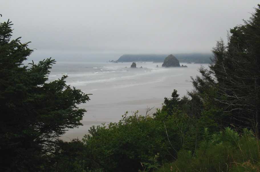
Moving on southward, the classic forms of the Oregon coast begin to show up in the fog.
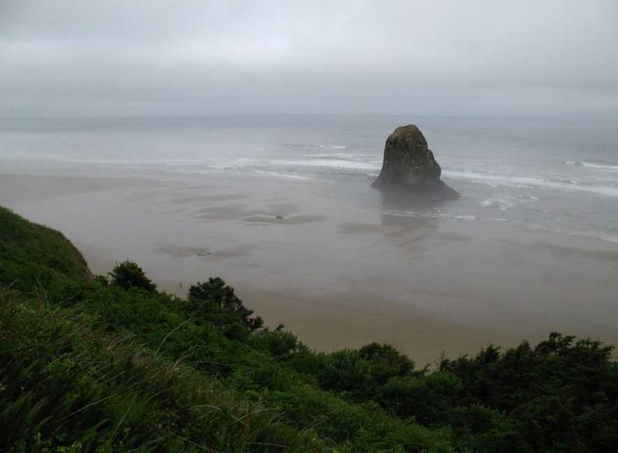
These offshore oddments (next two photos) are remnants of volcanic plugs that get left behind as the Pacific Ocean waves erode the coast.
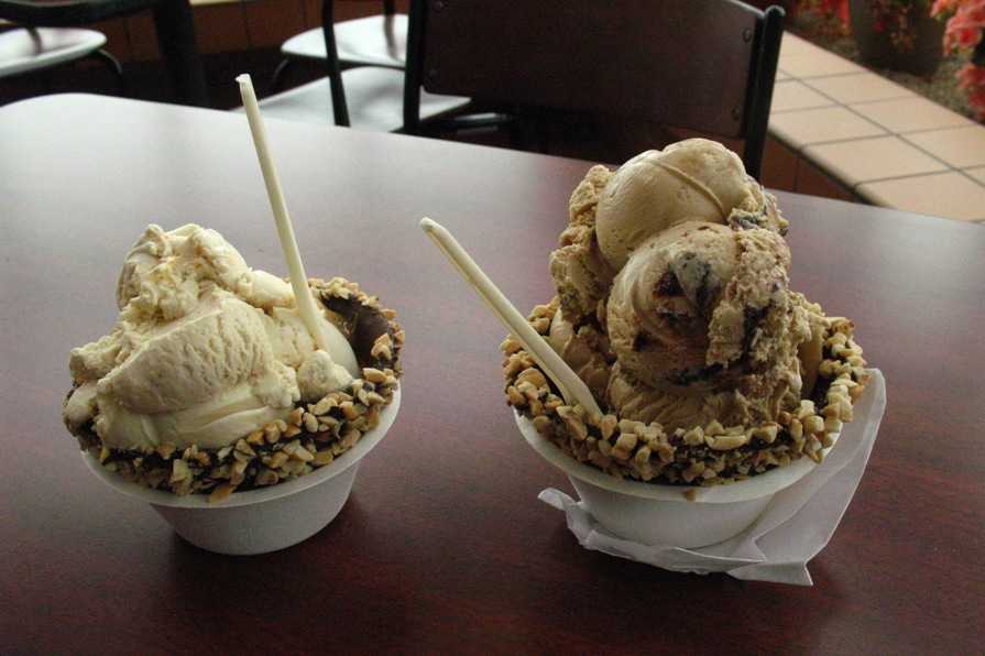
We couldn't pass up the Tillamook Cheese factory in Tillamook, OR. We did the self-guided tour, lightly sampled their three styles of cheddar (mild, medium, and aged/sharp) . . .
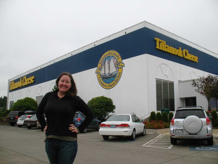
. . . then splurged (calorie-wise) on their ice cream!
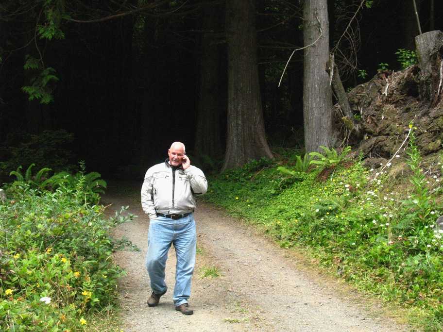
I carry my cell phone in my T-shirt pocket, programmed to ring and vibrate, and if it vibrates at a time of day is right for a call from Lynn, I'll pull over and check. This was one such time, but what got my attention as much as Lynn's voice was these spooky woods and the narrow gravel road into them. Tempting, until the property's owner pulled in driving a Lexus (with its headlights on). Tania pulled out the camera while I talked.
We made Reedsport a bit later, and discovered to our chagrin that large portions of the 40-odd miles of coast near Reedsport that are home to Oregon Dunes National Recreation Area are designated as a play area for dune buggies. The traffic in the region was horrendous. In fact, the mess started 80 miles north, outside Lincoln City, and never let up the rest of the day. This stretch is the creamy nougat center of the particular bon-bon that is the Oregon coast, and there is no avoiding the traffic, at least in summer. People come from all over to vacation here, many of them in fifty foot RV "land yachts" towing SUVs as "dinghies". Bleah. Stop and go for 80 miles? Makes motorcycling no fun at all.
That's it for Update 21. The next update should be the last, taking us home to El Segundo in the next five days.