Day 96
Reedsport, OR to Crescent City, CA, 159 miles
The previous day, while "only" 206 miles, had been so slow and plagued by Oregon vacation traffic that Tania requested an itinerary revision, so this day got shortened from 240 miles to 159 and the remaining four days got evened out to just over 200 miles each, with the result that we were able to retain our original goal of staying on the coast roads the entire 1366 miles from Puget Sound to El Segundo.
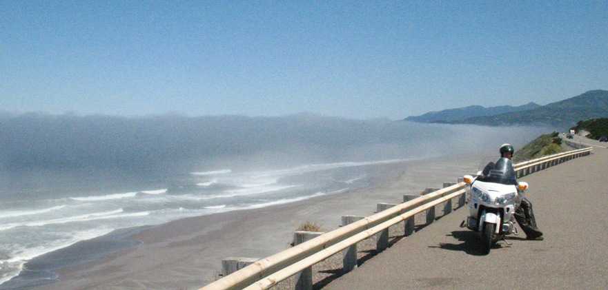
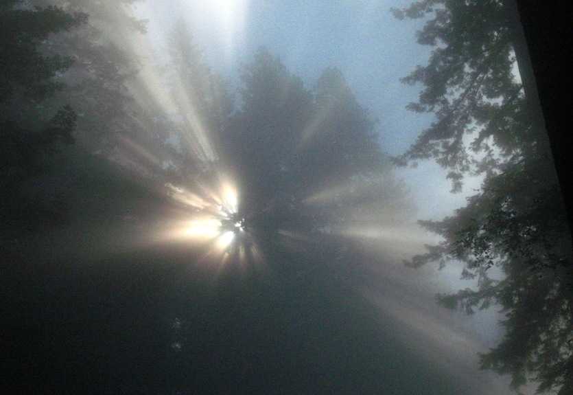
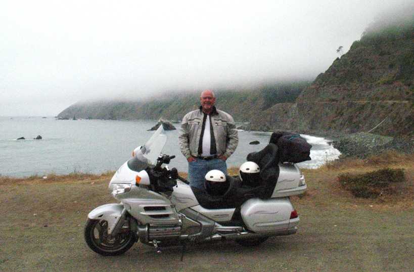
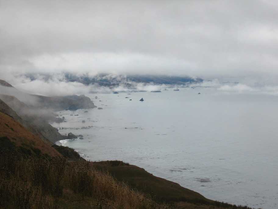
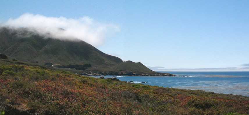
For anyone who does not think the Pacific Coast is characterized by microclimates, this photo is should be sufficient demonstration. Let me begin by reminding you that on this planet, at least in the middle latitudes, weather comes from the West. On the North Pacific Coast the weather condtions are also affected by the cold Humboldt Current, which travels right down along the coast from Alaska to roughly Point Conception, CA, and across which all weather must travel to get here. The result is a low, ocean-hugging "Marine Layer" of cold, moist air that dominates the coastal climate but dissipates rapidly inland in daytime as the sun heats the land. This photo shows the interaction as of late morning. The marine layer, which, because it is summer, is less than 200 feet thick here (it can get up to 2000 feet thick), is moving onshore driven by the northwesterly wind that comes out of the Northeast Pacific High, and its mists are dissipating right in front of our eyes here as they encounter the sun-warmed land and the fog evaporates. The difference in temperature between where the fog is and isn't is about 20 degrees.
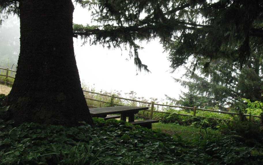
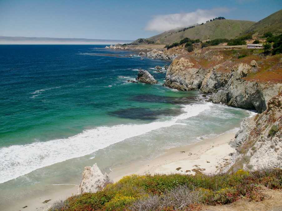
Which means, among other things, that places like this picnic table, where Tania and I stopped for some lunch of fruit and sandwiches, was freezing cold, because here the Marine Layer is thicker and the mists are flowing right up the land through the trees. We're about 200 feet above the water here, and if not for the fog you'd see the beach right in the middle of this photo. Tania and I ate at a picnic table like this one.
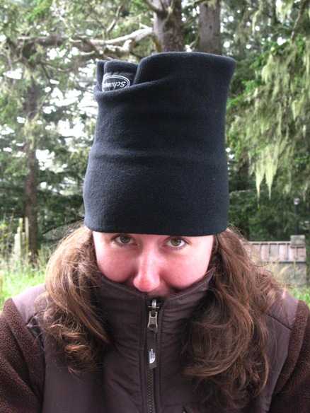
Tania had every stitch of clothing on that she'd brought. In fact, we had been wearing long underwear all day every day since leaving Omak, WA, and we did not remove it until Santa Barbara, CA, four more days south and only 100 miles from Los Angeles.
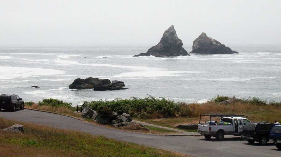
Later in the afternoon we were still in and out of fog. A little sunlight managed to find this scenic turnout just north of Brookings near the southern boundary of Oregon, but our remaining miles into Crescent City were solid overcast and cold.
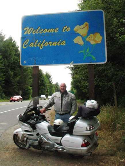
Not that we weren't glad to be back in California! I'd been outside my home state for three months. Fact is, I still like California better than any other state I visited, even with a $42B budget deficit and Arnold The Governator.
Tuesday 7/28/2009
Day 97
Crescent City, CA to Fort Bragg, CA, 217 miles
This was a day of traveling in and out of fog. In places where we were in forest at the fog-sun transition, scenes like this occurred. It was about 52 degrees when we left Crescent City . . .
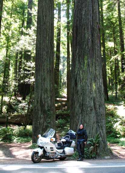
. . . whereas in these photos, along the Redwood Highway that runs through Redwood National Park parallel to US-101, it was over 100 degrees! Tania still had her outer jacket on (by maternal fiat), but I was in a T-shirt.
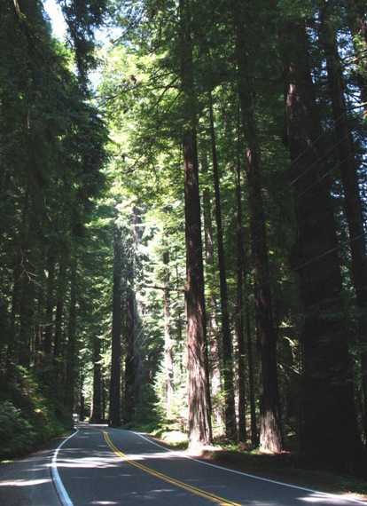
Well, that didn't last. At the town of Leggett, California Highway 1, aka Pacific Coast Highway (PCH) takes off to the SW heading to the coast and then south along it. It is quite slow and twisty coming down through the mountains. Below, that canyon beyond my left shoulder is where CA-1 hits the beach, and you can see there ain't much for it to hang onto.when it does.
We made it to Fort Bragg without incident, but the light was so poor that photography really wasn't worth the effort. We had dinner there at an unjustifiably upmarket establishment called the Mendo Bistro -- which, Tania told me to say, sucked. Food was so-so, portions were "fashionably" small, price was stupid, and service was beyond the pale. I very seldom stiff a wait-person -- maybe five times in my life -- but this was one of them.
Wednesday 7/29/2009
Day 98
Fort Bragg, CA to Half Moon Bay, CA, 202 miles
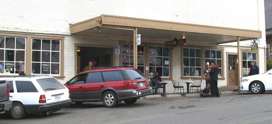
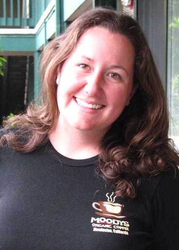
We started our day eight miles south in Mendocino at the polar opposite of the Mendo Bistro -- Moody's Organic Coffee Bar. Lynn and I had discovered this place during a trip up the coast in our 1965 Checker wagon in Fall 2007, and Tania and I decided to see if it still existed. Hungry for a "real" cup of coffee I ordered a medium-size dark brew "redeye", i.e. with a shot of espresso. The barista responded "Just one?" -- pause -- "It normally comes with three . . . " Oh YES sir, please, THREE shots. What was I thinking?
The result was, I'm not kidding, "The Best Cup Of Coffee I've Ever Had". I used to think the coffee at Urth Kaffe in Santa Monica was unsurpassable, but I was very wrong.
Tania can now say "Been there, done that, got the T-shirt."
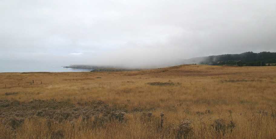
Good as the coffee made me feel, it did not dissipate the Marine Layer blanketing the Mendocino coast.
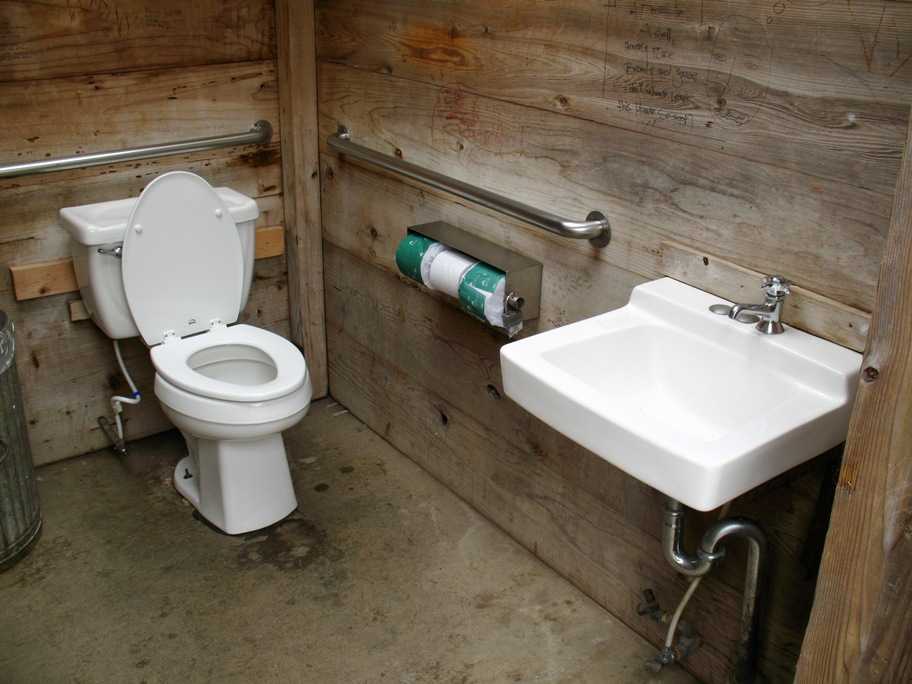
After a couple hours the coffee had worked its way through our systems, and we were looking for a legstretch and rest room when this turned up in a small turnout. Given the remote location and rustic look I figured it was a pit toilet. I opened the door and found . . .
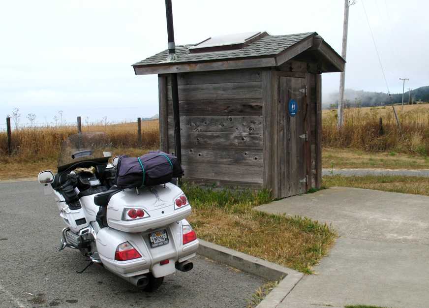
. . . absolutely brand new gleaming fully plumbed fixtures fresh out of the box. This is at least one place not affected by California's colossal deficit.
This what the coast looked like as we approached Bodega Bay. We had all our woolies on.
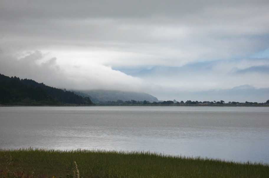
CA-1 runs inland of Tomales Bay, which is a 30-mile gash in the coast right on top of (and caused by) the San Andreas Fault. This photo looks south across it.
Thursday 7/30/2009
Day 99
Half Moon Bay, CA to Morro Bay, CA, 213 miles
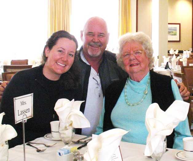
By the itinerary this was to be our next-to-last day on the road, and I have to admit we thought seriously about bailing and taking US-101 or I-5 straight down to LA in one day. As many times as I've been down the Big Sur coast, I know it ALWAYS takes twice as long and requires twice as much driving effort as I think it should, and since we hadn't seen much sun for the past 1000 miles I wondered what the Big Sur scenery would really be like. However, for the reasons I already mentioned plus the fact that if we bailed we'd miss being able to visit with the lovely lady on my left in the photo below (Lynn's mother, Joanne Lassen, who lives in Pacific Grove), we decided to continue per plan and follow CA Highway 1.
And as it turned out, even though it was still cold, the sun was shining! We were busy enough driving that we didn't take too many pictures, but here are two we did take, just to prove we were there.
Thursday 7/31/2009
Day 100
Morro Bay, CA to El Segundo, CA, 220 miles
This was the last day of the trip, and Tania's and my last day on the motorcycle together. As planned, we took CA Highway 1 from Morro Bay to San Luis Obispo, from Arroyo Grande to Gaviota, and from Oxnard to El Segundo, with just two short stretches of US-101 where it coincided with CA-1. We took no pictures because there wasn't much to see that we, and you, haven't all seen before. It was a perfect day and a perfect completion to our trip.
As you may recall, my cousin Randy suggested I bookend this trp with a sunrise picture at the northeastern extremity of my route, in Eastport, ME, and a sunset photo at the southwestern extremity in El Segundo. I got the sunrise picture on June 2nd as I was leaving Eastport). Here's that photo, from Update #10.
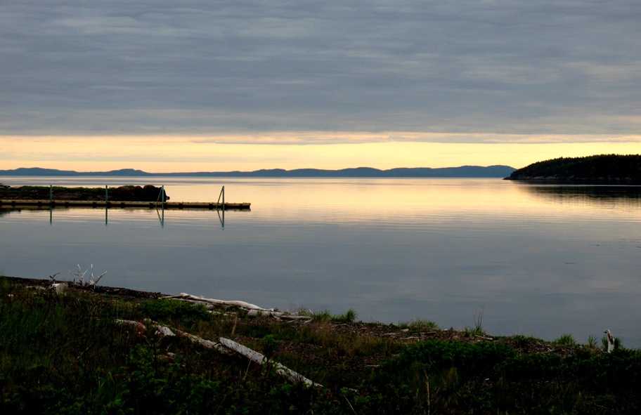
Here's El Segundo Beach on the evening of July 31st, 2009.
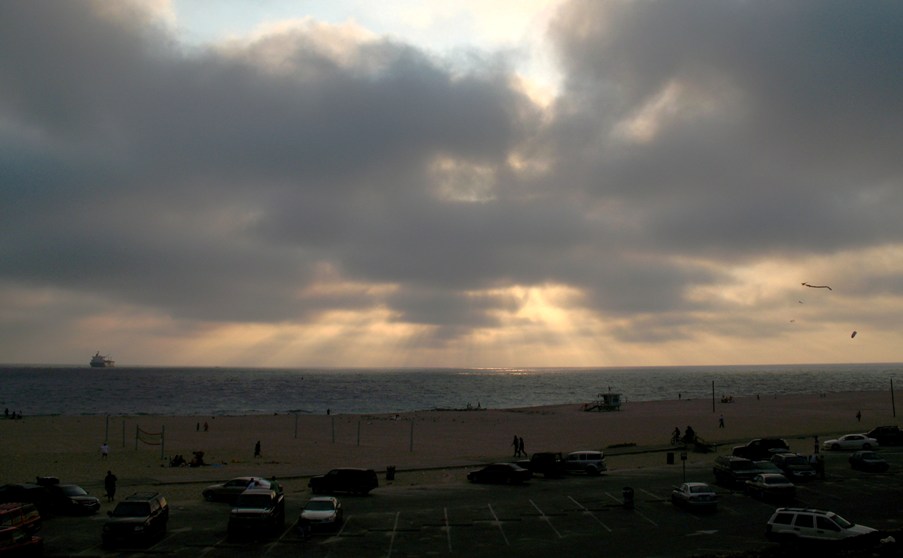
Overcast sky in both, sun invisible in both, cold in both . . . bookends indeed.
What did I get out of all this? For one thing, the realization once again that there is very little value in having done it except the doing of it. In the end, I've got this website, some misty memories, and thousands of dollars in credit card bills to show for this 100 days. The day-to-day doing of it is all there is. Actually I realized that somewhere around North Dakota. So was it worth it?
YES. Absolutely. This trip sits in my memory as a deep happiness, accomplishment, and completion.
One thing I've learned about myself over the years is I have to have is connectedness with my physical world. I have to connect the dots. Before this trip I'd already visited many of the places I visited on this trip, but those places were not connected together in my experience. I really dislike air travel for this reason. You get to a new place, but you've no idea what lies between where you started and where you ended up. The west coast and the east coast are totally different. I've lived both places. I've visited Salt Lake City, Denver, Boulder, the Colorado Rockies, Albuquerque, Corpus Christi, San Antonio, Washington DC, northern Idaho, the Chesapeake Bay, Boston, Fort Wayne, IN, Rochester, NY, Huntsville, AL, Lower Alabama, the Florida Panhandle, west coast, and Keys, the waterways of Georgia, the Carolinas, and Virginia, Pennsylvania, West Virginia, Michigan, the Southwestern deserts . . . but I hadn't experienced all the places in between except in an air-conditioned car on a six-day trip in 1997, and those in-between places are what connect the ends. I wanted to loop the country, to tie all the edges together, to know those areas like I know my home state . . . to add it all to my mental "backyard".
And that's been done. Now I can hold this entire country in my mind, just like I already hold California. In fact, counting everywhere I've been in my life, I now have direct first-hand experience of a contiguous stretch of this planet that extends from Fairbanks, Alaska to the Panama Canal to Georgetown, Exuma Cays, Bahamas. At one point in my life, back in the mid-1990's, I asked myself what I wanted to do most, having been granted one fairly short visit to this particular piece of the cosmos. The answer that came up was "See it. See the planet."
I know I haven't seen the whole planet.
But it's a start.